The "Road to Heaven" in Gujarat is a stunning 30-kilometer stretch of highway located in the Kutch district.
It connects Khavda to Dholavira which is an ancient archaeological site and a UNESCO World Heritage site, famous for its ruins from the Indus Valley Civilization.
The road runs directly through the Great Rann of Kutch, a vast white salt desert. Because the landscape is flat and devoid of trees or buildings, the horizon often blends with the sky. Especially during sunrise, sunset, or moments when the salt flats reflect the sky, it creates the illusion that you are driving straight into the heavens.
Source - Internet
The Atlas Edit
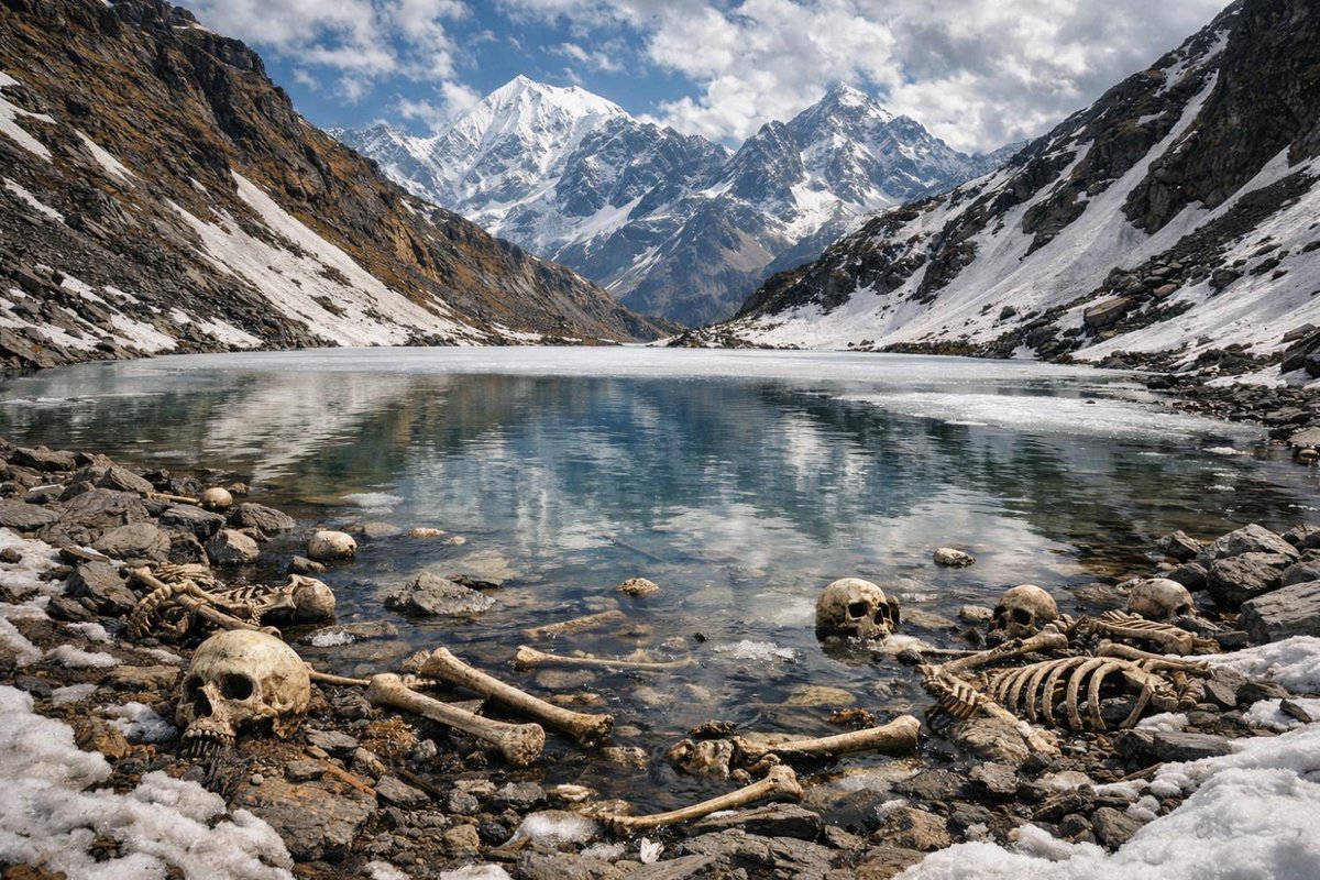
Forensic Geomythology: Roopkund Lake
The human remains at Roopkund Lake in the high Indian Himalayas represent a classic case where bioarchaeology has solved an ancient mystery. For decades, local legends attributed the skeletons to a medieval royal procession that was struck down by the wrath of the mountain goddess Nanda Devi for defiling her sacred path.
A 2019 genomic study of 38 skeleton samples extracted DNA from long bones, revealing that the remains belong to three distinct genetic cohorts who died in independent events separated by a thousand years:
The Atlas Edit..
The Low-Temperature Geochemistry of Eternal Flame Falls
The Eternal Flame Falls in Western New York represents a rare hydrocarbon seep where natural gas emerges behind a waterfall. The gas originates from the Rhinestreet Shale, a Devonian-era organic-rich bedrock layer located approximately \bm{400\text{ meters}} below the surface.
Source : Internet
⏱️ The 25-Second Race.
Seismic waves travel at a blistering 7 to 10 km per second. If a major quake hits Kutch, the tremors will reach Ahmedabad (250 km away) in just 25 seconds.
While we can't predict quakes, a robust early-warning system could use those 25 seconds to shut down grids, halt trains, and save thousands of lives.
7/7
Source: Bhaskar English
📍 Where is the real danger zone?
Major cities like Ahmedabad, Gandhinagar, and Surat don't sit on major fault lines.
However, Kutch is riddled with active fault systems and remains firmly in Seismic Zone V—India's highest earthquake risk category.
6/7
Source: Bhaskar English
🧘 Micro-quakes are actually a safety valve.
Seismologists point out that frequent, low-intensity tremors are a good thing. They gradually bleed off accumulated underground stress.
This slow release can actually push back the timeline of a massive earthquake by hundreds of years!
5/7
Source: Bhaskar English
🗺️ Location is everything.
The Himalayas are an earthquake hotspot because the Indian Plate is actively slamming into the Eurasian Plate.
But Gujarat? It’s located 400 km away from the nearest plate boundary. In seismology, this is called an "intra-plate zone."
Then why is Gujarat shaking 🫨
2/7
Source: Bhaskar English
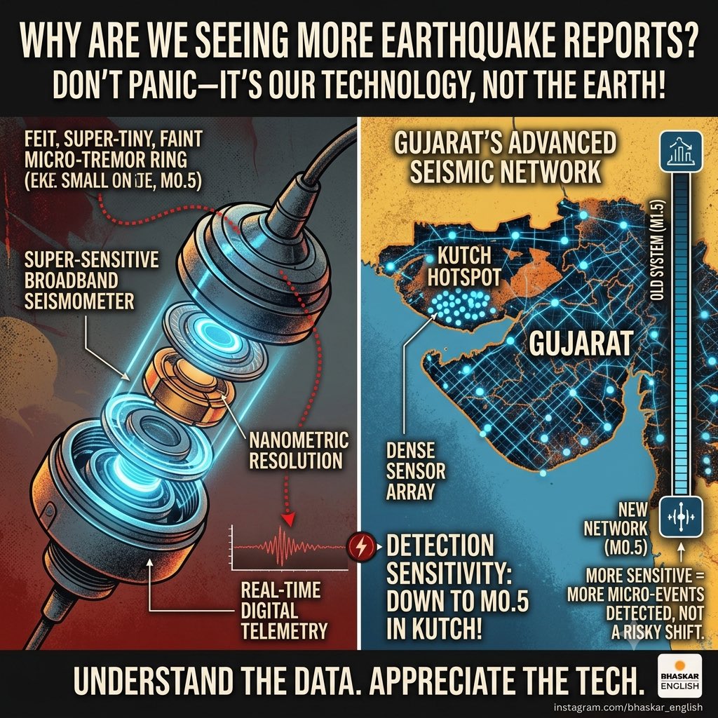
📈 Why are we seeing more earthquakes reported then?😮
Don't panic—the ground isn't getting angrier; our technology is just getting smarter.😎
Gujarat’s advanced monitoring network is now so incredibly sensitive it can detect micro-tremors down to a tiny 0.5 magnitude in Kutch.
4/7
Source: Bhaskar English
⏳ The 700-Year Clock.
Because Gujarat sits in the stable interior of a plate, its underground rocks deform at just 2–3 mm per year (compared to 18–25 mm in the Himalayas).
While the Himalayas can brew a major \bm{M6.0} quake in 20 years, it takes Gujarat 600 to 700 years to store that same energy.
3/7
Source: Bhaskar English
IS BHUJ 2.0 IN MAKING??
🚨 Five earthquakes hit Gujarat in just one month. With the memory of the devastating Venezuela quake fresh in mind, many are asking a terrifying question: Is a massive seismic threat quietly building beneath the state?
Let’s look at the science.
1/7
Source: Bhaskar English
Deep in western Pomerania near the town of Gryfino, lies a grove of roughly 400 pine trees that are strangely curved at their bases. Each tree bends sharply to the north before growing straight up, giving them the appearance of a giant's playground or a misaligned 3D render. There is no precise scientific consensus on what caused this bizarre growth pattern, though popular theories range from severe weather to mechanical manipulation by early 20th-century farmers.
Archaeologists compare Nan Madol to the Pyramids of Egypt. Both required the movement of massive stones with no clear engineering explanation. Both served no direct social good, no food, no shelter, no fairness.
The difference? Egypt gets all the attention.
Nan Madol sits in the middle of the Pacific, half-swallowed by jungle, mostly ignored, and just as impossible to fully explain...
Nature gives you the shapes; you just have to give people a safe way to see them. 🦖
Take Nusa Penida’s Kelingking Beach. It’s a massive coastal cliff that naturally looks like a T-Rex. By carving out a pathway down the razor-sharp spine of the rock, Bali turned a dangerous geological anomaly into one of the most photographed viewpoints on Earth.
Nature is a resource, but with the right design, it becomes an attraction.😍🥳
6/6
Bali didn’t become a global tourism powerhouse by accident. They mastered a genius playbook: transforming raw nature into highly lucrative, viral experiences.
Here is exactly how Bali engineered their natural landscape into a multi-billion dollar tourism machine. 🧵👇
1/6
Accessibility is the bridge between a hidden jungle secret and a high-revenue asset. 💧
Waterfalls like Tukad Cepung and Sekumpul used to be inaccessible terrain. Local communities built safe staircases, viewing platforms, and photo spots—turning raw, rugged river canyons into curated day-trip destinations that fund entire villages.
5/6
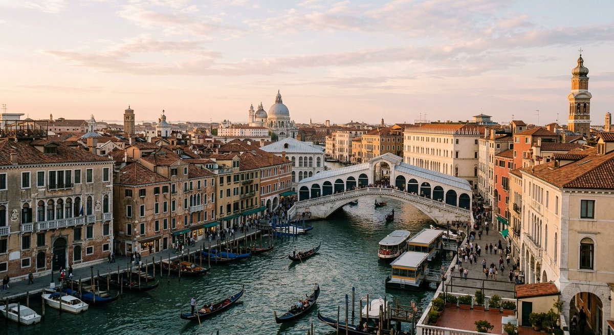
Ever look at a place and wonder why it is the way it is? In many spots, the culture is a direct answer to the geography.
Venice is the perfect example. Built in a lagoon to find security, it developed its entire life around canals, gondolas, and pedestrian bridges. The physical environment shaped everything, from commerce to the social squares (the 'campi') that are the heart of the city. Geography doesn't just define the landscape; it influences the soul of the culture that grows there. Where does geography shape culture in your favorite place?