Kevin Newman Photographer, Printer, publisher. Making photographs as wpnewington since 1979. Made in London N16 1961. Dystopian Melancholic Diversity. urban
Hornsey Town Hall, designed by Reginald Uren, was officially opened OTD in 1935. It was one of a number of suburban town halls opened in London in the 30s, and its design was influenced by Dutch architect Willem Dudok, Read more on this building here https://t.co/XF76F8Vs7F
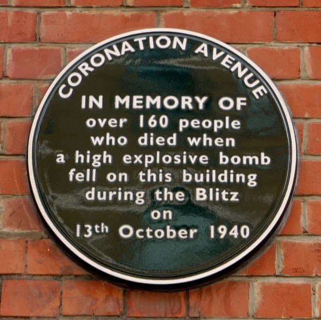
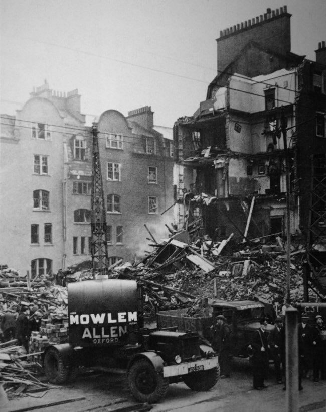
Today marks the 85th anniversary of the Coronation Avenue Disaster, one of the most devastating air raid incidents in London during the Blitz.
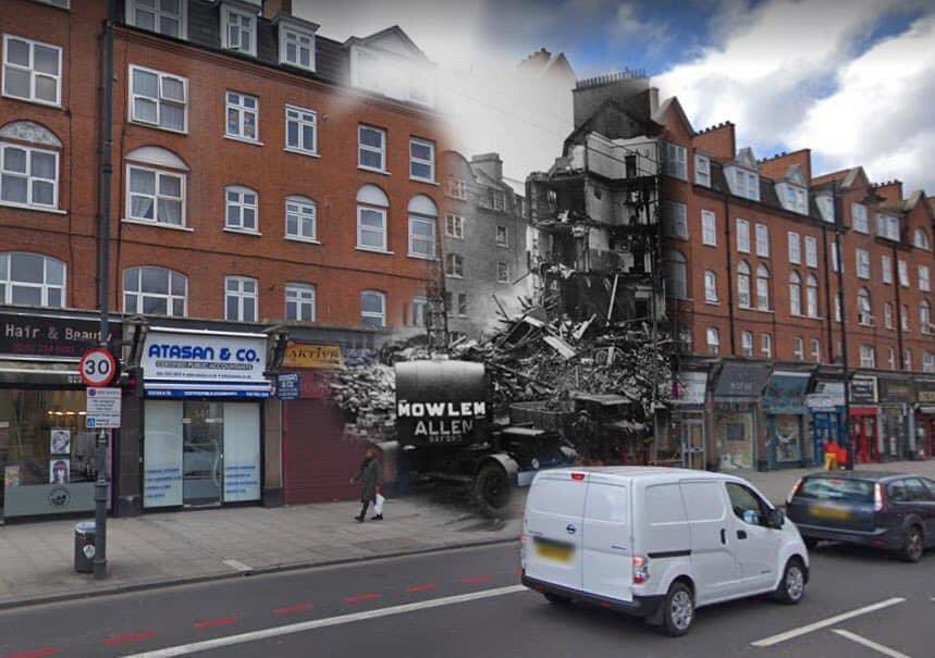
On the night of 13 October 1940, a high explosive (HE) bomb struck Coronation Avenue, 149–159 Stoke Newington Road, directly opposite West Hackney Church.
The bomb, weighing about 250 kilograms (550 lbs), pierced through the building and detonated in the basement where residents were sheltering—making it the worst civilian loss of life in Hackney during the war.
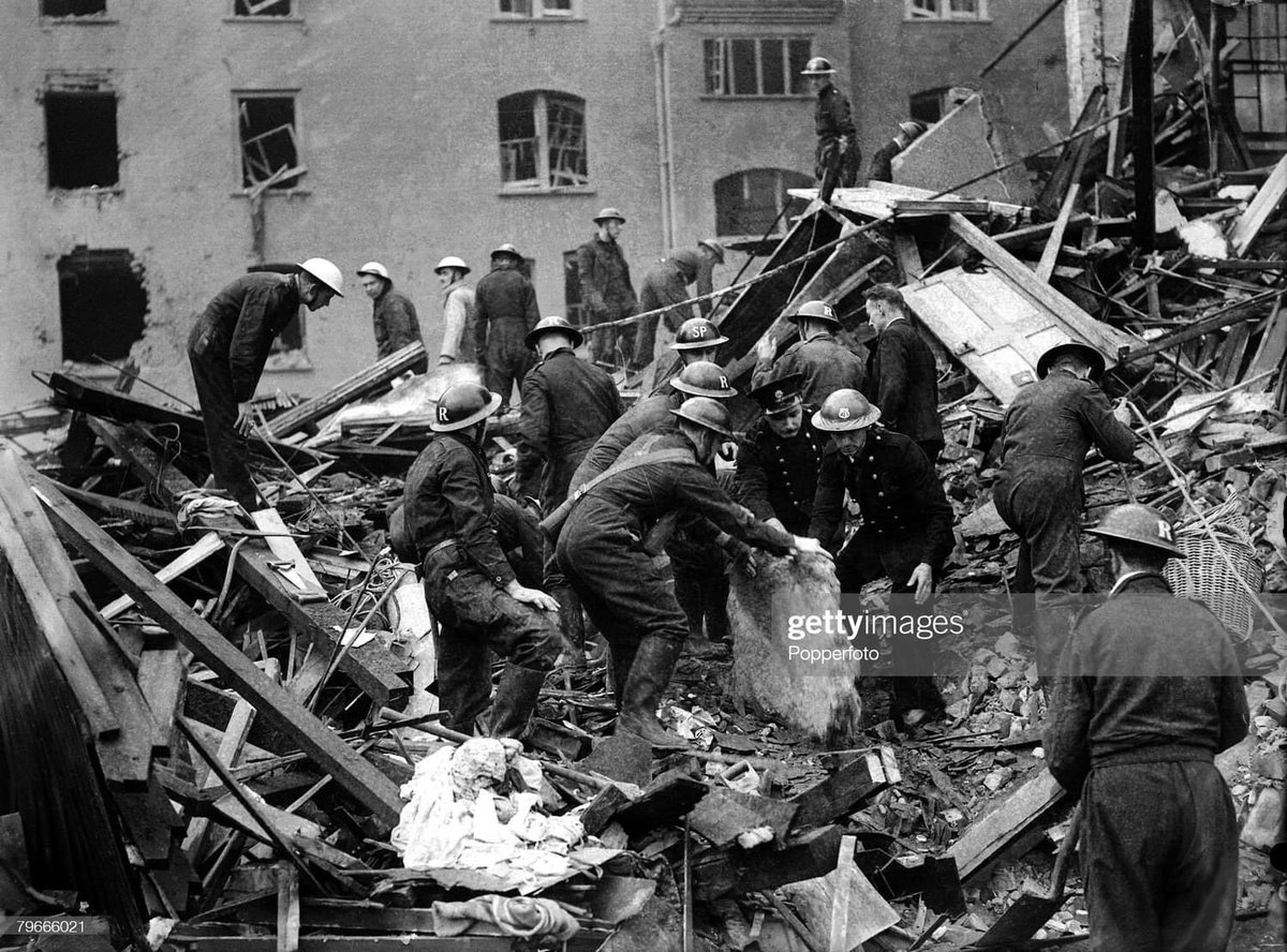
The blast ruptured water mains, gas pipes, and sewage lines, causing immediate flooding and hazardous gas leaks in the basement shelter. These deadly secondary effects greatly increased the death toll and made rescue efforts even more perilous for survivors and emergency teams.
At least 160 men, women and children lost their lives. Of the 154 people sheltering at the time, only 128 victims could be formally identified. Just seven lived in Coronation Avenue itself; most casualties were from surrounding streets such as Evering Road (33) and Beatty Road (23), reflecting how the shelter served the wider Stoke Newington community.
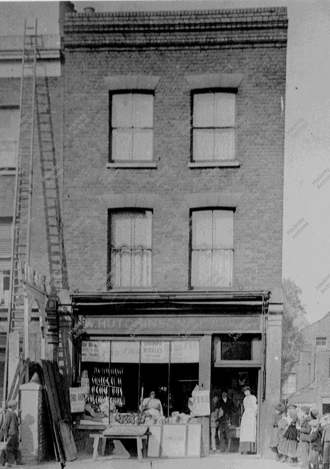
Storer’s Forge in Stoke Newington Church Street where William Patten School (originally named Church Street School) is now. The school was built in 1892. Storer’s Forge was there for 200 years when it was demolished along with other shops and houses to make way for the new school.
130 Stoke Newington Church Street next to the Red Lion, which dates to the 1720s and which I had the pleasure of visiting last year, is now for sale. Check out the photos I took of the house below.
https://t.co/93bhd9hxAL
While it was one of the smallest Metropolitan Boroughs when it was created in 1899, as a local authority in the 20th century until its amalgamation with Hackney and Shoreditch in 1965, Stoke Newington was larger than some people may think.
Because Stoke Newington is also a postal district, also named N16, which stretches eastward to Springfield Park in Upper Clapton, it is easy to see why, when asked 'how big is Stoke Newington?' today, more people are likely to refer to the postal district area rather than the boundaries of a local authority that was abolished 60 years ago.
As a local authority with its own council and Town Hall, Stoke Newington stretched from Crossway in the south to Hermitage Road, north of Manor House Tube Station. Its western border with Islington ran along Blackstock Road, Mountgrove Road, Green Lanes and Newington Green. The A10, consisting of Stoke Newington Road, Stoke Newington High Street and Stamford Hill, formed the boundary between Stoke Newington and Hackney, with the west side of those roads being in Stoke Newington.
You can explore Stoke Newington's municipal boundaries by following the instructions of my 9km self-guided walk: https://t.co/qIMaa2PoR5
Shops at 2-12 Balls Pond Road, Dalston, by Kingsland Road, looking east to Dalston Lane. Cobbled street with tramway track. Businesses, include Plummer's Eel and Pie & Mash House diner. 1913
Simpson Clothing Factory at 92–100 Stoke Newington Road was built in 1929 and designed by architects Hobden & Porri. It was extended in 1931 and 1934 down Somerford Grove.
Hobden & Porri also
designed then following buildings in Stoke Newington:
- Electricity Substation, Wordsworth Rd
- Clissold Rd Swimming Bath (demolished)
- WWI Memorial Hall, Church St
- Public Library 1925 extension in Edward’s Lane
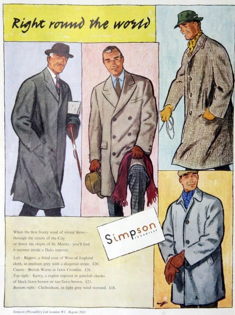
In its heyday, the factory employed 3,000 people and supplied the famous Simpson’s of Piccadilly – the largest menswear store in Britain when it opened in 1936. The Piccadilly store helped popularise ready-to-wear suits, but the clothes were made in Stoke Newington Road.
Simpson’s was one of many clothing factories and workshops in Stoke Newington during the 20th century, though most were small, with fewer than ten workers. Local clothing manufacturing declined through the 1980s and was gone by the early 1990s. Simpson’s left the site in 1982; it’s now used for shops and self-storage.
Stoke Newington’s past streetscape brought to life with AI.
1) Stoke Newington Road with Princess May Road on the left
2) Cowper Road from Allen Road looking south towards Matthias Road. Most of the street was demolished in the early 1980s to create Butterfield Green and today this is where the entrance to Butterfield Green in Allen Road is.
3) St. Matthias Church, Wordsworth Road
4) Wordsworth Road corner of Matthias Road
Louisa Sophia Calfe was the last Mayor of the Metropolitan Borough of Stoke Newington (1964–65). Her tenure came at a pivotal moment in local government history, as the Local Government Act 1963 led to a major reorganisation of London’s boroughs. Under this legislation, the former metropolitan boroughs of Shoreditch, Hackney, and Stoke Newington were merged in 1965 to form the London Borough of Hackney. This restructuring aimed to create larger, more efficient administrative units across the city.
(Photo courtesy of Louisa Calfe’s great-niece, Lorraine Vaissiere.)
The Electricity Substation in Wordsworth Rd. Built 1929.
Now mostly empty. Designed by Hobden & Porri who also designed the WW1 Memorial Hall in Church St, Simpsons clothing factory in 92-100 SN Rd and the Clissold Rd Swimming Bath (1930-97). Take a look inside here: https://t.co/ithGJ3enPW