Following hot on the heels of Storm Ciaran, another storm brewing over the Atlantic has been named by the Spanish Met Service #Domingos and it will bring gusts of up to 80mph and large waves to Atlantic coasts of France and Spain. #BorrascaDomingos
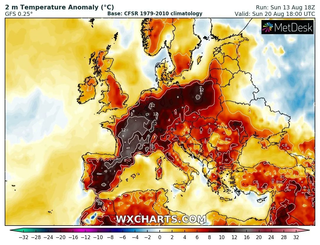
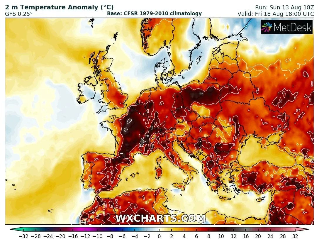
By the next weekend many EU countries are expected to see highs 10 to 15°C above normal that could again exceed 45°C in Spain, France and Italy, 40°C in Germany, 35°C in Poland and Switzerland.
The extreme heat will peak between the next weekend and early the following week.
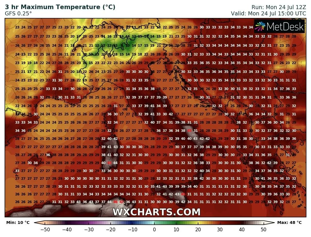
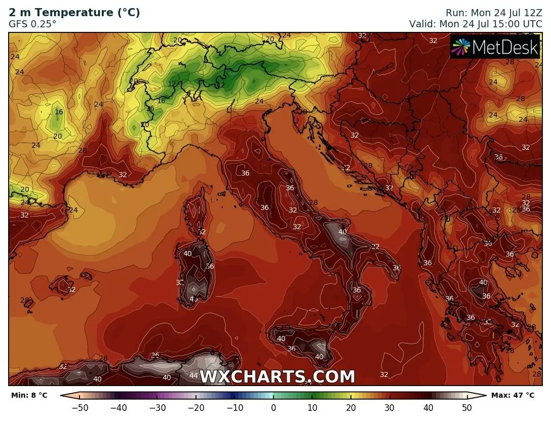
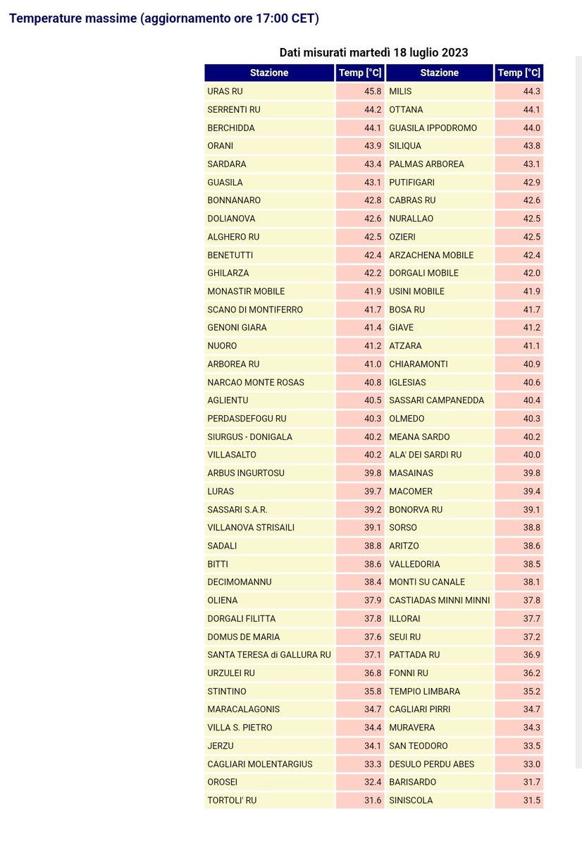
Historical day on the islands of Sicily and Sardinia in Italy: Jerzu (Sardinia) rose to +48.2°C, breaking the European record of max. temperature for July.
Syracuse (Sicily) jumped to +47.8°C, Palermo (Sicily) to +46.6°C, Olbia (Sardinia) to +46.4°. #heatwave#sicily#sardinia
Dozens of heat records today in France, Spain and Italy.
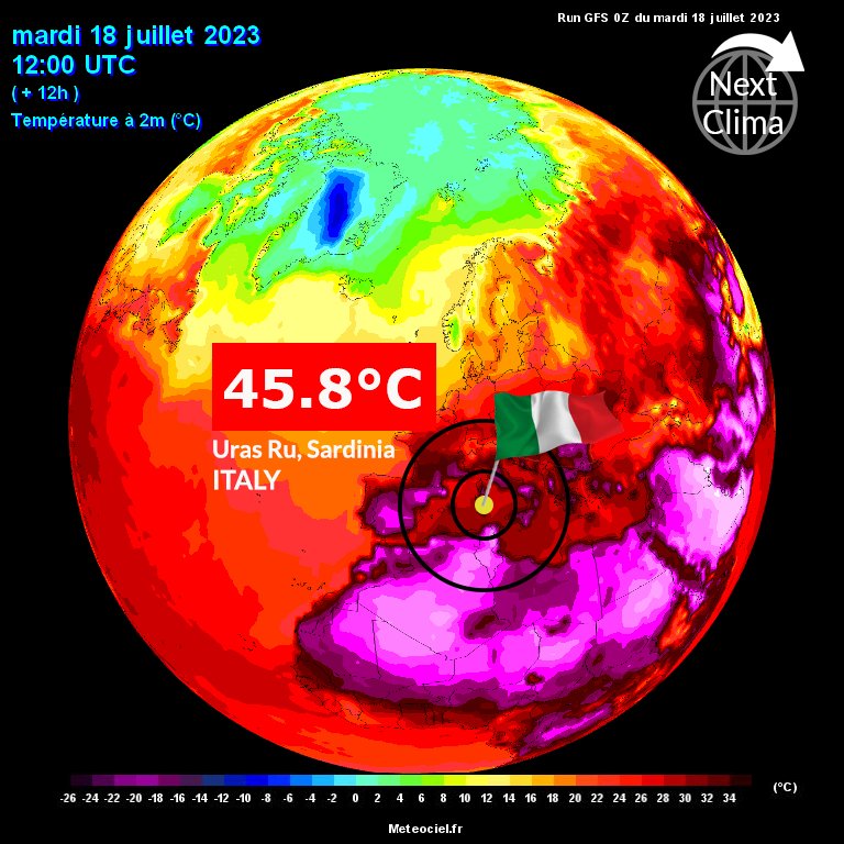
In Spain highs over 45°C in Catalunya. Scorching temperatures also in Italy, especially on the islands of Sicily and Sardinia. The highest value in Uras Ru with 45.8°C (Arpa data). @extremetemps
Many EU countries are facing a major #heatwave, with highs expected to climb to 48°C on Sicily and Sardinia, potentially the hottest temperatures ever recorded in Europe.
In Rome, temperatures could rise to 42/43°C on Tuesday, shattering the previous record of 40.5°C set in 2007.
An outbreak of severe to extremely severe storms is forecast in the next few hours across Switzerland, Luxembourg, Germany, Czechia and SW Poland.
A level 3 was issued by Estofex for damaging wind gusts, large to very large hail and regionally for tornadoes and heavy rainfall.
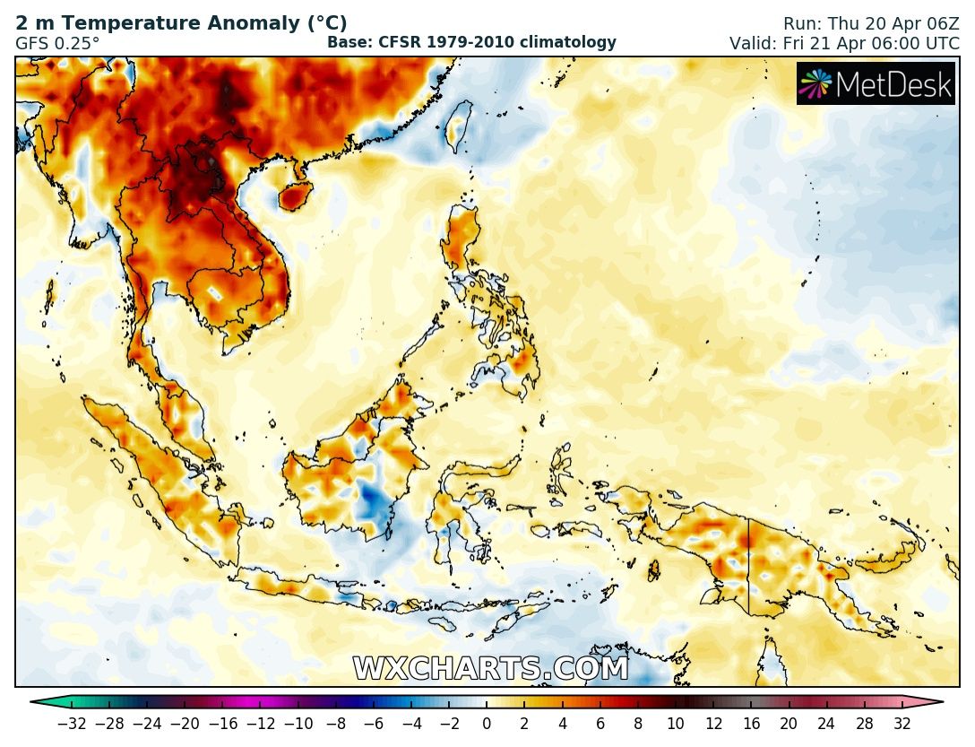
Historic heatwave in SE #Asia, where hundreds of heat records are falling. The inland heatwave was attracted by #Mawar typhoon airflow to the coast of S China, and a foehn was formed during the mountain climbing process, thus creating the extreme heatwave in Guangdong and Fujian.
After the recent flash-flooding in Italy's northern #EmiliaRomagna region, a new depression has formed off the coast of Tunisia in the western Mediterranean and is moving towards Italy bringing back downpours of rain across many parts, especially in the #Piedmont region.
A potentially historic heatwave is getting underway in parts of N Canada and will spread to British Columbia and Alberta, as well as into the northern U.S.
With temperature departures of 20-30° above average, numerous records may be broken as daily highs approach or exceed 90°F.
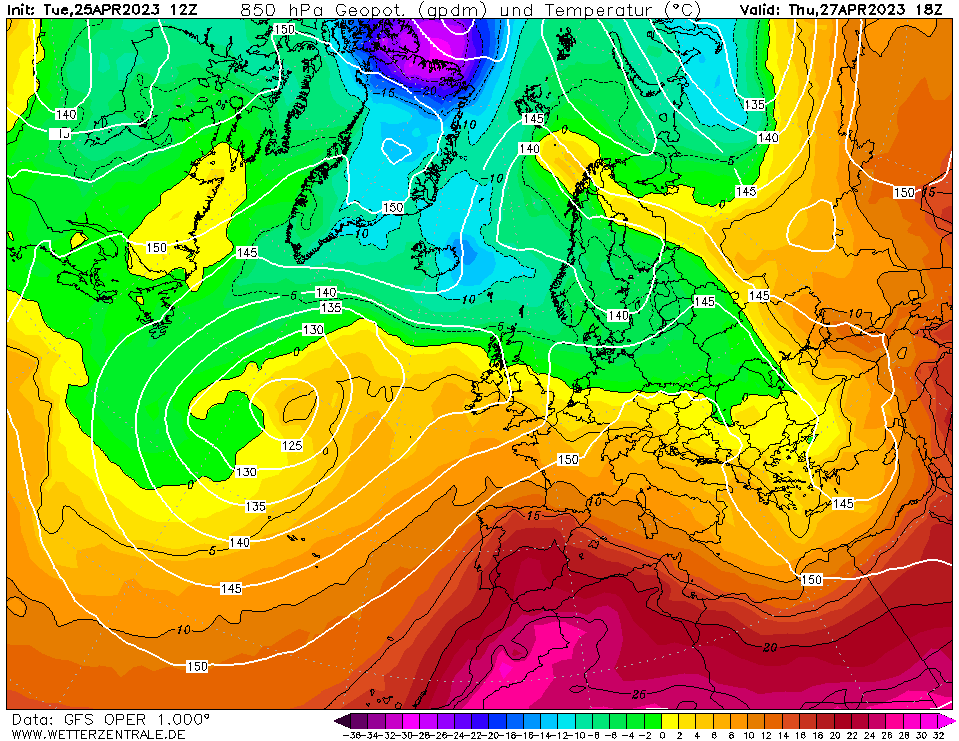
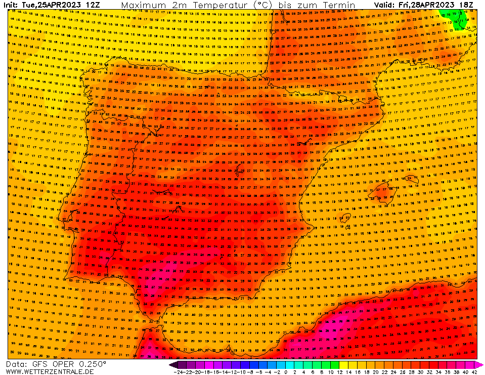
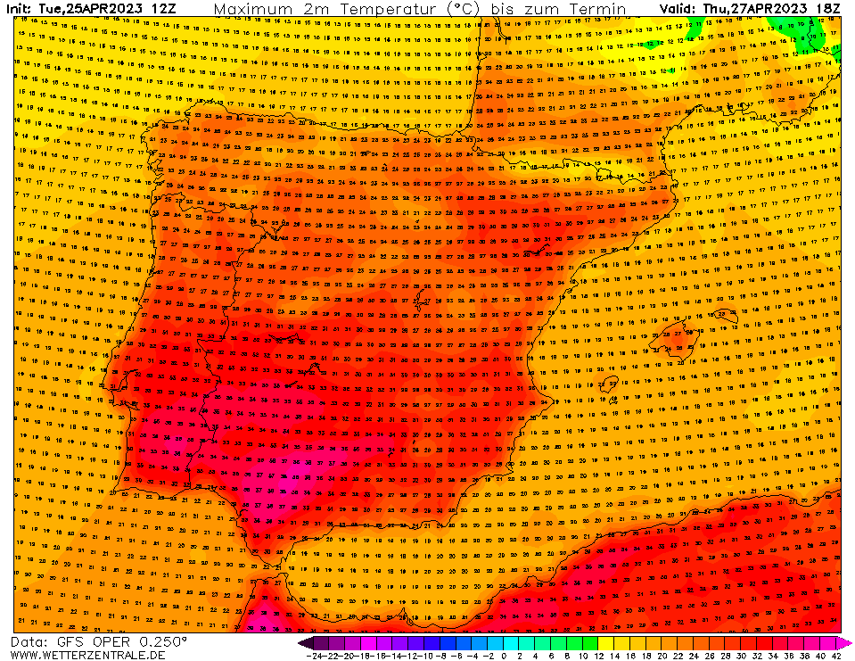
Summer heat has arrived early in #Spain, #Portugal and also SW #France.
After the exceptional highs recorded yesterday in the Basque Region, by Saturday temperatures will reach the low to mid-thirties inland across southern Portugal, southern, central and eastern Spain.
On Thursday and Friday record-breaking temperatures are expected in #Spain, with inland areas like Córdoba forecast to reach 15 degrees above average with highs of around 40°C.
Even coastal areas like Gibraltar have the potential for temperatures 10°C above average.
An unprecedented #heatwave continues to impact large portions of #Asia, breaking new temperature records in several countries and causing over a dozen deaths.
Countries such as Pakistan, India, Nepal and Bangladesh have experienced highs above 40°C (104°F) for several days.
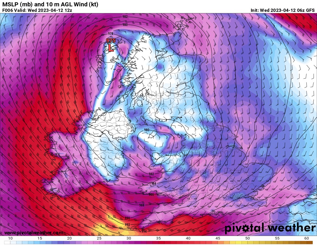
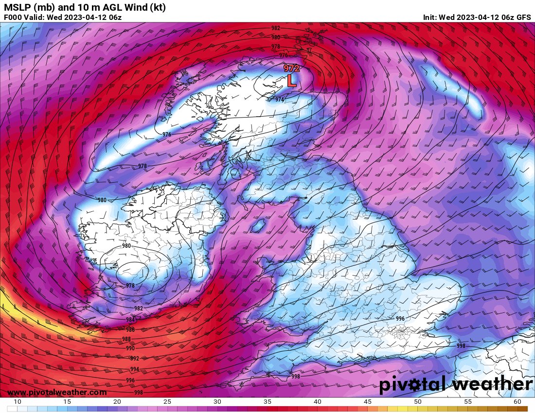
Today at 7am Meteo France has named a violent low over the UK Storm Noa, for its severe weather and potential wind impacts later on Wednesday.
There will be severe gales in exposed areas, gusts over 70mph and the risk of flooding.#StormNoa#ukweather
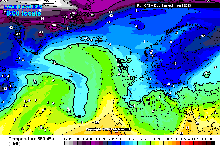
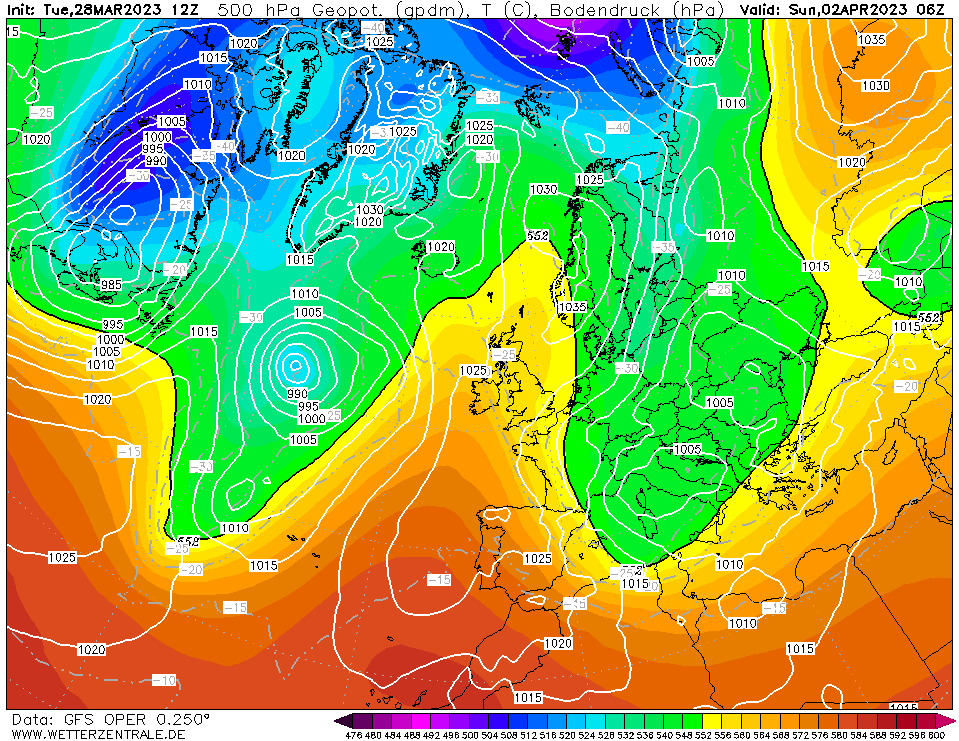
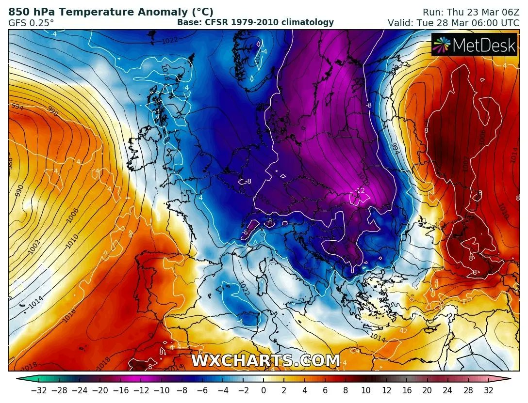
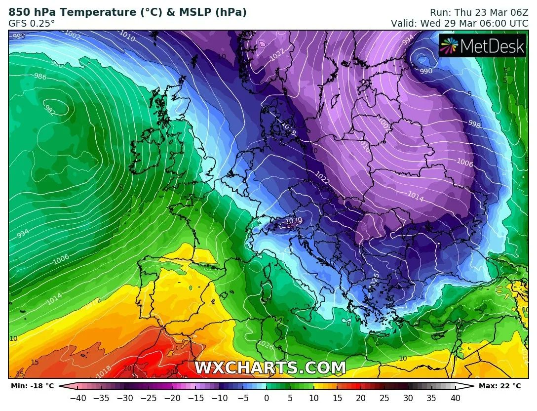
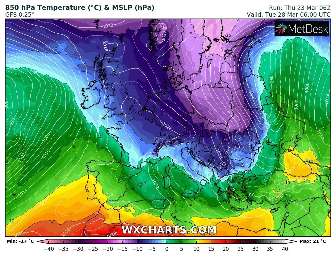
#Easter week will be colder than last Christmas week in many European countries, due to an Arctic outbreak that will bring back cold weather to central and eastern Europe.
Temperatures could be up to -8°C degress below average over the Balkans and eastern Europe. #euweather
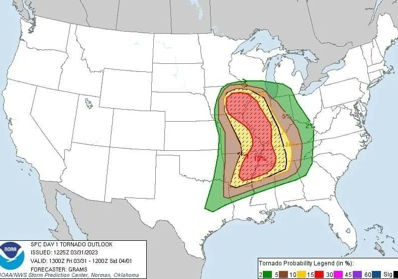
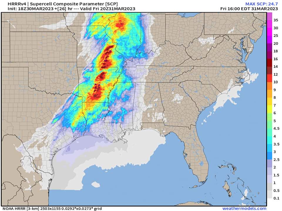
The SPC has issued a Moderate Risk (level 4/5) of severe thunderstorms across parts of SE Iowa, NW Illinois and NE Missouri, as well as a separate area from NE Arkansas to far W Kentucky.
Some strong tornadoes are expected between the Midwest and Lower Mississippi Valley.
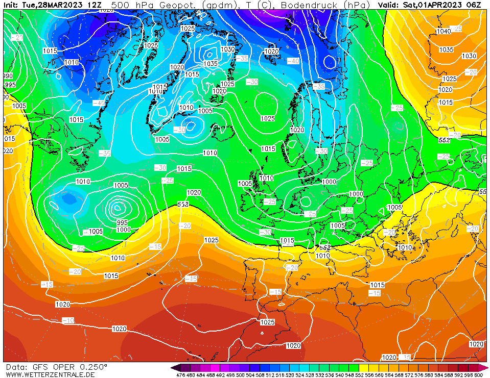
After a temporary comeback to winter weather conditions over central and eastern Europe, temperatures will rise again but more unsettled weather is expected by the next weekend.
Heavy showers are forecast over the Adriatic, Balkan states, Sardinia and Malta.
Next week an Arctic outbreak will bring cold weather back to most of Europe and will peak over the #Balkans and eastern Europe around mid-next week.
Temperatures up to -10°C below average and some late frosts in places are expected, especially over eastern Europe.
A strong storm will move ashore across #California today accompanied by strong winds, heavy rain and heavy snow for the higher terrain.
The storm center is expected to approach and possibly make landfall near #SanFrancisco this evening, bringing potentially damaging wind gusts.
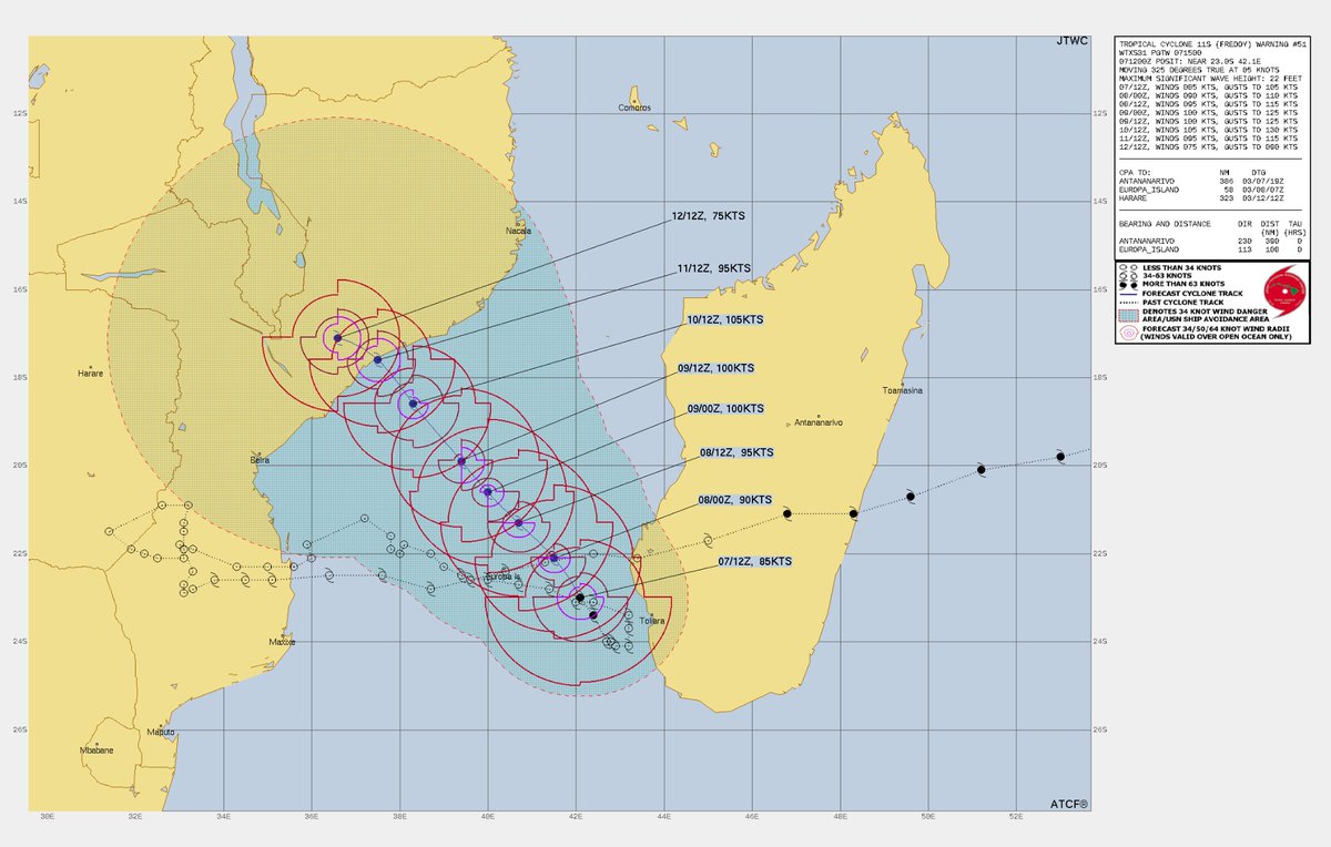
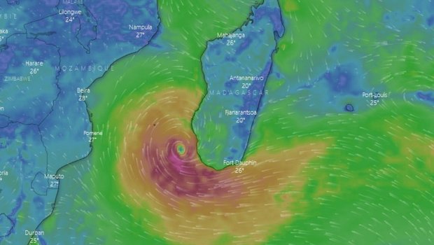
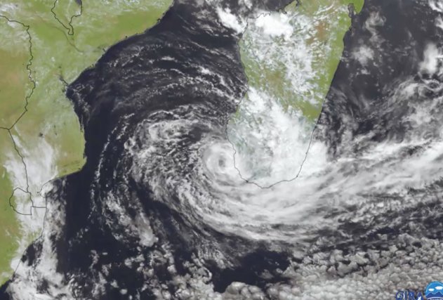
History is being made in the world of tropical cyclones, as #TropicalCycloneFreddy, born NW of Australia on February 3, continues to make its mark and is now the longest-lived cyclone ever documented.
#Freddy could possibly make another landfall in Mozambique by the next weekend.