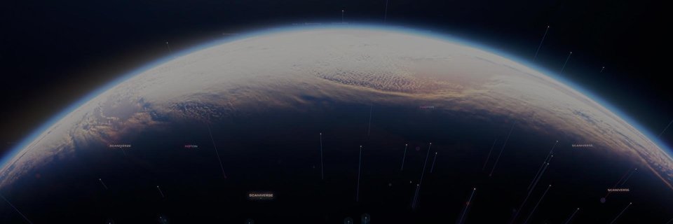
We're building real-world foundation models that unlock physical AI for a more productive and resilient world.
Powering robotics, defense, and oil & gas.
Today, Niantic Spatial introduces Scaniverse — our flagship product and the gateway to our spatial intelligence platform and Large Geospatial Model.
Here’s what’s new:
🔹Scaniverse (iOS mobile + web): Capture once, generate multiple outputs—VPS maps, meshes, and Gaussian splats (Android coming soon)
🔹Collaborative mapping: Multi-user scans fused into a single, continuously improving model
🔹 On-device validation: Preview VPS coverage and test localization in real time
🔹VPS 2.0: Global-scale positioning—centimeter-accurate where mapped, reliable everywhere else (even where GPS fails)
🔹NSDK 4.0 (coming soon): A unified SDK across Unity, Swift, Android, and ROS 2
Read more: https://t.co/9oMKFBCnLA
#NianticSpatial #Scaniverse #VPS #GeospatialAI #AI
Need more Scaniverse credits? We've got good news.
✅ Top-Ups are now available for all paid accounts.
✅ Go annual with Plus & Pro. Get 2 months free.
✅ Buy an annual plan before June 30 → get a full month of bonus credits.
No plan changes. No promo codes. Just more processing power to #SplatYourWorld 🌐
Learn more: https://t.co/UZrYMgYT9G
#NianticSpatial #Scaniverse #Reconstruction #3DScanning #GaussianSplat #360Capture #AI #GeospatialAI #PhysicalAI #VPS #DigitalTwins
i like big splats and i cannot lie.
you can now compress, tile and stream city scale 3d gaussian splats -- glTF has an official 3DGS extension now too.
this is what the future of google earth looks like. no more broccoli trees. no more melted powerlines. immaculate ground level detail that actually holds up.
How do you build a 3D map that both humans and robots can use to navigate?
Our CTO Brian McClendon joined Jacob Goldstein on @pushkinpods' What's Your Problem? to talk about how Niantic Spatial is teaching AI to understand the physical world.
🎧https://t.co/JxQDuXLHw2
#NianticSpatial #PhysicalAI #GeospatialAI #AI #Robotics
Physical AI for defense and intelligence starts with an accurate model of the world – high-fidelity, geometrically grounded, built for the environments where it actually matters. Today, @NianticSpatial is awardable on the @DeptofWar’s Tradewinds Solutions Marketplace for 3D Reconstruction, our second capability to clear that bar after Visual Positioning, announced earlier this month. Together they deliver two critical layers of the spatial stack: high-fidelity 3D models of contested environments, and precise location within them; a foundation for mission-critical operations that need to visualize and navigate the physical world. The capability is ready. The procurement path is open.
Most AI-generated worlds are optimized to look realistic. But physical AI systems operating in the real world need something much harder: geometry that is physically consistent, spatially accurate, and grounded to real-world coordinates.
Our latest Ground Truth blog breaks down how Niantic Spatial reconstructs georeferenced 3D environments from off-the-shelf drones, phones, and 360° imagery — solving depth, alignment, and surface consistency at scale.
🔗Read more: https://t.co/LWx2TXOjAA
#NianticSpatial #Spexi #PhysicalAI #Reconstruction #GaussianSplat #DigitalTwins #Robotics #GeospatialAI #AI #GeospatialIntelligence #GEOINT #SpatialIntelligence
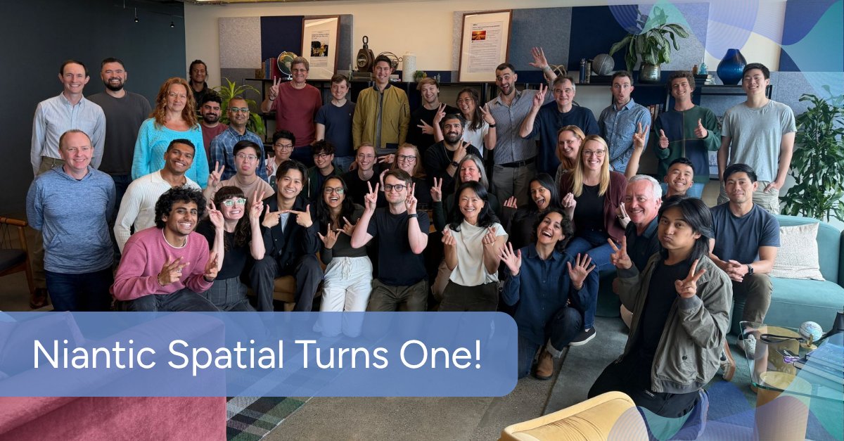
One year ago, Niantic Spatial launched with a bold vision: to build real-world foundation models that unlock physical AI for a more productive and resilient world.
Excited for what’s ahead as we continue scaling the real-world model for physical AI!
#NianticSpatial#PhysicalAI #AI #Robotics #Reconstruction #VPS #Scaniverse #Geospatial
@SpexiGeospatial By combining Spexi’s aerial capture network with Niantic Spatial’s reconstruction pipeline, customers can turn raw drone data into high-fidelity Gaussian splats and city-scale 3D environments ready for simulation, localization, inspection, measurement, and autonomous operations.
Physical AI needs more than maps, GPS, or pixels alone. It needs a living, geometrically accurate understanding of the real world.
Niantic Spatial and @SpexiGeospatial are partnering to transform drone imagery into large-scale 3D intelligence for physical AI.
🔗Learn more: https://t.co/zARe9Qmnnv
#NianticSpatial #Spexi #PhysicalAI #Reconstruction #GaussianSplat #DigitalTwins #Robotics #GeospatialAI #AI #GeospatialIntelligence #GEOINT #SpatialIntelligence
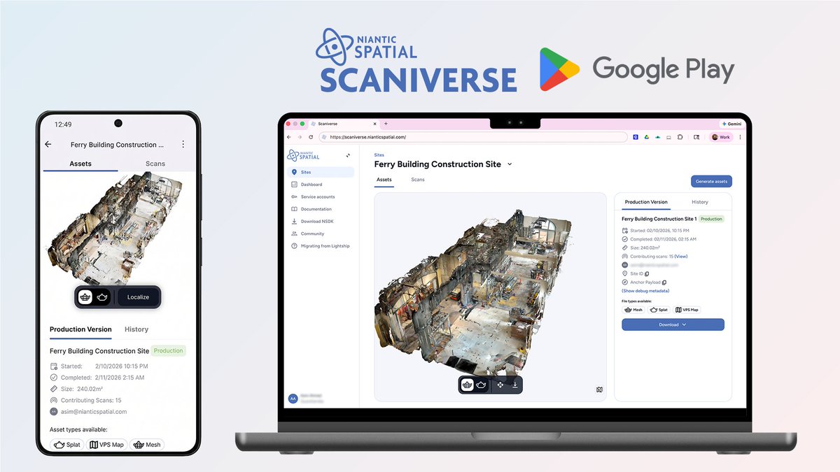
Construction sites change fast. Constant site revisits are expensive and time-consuming.
With Scaniverse, teams can capture and operationalize real-world environments with precision at scale using high-fidelity textured meshes and Gaussian splats.
Monitor progress remotely, improve collaboration, document site conditions, and reduce unnecessary visits — all from a phone or 360° camera.
Sign up for Scaniverse today and begin to #SplatYourWorld.
https://t.co/PQakqgWLdr
#NianticSpatial #Scaniverse #VPS #GeospatialAI #AI #GaussianSplat #Reconstruction #PhysicalAI
🚀 Scaniverse now supports Android enterprise cloud features including cloud-processed splats + meshes, multi-user Sites, and NSDK integration for VPS experiences.
SPZ4 also brings 3–5x faster compression and up to 20x faster browser performance.
Plus, new 360° camera workflows with Insta360 X4/X5 make high-quality spatial capture faster than ever.
🔗Sign-up for Scaniverse today: https://t.co/UULflEPliB
🔗Android version: https://t.co/lSM6WB4tjL
#NianticSpatial #Scaniverse #VPS #GeospatialAI #AI #GaussianSplat #Reconstruction #PhysicalAI
GPS told you that you're 3 metres away. But which direction? For blind and low vision people, that gap is the difference between arriving and not arriving. We built NaviNote to close it.
🏆 CHI 2026 Honourable Mention - top 5% of thousands of submissions.
Read blog: https://t.co/nS7TEgemSF
#NianticSpatial #GeospatialAI #AI #PhysicalAI #VPS
Thread 👇(1/5)
(4/5)
The results: 88% of participants reached their destination with NaviNote. With standard GPS navigation: 38%. And all 18 participants independently authored their own spatial annotations during the session.
(3/5) Users can also ask what's around them in natural language, hear annotations left by others, and create their own — just by speaking. Notes are pinned to exact 3D locations. In our study, participants created annotations not just for themselves but for the whole BLV community.
(2/5)
NaviNote runs on a smartphone and uses Niantic Spatial's Visual Positioning System - centimeter-level accuracy, not GPS approximation - to give blind and low vision users precise turn-by-turn navigation to specific objects, with an audio compass that gets louder as you face the right direction.
Appreciate the respect 🤝
The future of 3D Gaussian Splatting depends on open, interoperable formats that make high-fidelity spatial data faster, lighter, and easier to use across the ecosystem.
Excited to see the community building with SPZ 4.
#NianticSpatial#Scaniverse #GaussianSplat #SPZ4 #Reconstruction #GeospatialAI #AI #PhysicalAI #VPS
Scaniverse is technically our competitor. But they just shipped SPZ 4 😤
Faster encoding, tens of millions of Gaussians, configurable SH quality, extension-based metadata. Hard to ignore.
Honestly? Good. The whole 3D Gaussian Splatting ecosystem wins when the format layer matures.
Okay. Respect🤝 @NianticSpatial
SPZ 4 is here. 🚀
3–5x faster encoding. 2x faster loading. 20x faster in the browser. Tens of millions of points, no sweat.
The "JPG for 3D Gaussian splats" just leveled up. Big thanks to everyone who made this release happen, especially the team at @Adobe.
Read more: https://t.co/oz6YCDlUHJ
#NianticSpatial #Scaniverse #SPZ #GaussianSplat #Reconstruction #PhysicalAI #GeospatialAI #AI #Adobe
at @nianticspatial, we're building the real-world model for physical AI. we believe the next generation of AI will move beyond the screen, into real-world environments where some of the hardest problems need to be solved.
with high-fidelity gaussian splats as the foundation – robots, AI agents, & autonomous systems can see, localize, understand, & operate in the environments that matter most.
What does it look like when a robot truly understands where it is in the real world?
It starts with Niantic Spatial’s Scaniverse, capturing a real-world environment and reconstructing it into a high-fidelity Gaussian splat.
From there, our Robot Adventures demo simulates how VPS could localize a robot within that environment, mirroring 360° video of it navigating the physical space.
🔗Get started with Scaniverse today: https://t.co/cxXhnOs7Xm
#NianticSpatial #Scaniverse #Reconstruction #VPS #GeospatialAI #AI #PhysicalAI #Robotics