ALERT - CABARRUS & ROWAN CO. COMMUTERS
I-85 SB is SHUT DOWN near Concord Mills this morning due to a serious crash. All SB traffic is being diverted onto Poplar Tent Rd.
#LIVE updates on @SpecNews1CLT
ALERT - CABARRUS & ROWAN CO. COMMUTERS
I-85 SB is SHUT DOWN near Concord Mills this morning due to a serious crash. All SB traffic is being diverted onto Poplar Tent Rd.
#LIVE updates on @SpecNews1CLT
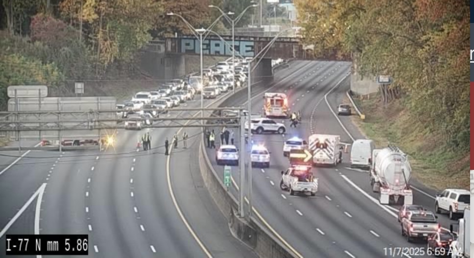
A major traffic issue early this morning as a serious accident has forced the closure of I-85 southbound at Bruton Smith Blvd. @NickBuffo has all of your updates on the air this morning.
TRAFFIC ALERT 🚨
Water main break is currently flooding W Morehead St. near I-77 & Calvert Street just outside of Uptown. Expect heavy delays commuting in from West Charlotte & Wesley Heights this morning. @SpecNews1CLT#nc#CLT
📸: @ClaudiaPuenteTV
TRAFFIC ALERT 🚨
Expect road closures & delays today throughout #Charlotte as the Venerable Monks continue their #PeaceWalk towards DC.
#LIVE reports throughout the day on @SpecNews1CLT
Link to the LIVE map & route: https://t.co/7g4Vwu3h1Y
We have some special visitors walking through NC!
Buddhist monks on a Walk for Peace journey to DC are passing through Charlotte, Greensboro, and Raleigh over the next few weeks.
Encounter them on the road? Slow down and stay alert.
#BREAKING The #FBI and our law enforcement partners thwarted a potential terrorist attack on New Year's Eve in North Carolina. The subject was directly inspired to act by ISIS. The @USAO_WDNC and FBI Special Agent in Charge will announce details at an 11:30 am news conference in Charlotte.
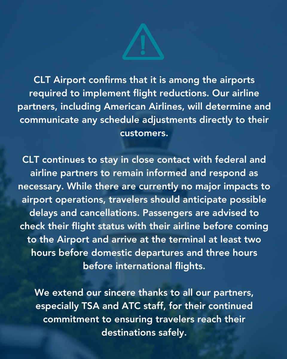
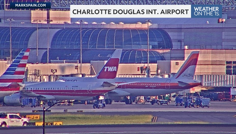
CLT Airport confirms that it is among the airports required to implement flight reductions. Our airline partners, including American Airlines, will determine and communicate any schedule adjustments directly to their customers.
CLT continues to stay in close contact with federal and airline partners to remain informed and respond as necessary. While there are currently no major impacts to airport operations, travelers should anticipate possible delays and cancellations. Passengers are advised to check their flight status with their airline before coming to the Airport and arrive at the terminal at least two hours before domestic departures and three hours before international flights.
We extend our sincere thanks to all our partners, especially TSA and ATC staff, for their continued commitment to ensuring travelers reach their destinations safely.
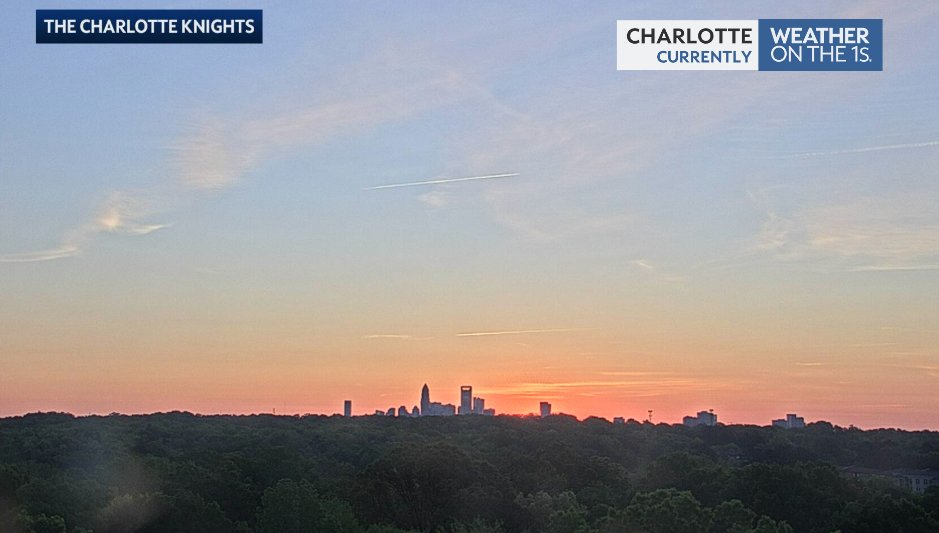
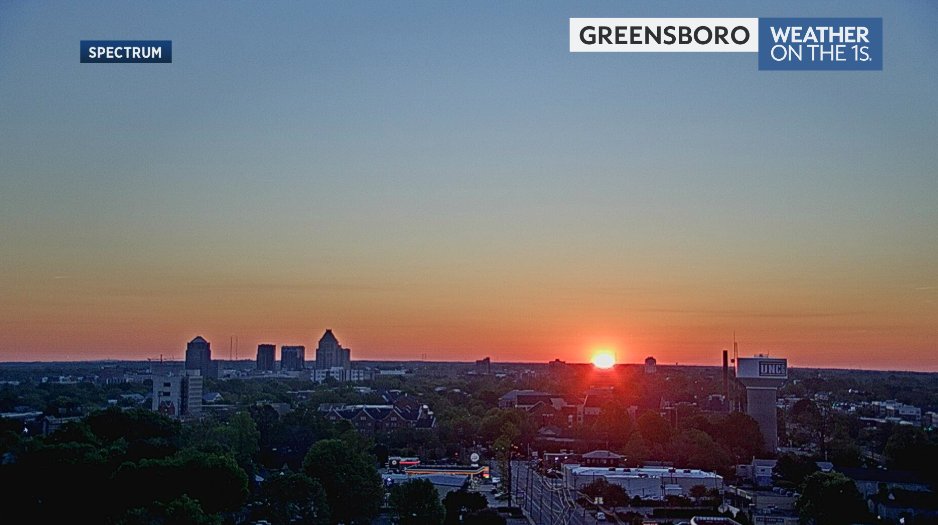
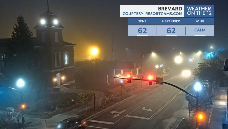
Sort of a Spooky Season look to the morning in Brevard with some fog in place while Charlotte and Greensboro look pleasant. A few showers in the western mountains could impact other mountain areas this morning. #ncwx#cltwx#triadwx#wncwx
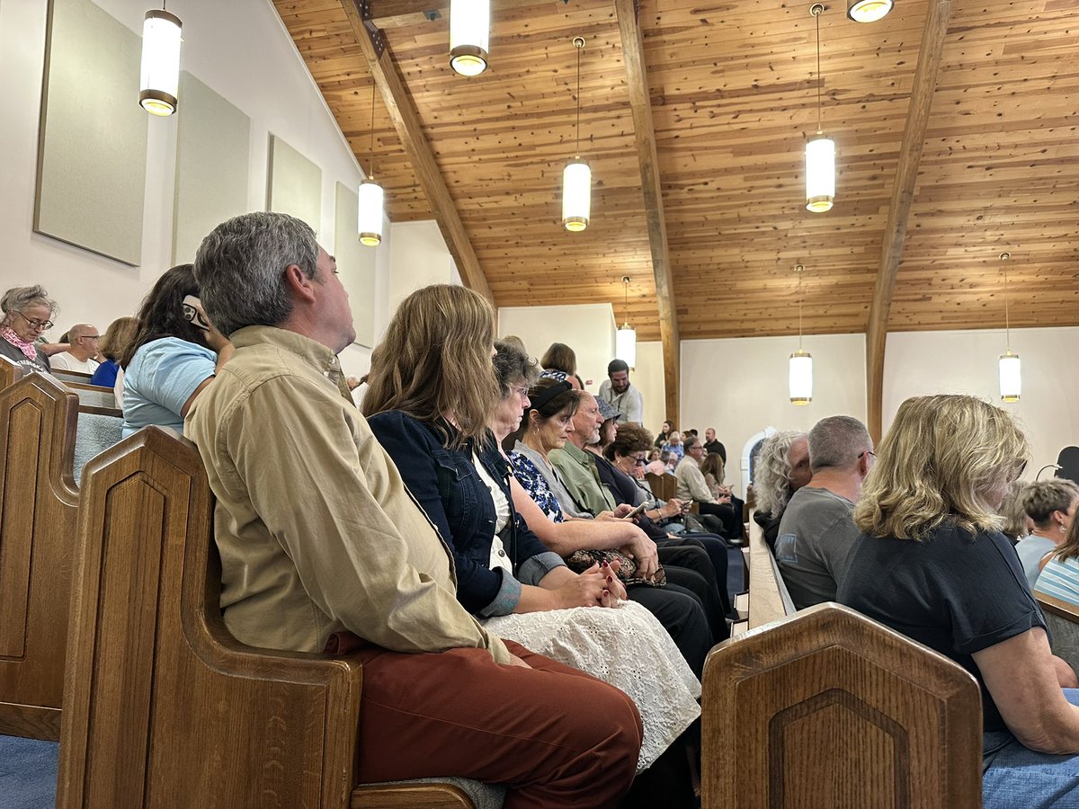
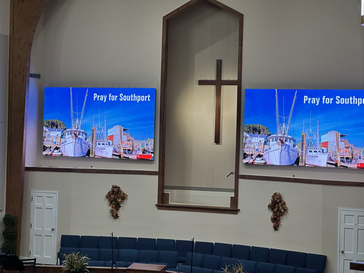
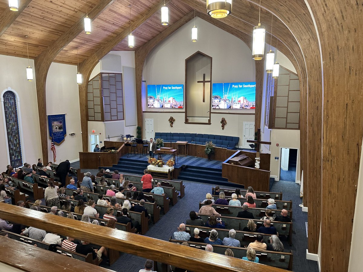
HAPPENING NOW: A vigil in Southport, NC honoring the lives that were taken in a mass shooting Saturday.
You can see in these pictures… people are packed into Southport Baptist church, mourning as a community.
Stay with @SpecNews1CLT for the latest.
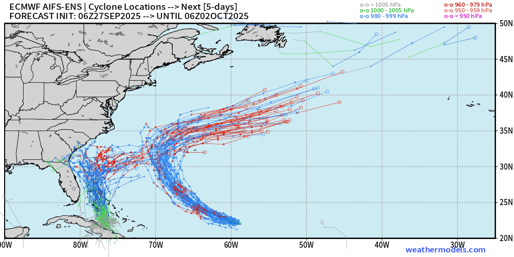
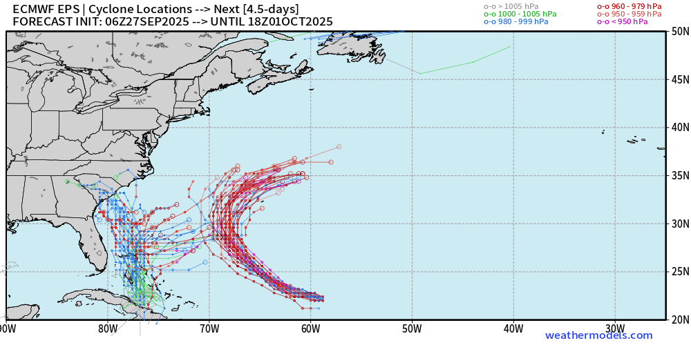
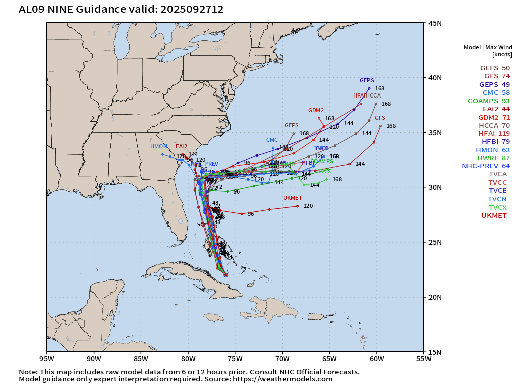
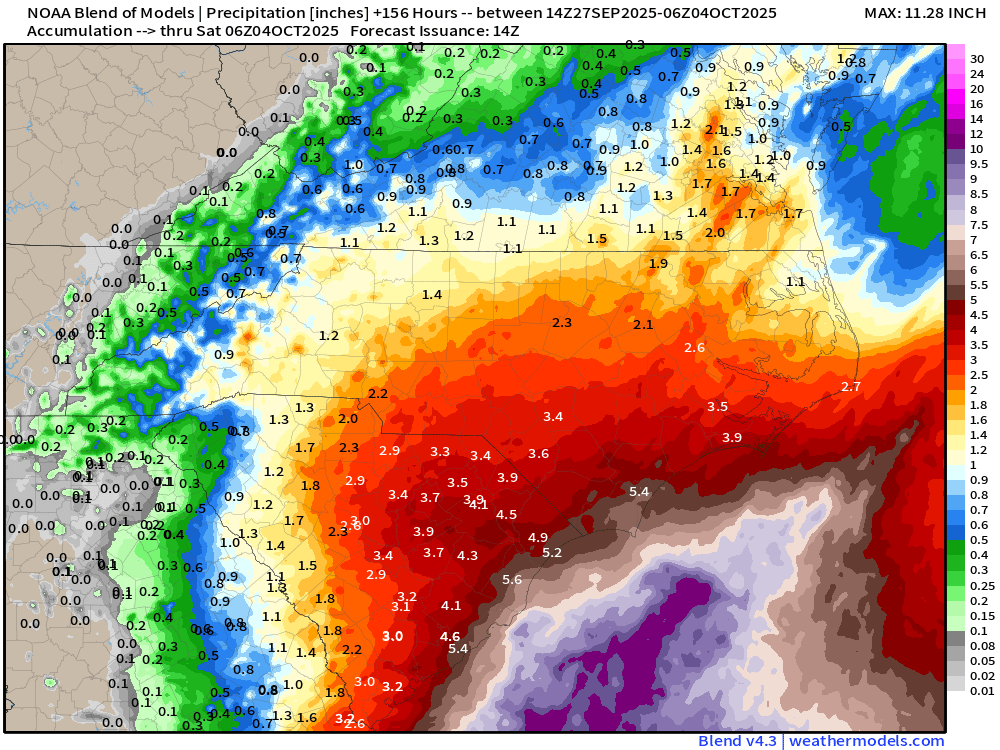
11:50am Saturday Tropical Update:
In my discussion, as well as on-air yesterday morning, I outlined 3 possibilities with Imelda-to-be... 1) the system plows inland into the SC and the interior Carolinas, 2) the system stalls just offshore for several days, or 3) the system turns out to sea before reaching the coast. I mentioned any of those scenarios as being possible.
I cautioned against paying attention to and sharing the scary-looking 12-16"+rain totals from a few of the models and recommended paying attention to the model blend that I posted.
**As of this morning, there is a growing consensus that the system will stall just offshore for a while Monday-Wednesday, and there is less and less model data supporting of the idea of a SC landfall followed by the system moving toward the western Carolinas.**
As of this typing, it appears bands of rain will begin to move into the Carolinas Monday, Tuesday could be a pretty wet day, especially for central and eastern NC, and then we will see how the system behaves Wednesday-onward.
Also as of this typing, I am not overly concerned about any type of huge, tragic, widespread flooding problems for the mountains and foothills of NC.
The usual caveats apply here....changes are possible. However, the picture is gradually becoming clearer, and that trend should continue through the weekend.
Included in the post, I have the spaghetti charts from the European, the European AI, the rest of the global and hurricane models, as well as the latest model blend rain totals over the next week.
#ncwx #scwx #imelda #ilmwx #cltwx #triadwx #rduwx #wncwx
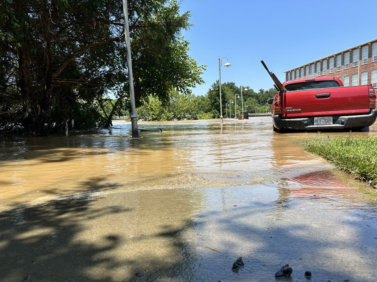
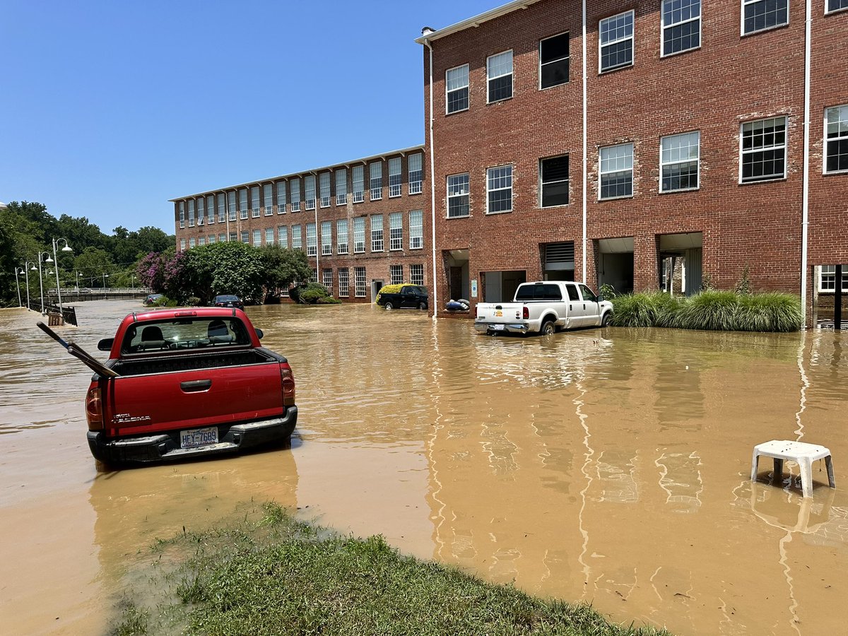
Power outages, cars completely submerged in water, community members concerned. This is the aftermath of a flood hitting Saxapahaw, NC.
I spoke with a woman who says this happens too often - yet she believes the community will come back stronger.
More tonight @SpecNews1CLT
Good news! I-40 is back open to one lane in each direction at the TN/NC state line, 9 days after flooding/rockslide closed the roadway. Please use extreme caution as workers are still present, as Helene repairs continue in this area. #myTDOT#WorkWithUs
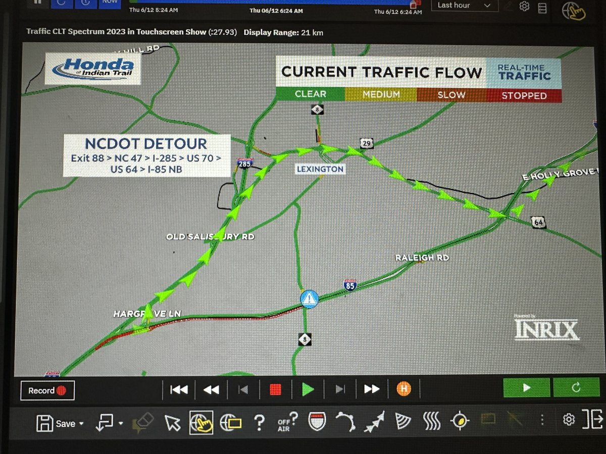
Heads up if you're heading towards #Greensboro this morning! I-85 NB is shut down near Lexington.
@NCDOT advises drivers take Exit 88, to NC47, to I-285, to US70, and to US64 to access I-85 NB.
@SpecNews1CLT
⏺️Heads Up⏺️
⚠️Morehead St. bridge over Stewart Creek is closed, just west of Freedom Drive
❎Emergency repairs are needed
❗️Detour: Freedom Drive, Allegheny Street, Ashley Road
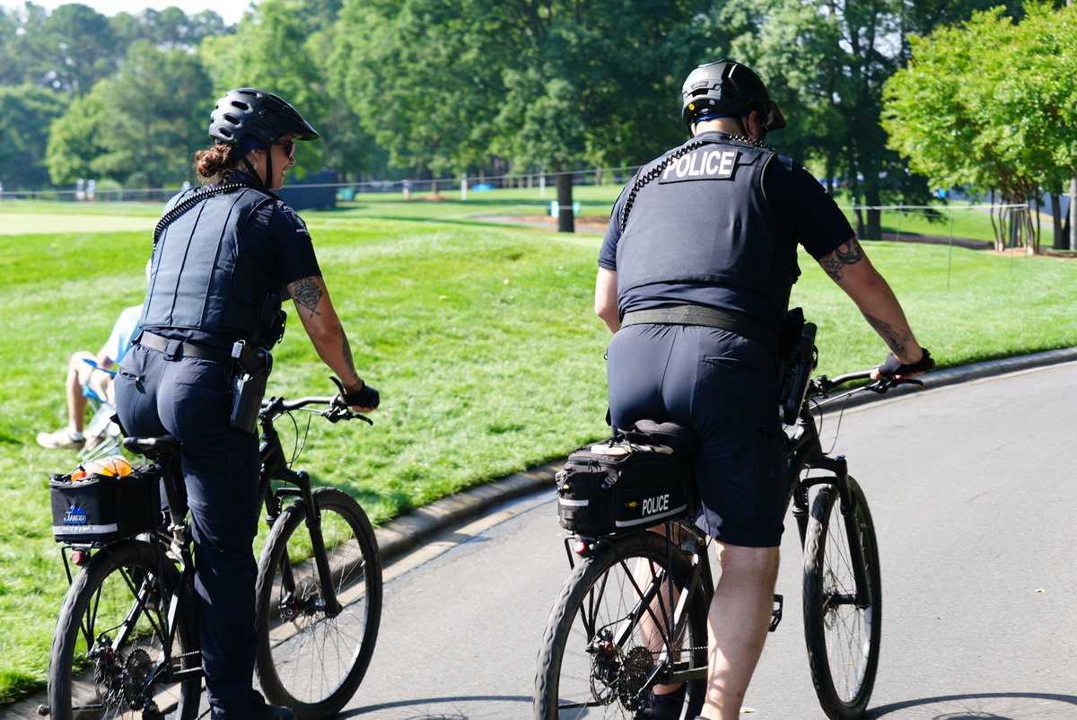
If you’re headed to the PGA Championship this weekend, you’ll see our officers walking the course with players and providing additional security for Quail Hollow Club. Let’s make this a safe and memorable event for all!
For attendees:
✔️ Arrive early, allowing extra time for travel and shuttles
✔️ Stay aware of your surroundings
✔️ Stay informed via the PGA Championship website or app
For area residents and visitors:
Gleneagles Road between Park Road and Quail Hollow Road will be closed daily from early morning until late evening.