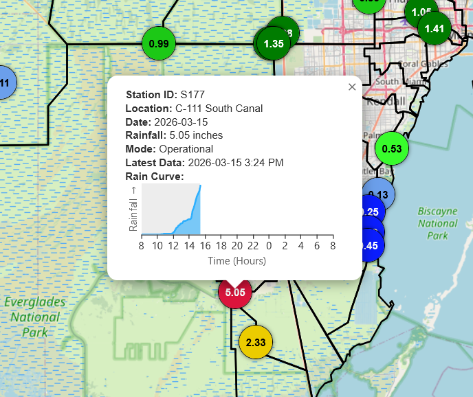
A confirmed 5.05" of rain has now fallen at SFWMD rain gauge S177, southwest of Homestead, FL, and continues to increase as stationary thunderstorms remain overhead. Much needed rain, though a bit much at once. #flwx
After a bit of downtime, the radar page is back up: https://t.co/e9hzpAr2gw
It now includes some bug fixes and performance improvements. The radar images are generated in NCL, which remains fast, extremely capable, and still holds up very well today. Thanks, NCAR!
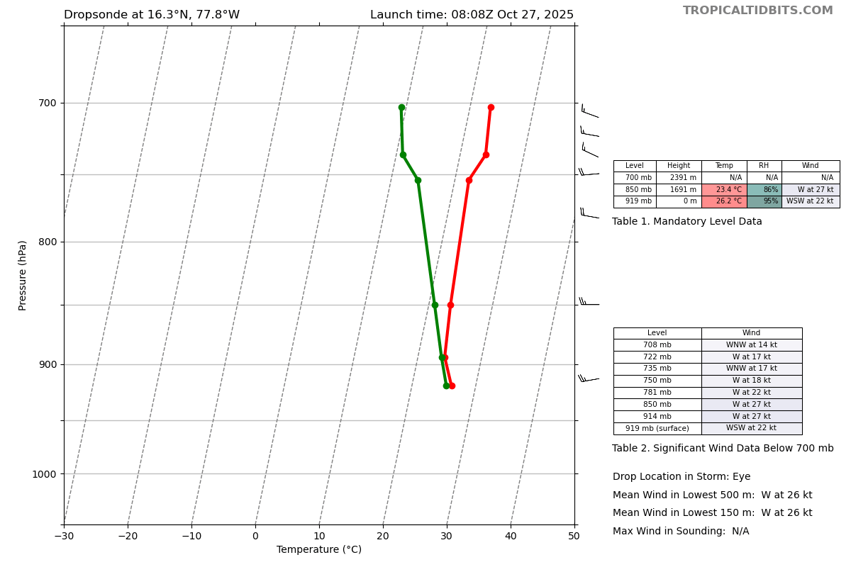
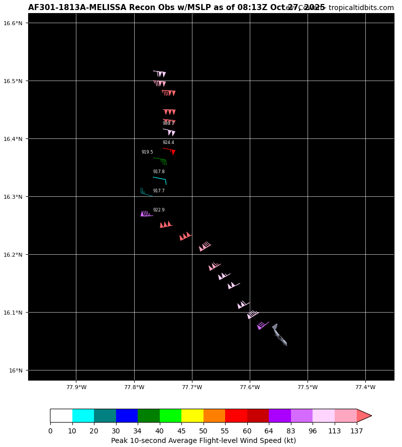
And now the aircraft observations are catching up with the satellite appearance. 917 mb with 150-155 kt flight levels winds in both the N and SE quadrants. Scary storm. #Melissa
The upper low north of #93L's 'center' is producing westerly shear and feeding dry air into the circulation, likely why convection weakened this afternoon. The system will continue to struggle until the low moves out, but enhanced rainfall is still expected over FL.
• College of Dupage (https://t.co/JtTW3Gqt5S)
• NCAR RAP (https://t.co/dLNydqUmbk)
• PolarWx (https://t.co/JbUG7LQ8YI)
• CyclonicWx (https://t.co/TPWtEsuYfY)
• Weathernerds (https://t.co/SPVbXNXe2X)
• Brian McNold's radar page (https://t.co/nHFe8FI0Y1)
To name a few!
The server room hosting my radar page (https://t.co/8lKoFUrmrp) is scheduled to shut down later today in preparation for #Idalia.
While this is unfortunate, there are many equivalent (if not, superior) webpages that offer similar imagery:
[continued in next post]
This is a dangerous storm. Please heed evacuation orders and follow guidance from local, state, and federal agencies. Your safety depends on making the right decisions.
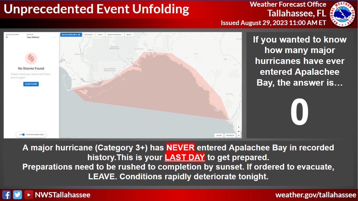
Hurricane #Idalia will likely be an unprecedented event for many locations in the Florida Big Bend. Looking back through recorded history, NO major hurricanes have ever moved through the Apalachee Bay. When you try to compare this storm to others, DON'T. No one has seen this.
Hurricane #Idalia will likely be an unprecedented event for many locations in the Florida Big Bend. Looking back through recorded history, NO major hurricanes have ever moved through the Apalachee Bay. When you try to compare this storm to others, DON'T. No one has seen this.
As Typhoon #Mawar nears the end of its eyewall replacement cycle, its new eyewall edges dangerously close to Guam. Fascinating to watch unfold on radar: https://t.co/0lcPGeQql2
Here is a long radar loop of #Hurricane#Fiona, where the eyewall is now along the S coast of #PuertoRico.
Unfortunately, flooding impacts likely prolonged as Fiona moves WNW & a large principal rainband on E side maintains substantial upslope rainfall over island. #PRwx 😰