🌦️ Stop reacting to the weather. With our new Weather Insights from Earth AI, you get 5 years of historical data to optimize routes and predict demand.
Move from reactive to resilient ➡️ https://t.co/ySW59xg3Zh
The next leap in AI will come from systems that can reason not only about information, but about the state of the physical world.
We’re starting to see the stack come together:
Multimodal perception → geospatial grounding → persistent context → spatial reasoning → tool use → action → verification
What makes this interesting is the convergence of several layers that used to evolve separately.
Maps and real-world data can provide agents with fresh spatial context. MCP can expose trusted tools and data as an execution layer. Agentic interfaces can translate reasoning into interactive actions. And embodied models are beginning to reason about objects, environments, movement, and physical constraints.
The real challenge now is not simply making models larger. It is building systems that can maintain a reliable representation of where they are, what is around them, what has changed, and what actions are actually possible.
That convergence between geospatial intelligence, agents, world models, and robotics is where I think some of the most important engineering work is happening.
Interesting progress across @GMapsPlatform@GoogleDeepMind@GoogleAIStudio@keerthanpg@_philschmid@pushmeet@jocarrasqueira.
#GeospatialAI #SpatialIntelligence #AgenticAI #EmbodiedAI #WorldModels #MCP #AIEngineering
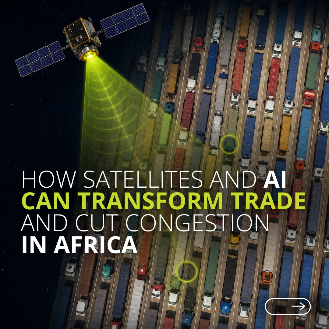
What if satellites and AI could help Africa's trade flow faster and cost less?
The @WorldBankGroup’s new research shows how geospatial data and artificial intelligence can track freight movement, pinpoint congestion, and reveal where infrastructure is holding trade back, giving policymakers the evidence they need to invest smarter and plan better.
As African economies deepen regional integration, these tools offer a practical path to stronger connectivity and greater competitiveness.
📖 Explore the analysis → https://t.co/yXg4PBBk0O
The most interesting shift in geospatial AI right now is not better map rendering — it’s the transition from model-centric intelligence to environment-grounded agents.
A useful real-world agent has to do more than generate a plausible answer. It needs to continuously connect language reasoning with places, routes, traffic, imagery, spatial constraints, and changing physical conditions.
I think the emerging architecture increasingly looks like:
Intent → Retrieval → Geospatial Grounding → Spatial Reasoning → Tool Execution → Verification
MCP is becoming an important interface layer in that stack, while agentic UI systems can turn model reasoning into interactive spatial actions instead of static text responses.
The deeper opportunity is that maps may evolve from something an AI queries into part of the AI’s operational representation of the world.
That is where geospatial AI begins to converge with world models, robotics, logistics, infrastructure intelligence, and embodied systems.
The next generation of agents won’t just know information about the world. They will need to understand where things are, how they relate spatially, what is changing, and what actions are physically possible.
#GeospatialAI #AgenticAI #SpatialIntelligence #MCP #AIEngineering #WorldModels #MachineLearning
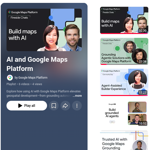
Our newest AI video collection for Google Maps Platform covers:
🤖 Deploying MCP servers
⚡️ Grounding autonomous agents
🧠 Building for real-world reasoning
🔧 Agent-assisted tools
and more! Dive in ➡️ https://t.co/enHYbhGRMC
Ask Maps is getting an upgrade. 🔍✨
Now powered by agentic capabilities, real-time information, and Personal Intelligence, Ask Maps is transforming how you plan and move through the world.
The next frontier for geospatial AI isn’t simply better maps — it’s building agents that can reason about the physical world.
A capable spatial agent needs more than an LLM. It needs real-world grounding, persistent geographic context, multimodal perception, dynamic routing data, and a reliable interface between reasoning and action.
What becomes especially interesting is the emerging stack:
Perceive → Ground → Reason → Plan → Act → Verify
MCP can provide the connection layer between models and trusted geospatial systems. Agentic interfaces can turn natural-language intent into spatial actions. Street-level imagery, traffic signals, places, routes, and Earth-scale datasets can then become part of the model’s operational context.
The long-term opportunity is much bigger than navigation. We’re moving toward systems that can understand how the physical world is changing — and make decisions inside it.
That could reshape mobility, logistics, infrastructure, urban planning, robotics, and eventually embodied AI.
#GeospatialAI #AgenticAI #SpatialComputing #MachineLearning #AIEngineering #MCP #DigitalTwins
This is a strong example of AI creating value beyond the digital world. Better models of the physical environment can translate directly into better planning, earlier decisions, and more resilient infrastructure.
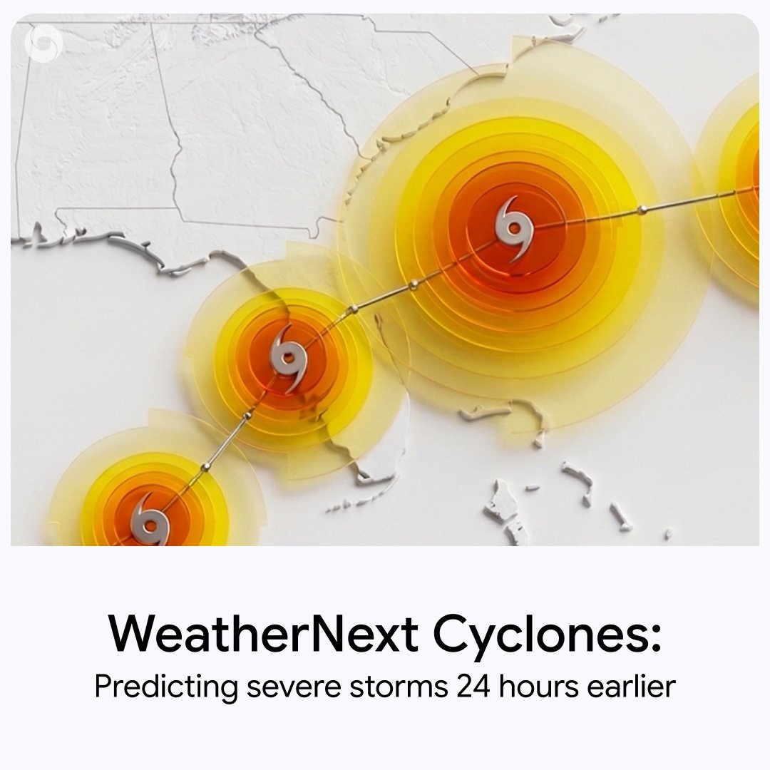
Predicting cyclones accurately can help save lives - and every hour of lead time counts.
Published in @Nature, our AI model WeatherNext achieves state-of-the-art accuracy in forecasting a storm’s track and intensity, giving us a critical extra 24 hours to prepare on average. 🧵
Grounding agents in reliable real-world data will be critical as AI systems become more autonomous. Geospatial context is a particularly powerful layer because so many real-world decisions ultimately depend on location, distance, movement, and time.
Our newest AI video collection for Google Maps Platform covers:
🤖 Deploying MCP servers
⚡️ Grounding autonomous agents
🧠 Building for real-world reasoning
🔧 Agent-assisted tools
and more! Dive in ➡️ https://t.co/enHYbhGRMC
The shift from navigation to intelligent, context-aware assistance is one of the most interesting changes happening in maps. The real engineering challenge is making increasingly capable systems still feel simple, fast, and trustworthy.
Ask Maps is getting an upgrade. 🔍✨
Now powered by agentic capabilities, real-time information, and Personal Intelligence, Ask Maps is transforming how you plan and move through the world.
Geospatial intelligence is moving beyond static maps and traditional search.
The next phase will be defined by the convergence of foundation models, real-time location data, multimodal reasoning, and agentic systems that can understand not only where something is, but also context, intent, movement, and change over time.
The engineering challenge is significant: models need to reason across massive spatial datasets, dynamic environments, imperfect signals, privacy constraints, and constantly changing real-world conditions — while still delivering results that feel fast, simple, and trustworthy to users.
What interests me most is how geospatial AI can evolve from “help me find a place” into systems that can better understand the physical world and support more intelligent decisions across navigation, logistics, urban mobility, local discovery, and infrastructure.
#GeospatialAI #ArtificialIntelligence #MachineLearning #GoogleMaps #Engineering #LocationIntelligence #AgenticAI #SpatialComputing
@gmail With Personal Intelligence, you can securely connect Ask Maps to @gmail — and soon, @googlecalendar — to give you more relevant responses. Ask Maps to help plan your day around hotel bookings, dining reservations, flight details, and more.
Ask Maps is getting an upgrade. 🔍✨
Now powered by agentic capabilities, real-time information, and Personal Intelligence, Ask Maps is transforming how you plan and move through the world.
Consider this your personal tour of @DUALIPA’s home. 🗺️✨
Kosovo is officially live on Street View! We partnered with Dua and Service95 to share her must-see Prishtina recommendations, from favorite local hangouts to city staples.
Find all of Dua's recommendations at https://t.co/TNln1rYeTL
#GooglePartner
Ask Maps is getting an upgrade. 🔍✨
Now powered by agentic capabilities, real-time information, and Personal Intelligence, Ask Maps is transforming how you plan and move through the world.
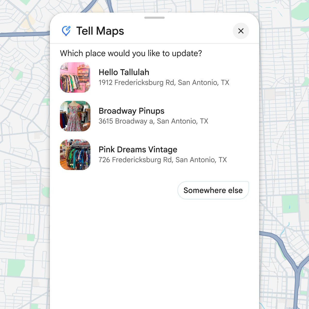
@gmail@googlecalendar Finally, there’s a new conversational way to share updates with the community. Just tell Maps what you know about a place, like new business hours or parking tips, and we'll handle the heavy lifting to suggest an update for you to confirm.
We’re upgrading Ask Maps with some helpful new features. 🔍
New agentic capabilities and smarter answers using booking details from @gmail — plus live traffic and transit schedules — can help you tackle whatever the day throws at you in real-time. We’re also expanding to 150 new countries and territories including Australia, Brazil, Canada, Indonesia, Japan, and Mexico.
Let’s dive in and see what’s possible 🧵
We're shipping big updates to Ask Maps! Since we've launched Ask Maps, I've been inspired by how people are using Google Maps in totally new ways to ask the questions really on their minds.
Building on that, we're expanding Ask Maps to 150+ markets in English and rolling out:
🍔 Food ordering with partners like Square and Toast, with Uber Eats coming soon
🧠 Personal Intelligence with Gmail integration
🚆 Real-time transit info
🗺️ Suggest tips and edits conversationally
The way you use Google Maps will never be the same.
Introducing Ask Maps, a new way for you to ask anything about anywhere, with help from the latest Gemini models. Rolling out now on Android and iOS in the US and India.