We ask that you continue listening to law enforcement and do NOT enter the newly evacuated area.
Thank you to our community members for your continued support, patience, and cooperation.
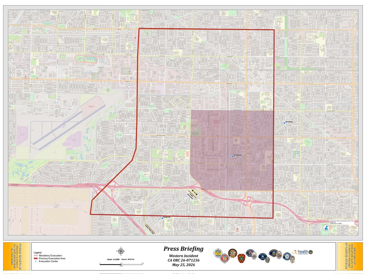
***UPDATED INCIDENT MAP***
Effective as of Monday, May 25 at 6pm, the red shaded area represents the newest evacuation zone, while the red outline represents the previous evacuation zone.
Boiling-Liquid-Expanding-Vapor Explosion (BLEVE)
A type of rapid phase transition in which a liquid contained above its atmospheric boiling point is rapidly depressurized, causing a nearly instantaneous transition from liquid to vapor with a corresponding energy release.
***INCIDENT UPDATE***
Note: Videos include AI-generated captions. While efforts have been made to ensure accuracy, some transcription errors may occur.
Firefighters are responding to a vegetation fire in the area of Carbon Canyon and Olinda Place in Unincorporated Brea that was reported at 1:37 p.m. Currently estimated to be approximately four acres.
San Clemente - Firefighters are on scene in the 300 block of Avenida San Pablo for a vegetation fire. Forward progress of the fire has been stopped. No damage to structures. No cause determined yet.
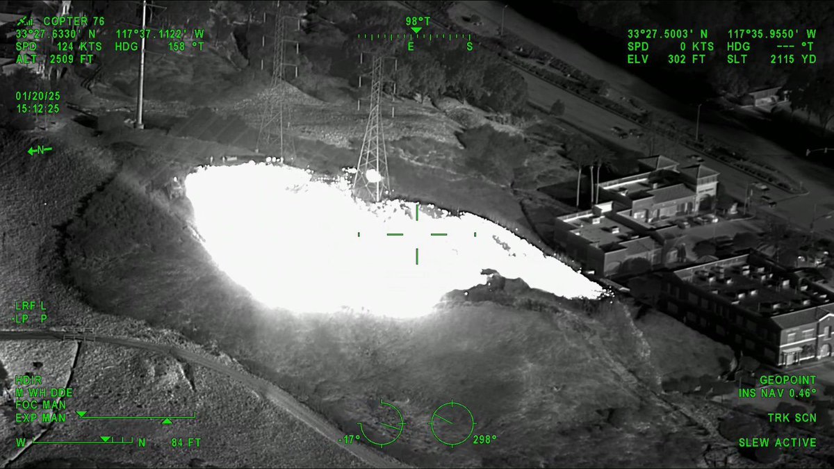
Quick Reaction Force (QRF) Helicopter 76 captured these images. The heat signature of the fire is visible in the second photo. OCFA and QRF helicopters are invaluable assets, not only for firefighting but also for providing intelligence to our firefighters on the ground.
Firefighters are on scene of a vegetation fire near Avenida Pico and Avenida La Pata in @CitySanClemente. A full vegetation fire response, including our augmented resources for this Red Flag event, are part of the fire attack.
Cell phones across Orange County may have received an emergency alert for an evacuation warning. This is likely related to the #KennethFire in the West Hills area of Los Angeles and does not affect Orange County. There is no threat to Orange County.
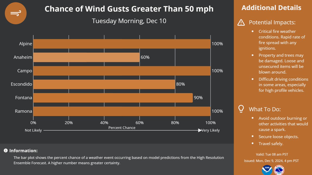
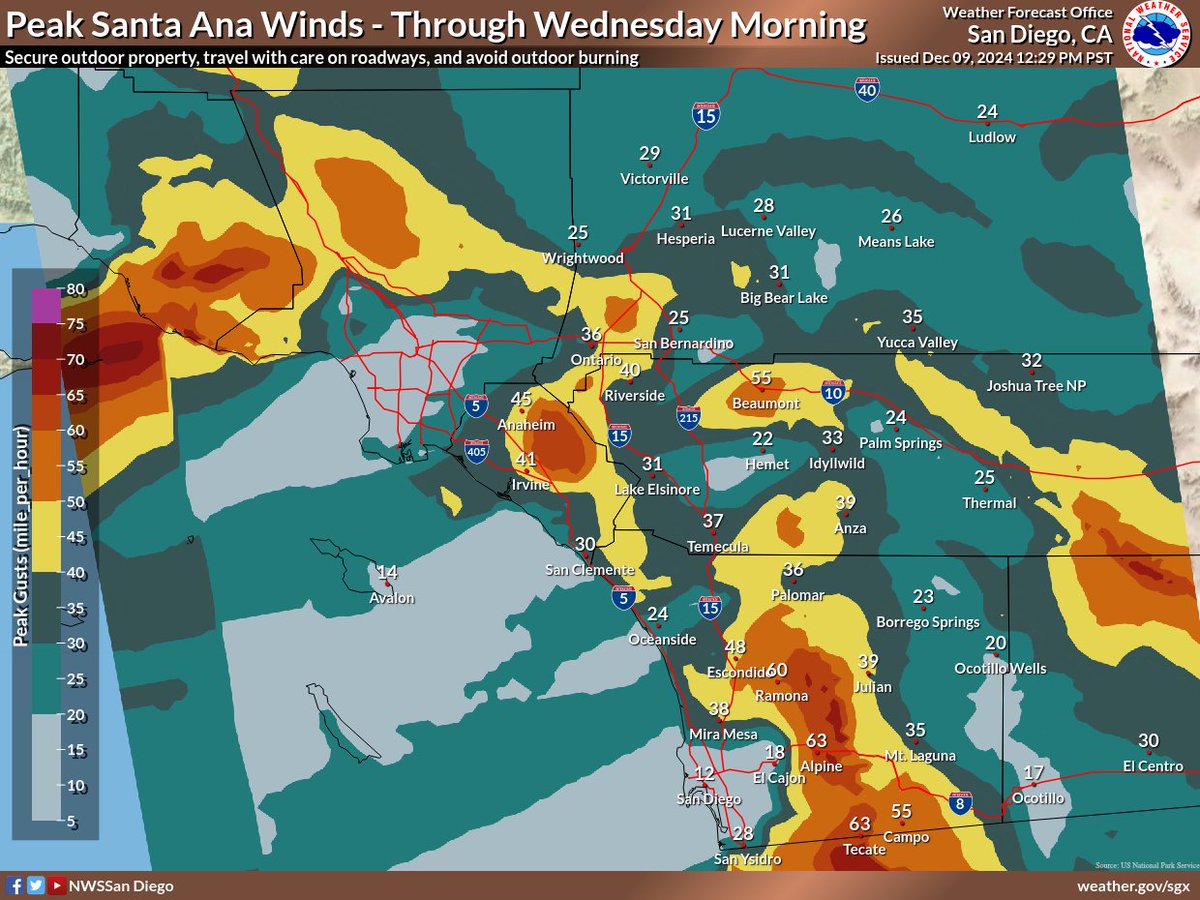
A Particularly Dangerous Situation is expected for the highlighted portion of our area from 7AM - 1PM on Wednesday. Very strong gusts and low relative humidity will allow any fires that develop to spread VERY rapidly! Wind damage including downed trees expected in some spots!
Santa Ana winds ramp up tonight into Tue. Gusts 60-70 mph+ expected for Cajon/Banning passes & wind prone areas in the SD mtns. Gusty winds will blow unsecured items around & cause difficult travel for high profile vehicles - secure umbrellas/inflatable reindeer & travel w/ care!
The roads below are closed to the public at the following intersections:
Plano Trabuco and Joshua Drive
Plano Trabuco and Robinson Ranch
Antonio and Alas de Paz
Trabuco Canyon and Trabuco Creek
Santa Margarita and Antonio
Avenida Empresa and Santa Margarita Parkway
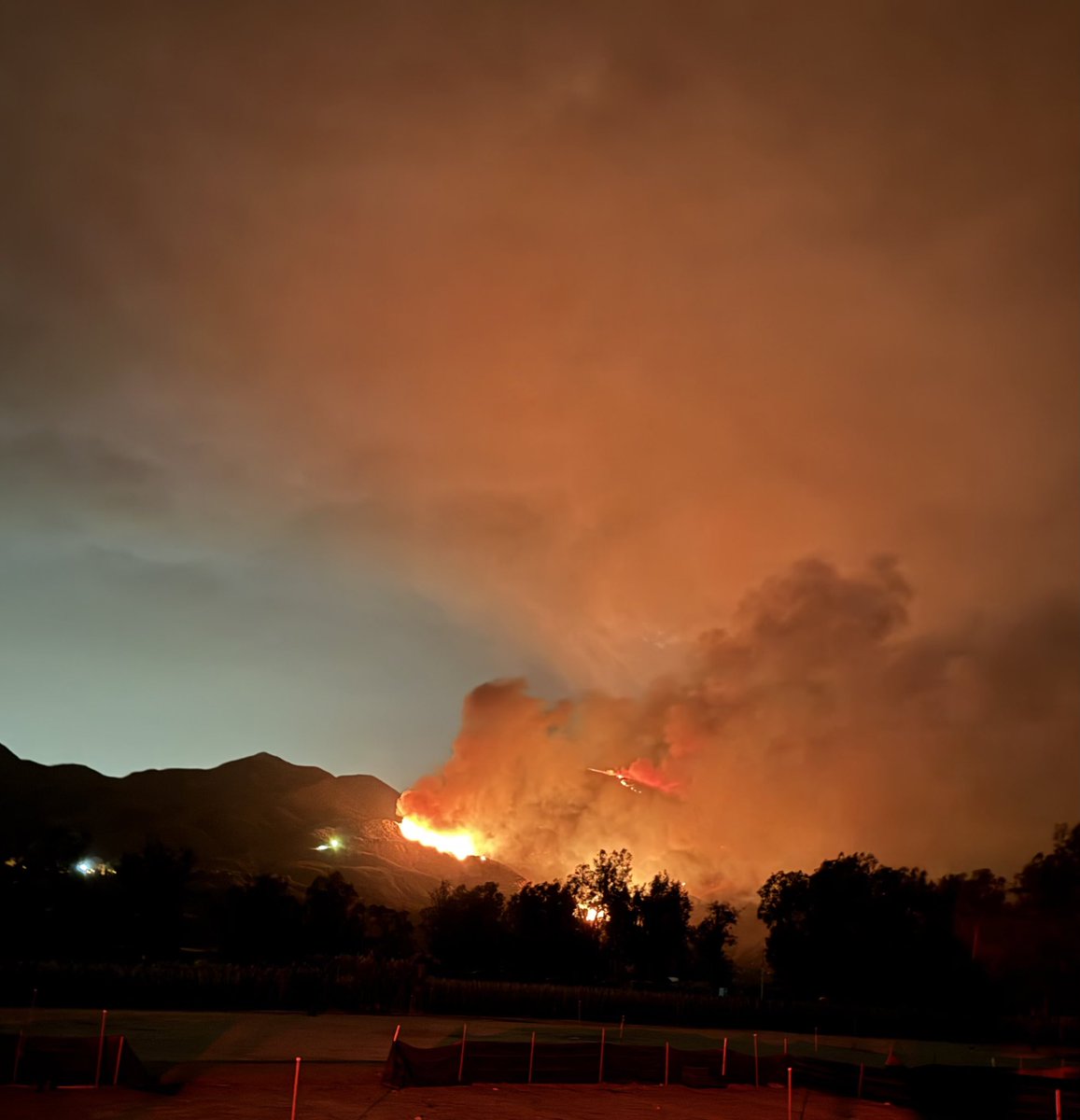
#AirportFire
@OCSDRanchoSM@ClevelandNF Firefighters continue the aggressive attack. The current estimate is approximately 800 acres. As always, we thank our community for being prepared, remaining out of the area, and allowing us all to work safely
Due to the #AirportFire, there is an evacuation warning (voluntary) for residences near:
- Rose Canyon Road
- Trabuco Creek Road
- Trabuco Canyon Road
- Trabuco Oaks Drive
- Joplin Loop
- Cook's Corner