⚠️ MAJOR WIND STORM EXPECTED FRIDAY IN TEXAS 💨
Wind gusts nearing hurricane strength (60-75mph) will be experienced across the Texas Panhandle, West Texas, Northwest Texas and western Oklahoma on Friday March 14th. Here are the latest peak wind gusts Friday afternoon from the Euro model. Numerous dust storms and a wildfire outbreak will be possible. Light damage to infrastructure and roofs/siding/fencing. Tractor-trailers and RVs will be at risk of being blown over.
These damaging winds will be in response to a potent low pressure system in the Central Plains, and are not associated with thunderstorms. In fact, these areas will experience extreme dryness and critical/extreme fire danger. We do note a slight chance for severe weather in far east Texas on Friday.
Lesser wind gusts (but still strong) will be felt all around Texas: 50-60mph in Midland/Odessa, Abilene and San Angelo / 45-50mph in DFW and El Paso / 30-35mph in AUS/SAN and Houston.
#txwx #texas #wind #extreme #weather #fire #storm #damage #danger
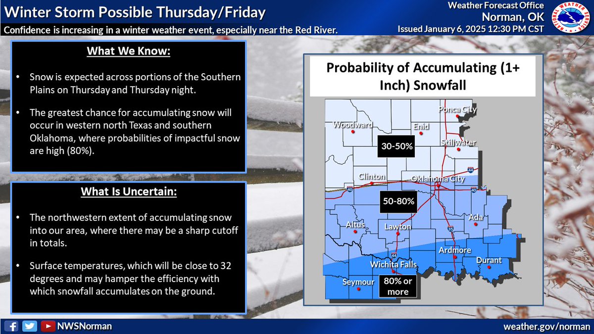
Heads up: we're monitoring the potential for impactful snow from Thursday through early Friday, especially across our Red River counties. Considerable uncertainty exists further to the north. #okwx#txwx
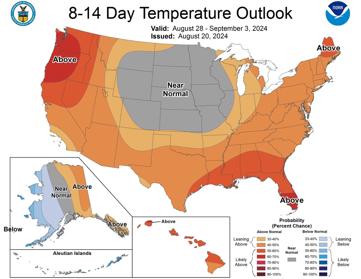
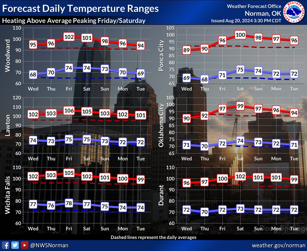
Unseasonably hotter temperatures ahead for the next 7-days peaking on FRI & SAT with widespread heat indices of 105-110 degrees. CPS 8-14 day outlook going into early Sept has our area progged at a 30-50% leaning above normal/seasonable.
#okwx#texomawx
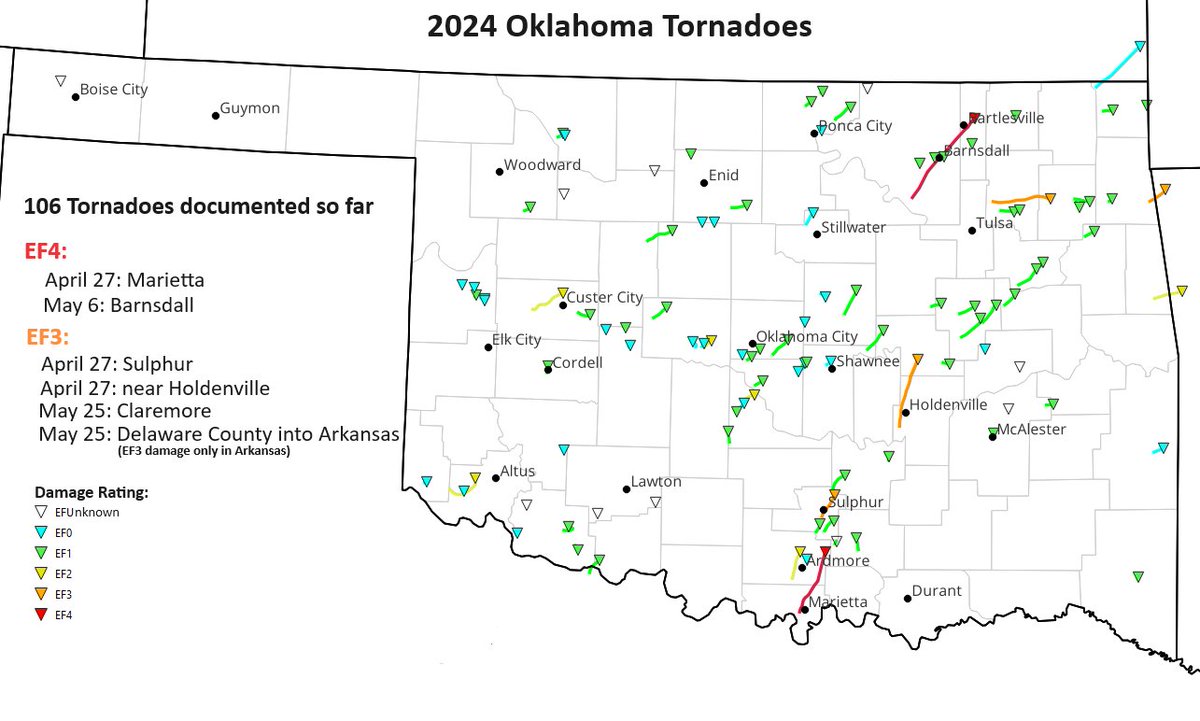
Twisters? Unfortunately we have had an active year for tornadoes in Oklahoma. 106 tornadoes have been documented so far, making it the 6th most active year since 1950. #okwx
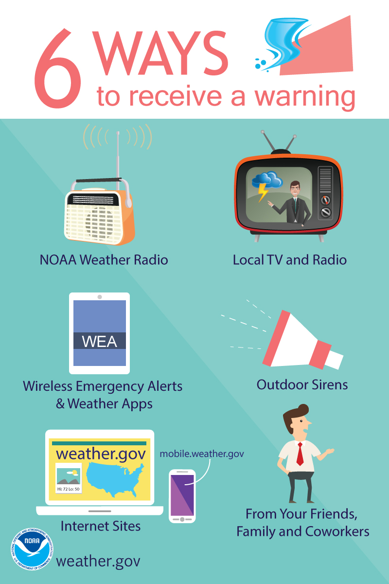
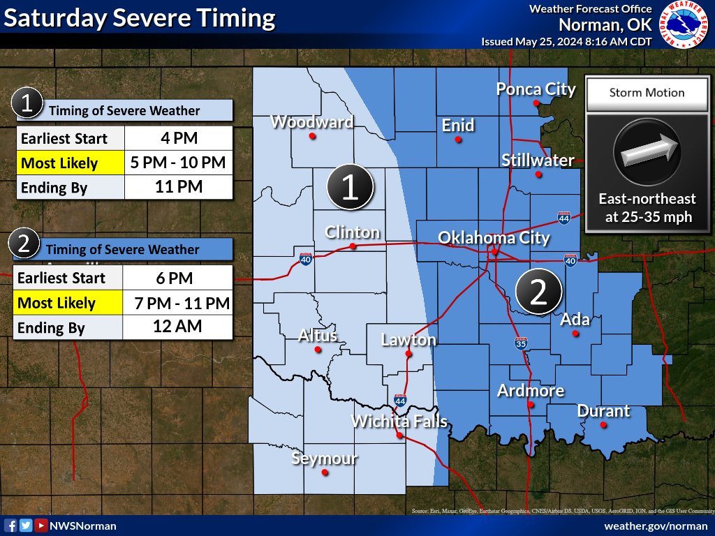
Significant severe weather is expected today, with risks for large hail, damaging winds, and tornadoes. Make sure you have multiple ways to receive warnings and have a sheltering plan for if storms threaten your area. #okwx#texomawx
Today's storm environment is like a gasoline-soaked brush pile--any storm that goes up is likely to produce large hail, damaging winds, and (toward evening) perhaps tornadoes. The biggest uncertainty is the match--where is there enough forcing to initiate storms this afternoon?
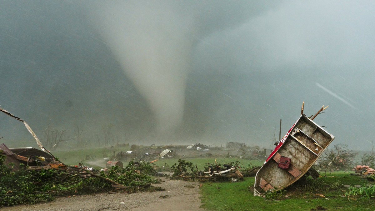
Haunting photo of the Carbon, #Iowa#Tornado that crossed close range and leveled houses right before my eyes. We checked on all parties, and they were in the shelter! #disaster#storm@Tornado_Warned@Jariy
A request for storm spotters/storm chasers: If you have any reports (hail, tornadoes, damage, storm photos, etc), please tag our office directly! That will do the best to ensure that we see it.
Our latest thinking regarding onset of freezing drizzle/rain this (Sunday) evening. Once icing begins, travel conditions will become hazardous/slick. Use caution and check back!
#okwx#texomawx
Unsettled weather arrives beginning late tomorrow, with snow likely over the northern third of Oklahoma & widespread rainfall tomorrow night.
A brief break over the weekend, and then a more impactful system expected early next week.
#okwx#texomawx