Agriculture and weather. OSU Triple-Dipper. Ag and Horticulture in OR CA ID OH & OK. OSU Emeritus. Certified Crop Advisor since 1996. 20 yr Mesonet Agriculture.
Oklahoma wheat harvest remains slow, with just 30% complete according to the OK Wheat Commission.
Read the latest #WheatHarvest25 update on our blog: https://t.co/WCIR9rZR35 🌾
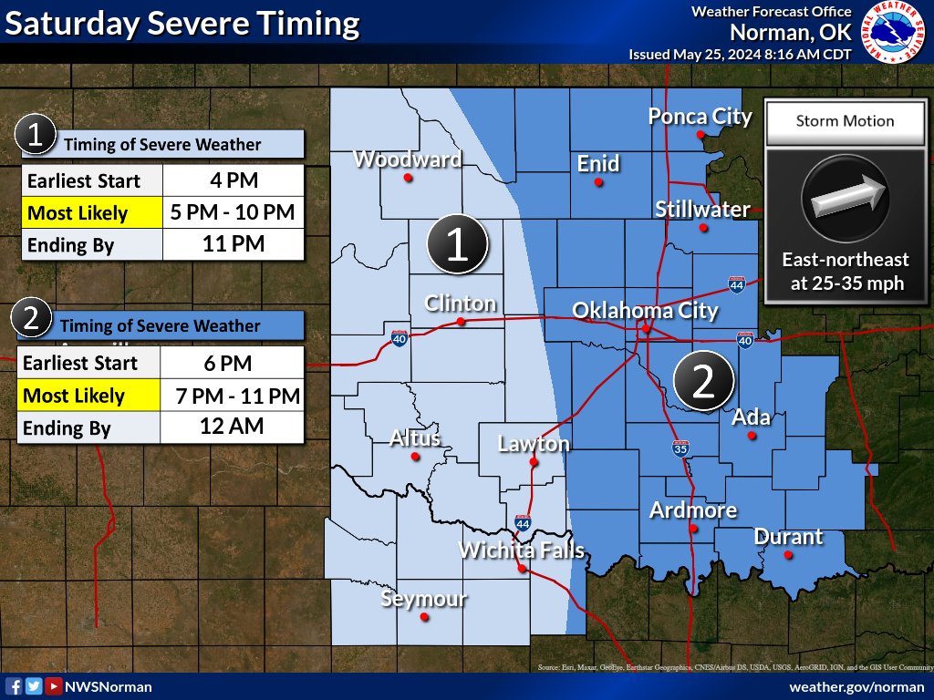
Strong to severe storms capable of all hazards are possible this weekend into early next week. Timing of the incoming system will impact the exact days for potentially higher end severe weather. The track of the system will play a role in the location for storms. #okwx#txwx
We're still watching the early-to-mid-week period for the potential for:
-Rain across the southern part of our area
-Winter weather potential across the northern part of our area.
We'll continue to refine the forecast as we receive more information. #okwx#txwx
We have placed KTLX into standby until further notice to prevent a larger issue from arising. Not to worry though, the radar is still operational! Should the need arise, we can take it out of standby and use the data. #okwx#txwx
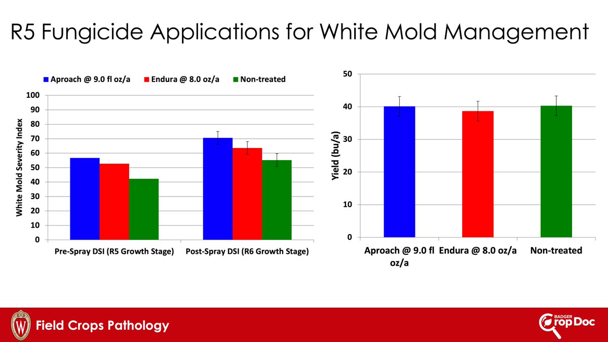
Revenge fungicide applications never work. Below is some data where we tried rescue treatments of fungicide for white mold management. You can't get diseases under control once they are already moving, especially white mold. Plus negative ROI! @badgerbean
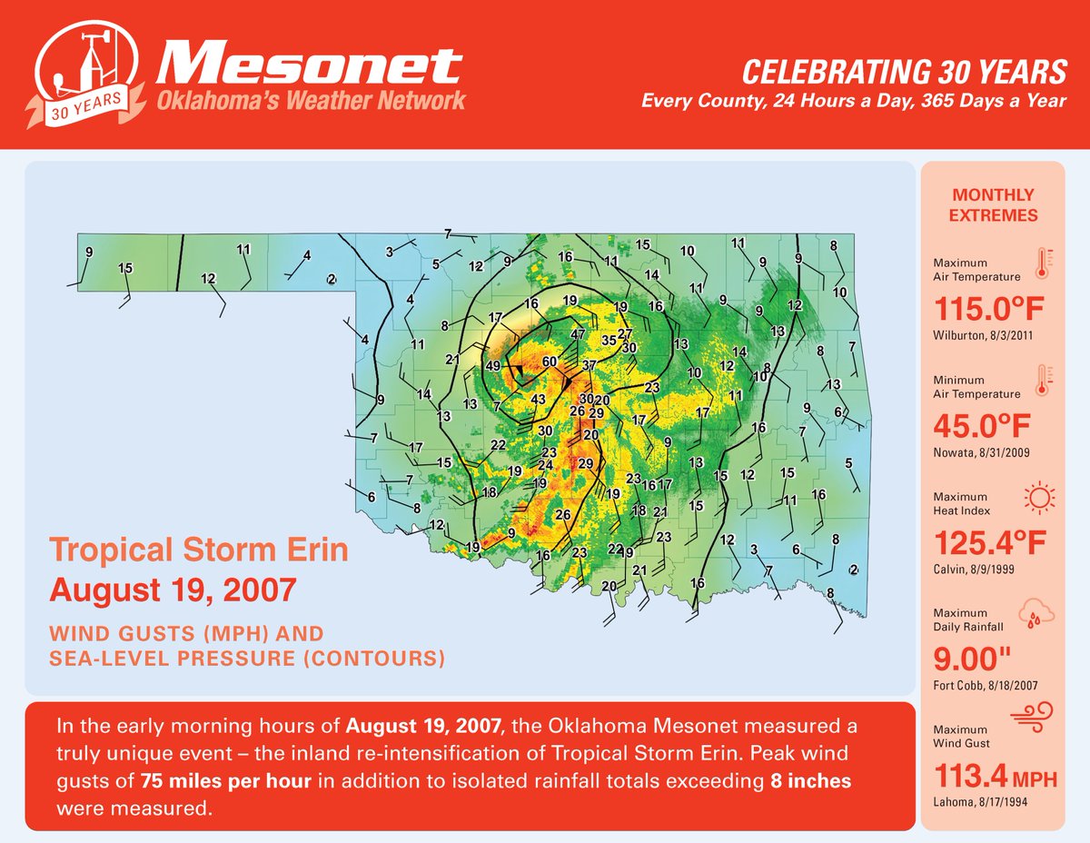
🎉 Oklahoma Mesonet 30th Anniversary post for August! 🎉
On this date 17 years ago, one of the craziest #okwx events occurred when Tropical Storm Erin re-intensified over Oklahoma producing major flooding and peak wind gusts of 75 mph. #okmesonet
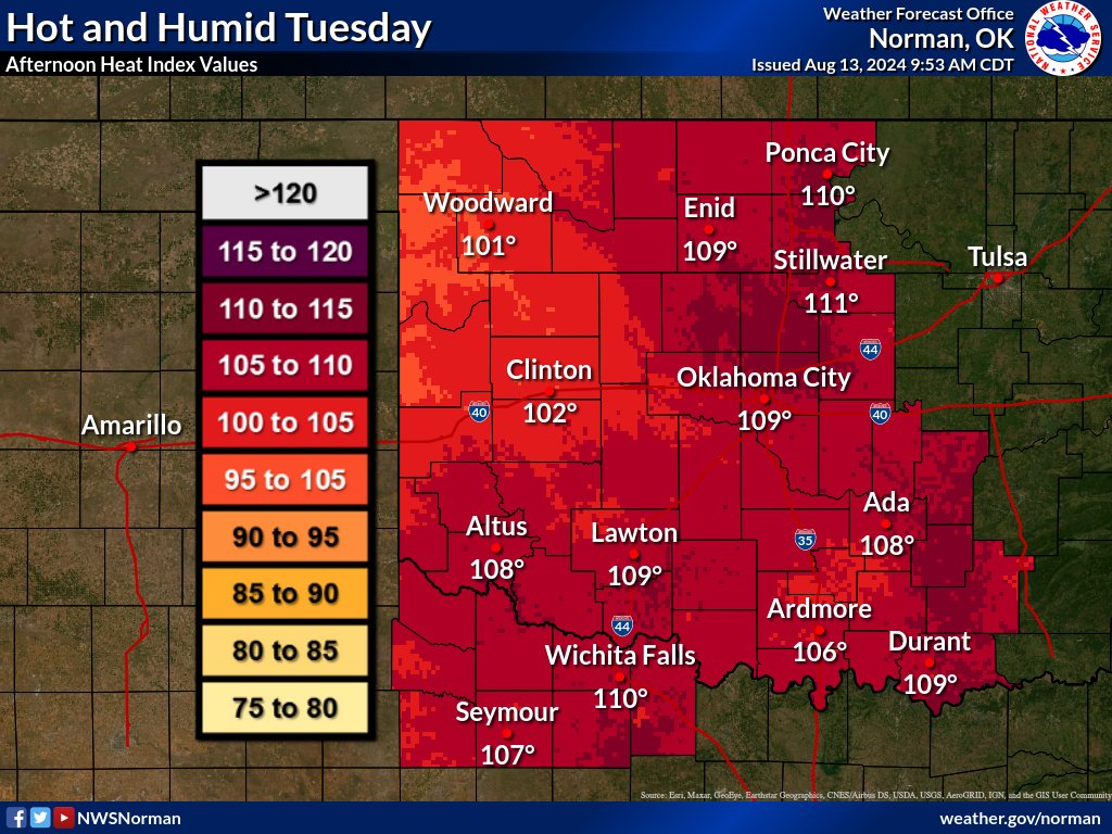
Hot & humid conditions today will lead to triple digit heat index values across the area. Heat index values of 105 to 113 will be possible in some areas. An Excessive Heat Warning and Heat Advisory are in effect. Take steps to prevent heat related illnesses. #okwx#texomawx
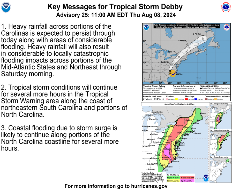
11am EDT Tropical Storm #Debby Key Messages. The most significant threat with Debby continues to be flash flooding from heavy rainfall...worst today across portions of North Carolina and Virginia, and Friday farther north in the Mid-Atlantic & Northeast U.S.
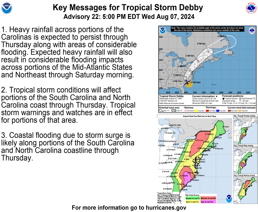
5pm EDT Aug 7th -- Here are the latest Key Messages from Tropical Storm #Debby.
Heavy rainfall continues across parts of the Carolinas, extending to the Mid-Atlantic and Northeast through Saturday.
Latest: https://t.co/q8oErTot7t
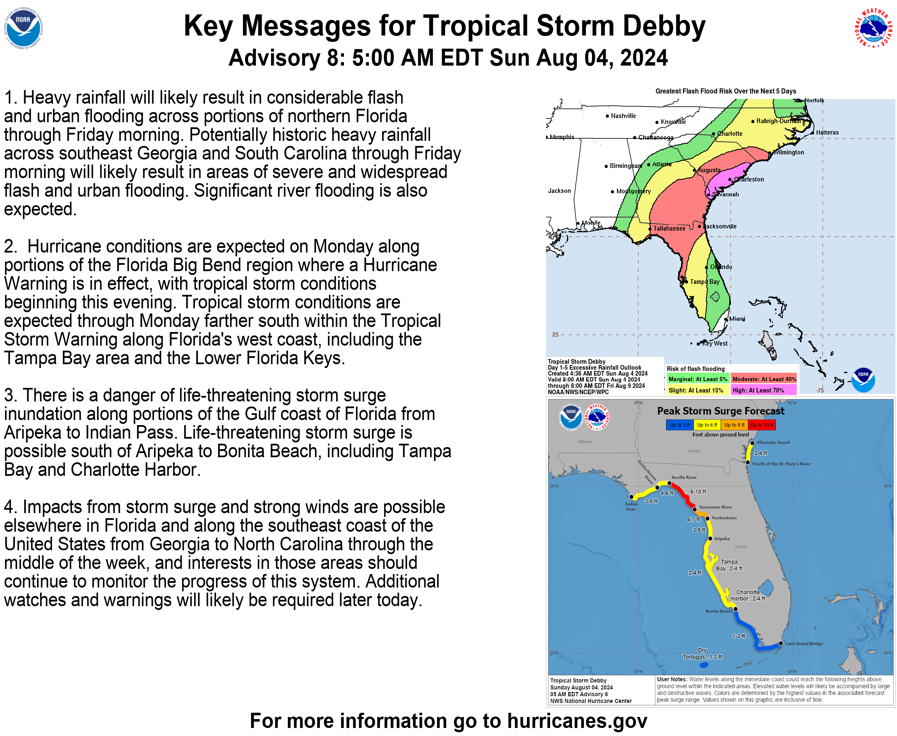
5 am EDT: Tropical Storm #Debby strengthening, expected to become a hurricane before it makes landfall in the Florida Big Bend Monday morning. Significant impacts expected across much of the southeast U.S. Here are the Key Messages. Visit https://t.co/tW4KeGdBFb for details.
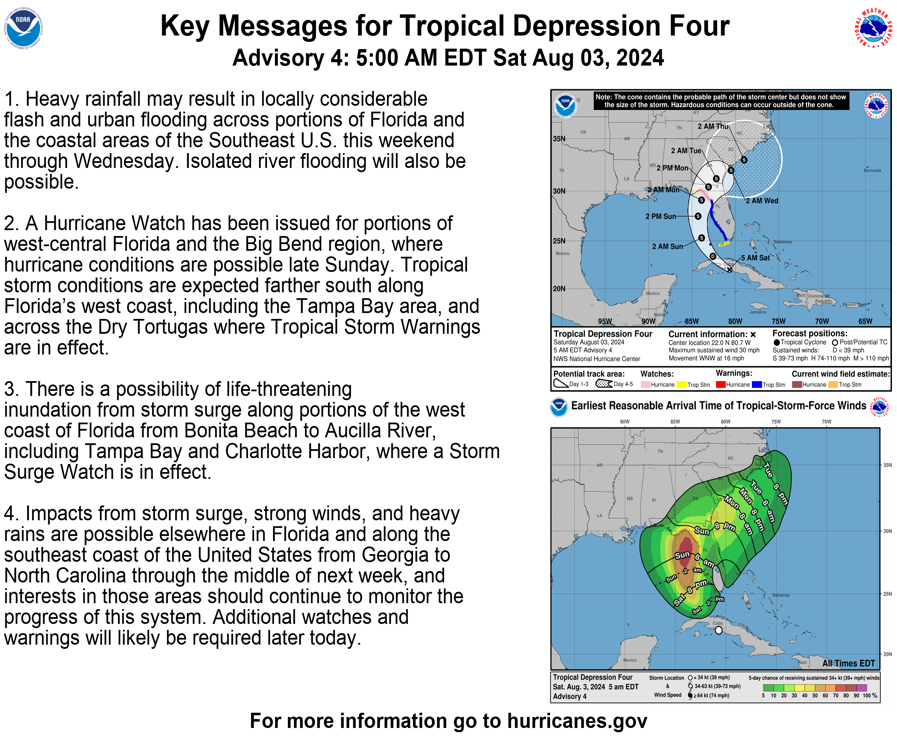
5 am EDT: Tropical Depression Four expected to strengthen over the southeastern Gulf of Mexico. Hurricane Watch issued for a portion of Florida's Gulf Coast. Here are the Key Messages. Visit https://t.co/tW4KeGdBFb for details.
Today's forecast is very similar to yesterday's, with afternoon heat index values in the 105 to 110 degree range for most of the area. Make sure to stay hydrated and take breaks from the sun when spending extended amounts of time outdoors! #okwx#texomawx
Unfortunately we are going to be dealing w/ triple digit heat index values today. Temperatures are expected to climb into the 90s w/ max heat index values of 100-104 expected across parts of the area. Take precautions to prevent heat related illnesses. #okwx#texomawx.
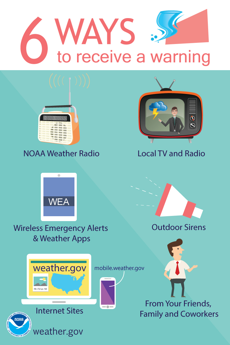
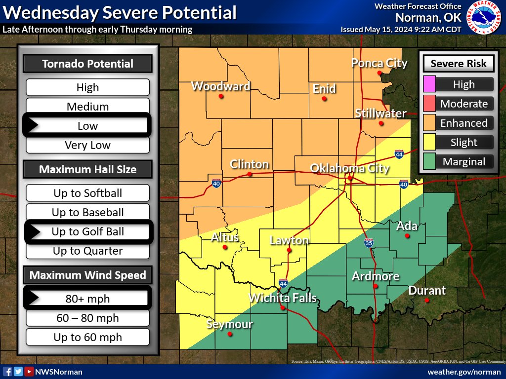
Significant severe weather is expected today, with risks for large hail, damaging winds, and tornadoes. Make sure you have multiple ways to receive warnings and have a sheltering plan for if storms threaten your area. #okwx#texomawx
1130 AM UPDATE: Key messages today: 1) most people will not see a storm, but IF you do, it will be likely be dangerous; and 2) the potential for tornadoes will INCREASE after dark, so do not let your guard down!
Monday Update - Don't focus too much on the outlook lines - the ENTIRE area has a chance for significant severe weather. Very large hail and significant, long-tracked tornadoes are possible with ANY storm that forms in the afternoon/evening. Have your plan in place! #okwx#txwx