The County of Kauai is one of the first places in the U.S. to include GIS-based visualizations in its planning policy around sea level rise. Find out how it’s being used: https://t.co/HMtApIdm4X
#SeaLevelRise#ClimateAction#ClimatePolicy
Aloha drives #THG. Akahai, Lokahi, Olu‘olu, Ha‘ah‘aa, and Ahonui reflect grace and open-mindedness with change. Guided by Hawaii Revised Statutes and late Aunty Pilahi Paki, who taught Executive Director Christine Sakuda, we prioritize these principles to ensure voices are heard.
Be visualizing the disaster increases the understanding of it's magnitude. See the scale of Pakistan’s flooding in maps, photos and videos.
https://t.co/DuFoNpBwCR
Dr. Dawn Wright (@deepseadawn) made history as she dove to the deepest place on Earth, Challenger Deep, to map it in never-before-seen detail. Explore the five deepest parts of the ocean in this animated map. 🌊
For a deeper look visit: https://t.co/9oCFpAKQF8
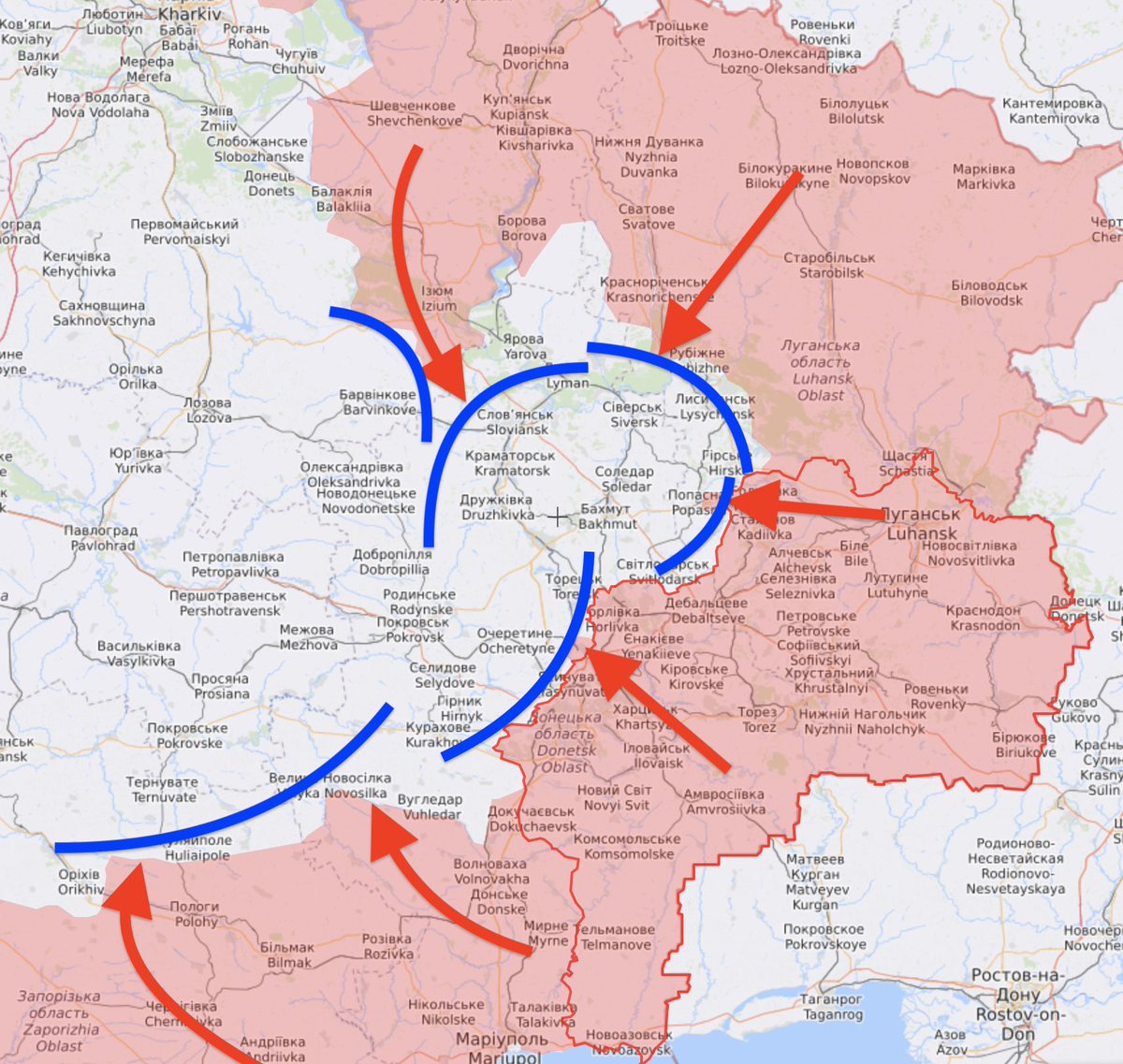
Here’s a very, very basic map that will help you understand the Battle of Donbas now.
The Red is the Russians, the blue is the Ukrainians.
As you can see, the enemy is trying to pinch off a Ukrainian salient with two major strikes from the north and the south.
We are deeply saddened to share the passing of E.O. Wilson, preeminent scientist, naturalist, author of #halfearth at 92. "His gift was a deep belief in people and our shared human resolve to save the natural world" - Paula Ehrlich
https://t.co/suAoRUPil6
#eowilson#extinction
The highest peaks of Hawaii — Mauna Kea summit — spent the weekend under a blizzard warning due to the development of a large storm system. The last blizzard warning was issued in the state in 2018.