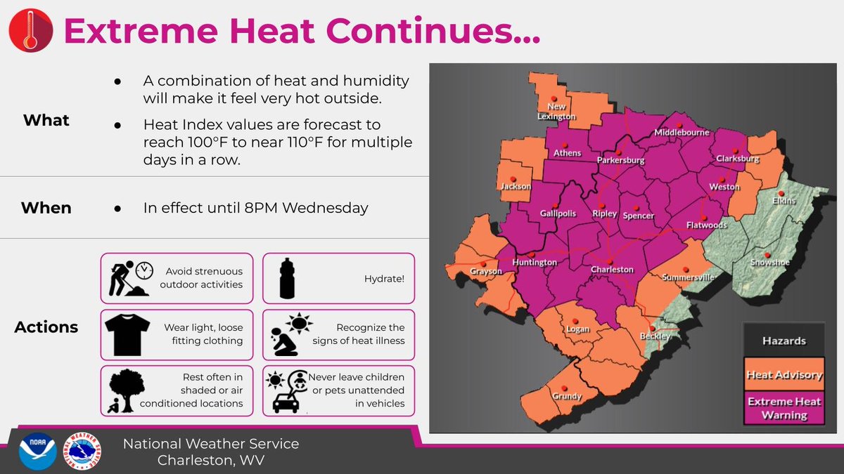
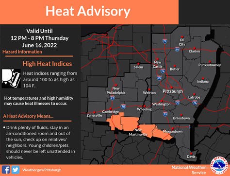
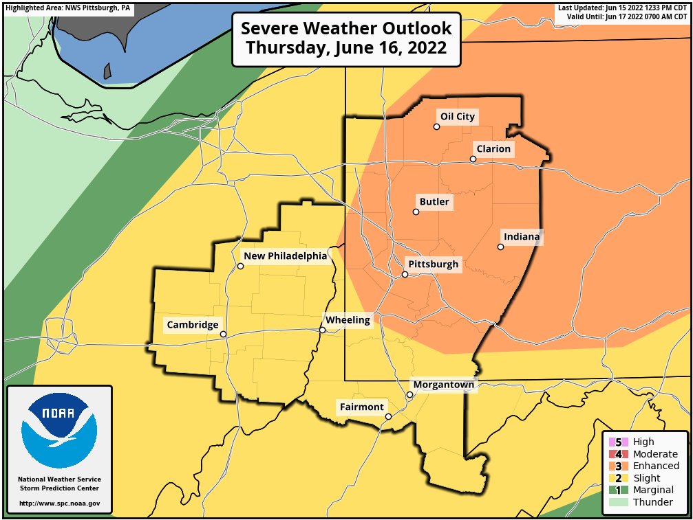
Extremely hot again today with strong to severe storms possible this afternoon/evening.
⚠️ A Heat Advisory remains in effect until 8PM.
💧 Stay hydrated
🏠 Stay cool
⏰ Limit outdoor activity
#WVwx@NWSCharlestonWV https://t.co/CHRrIAk3ji
‼️DEBRIS REMOVAL NOTICE‼️
Cleanup crews are asking that all debris be placed at the curb in front of your home or business as soon as possible.
Removal teams are working to clear major debris from the area by Monday, and your cooperation will greatly assist in these efforts.
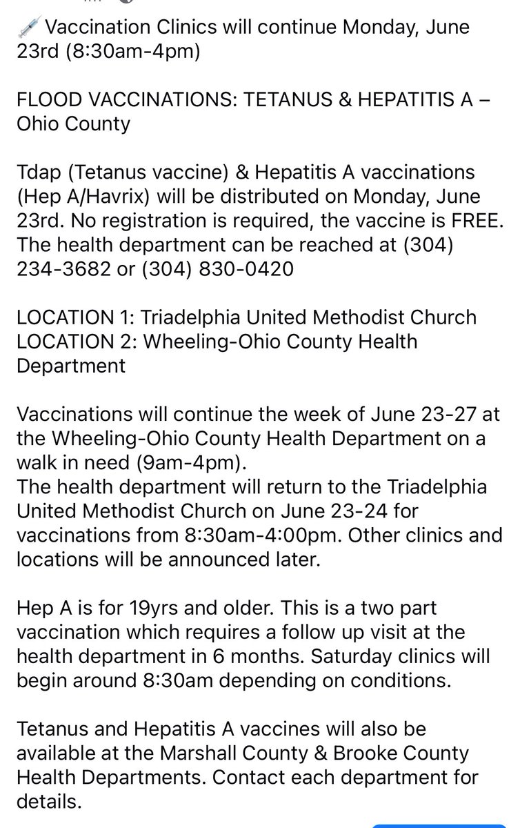
FLOOD VACCINATIONS: TETANUS & HEPATITIS A – Ohio County
No registration required. The health department can be reached at (304) 234-3682 or (304) 830-0420.
LOCATION 1: Triadelphia Fire Dept Parking Lot - (WOCHD)
LOCATION 2: Valley Grove Fire Dept - (Wheeling Health Right/WOCHD)
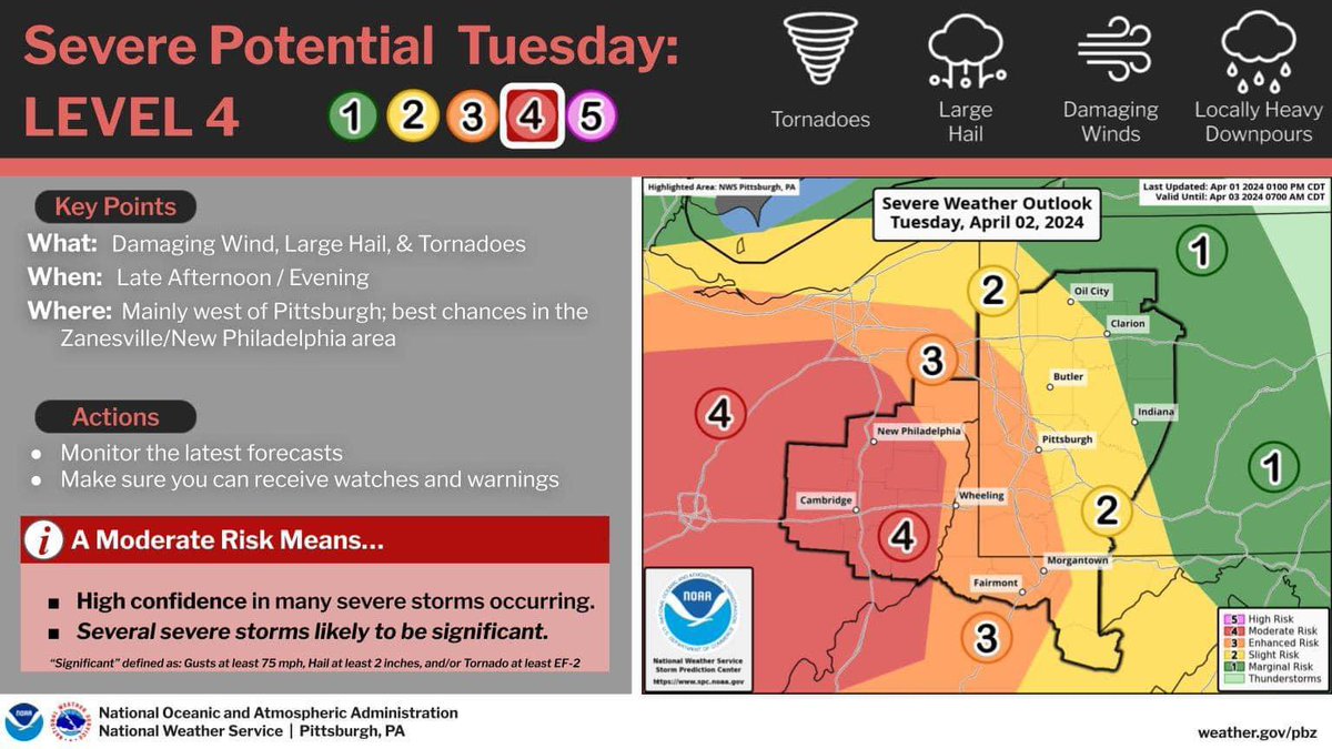
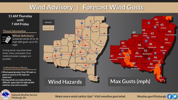
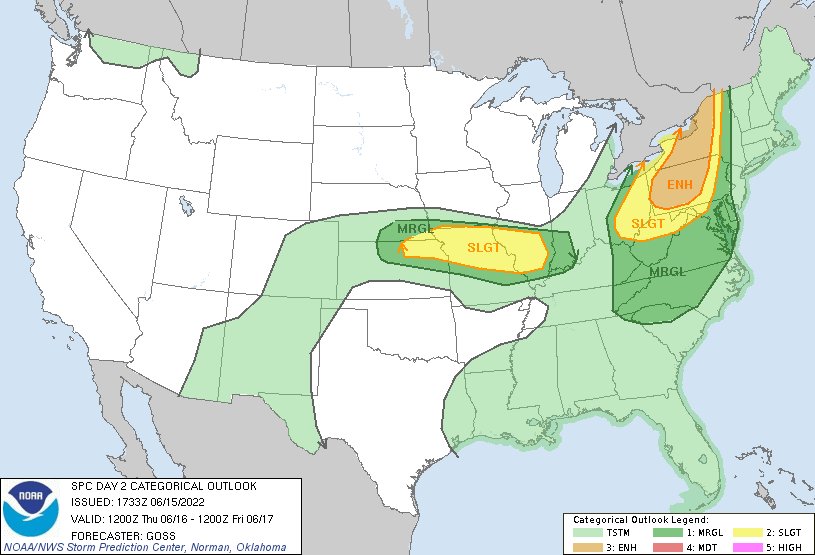
Another hot and muggy day is on tap -w- possible severe thunderstorms later this afternoon and evening. SPC has maintained the "enhanced" and "slight" risks for the region. Damaging wind gusts are the primary threat, but large hail and isolated tornadoes are also possible.
City administration, along w/ @WheelingPolice, @WheelingFD, @OhioCountyWVEMA, Ohio Co. Commission & the 911 Ctr. continue to operate out of the Emergency Operations Ctr. The group continues to assess damage from yesterday’s storm & discuss progress being made on power restoration
Lingering heat will give way to increasing thunderstorm chance on Thursday. The Storm Predication Center has upgraded parts of the area to an "enhanced" risk. Damaging wind gusts are the primary threat, but incidents of large hail and isolated tornadoes are also possible.