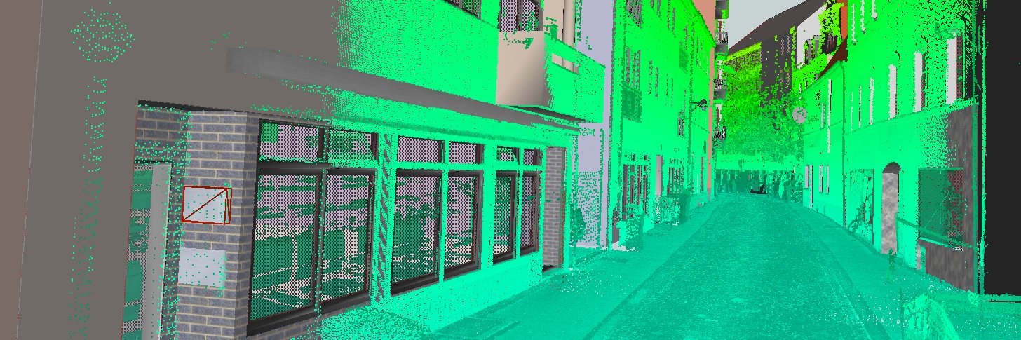
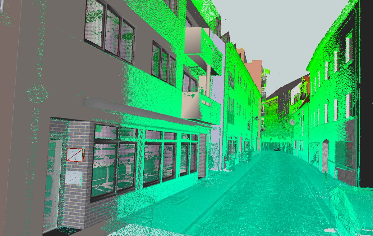
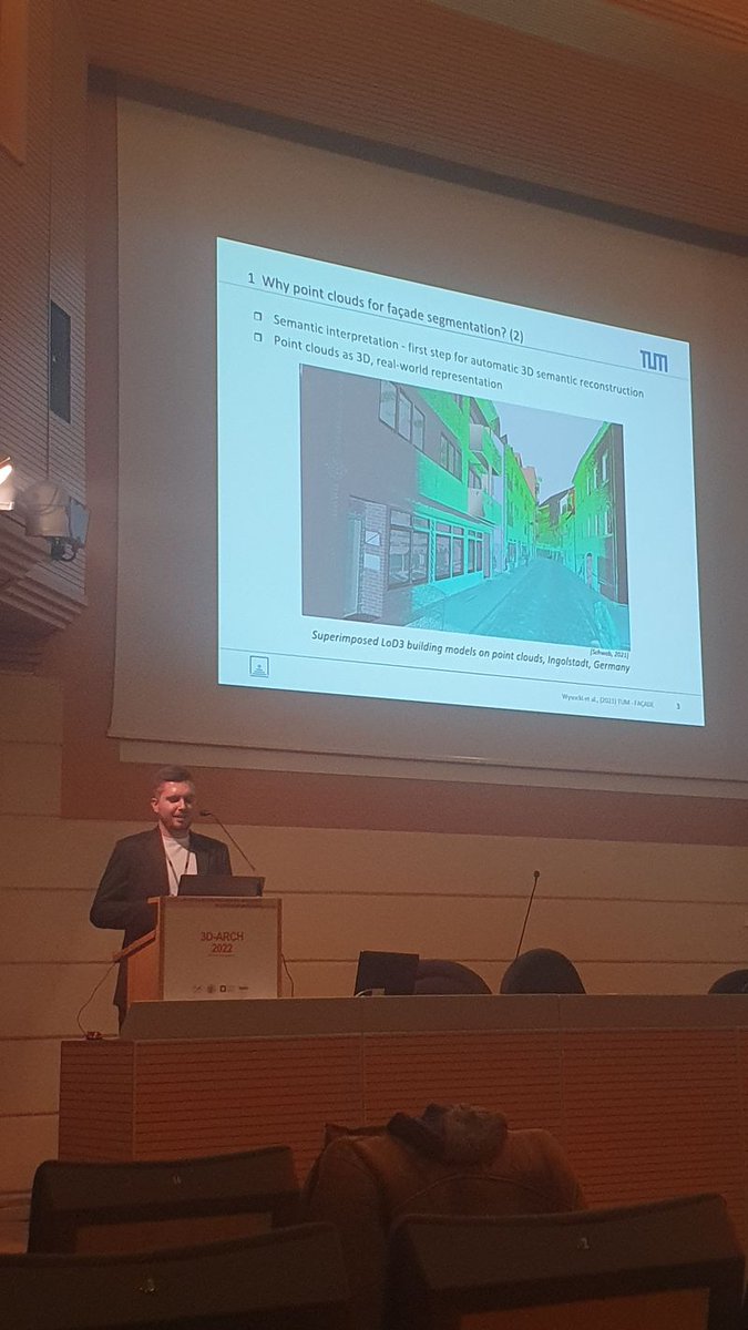
How to create a façade-level, #MLS, #pointcloud#dataset without any extra measurements?
I had the pleasure to present (in presence!) our paper at the #3D_ARCH_2022#ISPRS.
#review and the TUM-FAÇADE dataset:
Paper: https://t.co/SSB27ZurHA
Repo: https://t.co/Ifxa4YvOt5
Join us at the upcoming Developer Workshop of the #OGC Member Meeting, where we will present the new CityGML version 3.0 and a workshop on how to use the #OpenDRIVE to #CityGML converter r:trån https://t.co/a6i0jxu5lF.
Free registration at:
https://t.co/jc1qSaOUeI
#OGC21Sept
In case you missed it, open 3D city models for 56 Japanese cities are now available (10mil+ buildings) from @ProjectPlateau : https://t.co/DDTzvPwl2o #3DGIS#CityGML#Japan
@Nikola_MD@fbiljecki@urbanalyticslab But you may be interested in 3D city model of Poznan (https://t.co/qggGO4wffK) where you can find "Rok zakończenia budowy budynku" (see img) and download (https://t.co/tjYWBaQT0n). More stuff here: https://t.co/lLWr6ONf8X
We’ve just added built-in citation support to GitHub so researchers and scientists can more easily receive acknowledgments for their contributions to software.
Just push a CITATION.cff file and we’ll add a handy widget to the repo sidebar for you.
Enjoy! 🎉
@Nikola_MD@fbiljecki@urbanalyticslab Correct. As far as I know, 'x_katIstnienia' is the only attribute saying sth about the actual state of the bld/object in question. So, there is no explicit info on the construction date.
@Nikola_MD@fbiljecki@urbanalyticslab Hi, yes there is such info in this dataset. A) Go to the table that I linked before and open p. 14 B) check three fields 'aktualność', 'cykl życia', and 'data utworzenia'. Perhaps 'kategoria istnienia' should also be of interest. I hope that it helps!
with @Esri and @Microsoft_Green, we've been hard at work this past year working on a global land use / land cover map, built with #sentinel2, at 10 meter resolution. today, it's live!
the best part? it's OPEN DATA, so you can get it for free right now!
https://t.co/vv7SiXr32n
@fbiljecki@Nikola_MD@urbanalyticslab PS. How to decipher codes: (https://t.co/F2zyd7Evil).
Unfortunately, I found it only in Polish. Generally, BU stands for buildings. Should you encounter any problems please let me know!
@fbiljecki@Nikola_MD@urbanalyticslab Looks great! My recipe (see image): go to https://t.co/XGeZeYAHSR and select 'Data for download' (1), then 'BDOT data' (2), click wherever within Poland's border and select from the pop-up list BDOT again (3). [1/2]


![OloOcki's tweet photo. @fbiljecki @Nikola_MD @urbanalyticslab Looks great! My recipe (see image): go to https://t.co/XGeZeYAHSR and select 'Data for download' (1), then 'BDOT data' (2), click wherever within Poland's border and select from the pop-up list BDOT again (3). [1/2] https://t.co/965Sv12AM0](https://pbs.twimg.com/media/E3sFGLMWYAs_u5V.jpg)


