Greetings, friends! We are migrating all future social media content to @RaleighGov! Please be sure to follow that account for all City happenings and future data-related posts. https://t.co/QfLPIsFKRN will remain unchanged!
Save the Date!
Connected Communities Conference
🗓️ January 15, 2021
🔵 Digital Inclusion
🔵 Transportation & Mobility
🔵 Smart City Accomplishments
🔵 Future Technologies
🔵 and more!
More information: https://t.co/T5CWqnKhrJ
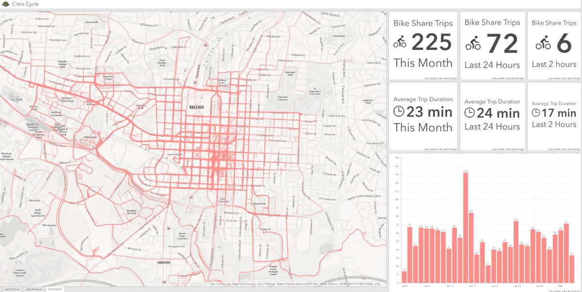
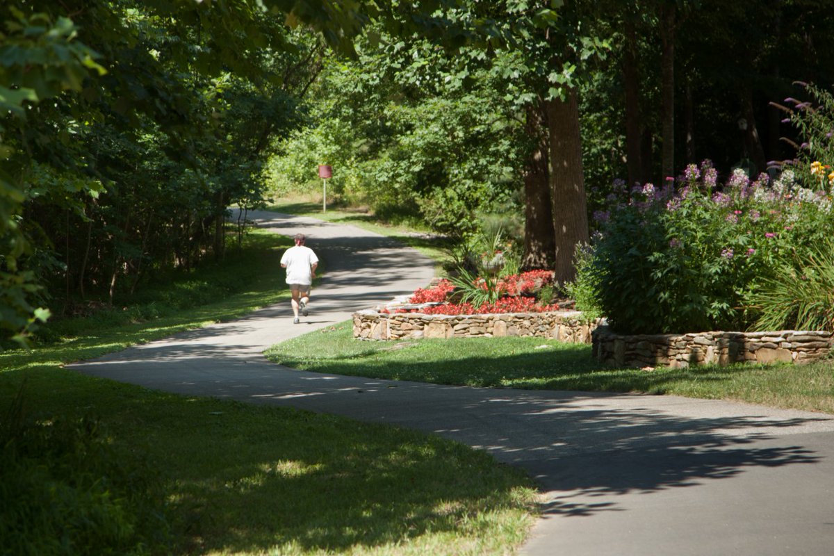
To improve social distancing, try a new park or take the trail less traveled! Use our Park Locator to explore the over 200 parks and over 100 miles of greenway Raleigh offers. 🌳☀️🙌 Remember to always stay 6 ft away from others. ❤️ #RaleighParks https://t.co/hgo2OoJsYH
@OakCityCRE @midtown_bike @_jcaruso@greenwayartist @RaleighBikeLady @JWDemby @AaronFrankPlan @OaksAndSpokes @KristyDactyl@greenwayraleigh@OpenRaleigh@raleighparks@inkscape 1. Find data at https://t.co/dWU7pNNw3y
2. Select Download>Shapefile. This will download a .zip file. Don't extract!
3. Go to https://t.co/Hz6dPqMGax
4. Drop the .zip into mapshaper and select Import
5. Click Export
6. In the Export menu select SVG, then export
Voila!