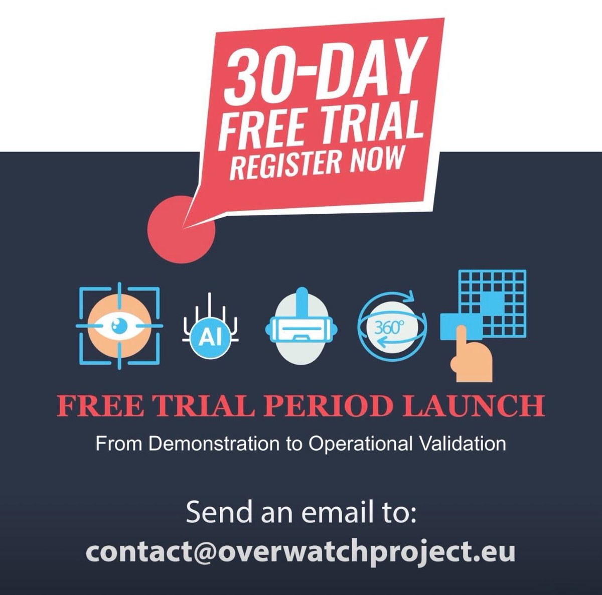
🟥 Your 30-Day #OVERWATCH#FreeTrial starts here 🟥
Curious about what #OVERWATCH can do? Now’s the time to find out.
✔ Free for 1 month
✔ Easy access
✔ Powerful tools
📆 Offer valid until 30 October 2026
📩 Contact us today
🟥 Try #OVERWATCH – No Risk, Full Value 🟥
We’re offering 30 days of free access to our platform.
💡 No commitment
💡 Full functionality
💡 Immediate activation
⏳ Available until 30.10.2026
📩 Get in touch to activate your #freetrial
🟥 Experience #OVERWATCH in Action 🟥
Take advantage of our 30-day #FREETRIAL and see how #OVERWATCH can support your workflow.
🔎 Explore features
📊 Analyze data
⚡ Improve performance
📅 Valid until 30 October 2026
📩 Contact us to join
🟥 30 Days. Zero Cost. Full Access. 🟥
The OVERWATCH Project Free Trial is your opportunity to test our platform in real conditions.
🚀 1-month free trial
🌐 Full web platform access
📆 Available until 30.10.2026
📩 Contact us and get started
🟥 Discover OVERWATCH – Free for 30 Days 🟥
Why wait? Start optimizing your operations now.
✔ Full platform access
✔ Real-time insights
✔ No cost for 30 days
📅 Offer valid until 30 October 2026
📩 Reach out and start your free trial
🟥 #OVERWATCH Project – 30-Day #FreeTrial 🟥
Ready to experience the full potential of OVERWATCH?
👉 Get 1 month of FREE access to our web platform and explore all features with no commitment.
⏳ Available until 30.10.2026
📩 Contact us to activate your trial today
🟥 OVERWATCH 30-DAY FREE TRIAL IS NOW AVAILABLE 🟥
⏳ Don’t miss your free access to OVERWATCH
You have limited time to test a platform that integrates:
✔️ Earth Observation
✔️ Advanced geospatial analytics
✔️ Immersive augmented reality
🚀 During the trial, you will be able to:
* Analyze wildfires and floods in near real time
* Compare pre- and post-event scenarios
* Upload your own custom layers
* Explore data in AR through a 3D holographic operational map
📩 Activate your free trial now: contact us!
📅 Platform available until October 30, 2026
👉 If you work in civil protection, research, safety, or spatial planning, this is the right moment to try it.
#FreeTrial #Overwatch #EmergencyManagement #Innovation #SpaceData #FutureOfWork
〰️〰️〰️〰️〰️〰️〰️〰️
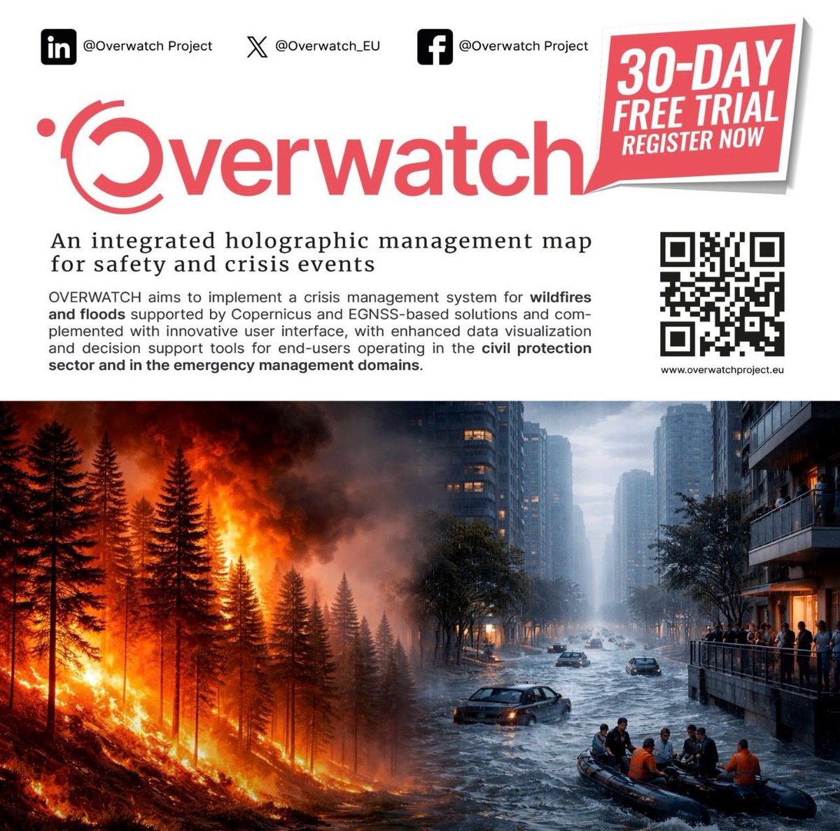
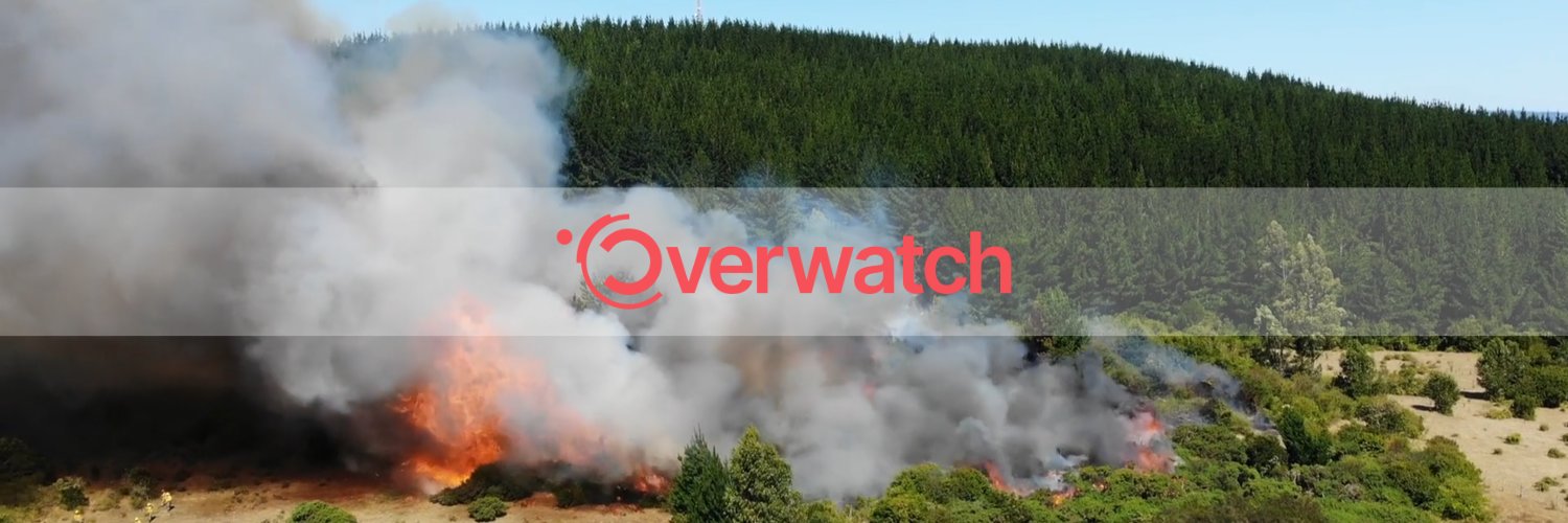
#OVERWATCH An integrated holographic management map for safety and crisis events.
〰️〰️〰️〰️〰️〰️〰️〰️
Partners: @Ithacasrl@LinksFoundation #ISQ -
@CBK_pan@EngineeringSpa@Holo_LightGmbH #AlphaConsult @INESCTEC@EU4Space
🟥 OVERWATCH 30-DAY FREE TRIAL IS NOW AVAILABLE 🟥
🌍 Satellite data + AI + AR = faster decision-making in emergencies
With OVERWATCH, you can analyze critical events with a unique level of detail and integration:
🔥 Wildfires
* Burnt area delineation
* Burn severity estimation
* Active fire and smoke detection
🌊 Floods
* Flood mapping from SAR imagery
* Multi-temporal pre/post-event analysis
🏗 Damage Assessment
* Change detection
* Infrastructure segmentation (buildings, roads)
And more:
✔️ Near real-time operational layers
✔️ External WMS integration
✔️ Immersive augmented reality visualization
👉 All in one platform.
🎁 Try it free for 30 days
📩 Contact us
#GeoData #SatelliteData #RiskManagement #ClimateTech #Innovation #DigitalTransformation #OVERWATCH #EarthObservation
〰️〰️〰️〰️〰️〰️〰️〰️
#OVERWATCH An integrated holographic management map for safety and crisis events.
〰️〰️〰️〰️〰️〰️〰️〰️
Partners: @Ithacasrl@LinksFoundation #ISQ - @CBK_pan@EngineeringSpa@Holo_LightGmbH
- #AlphaConsult - @INESCTEC@EU4Space
🟥 OVERWATCH 30-DAY FREE TRIAL IS NOW AVAILABLE 🟥
Are you working in emergency management, territorial safety, or geospatial analysis?
This is a concrete opportunity to test an advanced platform in real-world scenarios.
With OVERWATCH, you get 30 days of free access to:
✔️ EO analytics for wildfires and floods
✔️ Advanced geospatial data visualization
✔️ Pre/post-event analysis for damage assessment
✔️ Augmented reality features for crisis management
An integrated platform designed to turn complex data into operational decisions.
📩 Contact us
⏳ Available until October 30, 2026
#OVERWATCH #EarthObservation #DisasterManagement #Geospatial #Innovation #CrisisManagement #SpaceTech
Partners: @Ithacasrl@LinksFoundation #ISQ - @CBK_pan@EngineeringSpa@Holo_LightGmbH
- #AlphaConsult - @INESCTEC@EU4Space
⭕ 14th April | the #OVERWATCH consortium had its Final Meeting at Ithaca’s premises in #Torino, #Italy.
Throughout the day, partners presented the key activities that allowed us to successfully achieve the project’s objectives and to demonstrate the developed system's functionalities.
Results, lessons learned and discussion about future opportunities shaped the whole day.
👏 A big thank you to all partners for their commitment and collaboration throughout this journey:
@Ithacasrl - @LinksFoundation - #ISQ - @CBK_pan - @EngineeringSpa - @Holo_LightGmbH - #AlphaConsult - @INESCTEC - @EU4Space
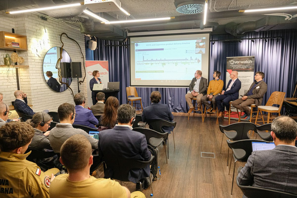
On March 25, 2026, the OVERWATCH demo meeting took place in Warsaw, focusing on innovative uses of geospatial data for managing floods and wildfires.
Let's have a look! 👉🏼 https://t.co/mwOOllrmmv
Partners:
@EU4Space@Ithacasrl@LinksFoundation@CBK_pan
@EngineeringSp
@INESCTEC@Holo_LightGmbH
‼️‼️ On March 31st, severe flooding hit Molise and Abruzzo.
The Liscione Dam reached capacity and started discharging toward Termoli's industrial zone.
Copernicus EMS activated Rapid Mapping (EMSR871) to monitor the flooded areas.
We ran our fully automated pipeline on the same event, covering 4,643 Km2 in 2 minutes and 30 seconds, from image retrieval to flood extent map.
This is one of the services we built within OVERWATCH, a near-real-time flood mapping that can work alongside services like Copernicus EMS and get maps to responders faster.
These maps were generated from a single Sentinel-1 acquisition, from 02/04/2026 at 05:03.
Partners:
@EU4Space@Ithacasrl@LinksFoundation@CBK_pan
@EngineeringSp
@INESCTEC@Holo_LightGmbH
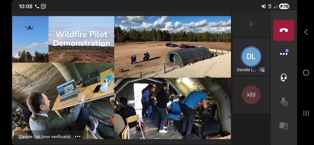
⭕ On March 25, 2026, the #OVERWATCH demo meeting took place in #Warsaw, bringing together experts and practitioners to explore innovative uses of geospatial data for managing #floods and #wildfires.
The event featured presentations on the OVERWATCH project’s activities and results, as well as an interactive demonstration that allowed participants to experience the developed solutions first-hand. Through engaging discussions, attendees exchanged insights on how modern technologies can strengthen threat monitoring, operational decision-making, and crisis response.
Two dedicated panel sessions focused respectively on the development of a potential #flood management solution for the Polish crisis management system and on experiences from Portugal’s #CINAMIL (Centro de Investigação, Desenvolvimento e Inovação da Academia Militar – Research, Development and Innovation Center of the Military Academy) and #ANEPC (Autoridade Nacional de Emergência e Proteção Civil) in tackling forest fires.
A guest speech by the COLLARIS Network addressed the social acceptability of drone-based solutions, while additional sessions presented the project’s achievements, implementation potential, and future dissemination opportunities.
The main panel discussion gathered representatives from various environmental initiatives to share perspectives on leveraging geospatial data for more effective, data driven emergency management.
By combining cutting edge data processing, drone analytics, and augmented reality tools, the #OVERWATCH platform demonstrated its ability to enhance situational awareness, support real-time coordination, and promote proactive crisis response across Europe.
Partners:
@EU4Space@Ithacasrl@LinksFoundation@CBK_pan
@EngineeringSp
@INESCTEC@Holo_LightGmbH
🟥 OVERWATCH 30-DAY FREE TRIAL 🟥
📩 Contact us: https://t.co/ZGquIEdxeu
〰️〰️〰️〰️〰️〰️〰️〰️
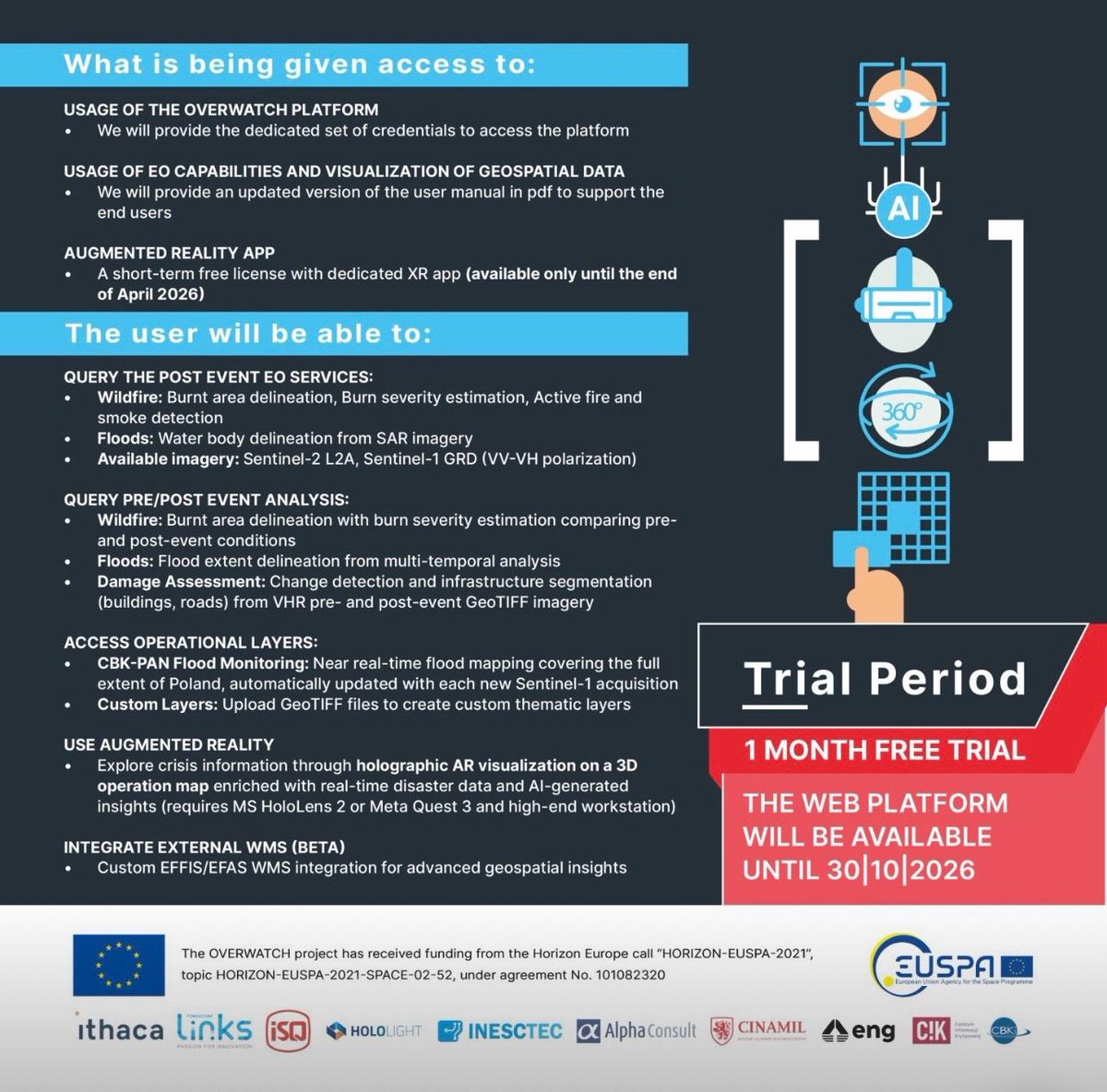
⭕ Trial Period: 1 MONTH #FREE TRIAL
⭕ The web platform will be available UNTIL 30|10|2026
〰️〰️〰️〰️〰️〰️〰️〰️
⭕ What is being given access to:
✔️ USAGE OF THE OVERWATCH PLATFORM: We will provide the dedicated set of credentials to access the platform
✔️ USAGE OF EO CAPABILITIES AND VISUALIZATION OF GEOSPATIAL DATA: We will provide an updated version of the user manual in pdf to support the end users
✔️ AUGMENTED REALITY APP: A short-term free license with dedicated XR app (available only until the end of April 2026)
⭕ The user will be able to:
✔️ QUERY THE POST EVENT EO SERVICES:
- Wildfire: Burnt area delineation, Burn severity estimation, Active fire and smoke detection
- Floods: Water body delineation from SAR imagery
Available imagery: Sentinel-2 L2A, Sentinel-1 GRD (VV-VH polarization)
✔️ QUERY PRE/POST EVENT ANALYSIS:
- Wildfire: Burnt area delineation with burn severity estimation comparing pre- and post-event conditions
- Floods: Flood extent delineation from multi-temporal analysis
- Damage Assessment: Change detection and infrastructure segmentation (buildings, roads) from VHR pre- and post-event GeoTIFF imagery
✔️ ACCESS OPERATIONAL LAYERS:
- CBK-PAN Flood Monitoring: Near real-time flood mapping covering the full extent of Poland, automatically updated with each new Sentinel-1 acquisition
- Custom Layers: Upload GeoTIFF files to create custom thematic layers
✔️ USE AUGMENTED REALITY
- Explore crisis information through holographic AR visualization on a 3D operation map enriched with real-time disaster data and AI-generated insights (requires MS HoloLens 2 or Meta Quest 3 and high-end workstation)
✔️ INTEGRATE EXTERNAL WMS (BETA)
- Custom EFFIS/EFAS WMS integration for advanced geospatial insights
〰️〰️〰️〰️〰️〰️〰️〰️
#OVERWATCH An integrated holographic management map for safety and crisis events.
〰️〰️〰️〰️〰️〰️〰️〰️
Partners:
@EU4Space@Ithacasrl@LinksFoundation@CBK_pan @EngineeringSp @INESCTEC@Holo_LightGmbH
#OVERWATCH EUSPA - EU Agency for the Space Programme #AIWeek
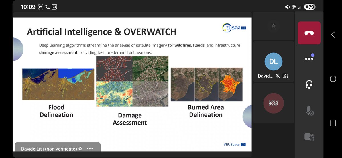
The OVERWATCH project was featured in the "AI for crisis management" session during EUSPA AI Week (19-23 Jan 2026), organised by EUSPA to showcase AI's revolutionary potential in the space downstream market.
#OVERWATCH project seeks to develop an integrated crisis management system to enhance communication, information gathering and coordination among disaster response teams in case of wildfire and flood events.
Deep learning algorithms streamline the analysis of satellite imagery for wildfires, floods, and infrastructure damage assessment, providing fast, on-demand delineations.
➡️ Learn more: https://t.co/YTbmFlhkqm Partners:
@EU4Space@Ithacasrl@LinksFoundation@CBK_pan
@EngineeringSp @INESCTEC@Holo_LightGmbH
#OVERWATCH – #EUSPA AI Week
On 20 January 2026, from 10:10 to 11:00 (CET)
The OVERWATCH project will be featured in the “#AI for crisis management” session of #EUSPAAIWeek, demonstrating an integrated hashtag#holographic management map that enhances situational awareness and coordination during #safety and crisis events.
The event is online and accessible via #MicrosoftTeams; participation is free❗
Register here EUSPA event page: https://t.co/Vo7baQqQgZ
@EU4Space
🟥 Workshop 📷 NOVEMBER 21st, 2025, from 10.00 am to 1.00 pm CET
#UNICORN took part in an inspiring workshop, and we’re excited to share all the details with you!
"Implementation of new technologies in operational activities of crisis management and civil protection services. AI, Drones, and Satellites for Real-Time Situational Awareness in Disaster Response".
The growing complexity of disaster scenarios in Europe requires stronger #collaboration between #research & #development, policy, and practice to ensure emergency responders are equipped with effective and future-ready solutions. Against this background, the Cluster is building international networks of practitioners, disaster assessment frameworks and harnessing the potential of Earth Observation data and new technologies like #AI, #drones, #AR & #VR to better forecast, plan for and manage disasters.
The cluster aims to strengthen Europe’s capacity to face climate-driven hazards and disasters, and brings together 42 organisations from 17 European countries.
COLLARIS2 - https://t.co/l97O8toDjp
DIREKTION - https://t.co/rKARNQueVh
OVERWATCH - https://t.co/DmbYj6szJQ
UNICORN - https://t.co/8WCeuBnChS