Thanks to a late season cold front getting pushed down into the SEAST and FL...temps on Thursday will well below average for many.
Never fear...Summer rebound starts this coming weekend.
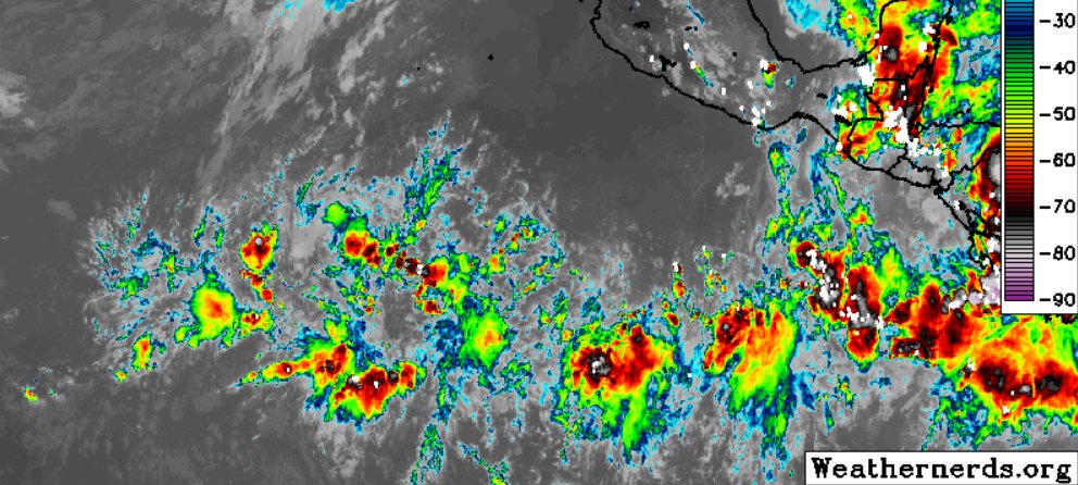
Developing thunderstorms may bring a threat for isolated damaging downburst winds and perhaps an instance or two of large hail along the eastern Florida Peninsula this afternoon/evening.
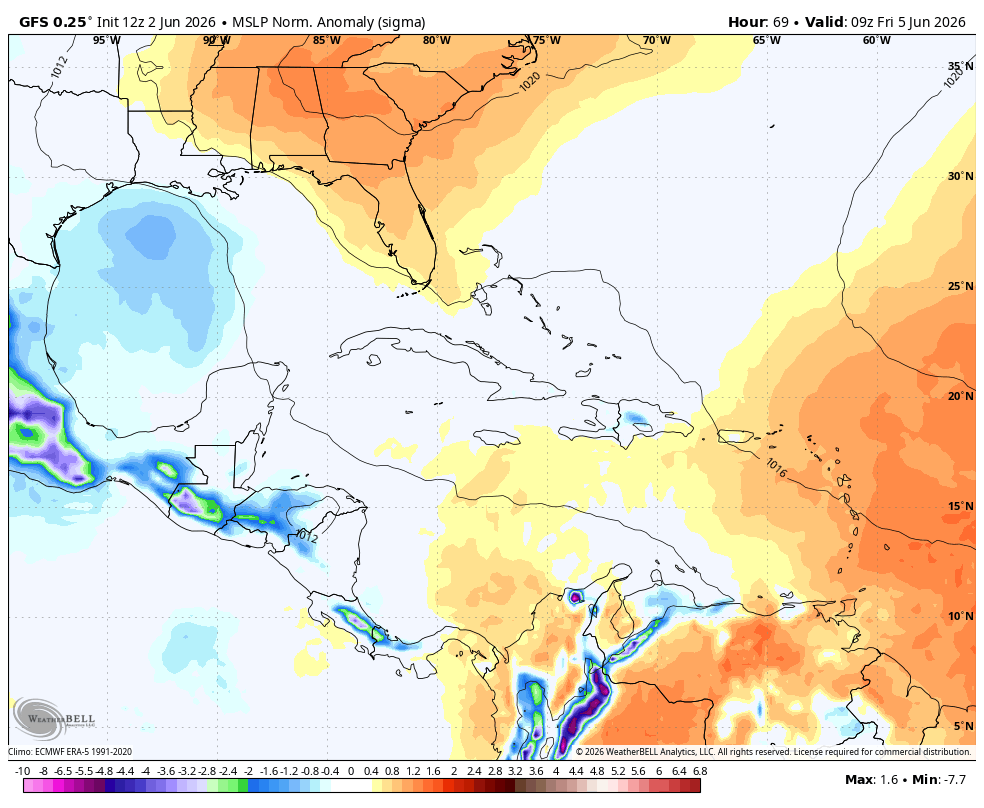
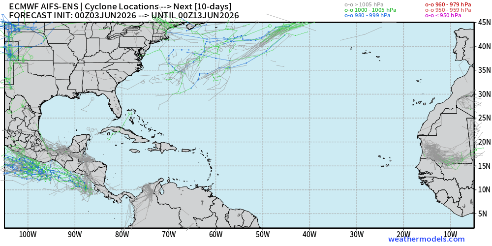
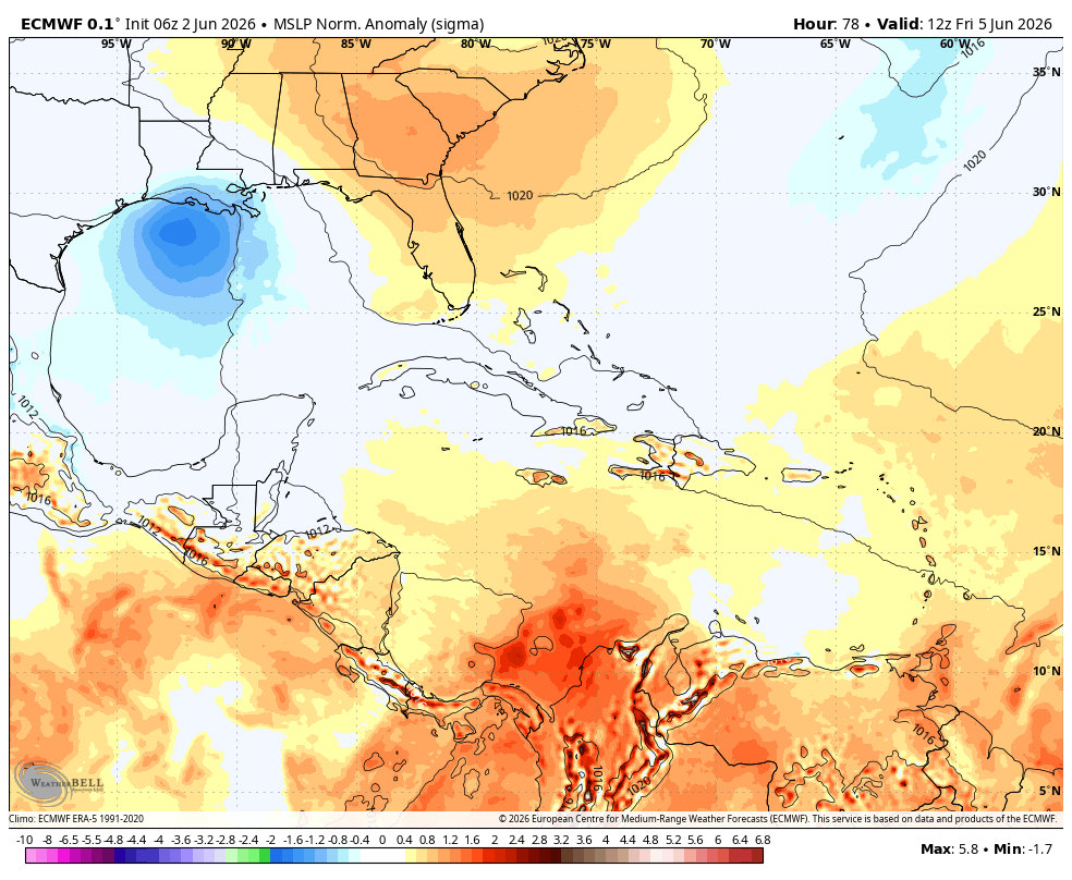
The weather world is currently all a buzzz about this area of disturbed weather in the Gulf.
Large broad area of low pressure currently dominating the entire Gulf right now. EURO and GFS aren't doing much with this area right now. However, if anything were to develop in the tropics, this would be the area in the month of June.
Nothing right now to worry about as this is like going to be rain maker for Tx and or La as this area continues to meander Northward.
A deepening upper trough and associated large-scale ascent will augment mesoscale factors (including surface moisture convergence and sea-breeze boundaries) to support numerous thunderstorms across the region. Strong buoyancy and modest deep-layer shear could support occasional storm organization and robust updrafts capable of producing damaging downbursts. Interactions between ongoing storms and mesoscale boundaries could also augment updrafts, with the resultant water loading also producing occasionally strong gusts.
Nice little area of convection popping off this morning on satellite.
This is an area the EURO ensembles are hinting for potential minimal development, if any, out of this area. This would have no impacts to land but would stay out into the Atlantic if development was to occur.
This is the same area, as mentioned in my earlier post, that will help push down some drier air into the South for this weekend.
Weather Outlook for Tuesday 6/2/26:
An upper-level trough will move southward into the Southeast on Tuesday, as a cold front advances southward into southern Georgia. Along and to the south of the front, surface dewpoints from the mid 60s to lower 70s F will contribute to the development of moderate instability by afternoon. Within this unstable airmass, low-level lapse rates will become steep during the mid to late afternoon, which may support an isolated wind-damage threat with the stronger multicells. An isolated potential for severe wind gusts will also be possible in the afternoon along sea breeze boundaries near the coast of northern and eastern Florida.
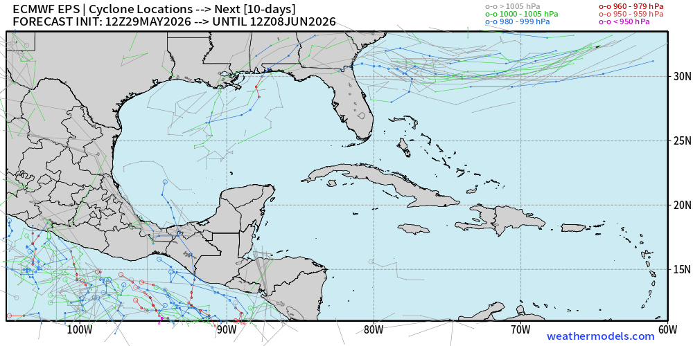
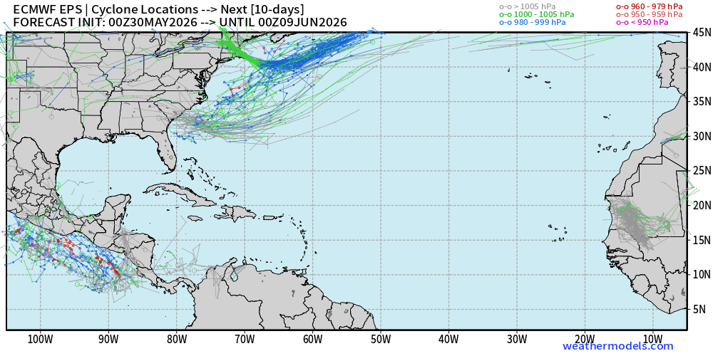
Maps to kick off the start of the 2026 Atlantic Hurricane Season.
Nothing officially showing on the NHC map.
EURO ensembles showing a weak low pressure system likely to spin up this week and then move off into the Atlantic. This looks to aid in brining some nice weather down into the SEAST and FL by the weekend.
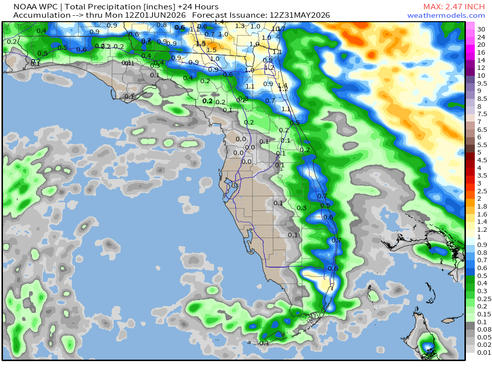
🚨SUNDAY POTENTIAL RAIN FALL TOTALS🚨
An idea of Sunday AM to Monday AM rainfall totals. Isolated showers again on radar. Heaviest numbers moving farther north with the bulk of the rain favoring the East side of the state. Sorry West FL!
Good Sunday Morning to you all! Hope your weekend is going well!
Below is the future radar loop from the HRRR showing the likely set up weather wise that we will see through the day today. Same set up as we have been seeing the last few days. Showers and storms looking to still favor the Eastern side of the state.
Official NHC map is quite along with the EURO EPS ensembles. Both showing nothing cooking with in the next 7 days.
Official start of the 2026 Atlantic Hurricane Season is in 2 days!!!!
Potential rain totals expected through the next 7 days.
East wind is keeping the storms to favor the East side of the state....keeping the West side some what dry.
Future radar loop from the HRRR model giving an idea of the weather set up through out the day. Mainly dry across the state for many with some isolated showers and storms developing later in the day and impacting mainly the Eastern half. #dontshootthemessanger
EURO and EURO AI still trying to keep things interesting.
EURO EPS ensembles hinting at a sloppy loosely organized and very sheared tropical wave to try and spin up in the Gulf come mid to the end of next week.
EURO and EURO AI both hinting with nothing showing on the GFS. GFS shows...no body cares...EURO shows...eye brows raise. Just how it is.
Will be something to keep an eye on. Would be middle-end of next week. Low concern for now.
Talk about a major flip flop. With the wind shifting back to the East, rains over through the weekend looking to fire off primarily across the Eastern side of the state.
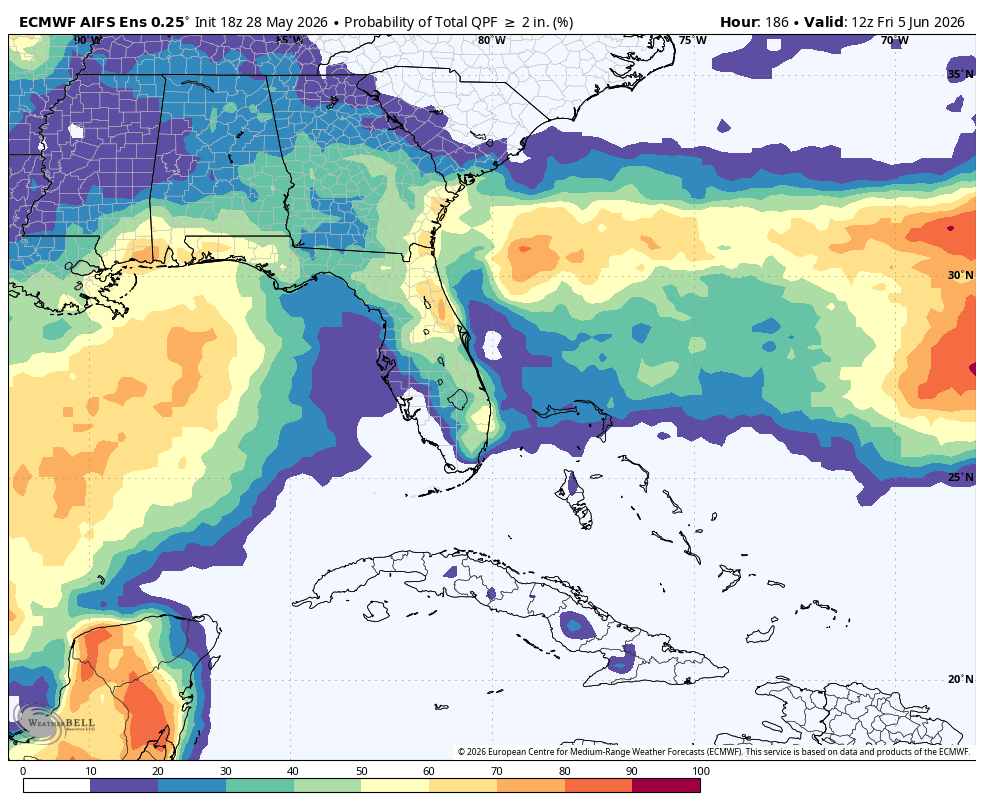
🌧️ The latest EURO AI model guidance is showing a fairly strong signal for parts of Florida and the SEAST to pick up significant rainfall over the next 7 days. 👀
This map shows the probability (%) of locations receiving AT LEAST 2 inches of rain through next week.
📍 Highest probabilities currently appear across:
➡️ Central & South Florida
➡️ Portions of the FL Gulf Coast
➡️ Areas along the Southeast coastline
Some spots across Florida are showing a 50-70%+ chance of seeing 2"+ of rainfall, which could bring much-needed relief to drought-stricken areas if this trend holds. 🌴⛈️
Meanwhile, lower probabilities are noted farther inland across parts of GA and AL.
Remember:
⚠️ This does NOT guarantee rainfall totals
⚠️ It only shows the probability of reaching/exceeding 2 inches
⚠️ Exact placement and amounts WILL change over the coming days
But overall, the pattern is definitely trending wetter across parts of FL and the Southeast heading into early June. 🌧️
#FLwx #SEwx #Florida #Rain #Drought #EURO #Weather #ECMWF #Tropics
CHECK IT OUT!!!! This is something that we haven't seen in a long while. Nearly the entire state saw rain today with still on going as I am typing this post.
These are the rain accumulation totals over the past 6 hrs. Some seeing more, some seeing less and some none at all but a good step in the right direction with this drought.