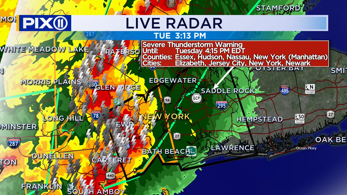
An intense of line of severe thunderstorms are making their way toward the city. They may contain gusts of 70 mph and penny-sized hail along with torrential downpours. It is not wise to be outdoors in the city when these storms arrive. @PIX11News
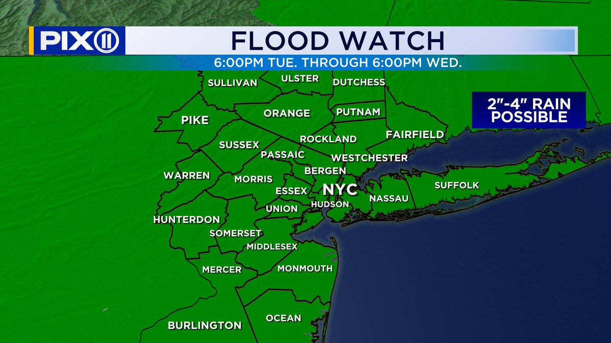
Most rivers in our region have started to back down. Only parts of the Passaic River has not started to crest yet. Major flooding persists for a number of communities until later this week. @PIX11News
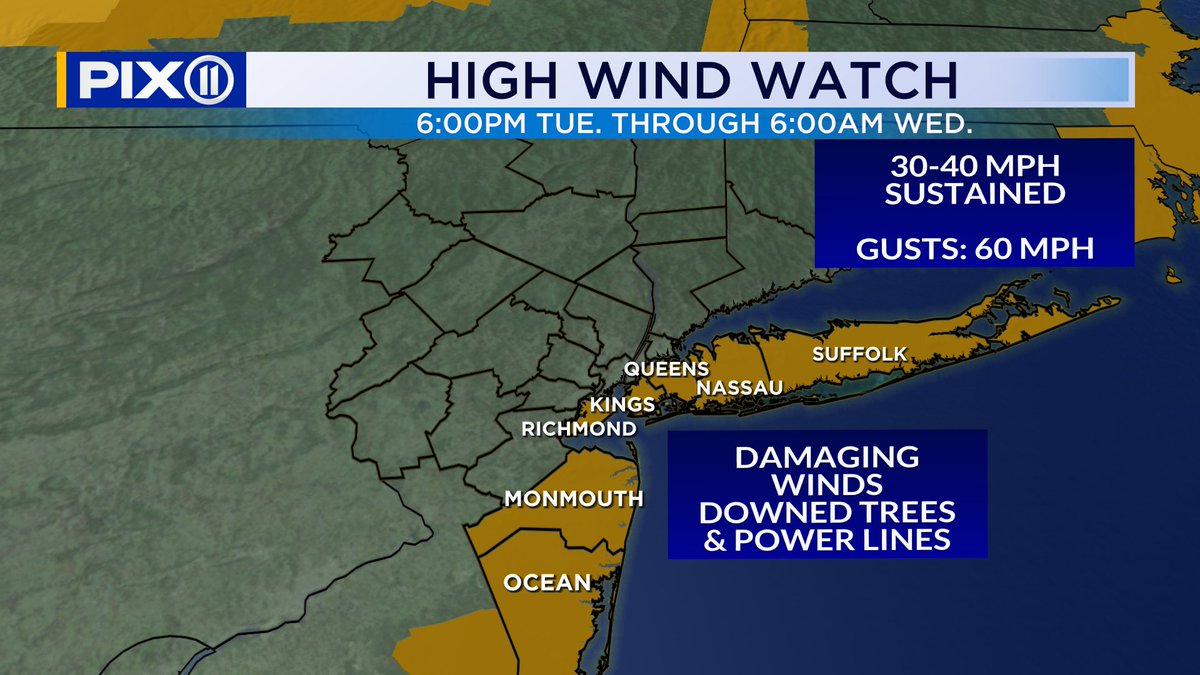
The rain is tapering off, but the damage is done. Numerous Flood Warnings have been issued with a few rivers dealing with major flooding. Also we are at high tide now with flooding being reported across coastal sections. @PIX11News
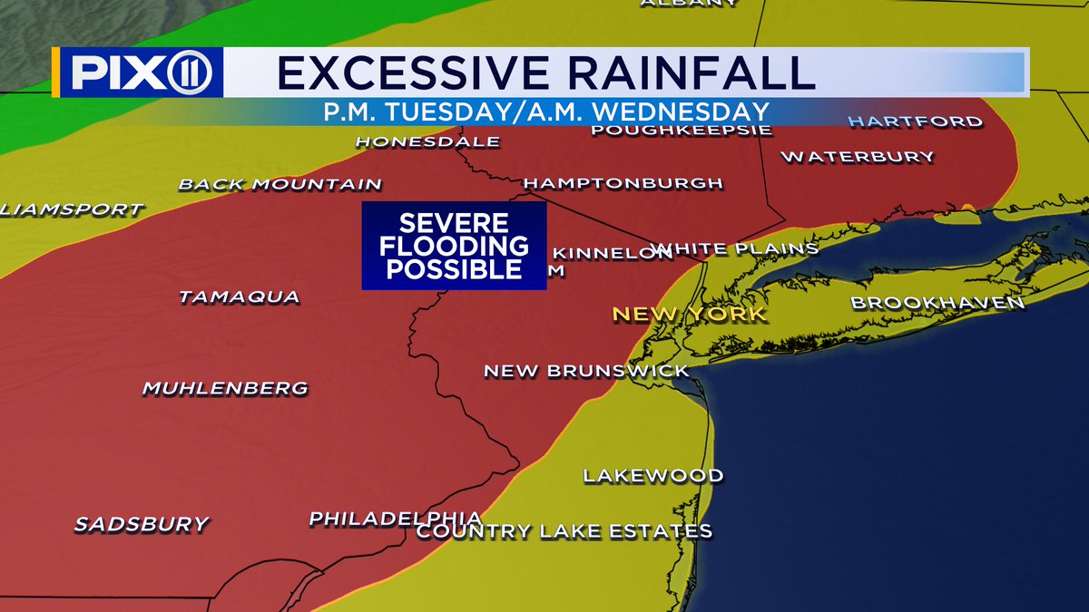
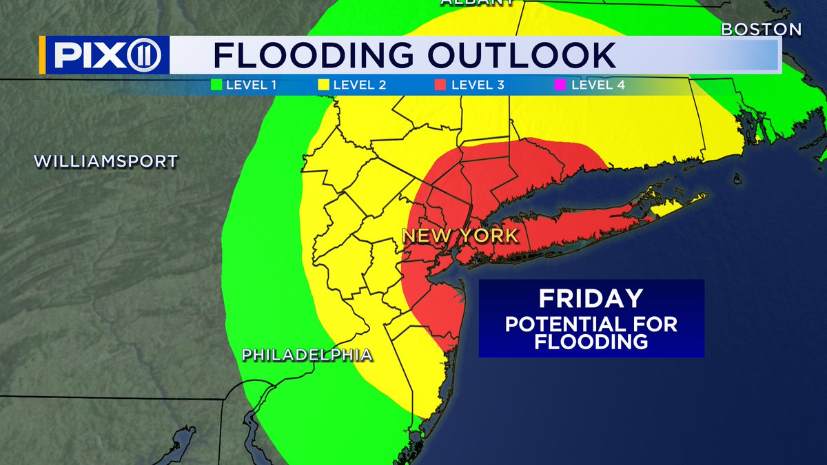
Friday is going to feature another storm system bringing in potentially a lot more rain for the region. The city may easily 2 inches or more, with some areas potentially getting as much 5 inches of rain. The flood threat has been elevated as a result. @PIX11News
It is going to be rough end to the week. A storm system is expected to bring copious amounts of rain on top of what we've had earlier this week. Flooding risk is at a level 3 out of 4. @PIX11News
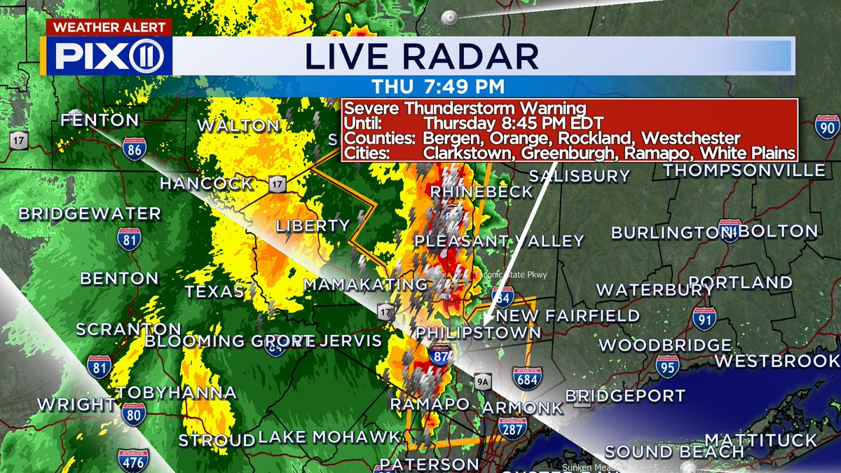
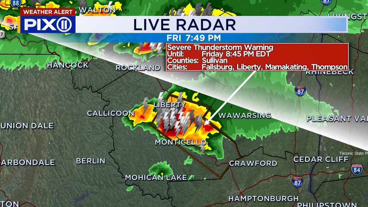
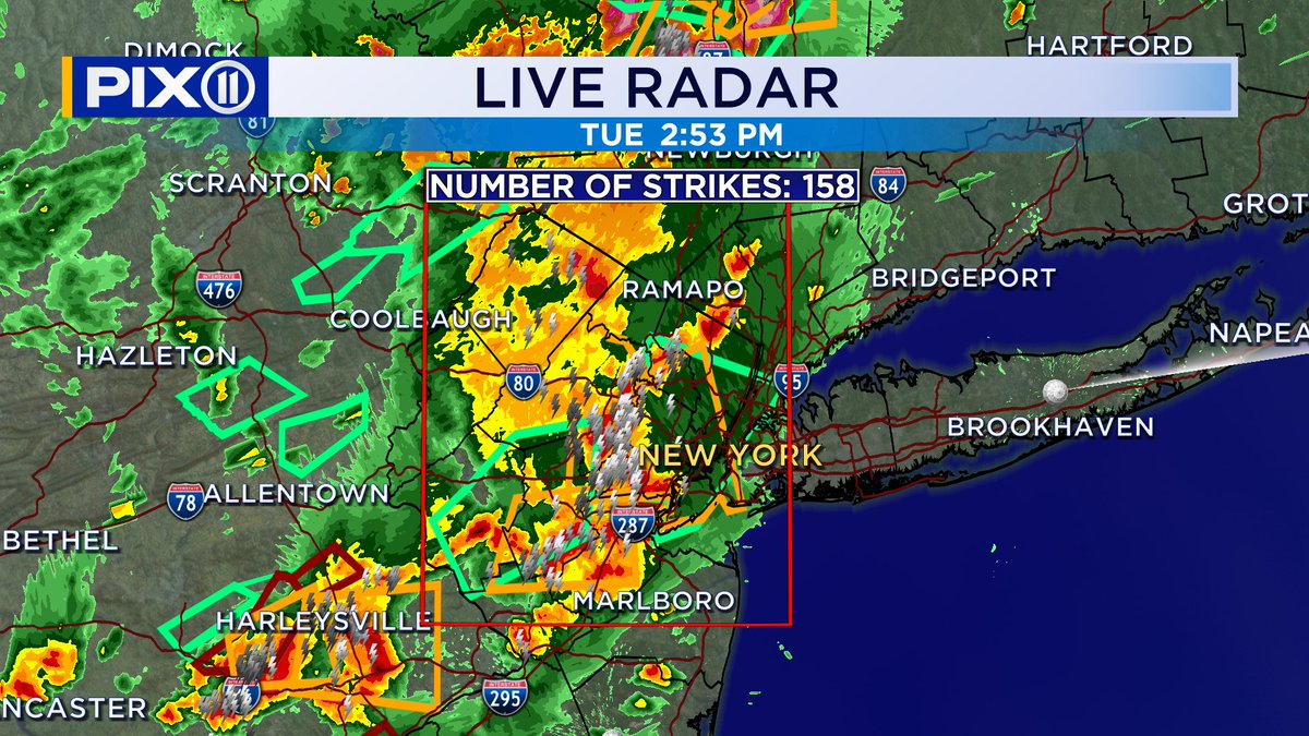
Severe Thunderstorms are rolling across the Hudson Valley this evening. There storms are capable of producing gusts of 60 mph and a lot of lightning. @PIX11News
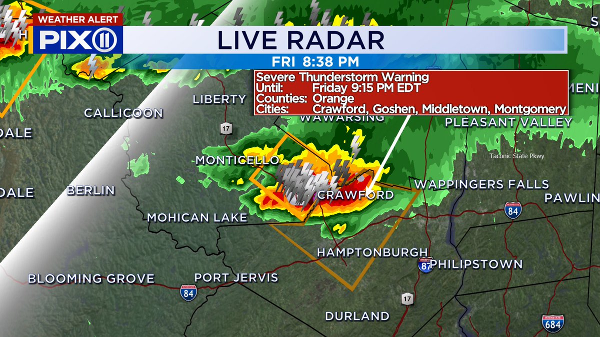
A Severe T-storm Warning has been issued for Orange County until 9:15pm. Watch out for damaging winds and large hail, along with frequent lightning. @PIX11News
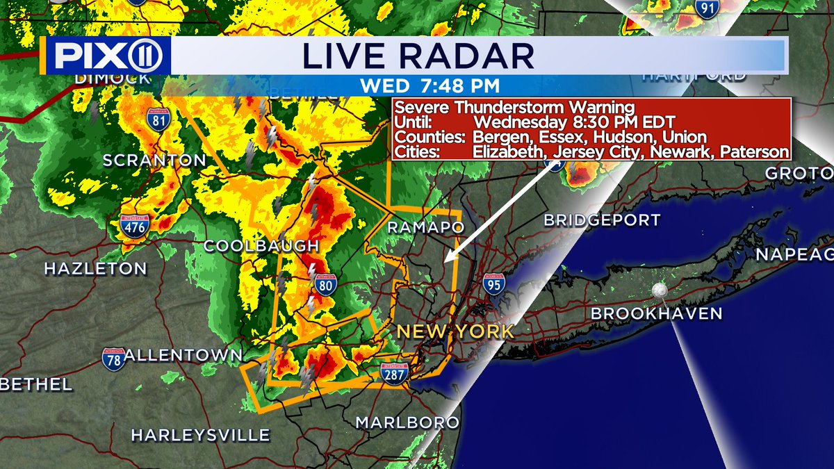
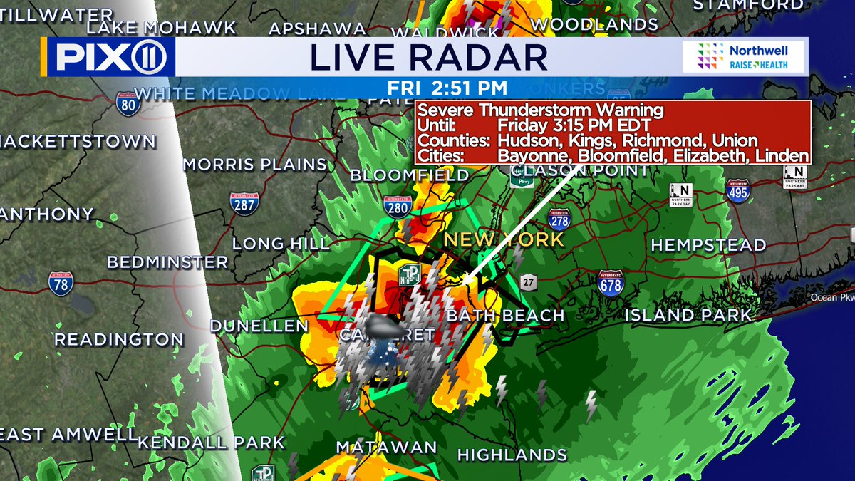
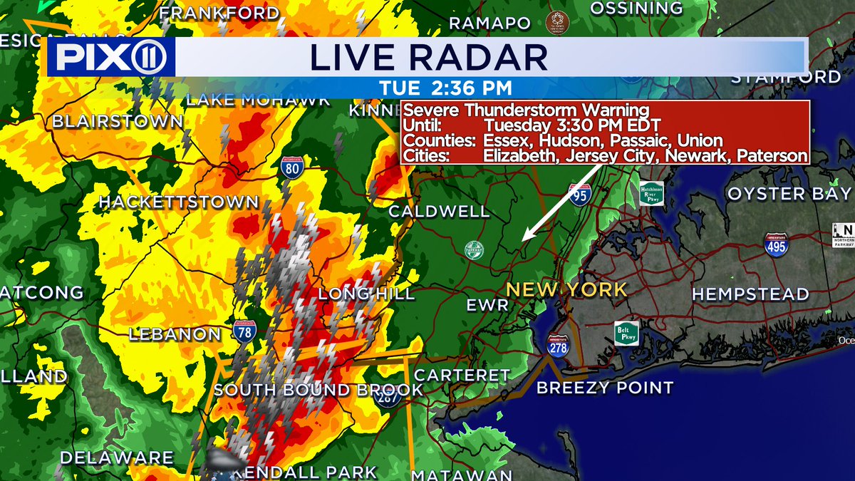
Severe T-storm Warning has been issued for Newark and parts of the city until 3:30pm. Damaging winds, some hail and a LOT of lightning is expected with the approaching storms. @PIX11News