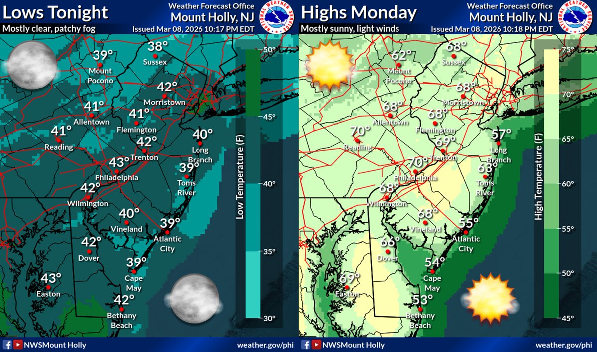
Spring-like weather will continue through the middle of the week. Temperatures by dawn Monday will be in the upper 30s to mid 40s, followed by highs in the mid 60s to low 70s in the afternoon. Mostly clear/sunny skies and light winds. Enjoy! #PAwx#NJwx#DEwx#MDwx
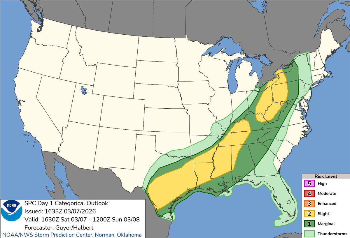
Easy to explain the eastern terminus of the Slight Risk in PA based on the current satellite picture.
Tough to get much surface based instability with such persistent low clouds.
10:35am CST #SPC Day1 Outlook Slight Risk: from parts of Texas to the Lower Mississippi Valley/Tennessee Valley and Upper Ohio Valley https://t.co/TgJgC6cj9Y
Even though the current air temps may still be around freezing in some locations, the road temps are now all above 32°F (see map below). The remnants of the first round of rain is now north and east of Pittsburgh. The second round of rain is expected to move in by mid-afternoon.
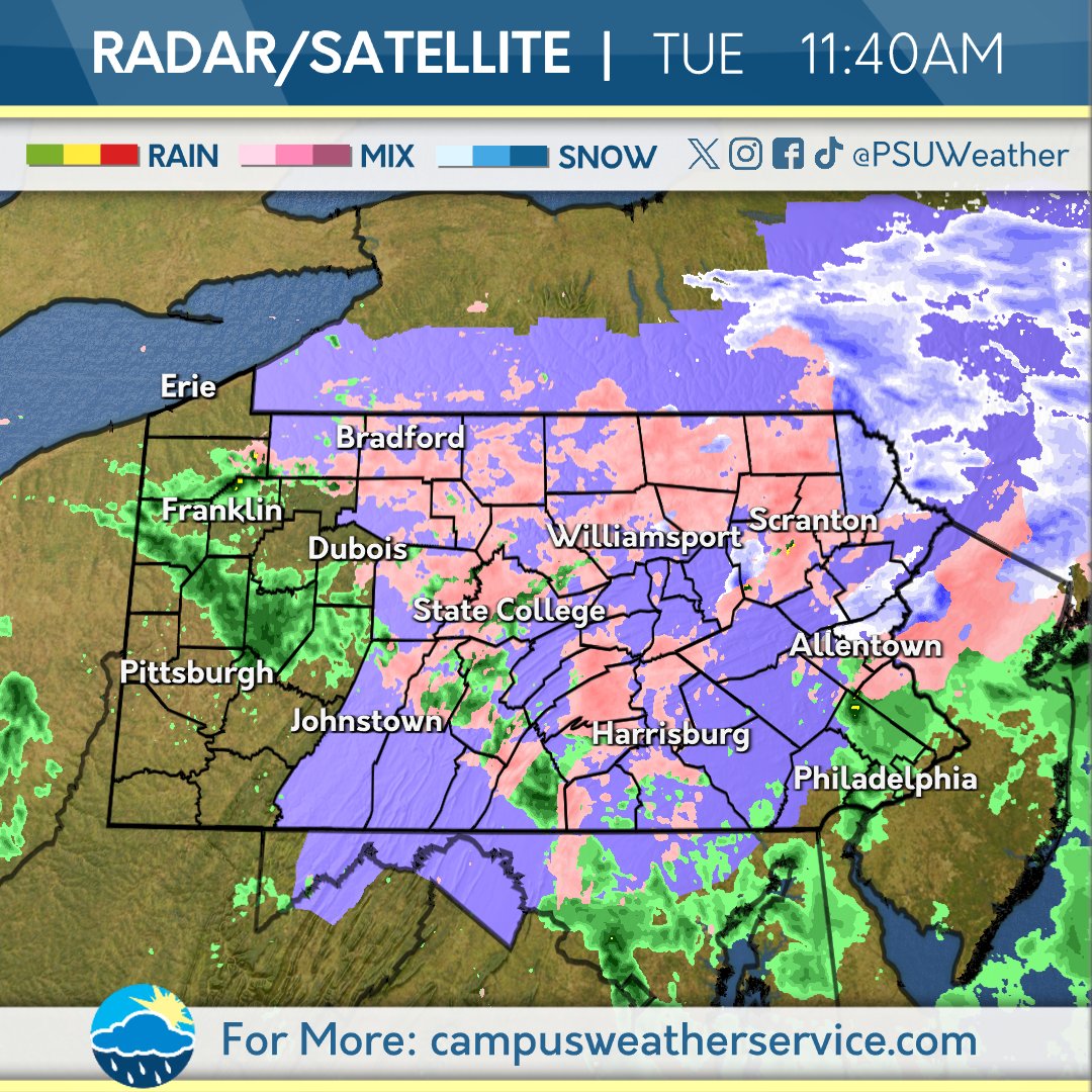
Light rain showers will continue to move across north-central PA this morning, giving way to mainly dry conditions for the rest of the day with highs in the 40s and 50s. #PAwx