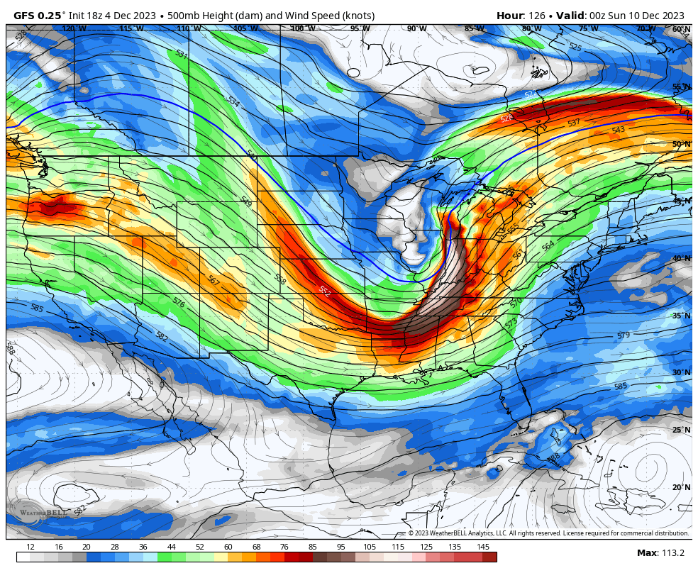
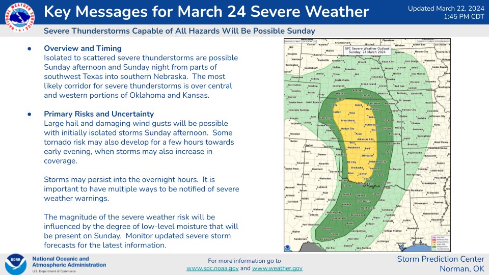
Potent trough is still looking likely this weekend, although models do show some differences in regard to timing and placement. GFS left vs. Euro right - either way it still looks like severe weather and wintry weather with this system. Finer details are still a couple days away!
I am LIVE on YouTube now - TORNADO threat increasing here in Louisiana this afternoon. I am in Winnsboro, LA at the moment with a tornado warned storm about 30 miles to my west. Tune in with the link below!
https://t.co/Lh4s4EQj0P
I will be LIVE on YouTube later today covering the severe weather threat across Louisiana/Mississippi. Strong (EF2+) tornadoes are possible. I have attached the link to my YouTube below, please consider subscribing!
https://t.co/vqE8HJa01i
A wildfire impacted southern portions of Shenandoah National Park today near Afton, Virginia. This fire caused i-64 to close down, and required AERIAL firefighting tactics to get it under control. Watch my full video with the link below!
https://t.co/0nfesptMQN
Storm Surge is overtaking hwy 12 going out to Cedar Island, North Carolina. A foot or more of water and rising at 5:20pm. #Ophelia moving closer to the NC coast this evening.
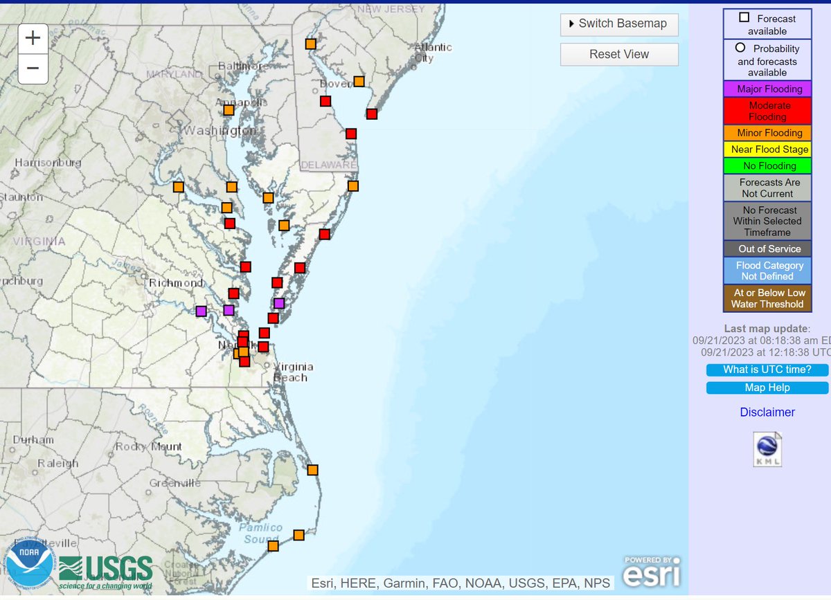
Name or no name, *significant* coastal flooding impacts are likely Friday and especially Saturday with the coastal low from OBX to New Jersey. MAJOR flood stage could be reached at some sites along the Chesapeake Bay in Virginia Saturday afternoon! Strong winds are likely too, with gusts up to 60mph possible along the immediate coastline. We could see high wind products (if the system isn't tropical), or tropical storm products (if the system does become #Ophelia). Beach erosion is going to be another issue, especially for the OBX with the persistent onshore flow tomorrow. Currently, NHC has development odds at 40% - these odds will probably increase today. #NCwx #Vawx #MDwx #NJwx
Hurricane #Lee will likely make landfall in eastern Maine Saturday night. BUT the worst impacts may be felt away from the center. It is possible that I end up on Cape Cod for Lee. If you haven't subscribed yet, please do! I plan to be LIVE chasing Lee - https://t.co/Jz4UigCGB7
Keep this in mind - the shape of the Cape allows for big issues no matter the angle a storm hits. Even if #Lee stays offshore, a north wind would pile water into Cape Cod Bay causing surge issues for many locations along the shore. The exact track can and will likely change more, but impacts are looking more and more likely for eastern Massachusetts. Depending on the exact track, coastal New Hampshire, and coastal Downeast Maine could see significant impacts as well from Hurricane Lee even without a direct landfall.
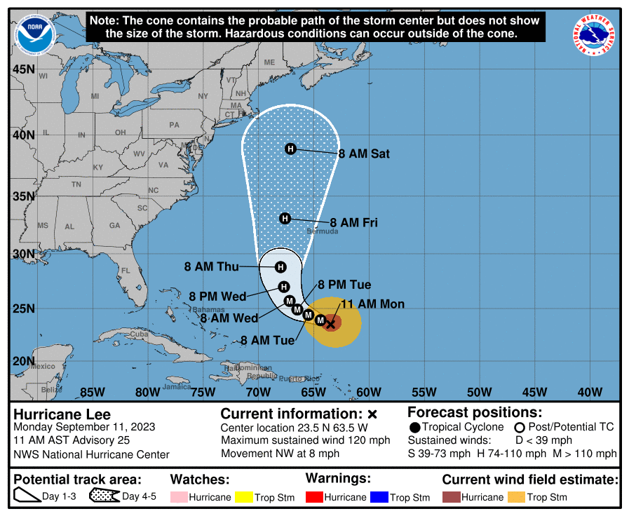
Hurricane #Lee is expected to make a northward turn by mid-week, and eventually become a threat to New England and Atlantic Canada by this weekend. With an expanding windfield impacts will be felt well away from the center, even if the center stays offshore.
The 12z ICON model depicts a not-so-good scenario for New England regarding #Lee. #Margot is much further east, allowing the ridge to build over Lee blocking the escape route towards Atlantic Canada and/or out to sea. This would push Lee a bit west once the storm is at the latitude of New England. A reminder that there is still uncertainty regarding the future track of Hurricane Lee. This is NOT a forecast - but only ONE run of ONE model. If I had interests in New England, and/or Atlantic Canada (especially) I would be keeping a very close eye on the progress of Lee this week.
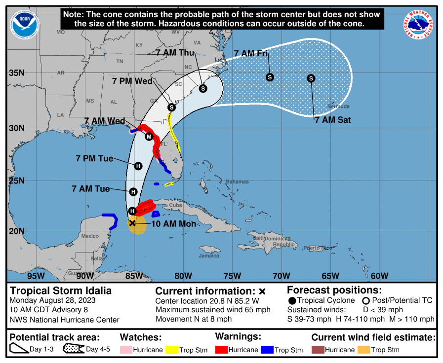
🔴 LIVE - MAJOR HURRICANE #IDALIA on approach to the Florida Big Bend region! Catastrophic storm surge, extreme winds possible! WATCH-https://t.co/cQ7kaL9Vbc
#FLwx
Current scene here in Cedar Key, Florida - Homes and business are boarded up ahead of hurricane #Idalia. Water levels in the Gulf are elevated this afternoon. 12 FEET of surge is possible here. #HurricaneIdalia#Florida#FLwx
Folks this is becoming a serious situation for the west coast of Florida, especially the Big Bend and Tampa Bay regions. A MAJOR hurricane is expected. We will be LIVE covering #Idalia from the area, be sure to subscribe on YouTube! https://t.co/KhWUwguf28
The entire West Coast of Florida will be impacted by storm surge from #Idalia. Especially the Big Bend region, where 7-11 FEET of surge is possible. This includes Cedar Key. Have your hurricane plan ready to be put into action by Tuesday.