Update: Evening showers and storms winding down. Saturday, scattered to numerous showers and storms expected with much lower chances Sunday. Hot, humid and dry everyday next week across Southeast Texas. https://t.co/UrJOAmpwrZ
Scattered evening showers and thunderstorms are expected tonight and again Saturday afternoon and Sunday morning due to an approaching upper-level disturbance. Hot, dry weather with highs in the low to mid 90s expected next week.
#12NewsNowWeather
https://t.co/dE7HWlZE8Y
Later this afternoon and early evening, a round of showers and thunderstorms is possible from Harding County northwards into the Lakes Area of Southeast Texas. https://t.co/UrJOAmpwrZ
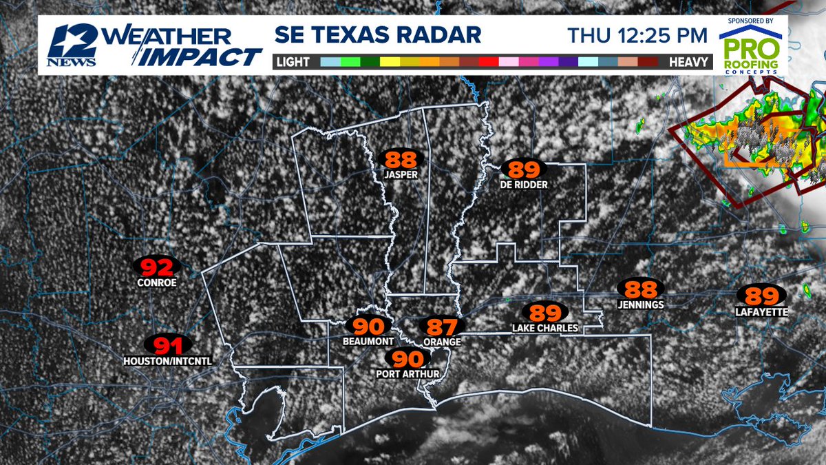
A few showers and breezy winds are expected tonight with a hot, humid and mainly dry day Thursday. A few showers are expected Friday with a 40% coverage Saturday due to an approaching upper-level disturbance.
#12NewsNowWeather
https://t.co/dE7HWlZE8Y
Locally heavy rain and breezy winds possible early Wednesday due to a weakening tropical system heading northeast through the coastal waters. 1-2 inches possible in the Triangle and gusts to 25 mph...little impacts expected.
#12NewsNowWeather
https://t.co/dE7HWlZE8Y
Between 5 am and about 2 pm will be the window for the best rain chances and breezy winds. Dry weather returns Thursday to Southeast Texas. https://t.co/UrJOAmpwrZ
Torrential rain has fallen in portions of Tyler and Hardin Counties with a Flash Flood Warning in effect. Latest modeling shows this weakening around 3 pm this afternoon. https://t.co/UrJOAmpwrZ
A potential tropical system, over S Texas, will move northeast tonight & Wed. This will be a lop-sided system with the rains & winds to the southeast over the gulf. And there's the potential that it weakens as it goes by SE Texas in the coastal waters. https://t.co/UrJOAmpwrZ
Weather Impact Alert across Southeast Texas through Wednesday for rounds of heavy rainfall – 3-5 inches additional inches possible. Dry weather returns Thursday with scattered showers & storms Friday and Saturday.
#12NewsNowWeather
https://t.co/dE7HWlZE8Y
The rains are slowly tapering off across Southeast Texas as our break develops. More heavy rain is expected early Tuesday morning in the Triangle spreading north during the day into the Lakes Area. https://t.co/UrJOAmpwrZ
Weather Impact Alert through Wednesday due an additional 3-5 inches with higher amounts possible. A weak low may move through the coastal waters heading towards Louisiana. Dry weather returns Thursday. https://t.co/UrJOAmpwrZ
Widespread rain with a few thunderstorms is moving across Southeast Texas currently. This should begin to taper off around 7 pm this evening only to restart early Tuesday morning. https://t.co/UrJOAmpwrZ
Heavy rain falling in Hardin and Northern Jefferson County moving northeast at 20 mph. Rainfall rates of 3 inches per hour are occurring which could cause some street flooding. https://t.co/UrJOAmpwrZ
Minimal rainfall and hot, humid weather conditions are expected through Saturday. Sunday, a surge of tropical moisture will arrive with scattered showers and thunderstorms. Monday and Tuesday look wet with the potential of 2-4 inches.
#12NewsNowWeather
https://t.co/dE7HWlZE8Y
The latest run of the European Model shows 2-4 inches of rainfall falling through late Wednesday with the heavies falling Monday and Tuesday across Southeast Texas. https://t.co/UrJOAmpwrZ