@amazingmap That's my map and the data I used was too broad (historic=castle). Please do better and check that the work you're stealing is correct...
https://t.co/2OZA80cvm1
NEW: We've tracked the world's largest iceberg, A23a, and it's on the move again!
It travelled along the seafloor ridge from the Filchner Ice Shelf to past South Orkney islands, pushed by currents, and is now in deeper waters en route to South Georgia.
It's time to log off. People are ingesting too much negative news, and it’s not only affecting them personally but impacting society at large. Psychology experts say you need to know your limits—and when to put down the phone. https://t.co/q1FWyRmnPB
🆕📘 'Merging statistics and geospatial information, Experiences and observations from the national statistical authorities, 2016–2020, 2024 edition'.
Read it here ⬇️
https://t.co/jX18GQnDIY
NEW: One of the worst methane leaks ever recorded revealed.
Using satellite data, scientists estimate 127,000 tonnes of methane escaped from an exploratory well in Kazakhstan.
We analysed @planet satellite images to understand exactly what happened, from the blowout to its fix
Incredible to watch tens of thousands of Grey-headed Flying-fox megabats (Pteropus poliocephalus 🦇) leave their roost at sunset to forage for nectar overnight - so many that they're accidentally mapped as rain on the @BOM_au weather radar! 🤯 #wildoz
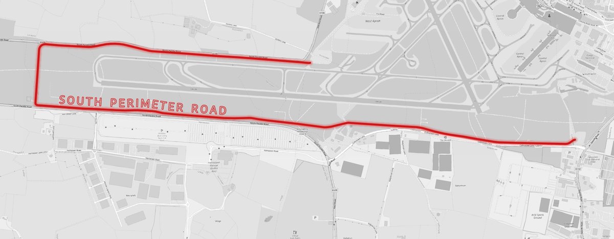
I also looked at a good few streets such as 'Woodstreet' which joins the N77 outside Portlaoise. Besides from OSM, I cannot find any record of it. Officially it's the 'L26812'. There is a wood design business on the road which may explain the name on OSM. (3/3)
Being a quiet New Year's Day I thought I'd take a quick look at what the longest road and street are in Ireland. I downloaded the data from geofabrik and processed it using Osmium and GDAL then ran a few SQL queries in PostGIS. The results were disappointing (1/3)
The reason they were disappointing is that the longest streets and roads were colloquial names such as the below. OSM refer to it as 'South Perimeter Road' whereas the actual road signs (and MapGenie) refer to it as the 'R108' (2/3)