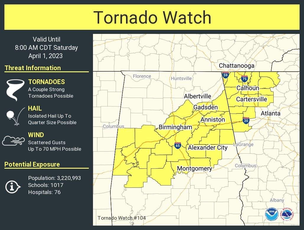
Pelham is included in a Tornado Watch until 8:00 a.m. Please stay weather aware. The tornado shelter at Pelham Park Middle School will be open by 4:00 a.m.
#pelhamalabama#alwx
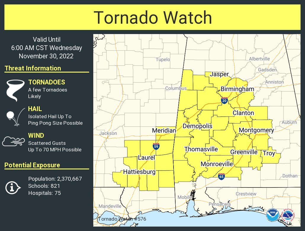
Severe thunderstorms are currently moving through Eastern Mississippi and will build into Central Alabama through the overnight hours. A tornado watch is effect through 4 AM. #alwx
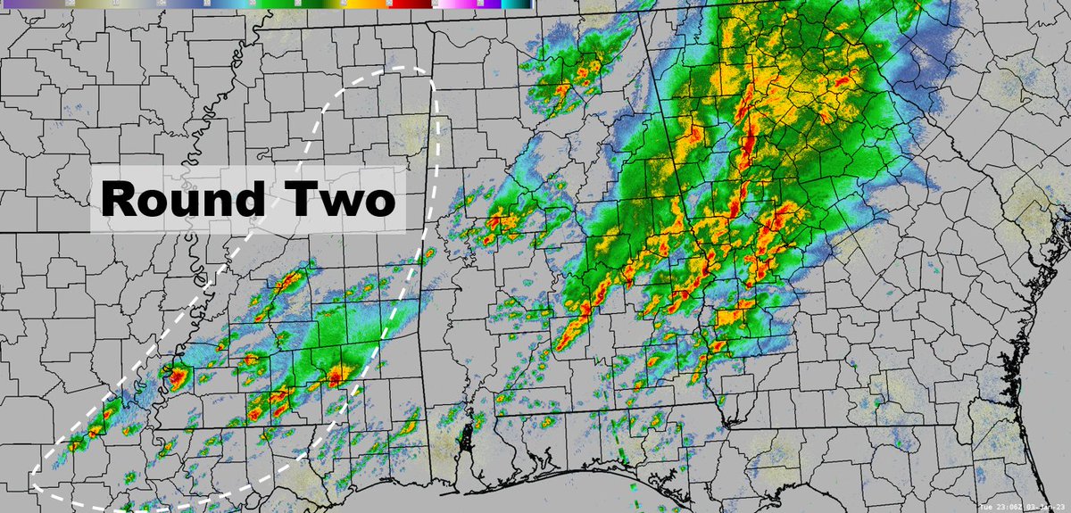
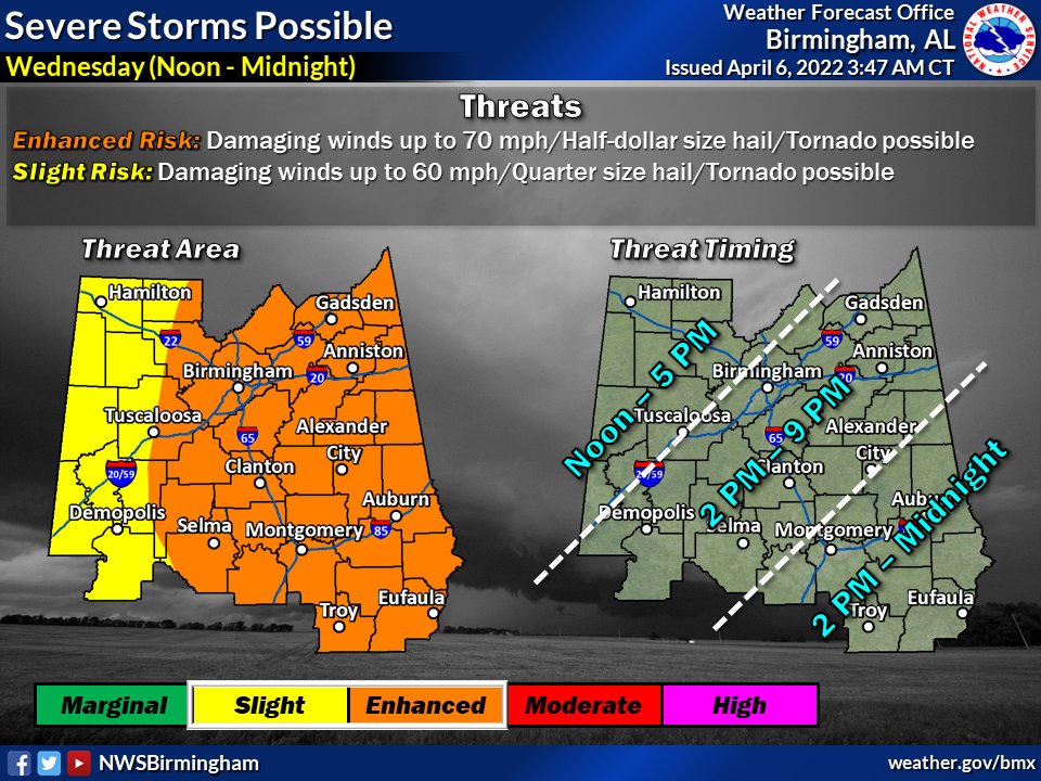
Round 1 of storms is in the process of shifting into GA w/ the tail end of activity still affecting areas toward I-85. Round 2 is kicking off back in MS and will pose a risk of severe weather tonight into early Wed AM, including: tornadoes, damaging winds, and quarter size hail.
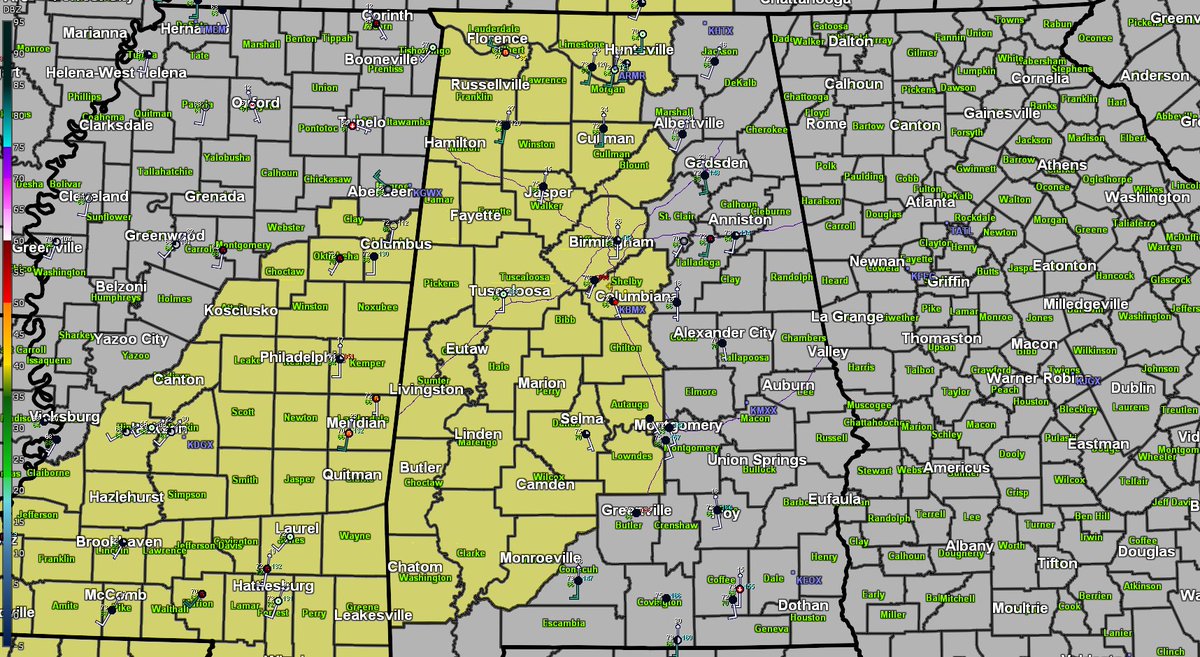
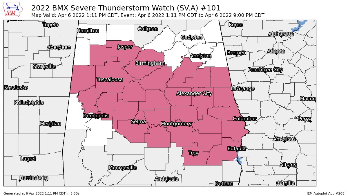
Counties in Central Alabama just added to the Tornado Watch include: Autauga, Blount, Chilton, Jefferson, Lowndes, and Shelby. This puts all counties along and west of Interstate 65 under a Tornado Watch until 5 pm for ROUND ONE of storms. #alwx
Bigger than the badge – @CityofPelham takes it one step beyond the blue lights and elaborate gadgets to make sure you can get all the help you need in any emergency @PelhamPoliceAL@PelhamFire#NationalNightOut@natsnd@CBS_42
MORE: https://t.co/I3L61hkGVQ
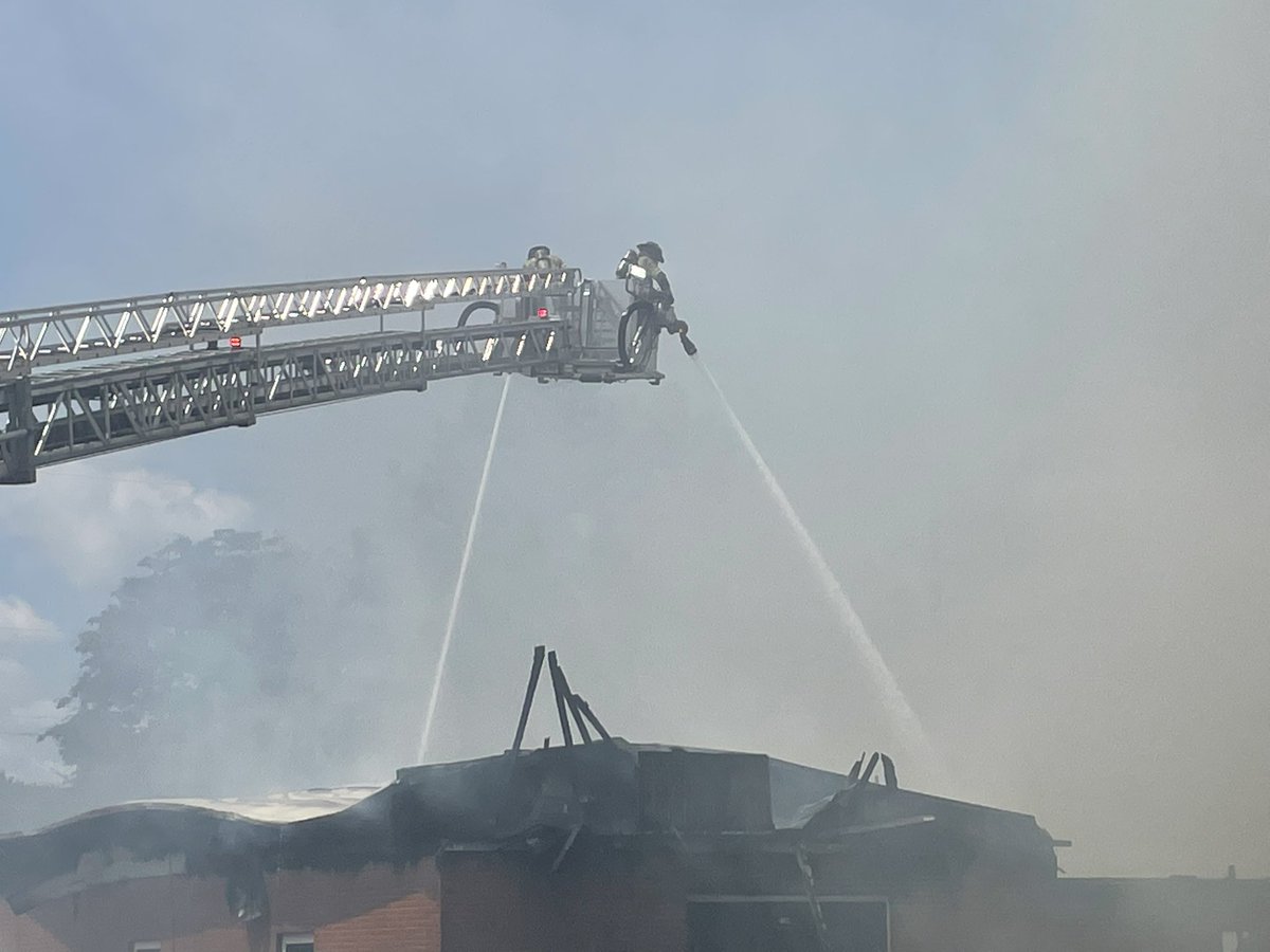
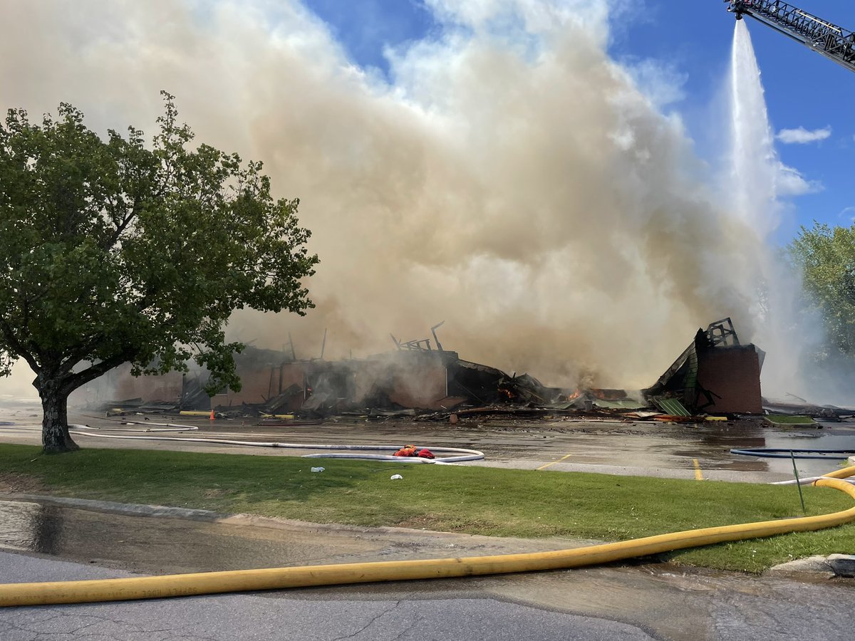
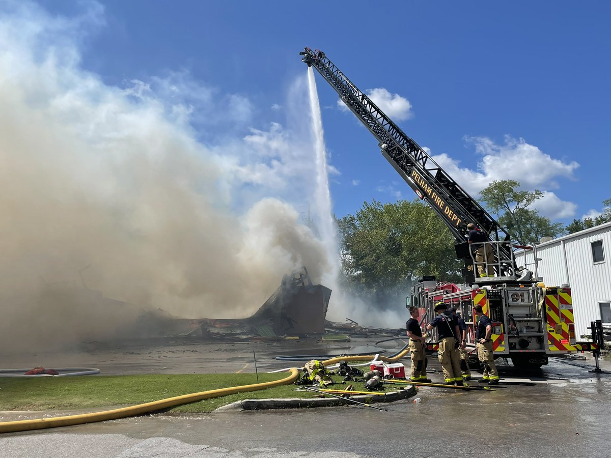
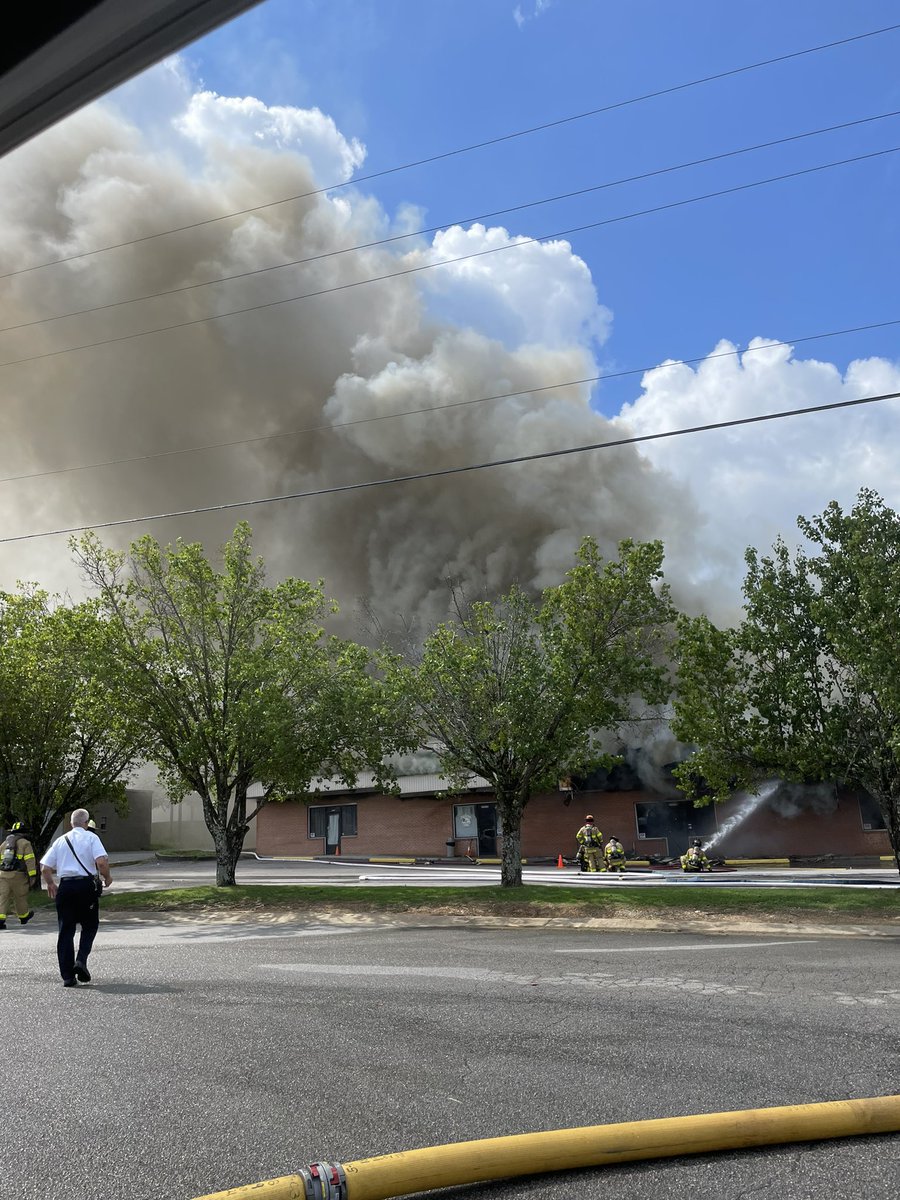
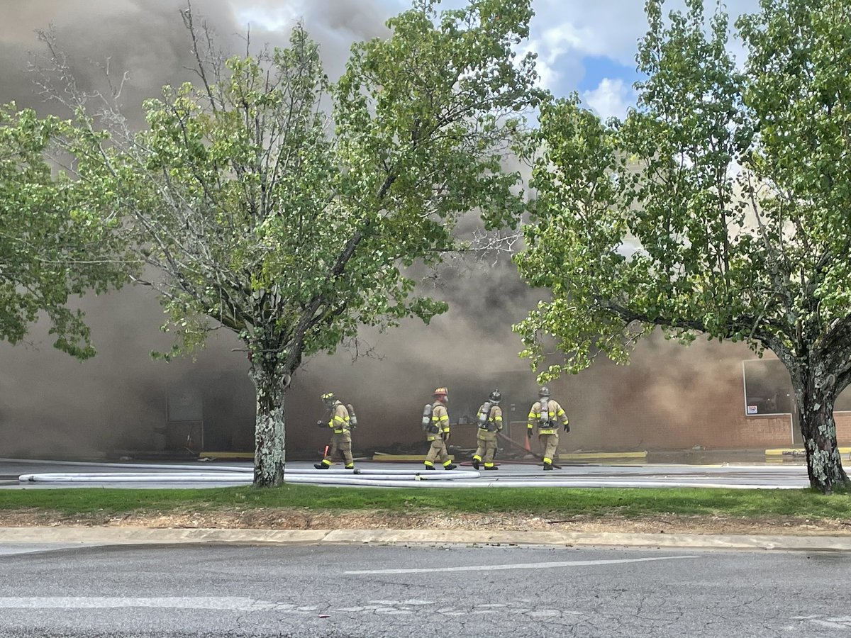
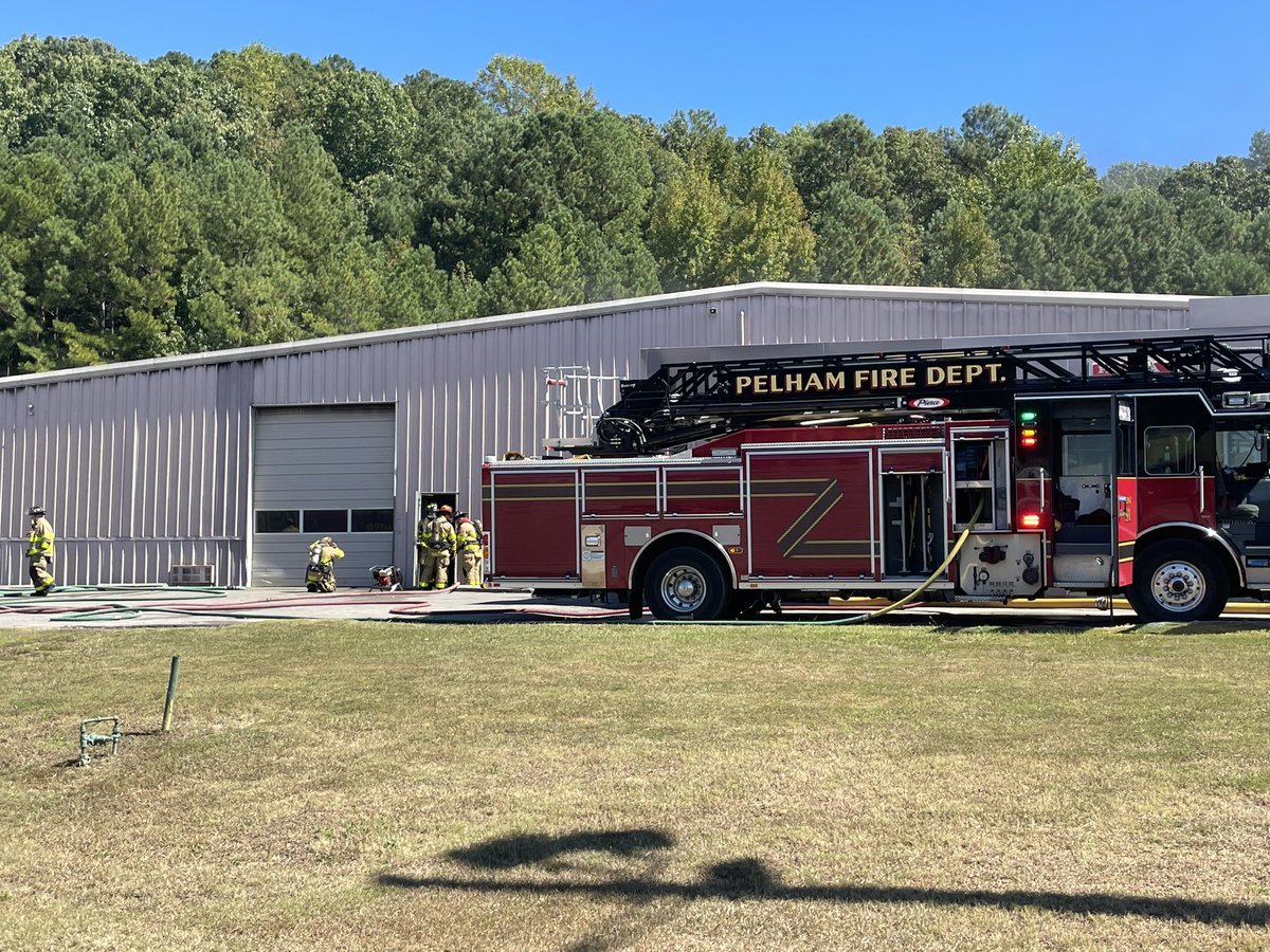
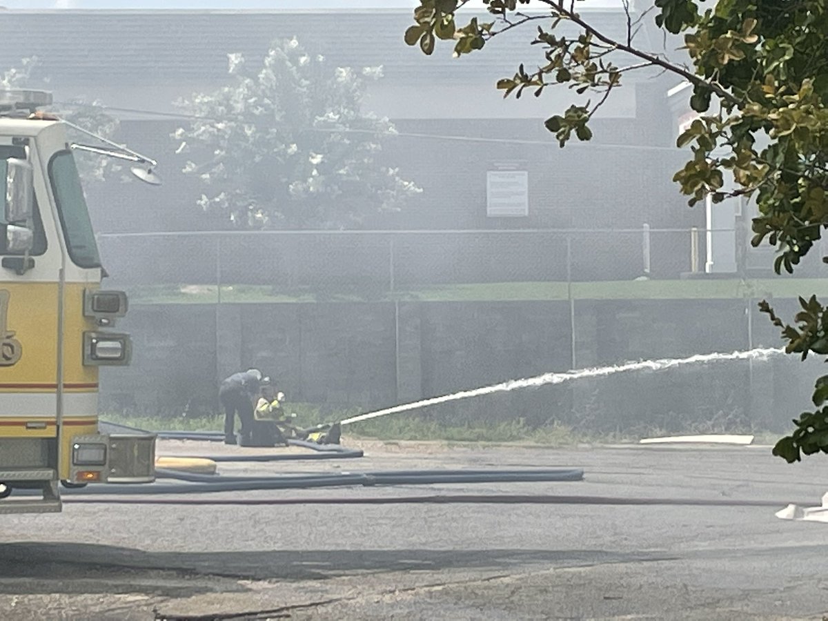
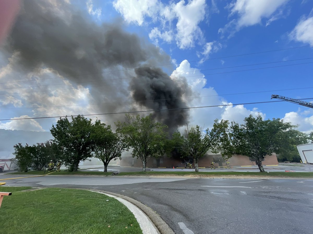
Crews remain on scene. Unfortunately, the business is a total loss.
We appreciate the mutual aid from @AlabasterFire and @HooverFireDept as well as our brother’s @PelhamPoliceAL
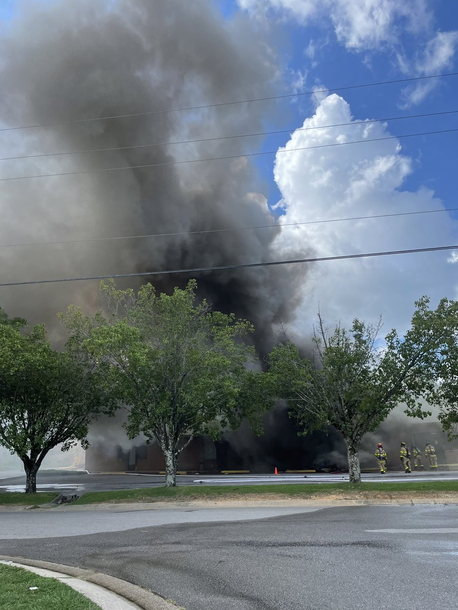
Traffic Alert: Due to a structural fire, road closures are necessary at these locations:
-Crosscreek Trail at Highway 31
-Chandalar place drive at 31 -chandalar place drive at chandalar drive
-Corporate Way
**Do not drive over fire hoses in the area.
Engines are working to bring a fire under control in the 2700 block of Chandalar Place Drive. This is an active scene with multiple departments on scene. Area is safely evacuated.
Official info will come from this agency and @PelhamPoliceAL
@CityofPelham is pleased to receive a donation of $50,000 from @Kinder_Morgan that will be used for emergency response services. Pelham Fire Chief Mike Reid received the donation from Kinder Morgan's Ben Lovelady, John Massey, and Luis Moreno.
Severe thunderstorms will be possible this afternoon and evening along and ahead of a frontal boundary. Damaging winds and large hail are the main threats, though a tornado is also possible. Stay weather aware today and make sure you have a way to receive warnings!
UPDATE: The brush fire is smoldering now, and our crews are clearing the area. Forestry will remain on scene, and our Battallion Chief will monitor throughout the night.
No further updates are planned.