We are aware of a comms failure out of the Paducah, KY NWS office. Sorry it took so long to get this update sent out, but we were buried with the severe weather warnings this afternoon/evening. Special thanks to NWS Louisville for helping us keep things running.
Pleasant and comfortable conditions will continue today and Friday. Saturday will be warm and dry, but increasingly muggy. Unsettled weather arrives Sunday and will continue into the first half of next week. The best chance of showers and thunderstorms will be Monday.
BLUE ALERT 2026-7 WEA: CARUTHERSVILLE, ZACHARY WALKER WHITE MALE AGE 42 ARMED & DANGEROUS Updates will be posted as they are known. Refresh this page or click the following link to ensure that you are viewing the latest alert information: https://t.co/UoXX3KdhG2
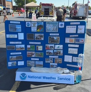
If you're in the Mayfield area today, NWS Paducah will be at the Graves County Health and Safety Fair at Graves County High School until 2 PM. Stop by and say hello!
𝗔𝗟𝗘𝗥𝗧 (𝗔𝗽𝗿. 𝟭𝟲, 𝟮𝟬𝟮𝟲) – KY 339 in Graves Co. is blocked between KY 1213 and KY 121, north of Fancy Farm, due to downed power lines. No estimated duration. Seek alternate routes.
REMINDER: Lane restrictions begin at 7 p.m. Sunday, March 1, on the I-24 Ohio River Bridge as crews set up for Monday’s Phase 2 rehab work. Expect delays and plan ahead.
https://t.co/C3HjuGg61Q
BREAKING: Nolensville Pk btwn I-440 & Vivelle Ave is presently closed while the MNPD Hazardous Devices Unit investigates a report of potentially dangerous material in a dumpster at the Mapco convenience store, 2200 Nolensville Pk. Glenrose Ave in that immediate area is also closed.
Warmer temperatures are on the way! Sunday through Tuesday will see a warming trend with high temperatures staying above freezing through next week. We could even hit 60 in some spots on Monday and Tuesday.
Temperatures will be much warmer through the weekend with even warmer conditions expected next week. It's still looking like we may even see some 60 degree reading in the 6-10 day outlook!!
🚨TRAFFIC ALERT🚨
I-24 WB in McCracken County is closed due to a crash involving a tractor-trailer. This will be a lengthy delay. We are working on a detour.
👉Please do not travel unless you absolutely need to. #WinterStormFern
⚠️ Be weather aware!
▪️Slow down on wet roads.
▪️Stay alert for unexpected road hazards like fallen trees, limbs or power lines.
▪️If the traffic signal is out, treat the intersection as a 4-way stop.
❇️Exciting news for Massac County! All lanes on the I-24 Ohio River Bridge reopen by the end of the day today as Phase 1—featuring deck repairs, steel work and joint replacements—wraps up.
Lane restrictions resume March 1, 2026, when Phase 2 begins. https://t.co/HwLxroUQto
Due to inclement weather, Governor Beshear has delayed the opening of all state office buildings until 10:00 a.m. ET on Friday, December 12, 2025.
This means that there is an Executive Branch building closure until 10:00 a.m., at which time Executive Branch buildings will open.
Rain/snow is moving into western portions of the Quad State. Northern portions of SE Missouri and S Illinois may see accumulating snowfall up to around an inch or so with roads affected if snowfall rates are high enough.
𝗨𝗣𝗗𝗔𝗧𝗘 - 𝗕𝗮𝗹𝗹𝗮𝗿𝗱 𝗖𝗼𝘂𝗻𝘁𝘆: Due to higher traffic volumes detouring along US 60 into Wickliffe, KYTC crews are manning key intersections and flagging traffic at 4-way stops.
#Rain#Drought OCT 6, 2025. Numerous showers and thunderstorms will develop in the region today, tonight, and tomorrow. Locally heavy rain is likely (esp over KY/TN).
𝗨𝗣𝗗𝗔𝗧𝗘 (𝗔𝘂𝗴. 𝟭𝟮, 𝟮𝟬𝟮𝟱) – KY 1322/Harris Road between U.S. 62 and KY 1837 in McCracken Co. will reopen to traffic at 6 p.m. tonight, Aug. 12, and remain open overnight. The roadway will close again on Wednesday, Aug. 13 from 8 a.m. to noon for finishing work.