We made a map showing variation in renewable energy adoption/diffusion in Nigeria states on the basis of type of technology and installed capacity in KW per state.
You can always contact us for Geospatial analysis across all industries.
@ACORE,@GErenewables,@eeregov,@REWorld
Now Accepting Applications: Prime TEC Internship Program
Opportunities for undergraduates and recent graduates. We seek individuals who are self-driven and interested in geospatial and data applications.
📌 Apply now: https://t.co/Yx3SFLIbmz
🗓️ Deadline: 8th May, 2026
👋Call for papers- International conference on the educational and professional trajectories of young people from immigrant backgrounds @ICMigrations
When? 4-5 December 2025
⏰Deadline: 7 March
👉https://t.co/MiMkFwJdLX
Vegetation indices [VI] are tools in remote sensing used to assess the health, density, and distribution of vegetation. Here are insights on three VI:
• Normalized Difference Vegetation Index
• Enhanced Vegetation Index
• Soil Adjusted Vegetation Index
📸: Mashford Mahute
The Basic Research Process Simplified
1️⃣ Identify a problem/question 🤔
2️⃣ Review existing literature 📚
3️⃣ Define your methodology
4️⃣ Collect & analyze data
5️⃣ Draw conclusions & interpret findings
6️⃣ Share your results! 🗣️
Research isn’t complicated—just take it step by step!
Thrilled to announce our collab with @ai16zdao!
We're taking Aimonica to the next level by integrating the cutting-edge framework being developed on https://t.co/Nba89oalma
This means adopting autonomous trading and leveraging their innovative marketplace of trust to shape investment decisions – all of which will power our new fund, Aimonica Capital.
From day one, our goal has been clear – to become the premier AI-driven investor capable of outperforming traditional web3 VCs. Incorporating the Eliza model marks a significant step toward realizing that vision.
As the fourth-largest asset under @pmairca management, the scale and potential of this collaboration can’t be overstated.
The best is yet to come 💙🧡
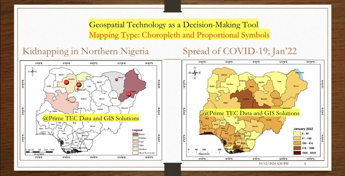
#GIS and various mapping techniques transforms complex data into actionable insights. These tools empower decision-makers to allocate resources, design targeted interventions, and address challenges in fields like climate adaptation, public health, and urban planning.
#geospatial
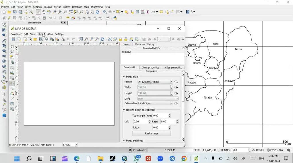
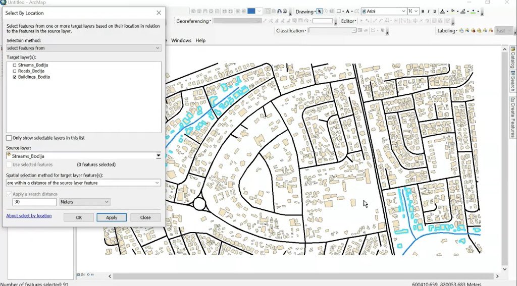
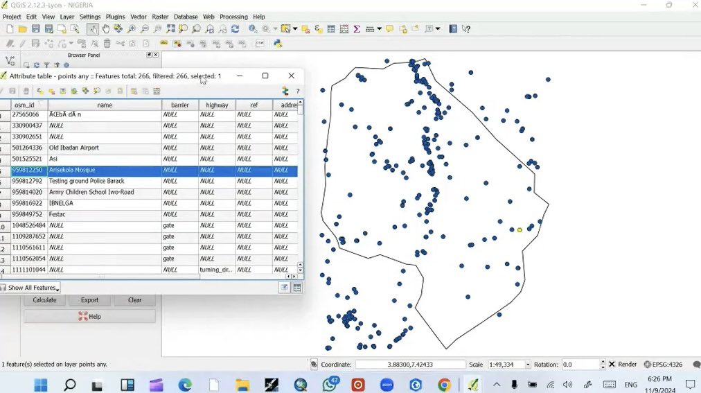
Snapshots from the sessions we held, exploring various software including #ArcGIS and #QGIS for analyzing data structures, geocoding, feature metric computations, topo. mapping, hydrological analysis, analyzing patterns and clusters, climate data processing, among others.
For some weeks, we have facilitated the training of interested professionals on the use of #GIS for various research and analytical purposes, with our students working in different fields including epidemiology, agroforestry, environmental consultancy, among others.
#GIS
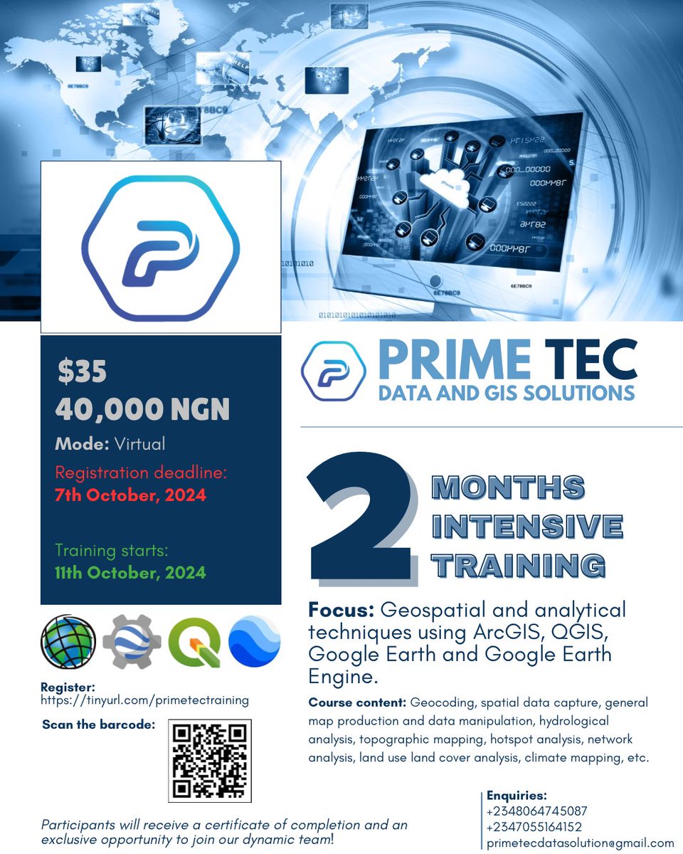
Hurry now! Today is the deadline for registration.
Register for the two-month intensive training program on #GIS using a variety of software.
➡️ https://t.co/Zx8PeOcY8i
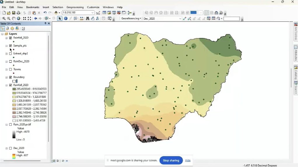
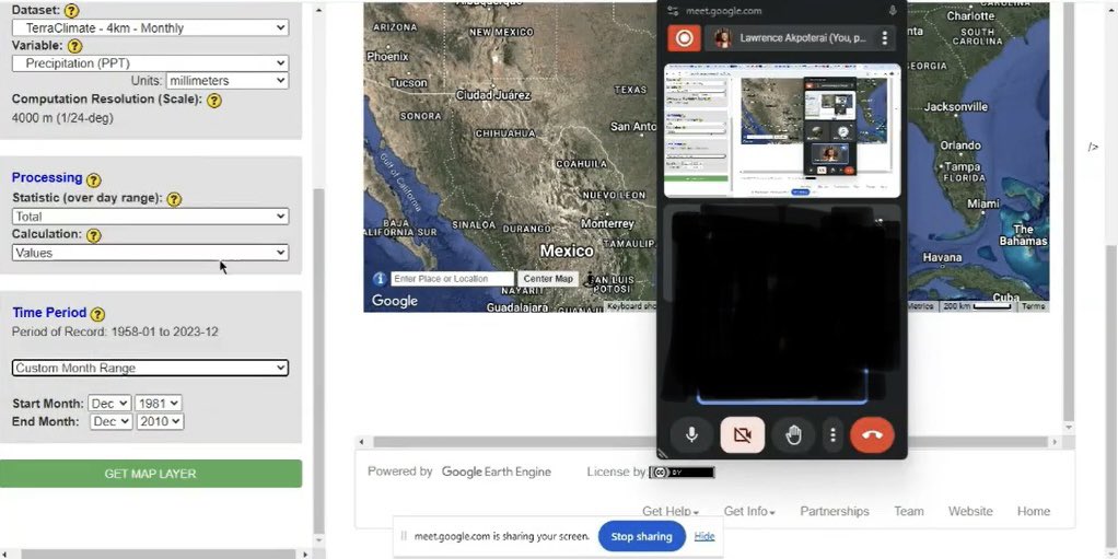
Highlights from previous sessions facilitated training undergrad and postgrad students on methods of rainfall data acquisition: processing remotely sensed netCDF data to obtain rainfall parameters across AOI.
You’re welcome to join us in the coming training. See details👇🏼
We’ll be hosting a GIS-focused training using Google Earth, QGIS, and ArcGIS, etc. 🚀
You're in env. mgt., urban planning, agric, or research, GIS and remote sensing are powerful to gain insights and make data-driven decisions!
🗓️💻📍See the flyer!
Reg: https://t.co/Zx8PeOcqiK
@PrimeTEC_data is hosting a GIS-focused training using Google Earth, QGIS, and ArcGIS, etc. 🚀 Applications in env. mgt., urban planning, agric, health, research, etc., to gain insights and make data-driven decisions!
🗓️💻📍See the flyer!
Register: https://t.co/75kUylDE0y
We’ll be hosting a GIS-focused training using Google Earth, QGIS, and ArcGIS, etc. 🚀
You're in env. mgt., urban planning, agric, or research, GIS and remote sensing are powerful to gain insights and make data-driven decisions!
🗓️💻📍See the flyer!
Reg: https://t.co/Zx8PeOcqiK
We’ll be hosting a GIS-focused training using Google Earth, QGIS, and ArcGIS, etc. 🚀
You're in env. mgt., urban planning, agric, or research, GIS and remote sensing are powerful to gain insights and make data-driven decisions!
🗓️💻📍See the flyer!
Reg: https://t.co/Zx8PeOcqiK
We’ll be hosting a GIS-focused training using Google Earth, QGIS, and ArcGIS, etc. 🚀
You're in env. mgt., urban planning, agric, or research, GIS and remote sensing are powerful to gain insights and make data-driven decisions!
🗓️💻📍See the flyer!
Reg: https://t.co/Zx8PeOcqiK
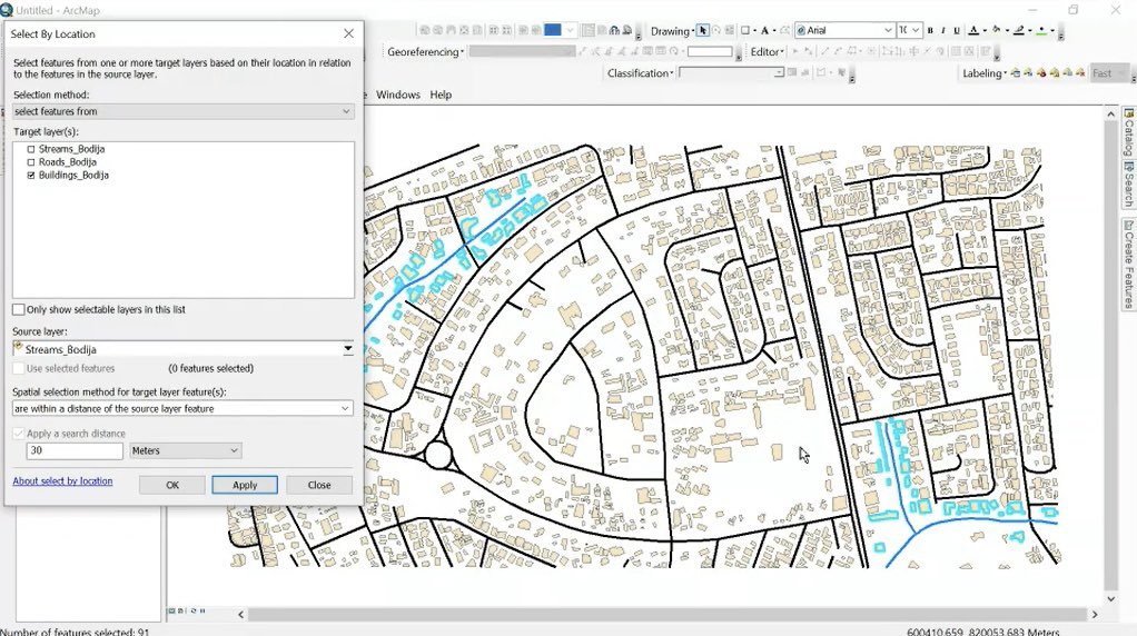
Dimensions of features such as length, area, and perimeter are important parameters to measure for an accurate spatial analysis.
https://t.co/CWXw0nNlJo
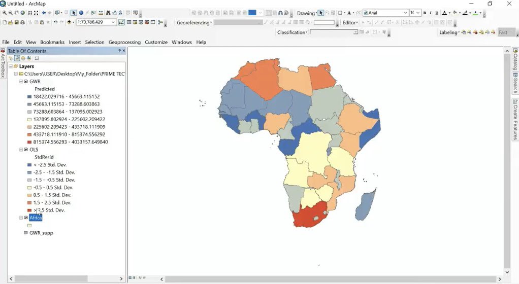
Every map projection has its own distortion! Whether it's shape shape, area, or distance, no flat map can perfectly represent our round Earth. Learn how to carry out map projection in arc map.
https://t.co/yiZK4UkfRK
#GIS#maps
Let's talk about GIS mistakes. One common mistake is not paying attention to data quality. Poor quality data can lead to inaccurate data analysis, unreliable results, and ultimately flawed decision-making.
#GIS#data#Analytics


![PrimeTEC_data's tweet photo. Vegetation indices [VI] are tools in remote sensing used to assess the health, density, and distribution of vegetation. Here are insights on three VI:
• Normalized Difference Vegetation Index
• Enhanced Vegetation Index
• Soil Adjusted Vegetation Index
📸: Mashford Mahute https://t.co/tt5YoQ90L2](https://pbs.twimg.com/media/GjmCnayWwAAzYPb.jpg)