OFB/Warm Front starting too lift northeast into the majority of the moderate risk area with intense CAPE and much better tornado ingredients should start filtering in the area especially as clearing is taking place in North Central Illinois.
Might be the craziest things I have ever seen from a model for the Chicagoland area….. literally supercells marching right into Chicago metropolitan area
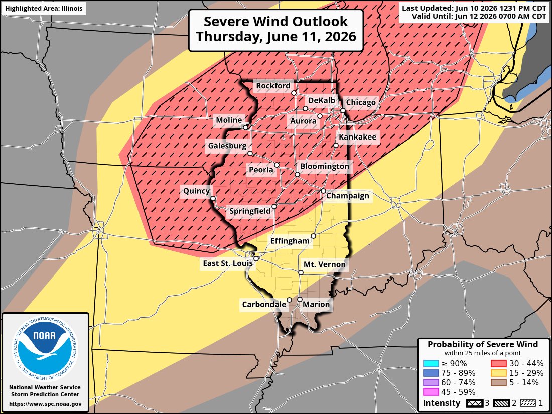
A fairly potent severe weather event will likely unfold across northern Illinois and surrounding areas Thursday.
A strong jet streak interacting with a humid and unstable environment will likely lead to explosive initiation of supercells merging into a damaging MCS quickly into evening. 75+ mph winds and strong tornadoes are possible alongside flash flooding.
Multiple Rounds of potentially significant severe weather are likely on Wednesday.
- We may see a morning round of thunderstorms in the area, but it's not expected to amount to much and may miss Illinois to our north. Afterwards, models are showing a new round of storms developing early afternoon across Iowa and moving east into northern Illinois on Wednesday afternoon. These could easily be strong to severe with a damaging wind risk. Then the main round of storms that organized across Minnesota and Iowa mid-afternoon will intensify and move southeast on Wednesday evening. This likely will be the strongest round of the day with significant wind gusts possible after dark Wednesday night into early Thursday morning. The latter round has the greatest tornado and damaging wind risk across the Orange outlined area (enhanced risk). Additional storms are expected to develop Thursday morning across Iowa and move into Illinois Thursday afternoon and evening with a significant damaging wind and tornado risk. Upgrades to both days are likely, given the environment in place. Damaging wind gusts would be the highest risk. #ilwx See less
As he said Much more muted threat due to morning convection lingering a bit longer than required for severe weather. All hazards threat will be low but can rule out a stray severe thunderstorm here and there #ilwx
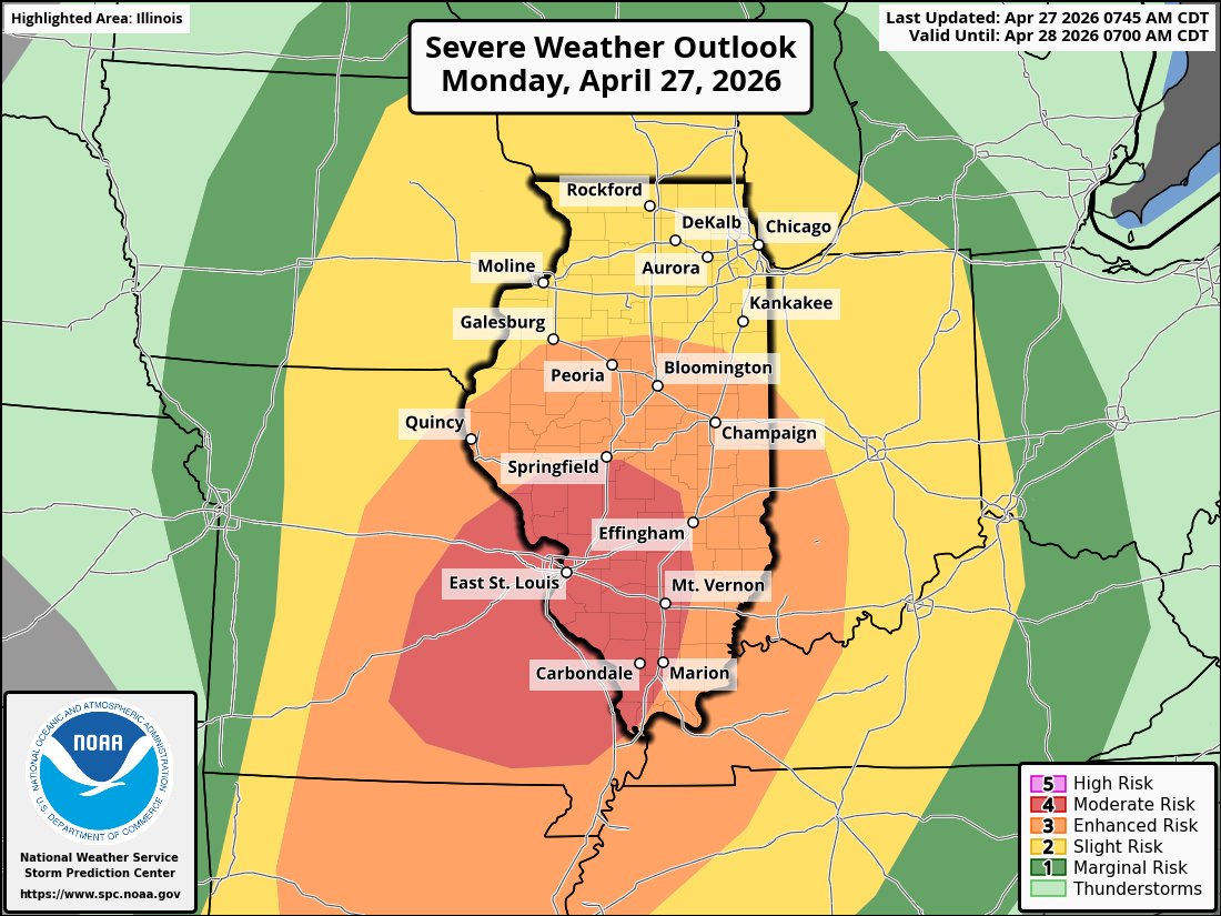
8am: **Tornado Outbreak Likely Today across Central and Southern Illinois**
- A round of storms will move though Illinois now through early afternoon. Behind this line of storms, robust recovery will take place across southern Illinois and new development will occur starting near the Mississippi River. These will quickly become supercells and could be dangerous with multiple long-tracked strong tornadoes possible especially in the Moderate risk. Tornadoes will be possible from 2pm through 11pm.
- Across Northern Illinois, a much more muted risk today with weak recovery behind this mornings thunderstorms. A limited all hazard risk will be possible from 5pm through 11pm. #ilwx
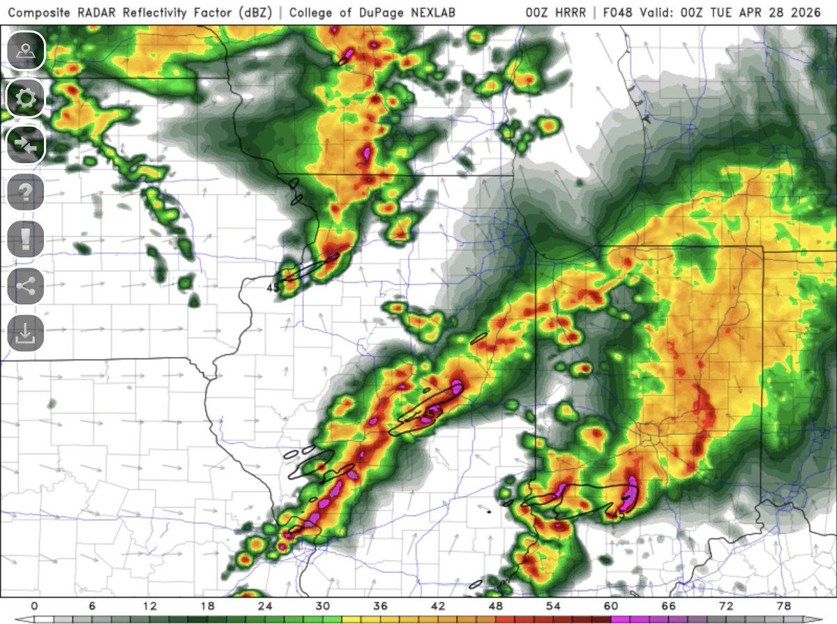
00z HRRR with a perfect example of what morning convection could do to this event. Environment is poor with disorganized cluttered convection with the tornado threat being lower. Smart of the SPC to maintain an enhanced risk as this is a big wildcard for this event #ilwx