🚨 EVACUATE NOW IN PAGOSA SPRINGS 🚨
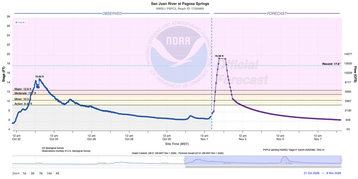
The San Juan River could crest at 19.38' tonight, nearly 5' above last week's flood and 2' above the 1911 flood.
Evacuate low-lying areas along the San Juan, Rio Blanco, Navajo, and Piedra Rivers. US 160 closes inbound at 4 pm. #COwx
On the evening of October 24, 2026, an EF1 tornado moved through south-central Santa Fe, causing damage to multiple homes/structures with many trees uprooted and snapped. More information here: https://t.co/IpVvojFnCt
🌪️ Another tornado in New Mexico!!
This one was just south of Shiprock Sunday afternoon. You can even see Shiprock at the beginning of the video!
📹 Katie Tache
@NWSAlbuquerque#NMwx
It was an ACTIVE few days across New Mexico and Southwestern Colorado with major flooding, severe storms, and tornados! Here's a look at some official rainfall totals across the state from the past 7 days! Many locations saw locally heavier amounts! 🌧
#nmwx
Posted: 10/26/26
Risk of severe storms N and central NM this afternoon and evening, then to a lesser extent Saturday. Risk of excessive rainfall capable of producing flash flooding decreases some today from yesterday, but will increase central and E Saturday, then linger E on Sunday. #NMWx
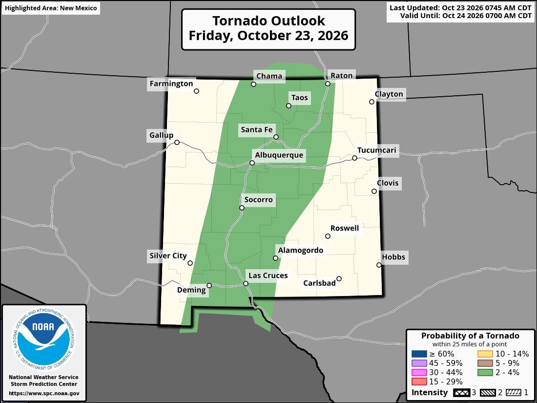
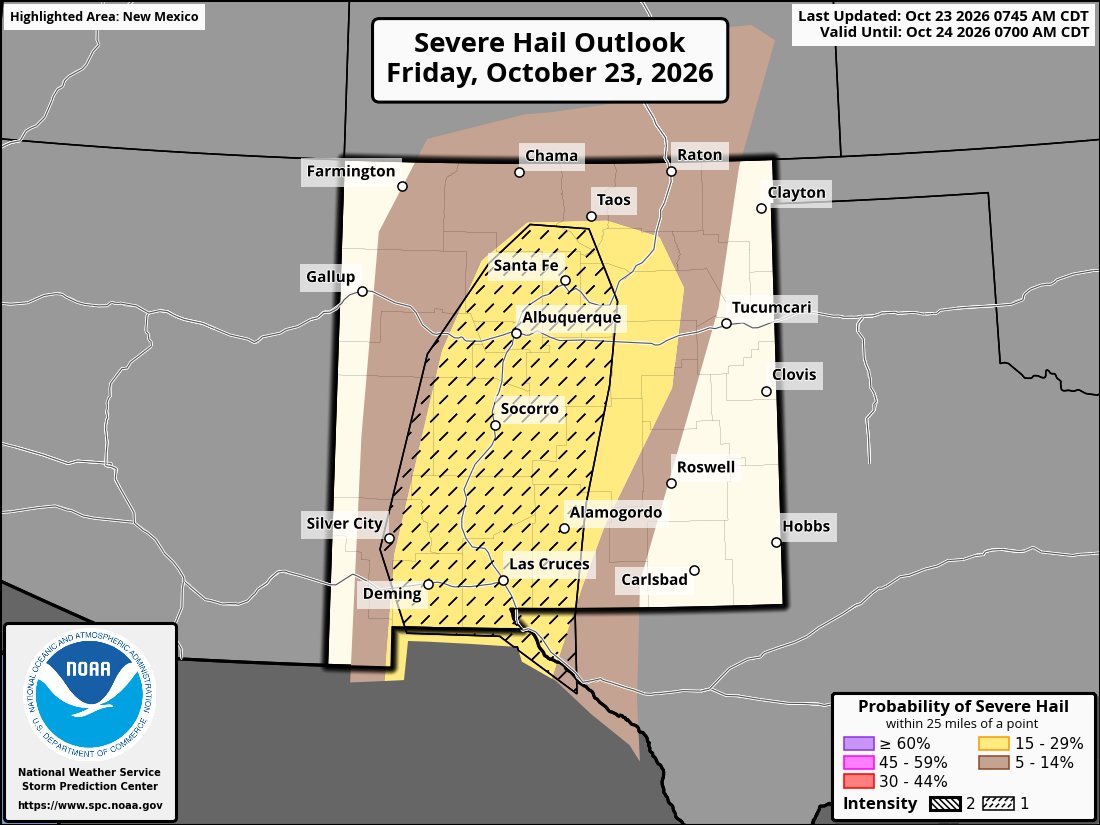
Another round of severe weather is possible across New Mexico Friday.
A Slight Risk (Level 2 of 5) is in place, with large hail, damaging winds, and even a tornado or two possible.
Multiple rounds of storms are expected from early afternoon through late tonight.
#NMwx
MANDATORY EVACUATIONS around Pagosa Springs, CO.
Evacuations have been ordered along the San Juan, Rio Blanco, Navajo, and Piedra Rivers due to rising water levels.
Another 1-3" of rain is possible through late tonight, increasing the threat of dangerous flooding. #COwx
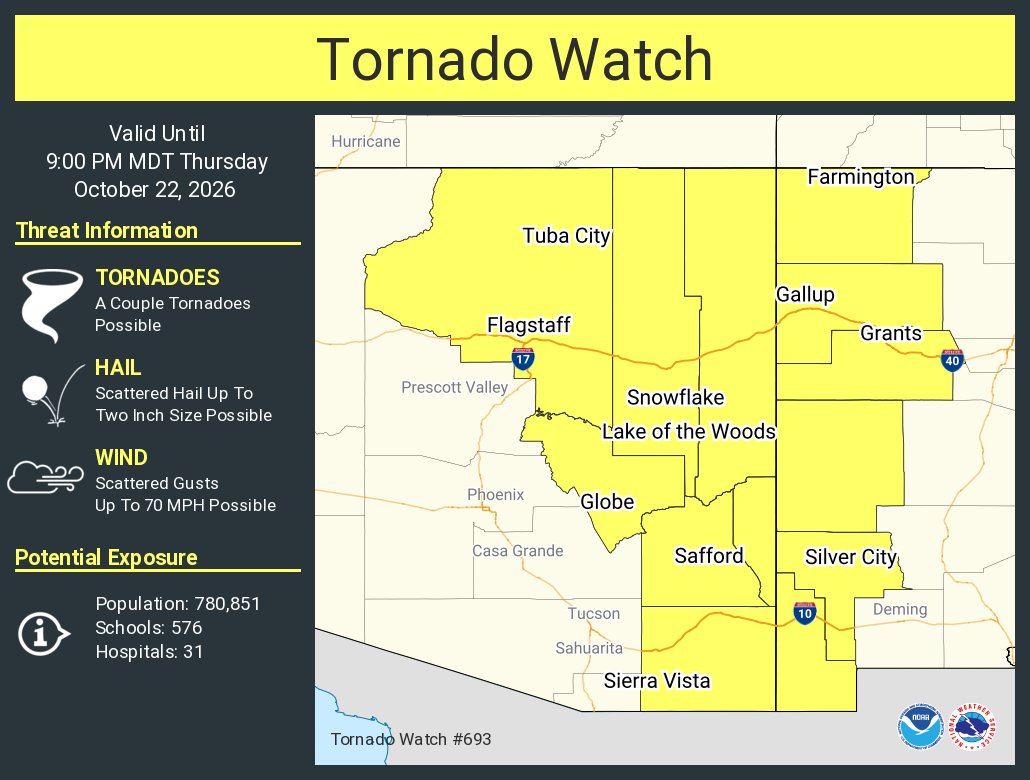
5:54PM: Strong thunderstorm capable of producing a tornado is moving through Deming, NM. A Tornado Warning is in effect until 6:15PM. This storm is also capable of large hail and damaging winds. Seek shelter. #nmwx
We've seen some COLD mornings across New Mexico this weekend! Angel Fire recorded the coldest temperature in the contiguous United States both Saturday and Sunday morning. #Brrrrr#nmwx
Posted: 10/18/26
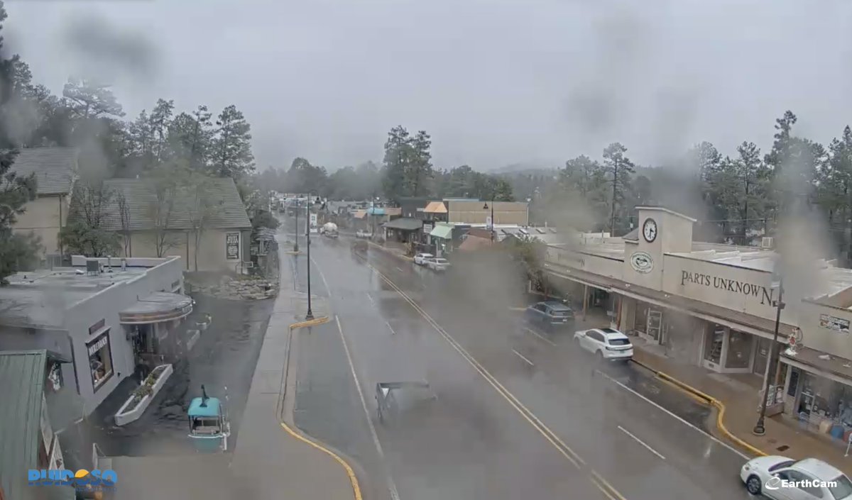
⚠️ VOLUNTARY EVACUATION: Ruidoso residents in the Upper Canyon area are under SET evacuation status because of an increased landslide risk from heavy rain.
The evacuation area includes Upper Canyon beyond Main & Fox Road. Landslides can happen suddenly and may be deadly.
#NMwx
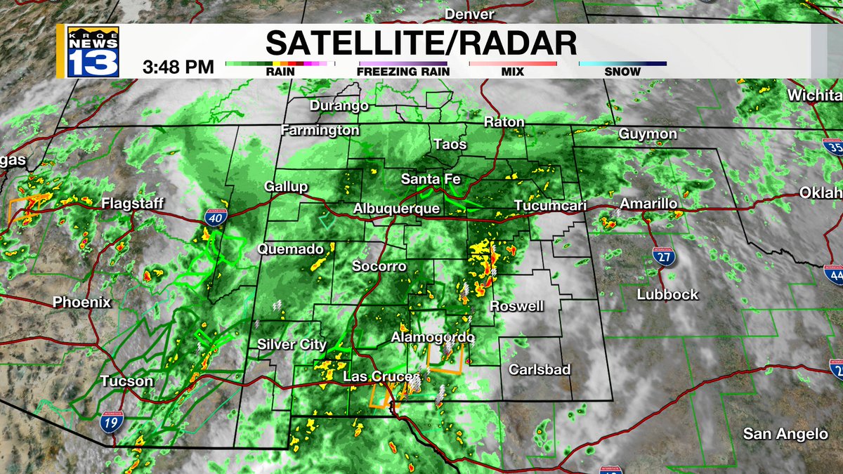
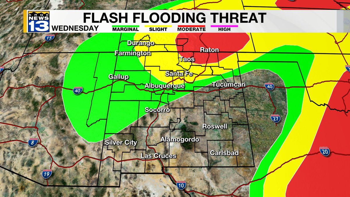
Heavy showers and storms continue to move through the state this evening and into Wednesday. Flash Flooding remains the largest threat moving forward!
Posted: 09/29/26
🚨NEW VIDEO:🚨 Flooding is overtaking I-25 in Hatch, NM (Near Las Cruces) as heavy rain soaks the southwest.
Firefighters are performing water rescues as the Rio Grande swells beyond its banks. #NMwx
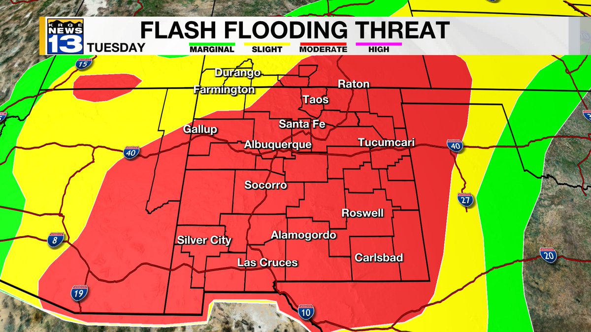
Remnants from Hurricane Polo will bring widespread rain to New Mexico for the first half of the week. Potential life threatening flash flooding will be possible across the state!
#NMwx