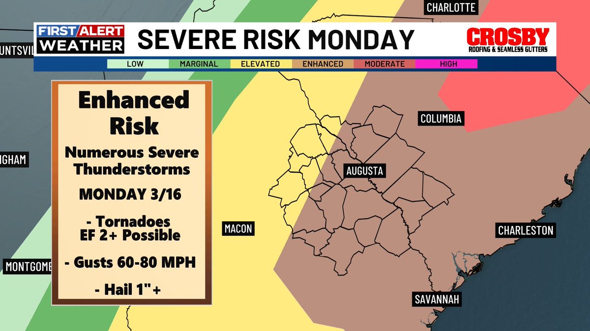
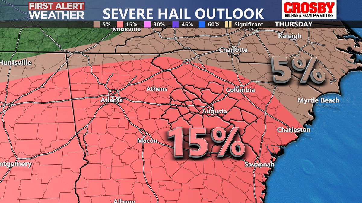
Have a way to receive alerts early Monday through the afternoon for the threat of severe weather. The CSRA is under an enhanced risk (level 3/5) - a severe outlook we only see a couple times a year for our region. More here: https://t.co/jPcvPIggtG
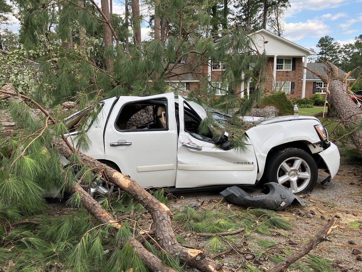
Heartbreaking Devastation...the scale of damage in Augusta/Central Savannah River Area & western Midlands is truly unprecedented. #Helene will be one of our area's most infamous storms, with over 20 fatalities and many communities left unrecognizable due to 100+ mph wind gusts.
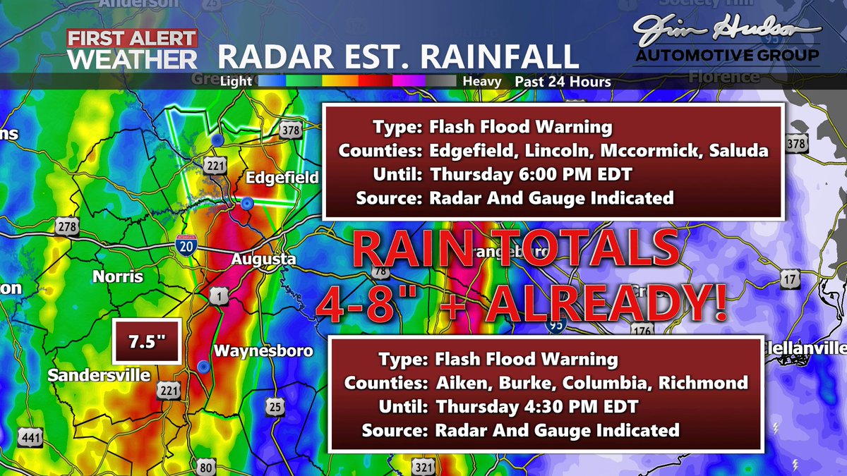
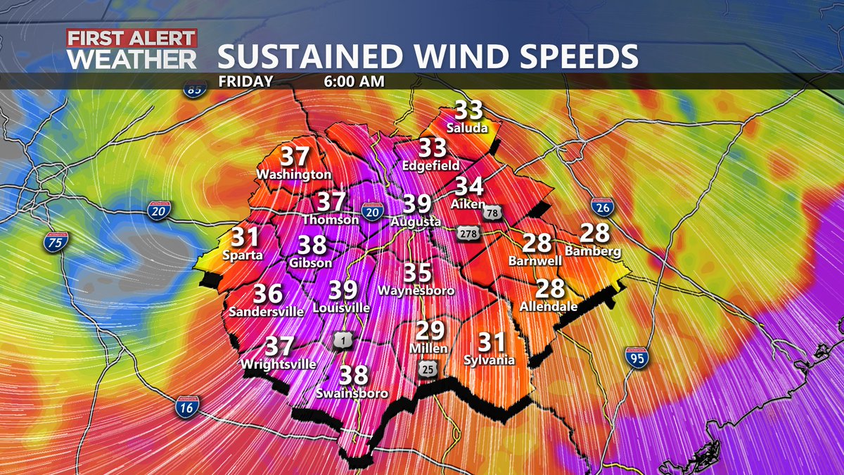
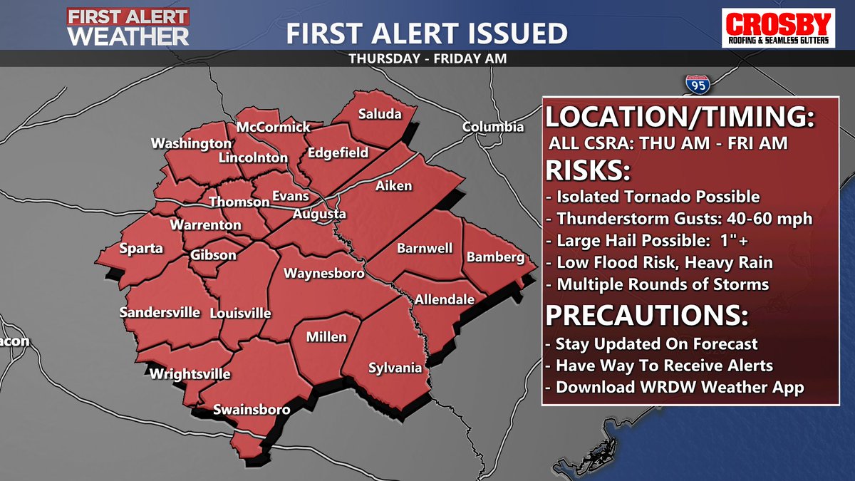
Significant rain has already fallen and more is on the way as Helene moves inland. Flash Flood Warnings in effect for many CSRA counties. Saturated soils + gusts 50-60 mph = power outages from trees coming down. Also, tornadoes possible through early Friday. Stay weather aware!
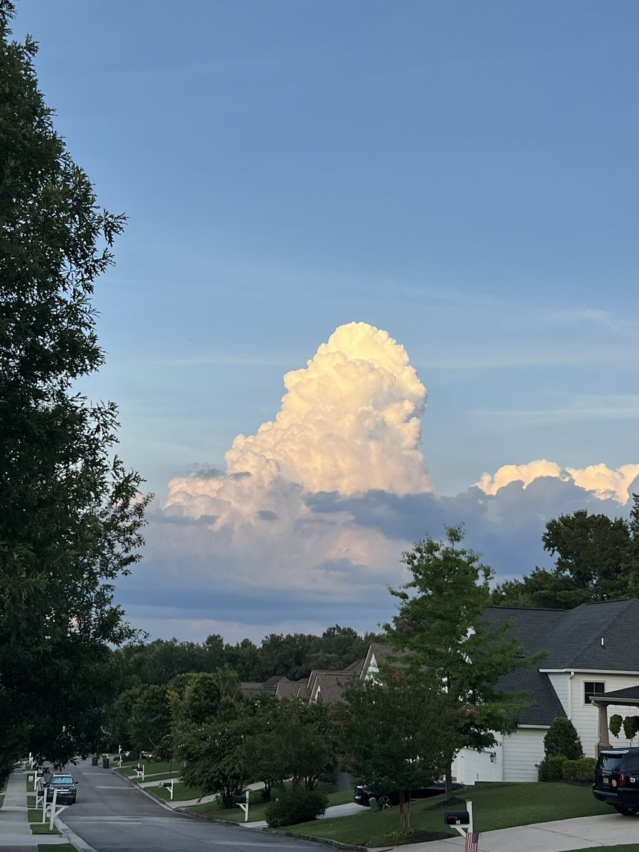
@DanielBaker1 Sea breeze is trying its hardest to pop up a few storms. Cool to see the skinny vertical profiles of storms trying to form today. Great shot!
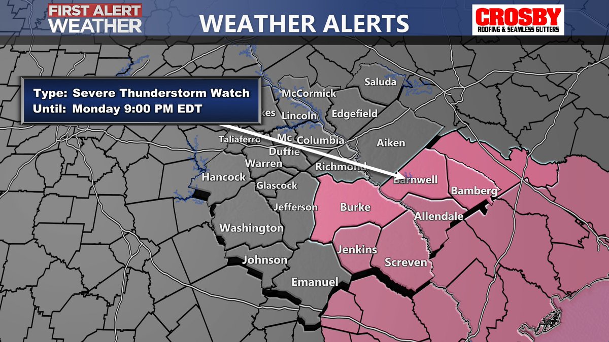
SEVERE T'STORM WATCH issued for Burke, Jenkins, Screven, Barnwell, Bamberg, and Allendale County until 9 PM! A watch means conditions are favorable for severe storms to form. Stay weather aware!
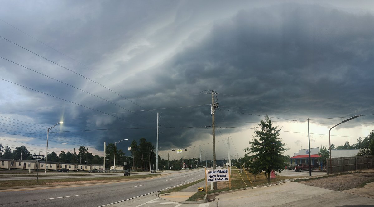
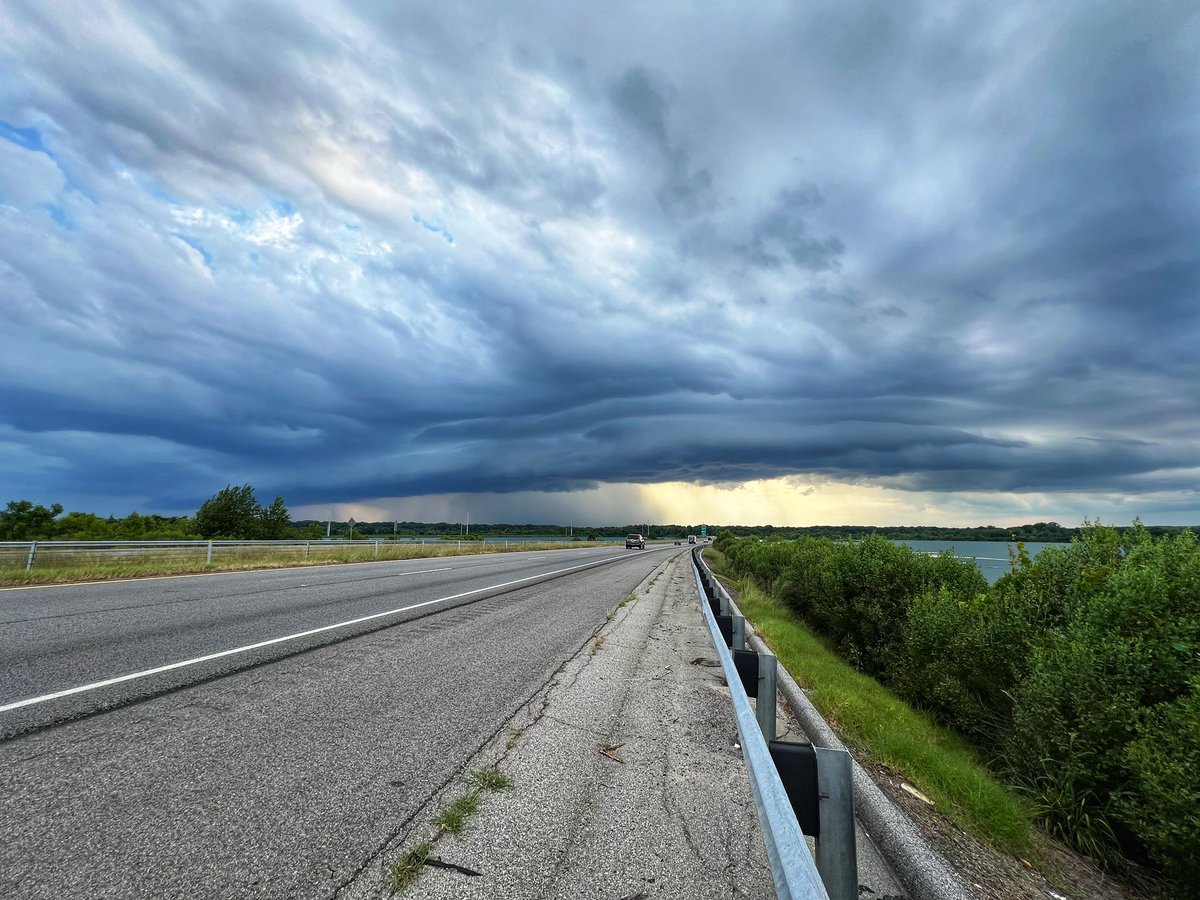
Time-lapse of the severe warned line earlier today over Clarks Hill. Crazy wind shift - you initially see the inflow and then the gust front/shelf cloud arrive with the wind.
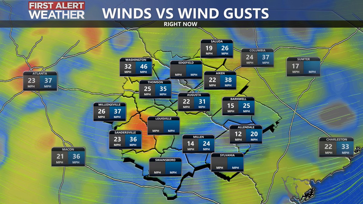
46 mph gust just reported in Washington! Strongest wind of the day is showing up now and could gust 40+ mph bringing down a few trees and knocking out power.