Man. #Hurricane#MELISSA. Incredible power. Perhaps the mightiest hurricane of the 83 I've witnessed.
My location (Crawford, a tiny beach town in St. Elizabeth Parish #Jamaica) took the full force of the inner right eyewall and may have seen the peak winds in this historic, record-smashing hurricane.
First pic: as it started to get scary. Bone-rattling gusts were making roofs explode into clouds of lethal confetti. The grand palm tree out front was starting to bend obscenely—in a way I found unnatural.
Second pic: after we bolted the door shut because it was getting too dangerous even to watch the storm. (I'd randomly ended up in the hotel's kitchen with a local family.)
The hurricane's inner eyewall was a screaming white void. All I could see through the cracks in the shutters was the color white—accompanied by a constant, ear-splitting scream that actually caused pain. (Notice the woman in the pic holding her ears.) The scream occasionally got higher and angrier, and those extra-screechy screams made my eardrums pulse. Meanwhile, water was forcing in through every crack—under the floor and between the window slats.
I remember shuddering at the thought of what was happening to the town—what this screaming white void was doing to people, homes, communities.
My fears were well-founded. The impact in this part of coastal St. Elizabeth Parish is catastrophic. Wooden structures were completely mowed down and in some cases swept from their foundations. Some concrete structures collapsed. The well-built ones—like my hotel—survived, but even they had major roof, window, and door damage. The landscape has been stripped bare—the trees just sticks. The roads are blocked with rubble and utility poles.
Nearby Black River—a unique old historical town right on the water—was smashed beyond recognition: historical sites destroyed, main streets filled with rubble, the town market twisted like a pretzel, even the regional hospital destroyed.
It's a good thing I wasn't in my hotel room during the storm because one of the windows blew out, showering the bed with glass and wood. The hotel lost most of its roof, and several third-story rooms were smashed open. But in the lower flooors, those grand old concrete walls protected us. And so far I'm aware of only two deaths in Crawford—a fellow who had a heart attack at the school next door (his body was still in his car and unclaimed the next morning, a sad and disturbing sight), and a woman who drowned in the storm surge in Gallon Beach. While walking down the devastated streets of Black River, I ran into the Jamaican Member of Parliament for this region, @floydgreenja. He's a great dude and I appreciate that he already has a gameplan for turning this catastrophe into an opportunity—to build this region back better. And I vowed on the spot that I'm going to make it my mission to spread awareness of this catastrophe and get that aid flowing in. I'll be talking about MELISSA a lot over the coming months—because it is both a fascinating meteorological event and a human disaster that demands an international response. (And I swear an epic video is coming out of this.)
Hurricane Hunters confirm Melissa's pressure is well into the 890's, which makes #Melissa one of the most intense hurricanes of all-time in the Atlantic Basin. Waiting on a Vortex Data Message for an official pressure reading.
#BREAKING: Melissa is now a catastrophic 185 MPH Category 5 hurricane. The pressure is down to 892mb.
#Melissa now rivals Wilma, Gilbert, and 1935 Labor Day as one of the strongest storms on record in the Atlantic Basin.
Do you see all that purple? That corresponds to incredibly cold cloud tops around minus-80 degrees Celsius (minus-112 degrees Fahrenheit). Clouds have to be about 52,000 feet tall (or greater) to be that cold.
The fact that Melissa has such a tall, cold CDO, or Central Dense Overcast, is an indicator of its extreme strength.
Truth be told, this looks like a satellite image of the strongest typhoons in the western Pacific – not really something we typically see in the Atlantic. Melissa is a rare, rare storm.
This footage from inside the eye of Category 5 Hurricane Melissa might be the most jaw-dropping video ever captured of a hurricane’s eye, showcasing the infamous “stadium effect."
And there we have it. #Melissa's WV eye temperature has broken -5°C, making it warmer than any other eye observed through geostationary water vapor imagery. Takes an upper echelon warm core for this
#Melissa continues to explosively intensify in the Caribbean.
Pressure has crashed to 909mb per the Hurricane Hunters! Melissa is approaching the mathematical limit for how strong a hurricane can get on planet Earth.
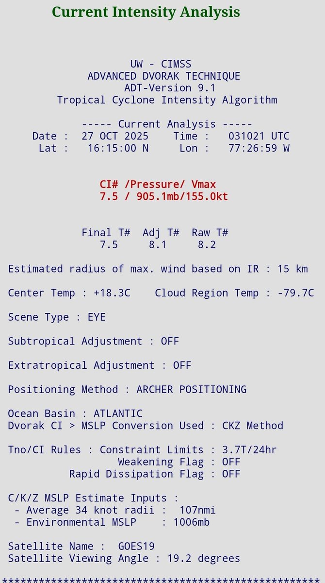
Melissa turned West Pacific grade over the past hour. Sudden, explosive expansion of its Central Dense Overcast reminiscent of some of some of the top-tier western North Pacific super typhoons. T numbers above 7.5 in the Atlantic??? Almost unheard of!
At 10:11 am on August 28, 2005, NWS New Orleans broadcasted one of the most chilling warnings ever heard ahead of Hurricane Katrina.
“PERSONS EXPOSED TO THE WINDS WILL FACE CERTAIN DEATH”
With a 30-foot storm surge, KATRINA would soon alter the U.S. Gulf Coast forever.