7:10 P.M. RADAR UPDATE:
Showers are now moving east across the Northland, meaning that they will be out of the region by midnight.
Don't be surprised if a few snowflakes are mixed in with the rain in the Arrowhead.
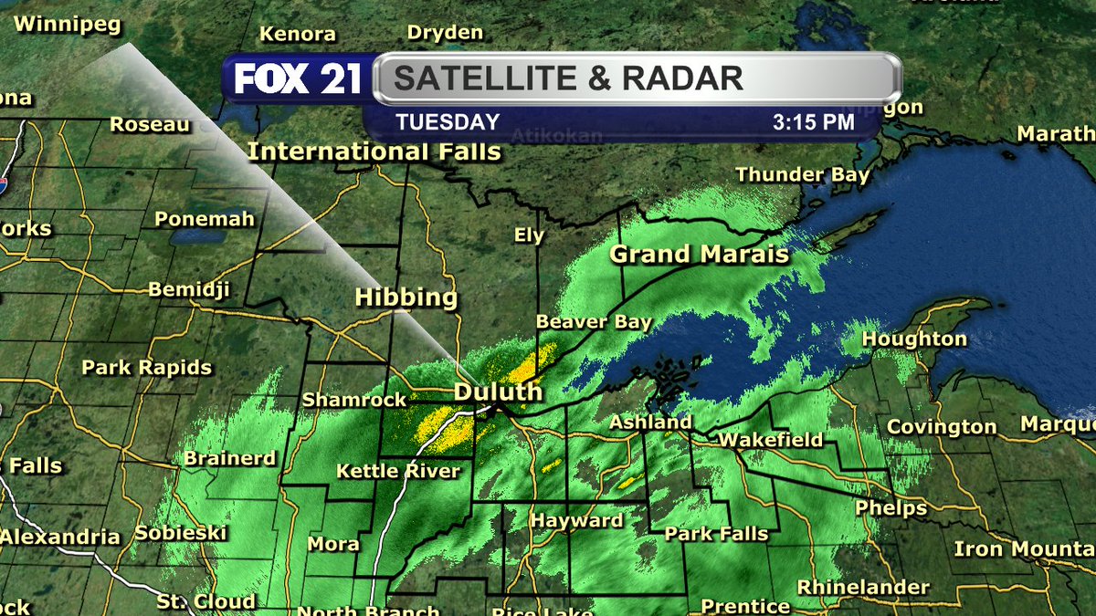
3:15 P.M. RADAR UPDATE:
The rain showers continue to move north through the Northland this afternoon, finally reaching the Twin Ports.
I do believe it will start moving more east, meaning the Iron Range and Rainy River Basin will stay dry.
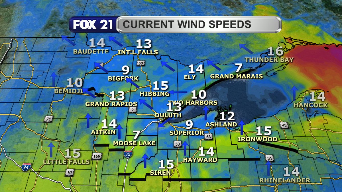
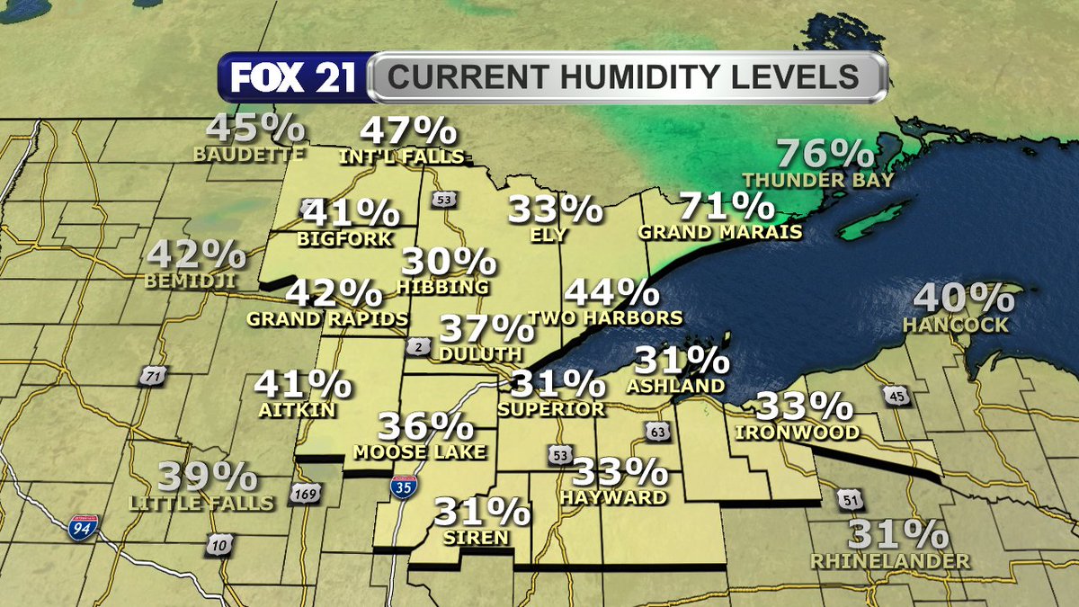
Happy Tuesday afternoon Northland!
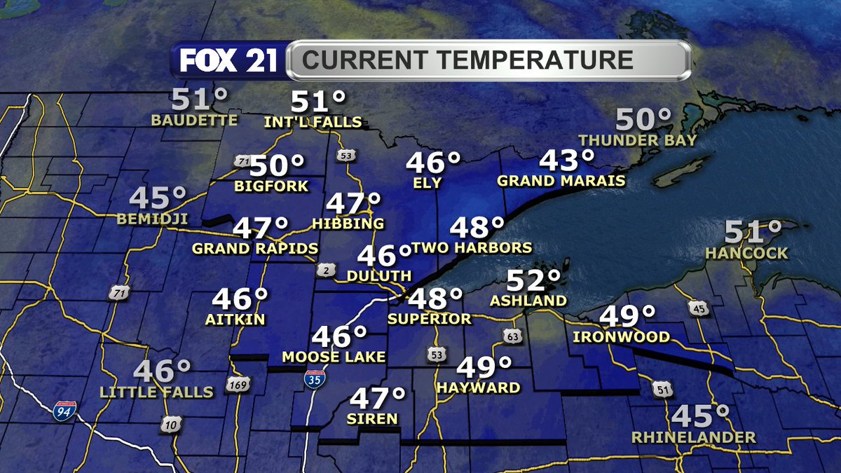
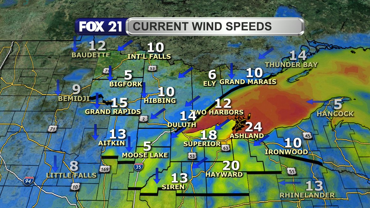
Everyone is dealing with clouds, seasonal temperatures, and light winds.
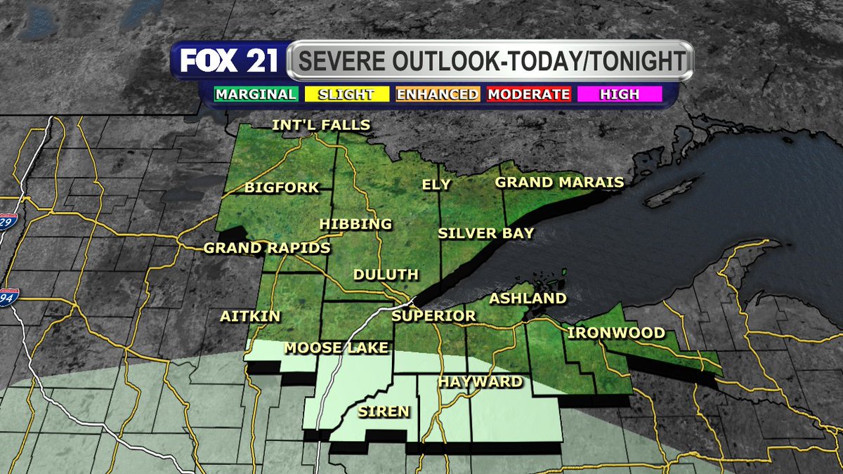
Showers are moving north through northwest Wisconsin and the Upper Peninsula. More of the region will see them later today.
The Northland will get a break from the precipitation tonight, but more rain showers will fall across the area on Election Day. The best chances are over northwest Wisconsin and the Upper Peninsula.
VIDEO: https://t.co/FadCokS9gi
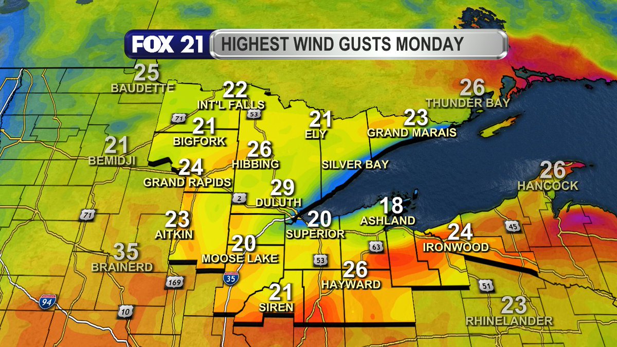
Happy Monday afternoon Northland.
It is warm, but the bulk of the rain for us today are moving out of the region. We could still see some sprinkles and an isolated shower this afternoon.
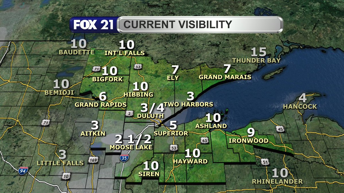
UPDATE: The Dense Fog Advisory has been expanded to cover more of the Minnesota side of the Northland.
Please take it easy and be safe heading to work or school Monday morning.
DENSE FOG LIKELY:
The Northland will see plenty of fog tonight and Monday morning as warm, moist air moves into the region with persistent rain chances.
The fog will be dense in spots, especially in the Twin Ports and North Shore.
Plan accordingly for the morning commute!
8 P.M. RADAR UPDATE:
Still seeing some light showers push through the Northland late this evening.
We should get a break for a couple hours, then the next round comes through later tonight and Monday morning.
Also, be ready for fog, possible dense in spots.
4 P.M. RADAR UPDATE:
A line of showers has been working its way through northwest Wisconsin and the Upper Peninsula.
It has reached the Twin Ports, and will continue into the Arrowhead over the next several hours.
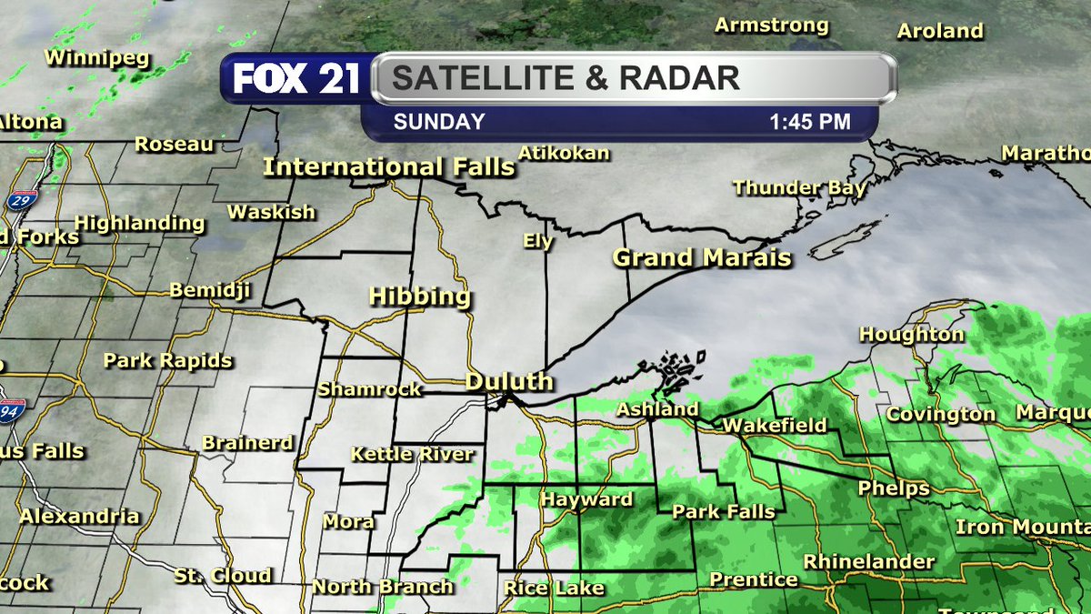
Happy Sunday afternoon Northland!
It's a cloudy day with showers ready to return to the region. The chances will persist tonight, Monday, and Tuesday.
It will all be rain as temperatures remain in the 40s.
Happy Thursday afternoon Northland!
It's a trick for Halloween along and south of Highway 2 where rain and snow showers will persist through the evening.
On the Minnesota side, it's mostly dry with a cooler end to October.
TRICK OR TREAT FORECAST:
Thursday afternoon and evening will be chilly compared to recent days, and a breeze will likely make it feel below freezing.
Have a plan to stay warm, and also have ways to stay dry the farther east you live with showers persisting.
HALLOWEEN SNOW:
Another round of showers will pass through the Northland Thursday, and this time it will include a mix of rain and snow.
Some snowfall over the Twin Ports and northwest Wisconsin will be heavy at times, leading to a decent accumulation and sloppy roads.
Happy Wednesday afternoon Northland!
The morning showers and storms have nearly all moved out of the region. What is left behind is a cooler and breezy afternoon.
More precipitation arrives tonight, and that does include snow for Halloween for some of us.
Happy Tuesday afternoon Northland!
It's still warm with light winds, but the clouds have arrived and some spots are seeing drizzle or sprinkles.
I'm monitoring two waves of precipitation, and that could include snow showers on Halloween.
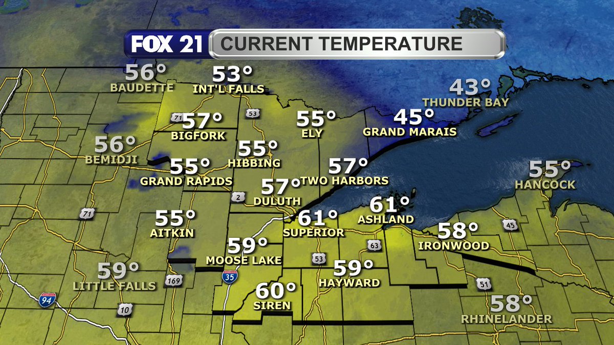
Happy Monday afternoon Northland!
The sunshine persists for many of us, but clouds are starting to increase from the southwest.
Temperatures are warm, but a lake breeze is keeping Lake Superior communities cooler.
Happy Sunday afternoon Northland!
It's been an ideal weekend to get outside and enjoy the warm temperatures and plenty of sunshine.
A more active weather pattern sets up over the region starting Tuesday.
8 P.M. RADAR UPDATE:
Most of the Northland is seeing the rain this late evening hour. A few spots in the Arrowhead and northwest Wisconsin are getting a decent soaking.
The showers will move out of the region from west to east over the next several hours.
4 P.M. RADAR UPDATE:
Showers continue to move across the Northland, with the heaviest rain falling in parts of the Iron Range and I-35 corridor.
Nearly everyone will see them this evening and early overnight. Sorry most of Koochiching County...
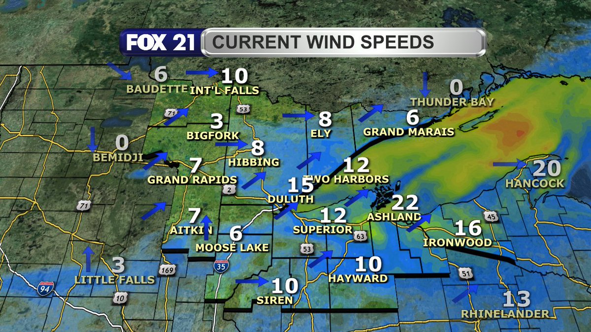
Happy Thursday afternoon Northland!
Showers are moving into the region. Expect plenty of light rain the rest of today and early tonight. A rumble of thunder is possible south of Highway 2.
Otherwise, it's a warm and breezy fall day.