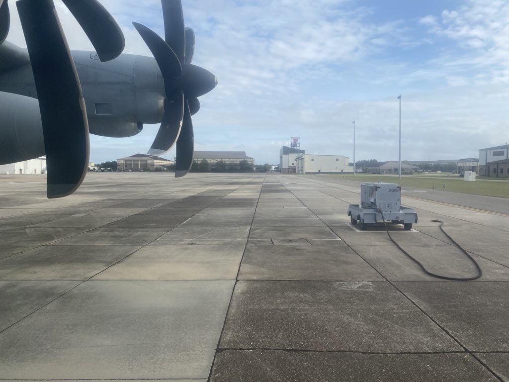
Off to mess with Texas 🤠✈️
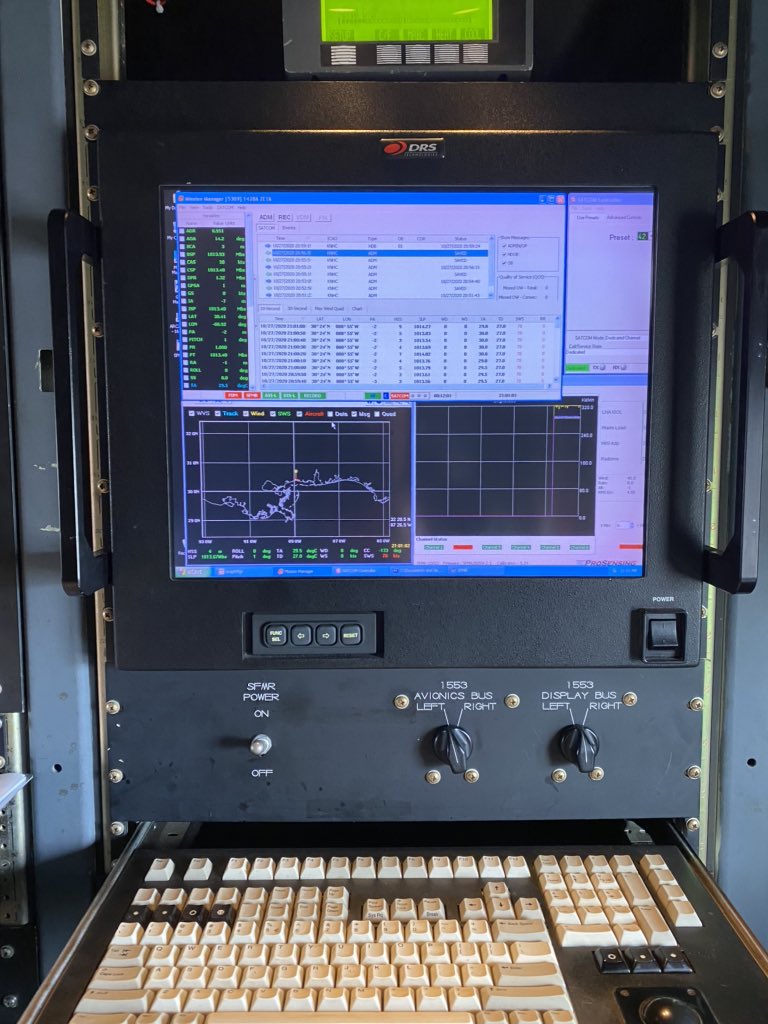
We will continue our mission collecting data from #TropicalStormFrancine for forecasters from Joint Base San Antonio-Lackland, Texas. Shoutout to everyone who works hard to keep our mission going wherever it takes us.
#ReadyNow
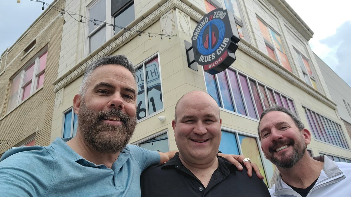
Awesome day in Biloxi #Mississippi. Thanks, @oneyounglee, for your great hospitality at Ground Zero—& big thumbs up for all you're doing to revitalize city's historic downtown. 👊 Also great to see Hurricane Hunter @RyanRickert4. (Lunch conversation was Cat-5 hurricane nerdout.)
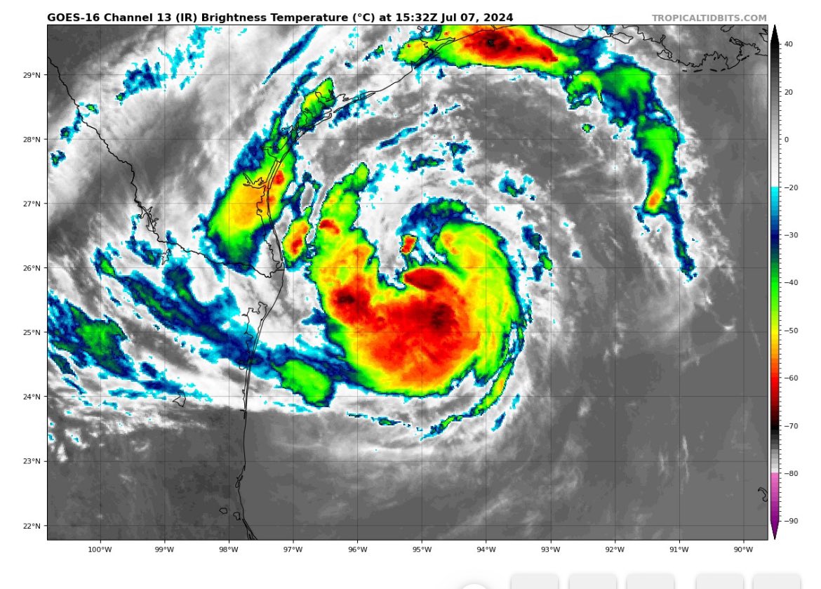
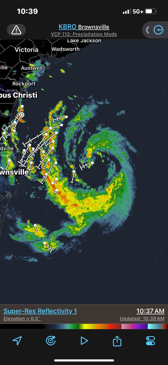
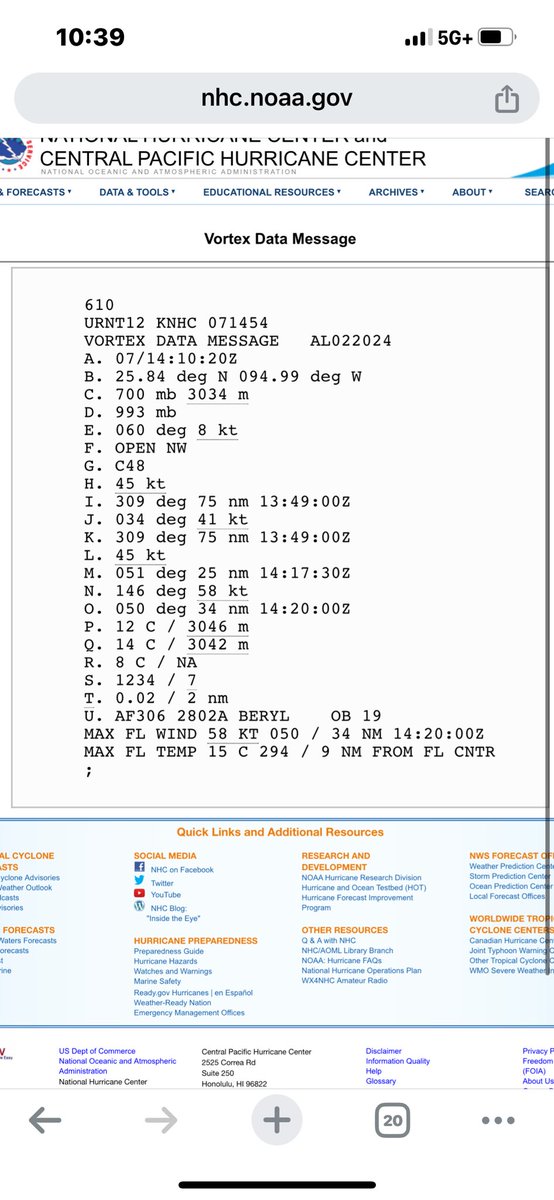
#Beryl continues to live on. 2nd to last @53rdWRS mission. Much better on satellite & radar. SLP continues to deepen & winds will most likely begin to increase during this mission. Wouldn’t be surprised to see it upgraded during this mission. #Texas
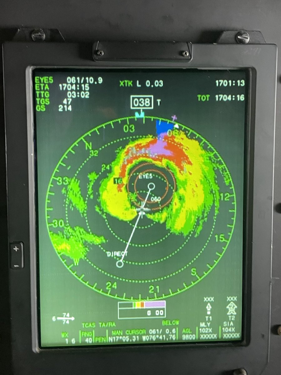
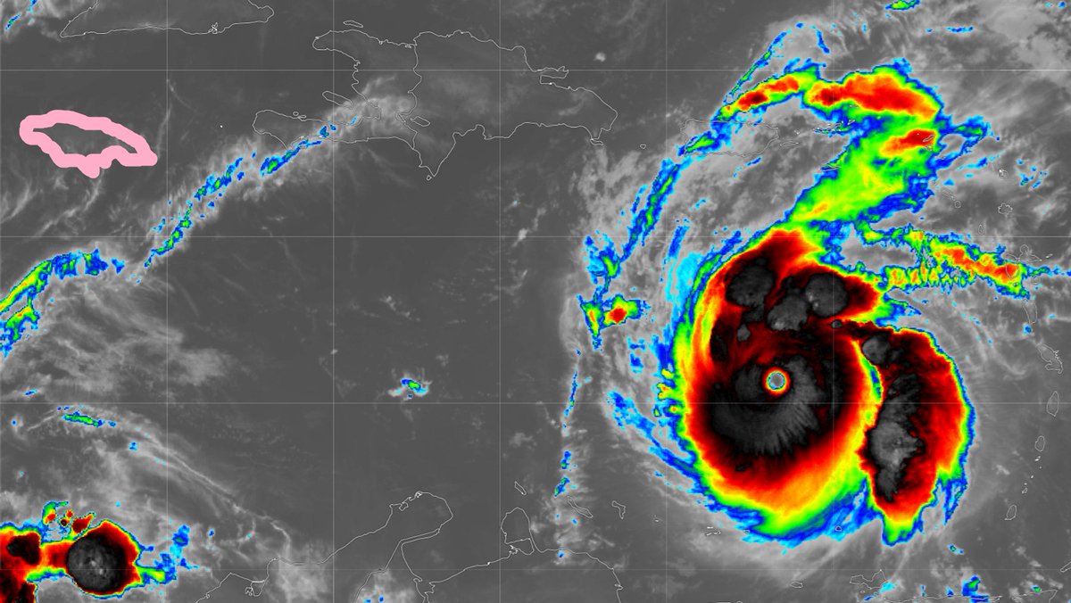
#Beryl is still packing a punch. We were stuck in the soup all day. Every radar blip in the northern half was rough. Went from an open eyewall to fully closed as it approached Jamaica with a really nasty NE eyewall. Got hail the last two passes. This thing is a fighter. @53rdWRS
Inside the eye of category 5 #HurricaBeryl, 4th mission from the #53wrs#wc130j. We will continue missions all the way until landfall and if it emerges into the #gulf we’ll continue until landfall again. Eye was pretty impressive stadium effect today at peak intensity. @53rdWRS
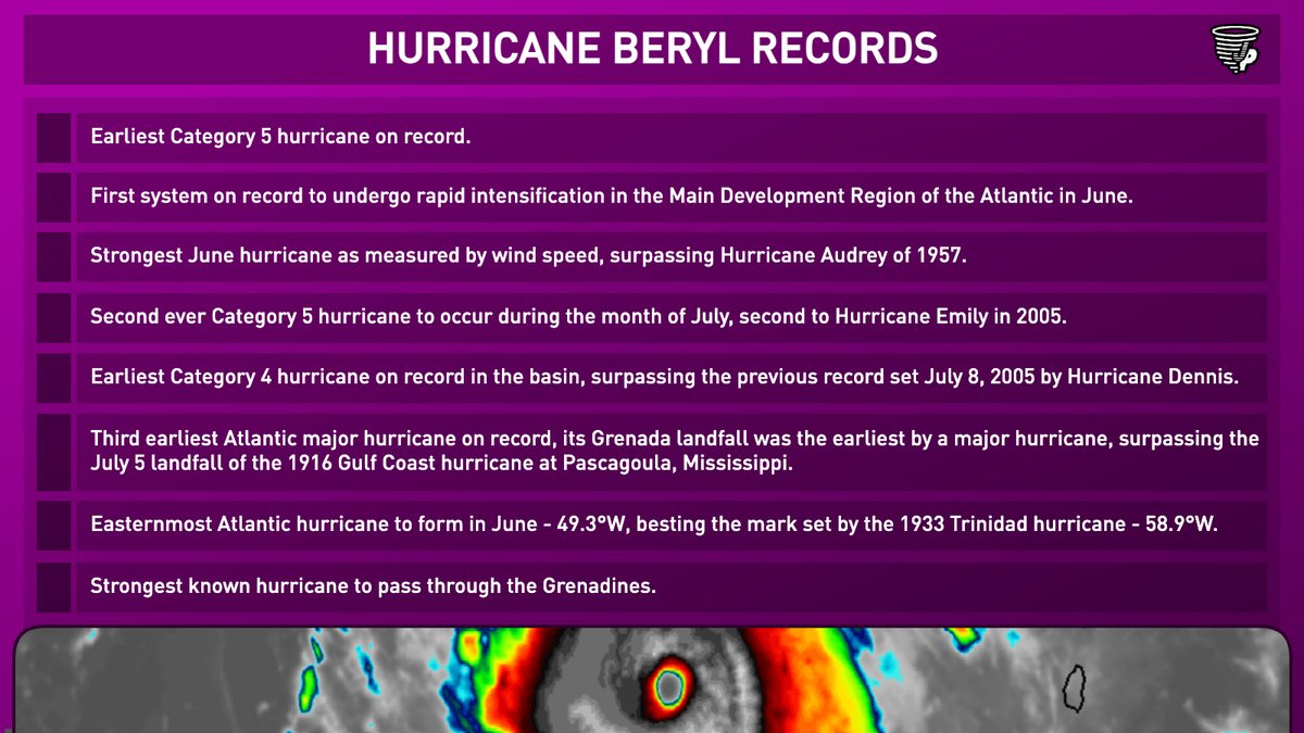
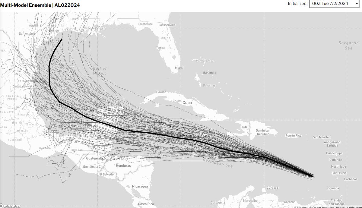
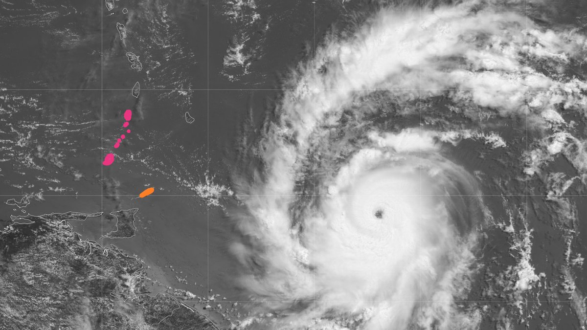
#Hurricane#BERYL is up to 145 knots now—earliest Atlantic Cat 5 on record. Next threatened landmasses are Jamaica (pink) & Mexico's Yucatan Peninsula. But it's likely peaked & should be much weaker when it impacts these places. Not sure of my next move—thinking about it.
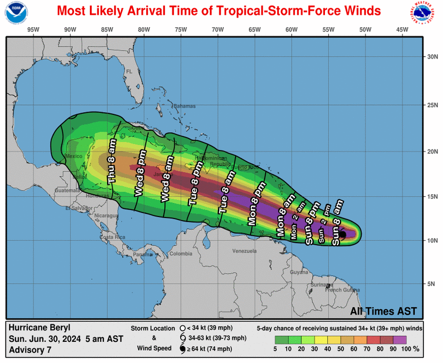
After #Beryl impacts the Yucatan Thursday night and Friday, hopefully as a weaker hurricane, more and more guidance starts to turn it north once it reemerges over the Bay of Campeche on Saturday. Even though some guidance has Beryl a TS at this point, some keeps it as a hurricane so the western gulf needs to be on alert potentially for the later part of the holiday weekend and early next week.
Much of the future fluctuation and strength will depend on shear and land interaction, but we still have lots of warm ocean out there to keep it going or strengthen it up at times. Stay tuned!
Concerns about being trapped somewhere after a #hurricane do not factor into my decision about whether to chase. I've been trapped many times, & I go into these chases just accepting that's gonna happen. The single & only factor in my decision: my odds of penetrating the core.
Powerful #Hurricane#BERYL is racing W, toward S end of Windward Isles. Me: After days of obsessive deliberation, I've decided to hold off on this round & focus on next impact (Mexico or Central America). I'll sometimes play Island Roulette, but I like to go in with better odds.
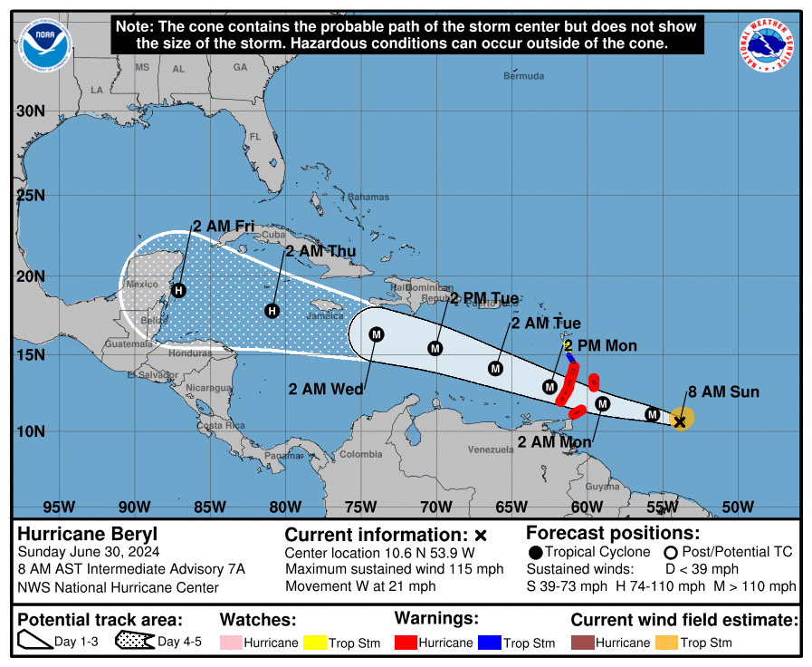
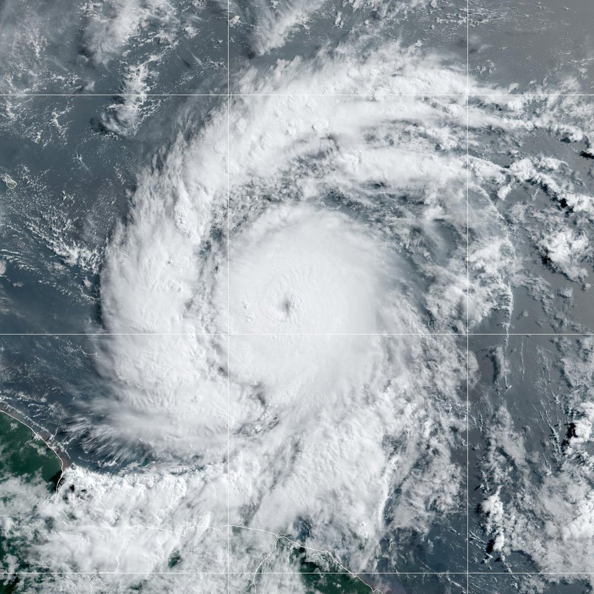
Hurricane #Beryl continues to quickly strengthen this Sunday morning. The storm is now a very dangerous category 3 hurricane with maximum sustained winds of 115 mph. Life-threatening winds and storm surge are expected in portions of the Windward Islands by early Monday. Latest at https://t.co/Wq6ZtKgfeH
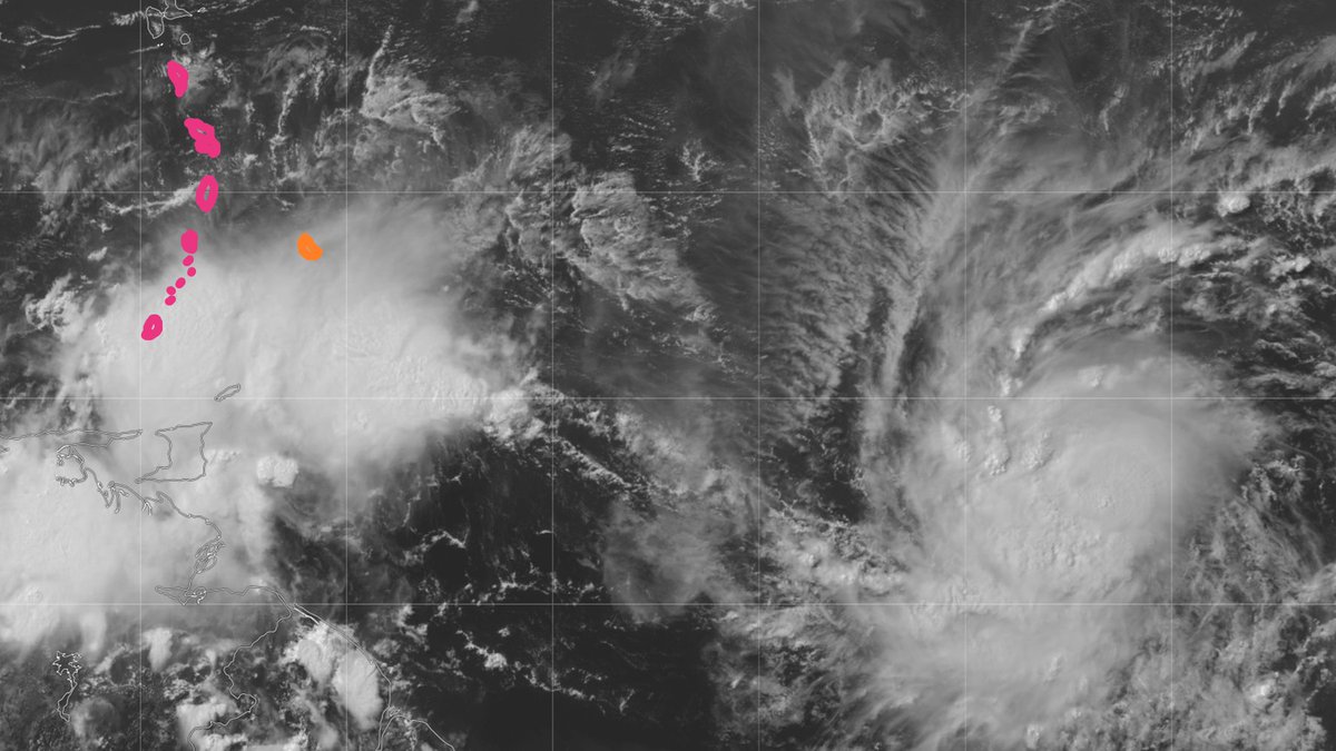
TS #BERYL is closing in on Barbados (orange) & Windward Islands (pink). Likely to be a decent #hurricane when it crosses the islands Monday. Me: weighing my options. Ain't sold on any one scenario yet—& there are many. There always are with Caribbean Cruisers. The trick with these setups is picking the right penetration point along the conveyor belt.
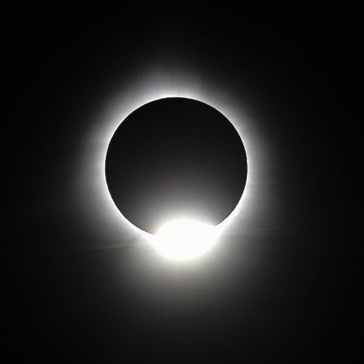
The diamond ring effect at totality in Houlton, Maine! Cindy and I are emotional. It was so incredible and one of the most spectacular things I’ve ever seen in my life. #scwx#ncwx#Eclipse#Eclipse2024