BIG SEVERE WEATHER PATTERN FRIDAY THROUGH SUNDAY including tornadoes and a derecho or two Oklahoma to the Carolinas!
We have an active pattern for severe weather including long-lived complexes of storms across the Mid-south during the end of this week through the weekend! Supercells and tornadoes will be most likely over the western portion of this risk area, especially with those daytime storms that can develop along remnant outflow boundary zones. These setups can be capable of producing some of the most significant tornadoes in the Great Plains, but hinge on the evolution of overnight storm complexes.
Some of these complexes have the potential of organizing into long-lived derecho events or wind bags as they push through southern Dixie Alley.
Stay tuned and buckle up!
Thank you @PettusWX for these incredible graphics
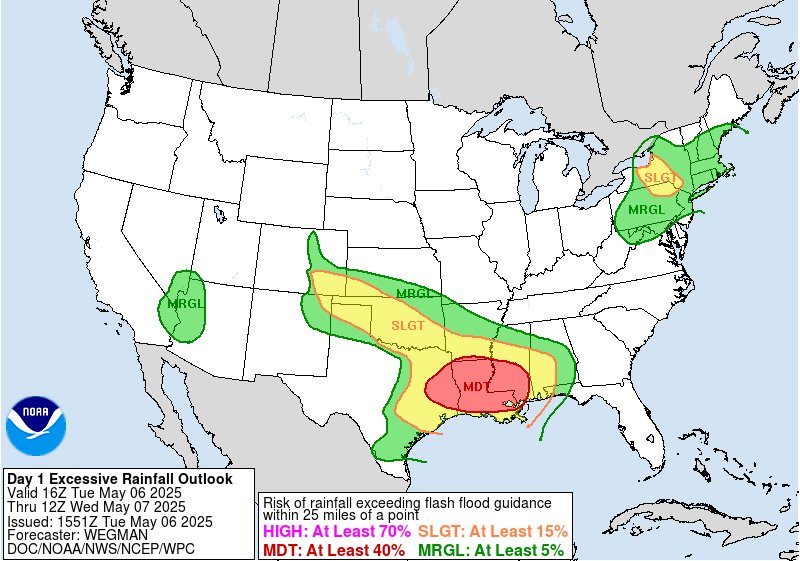
A NWS Damage Survey Team concluded that a strong EF-1 tornado with estimated maximum winds near 105 mph touched down Tuesday afternoon in Southwest Caddo Parish LA, and tracked nearly 13 miles into Southwest Shreveport. Max width of this tornado was ~810 yards.
@Mighty__Muffins@wx_Frankie Because whoooosh 🤣 I pay for both so I'm not hating on scope. Honestly I just find the UI and customization more user-friendly in Omega
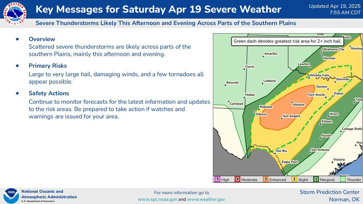
Scattered severe thunderstorms are likely across parts of the southern Plains, mainly this afternoon and evening. Large to very large hail, damaging winds, and a few tornadoes all appear possible. Damaging winds may also occur across portions of the OH Valley/Northeast.
Confidence is increasing we’ll have several severe storms this afternoon and evening in the Concho Valley, Big Country, and North Texas. Damaging hail, strong winds, and a few tornadoes are expected with the strongest storms. -David
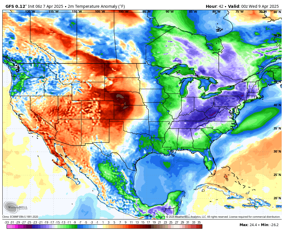
Bundle up! An impressive cold snap is overtaking the eastern U.S. today through midweek, with temperatures plunging 10-30°F below normal. Many spots will feel more like February than April… hang in there, spring lovers!