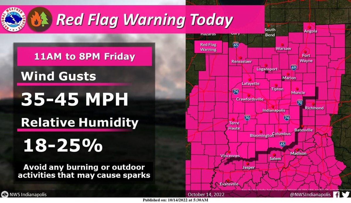
🚨Weather Alert🚨 Red Flag Warning is in effect from 11am-8pm today (10/14/22). Critical fire conditions will occur caused by low humidity and gusty winds. Avoid all burning as a small fire could easily spread. Graphic from NWS.
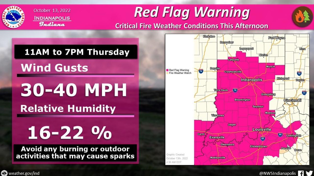
🚨Weather Alert🚨 Red Flag Warning is in effect from 11am-7pm today (10/13/22). Critical fire conditions will occur caused by low humidity and gusty winds. Avoid all burning as a small fire could easily spread. Graphic from NWS.
🚨Weather Alert🚨 SEVERE THUNDERSTORM WATCH has been issued for Monroe, Bartholomew, Brown, Greene, Jackson, and Lawrence Co until 11pm 8/1/22. Damaging wind, large hail, and an isolated tornado possible.
🚨Weather Alert🚨 SEVERE THUNDERSTORM WARNING has been issued for Johnson and Morgan Co until 9:15am 8/1/22. This includes Martinsville, Mooresville, Greenwood, and Franklin. Damaging wind gusts possible.
🚨Weather Alert🚨 SEVERE THUNDERSTORM WARNING has been issued for Monroe and Brown Co including Indiana University and Nashville until 815pm. Damaging wind, large hail possible. Some rotation detected on radar.
🚨Weather Alert🚨 SEVERE THUNDERSTORM WATCH has been issued for Monroe, Bartholomew, Brown, Greene, Jackson, Johnson, Lawrence, Morgan, and Owen Co until 11pm.
The entire area has a SLIGHT RISK of severe storms the rest of today. The greatest threat is for damaging winds. Stay weather aware if you’re out and about this afternoon/evening.
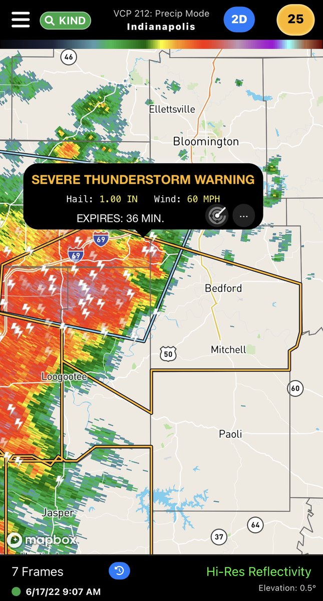
🚨Weather Alert🚨 SEVERE THUNDERSTORM WATCH has been issued for Monroe, Bartholomew, Brown, Greene, Jackson, Lawrence, and Owen Co until 12pm 6/17. Damaging winds are the highest threat.
🚨Weather Alert🚨 HEAT ADVISORY is in effect for all of south central Indiana until 9pm 6/16. The heat index could reach 105°. Luckily we’ll drop into the 80’s this weekend, but temps near 100° return next week.
🚨Weather Alert🚨 EXCESSIVE HEAT WARNING is in effect until 9pm 6/15 for all of south central Indiana. Heat index near above 110°F is expected. Stay cool and hydrated.
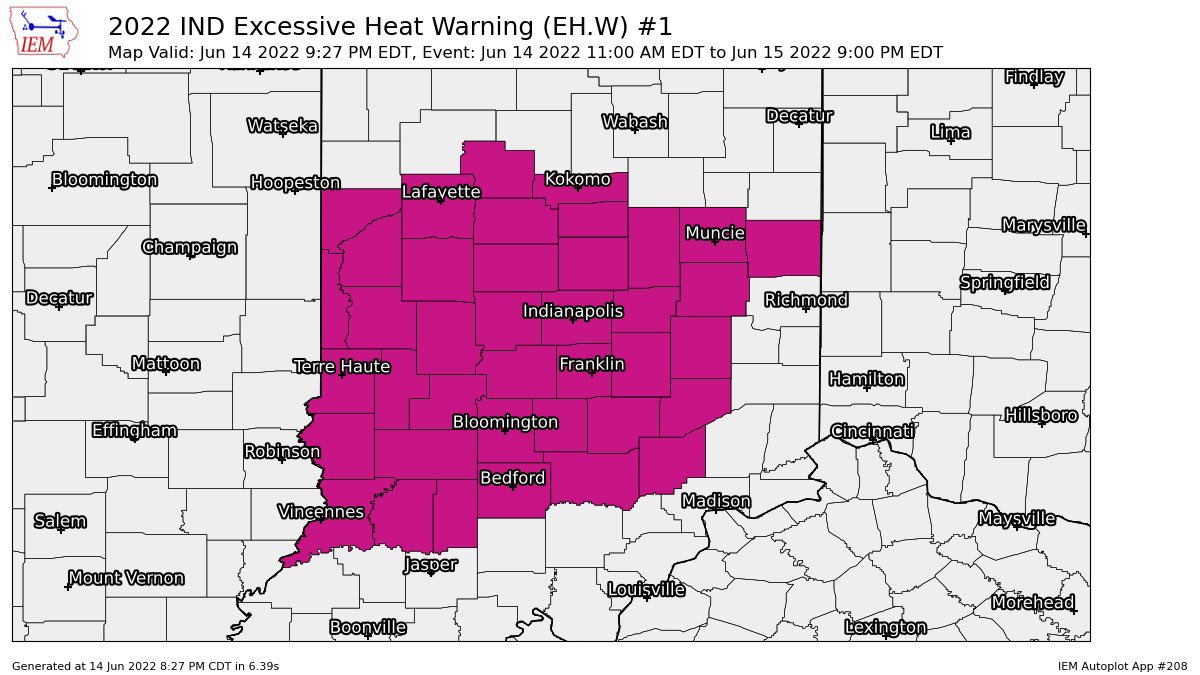
🚨Weather Alert🚨 EXCESSIVE HEAT WARNING is in effect from 11am to 9pm 6/14 for all of south central Indiana. Heat index near above 110°F is expected. Stay cool and hydrated.
🚨Weather Alert🚨 SEVERE THUNDERSTORM WATCH has been issued for Monroe, Bartholomew, Brown, Greene, Jackson, Johnson, Lawrence, Morgan, and Owen Co until 10pm 6/13. Damaging wind, large hail, and isolated tornado possible. Stay alert!
Most of the area has a SLIGHT CHANCE of severe storms this afternoon and evening. Primary threat is damaging wind. The further north you go the better the chance for severe weather.
🚨Weather Alert🚨 HEAT ADVISORY has been issued for Monroe, Brown, Greene, Jackson, Lawrence, Morgan, and Owen Co from 12pm-9pm Monday 6/13. This is just the first day of extreme heat this week. Stay cool and hydrated.
All of south central Indiana has a SLIGHT RISK of severe storms today. Threats include damaging wind, large hail, and isolated tornado. Be weather aware all day long as severe weather is possible now through this evening.
🚨Weather Alert🚨 TORNADO WATCH has been issued for Monroe, Bartholomew, Brown, Greene, Jackson, Johnson, Lawrence, Morgan, and Owen Co until 1000pm 6/8. Tornadoes, ping pong ball sized hail, and 70mph damaging winds all possible.