There is a lot to unpack from just looking at today's visible satellite imagery across SD. The Coteau des Prairies stands out in the east as the higher elevations received more snow than rain. Most lakes remain unfrozen. 1/
Elevation plays a role over western SD too. The higher ridge between the Moreau and Cheyenne Rivers stands out. Snow is deeper in the upslope-favored areas of the northern Black Hills and adjacent areas towards Vale and Newell. But my favorite... 2/
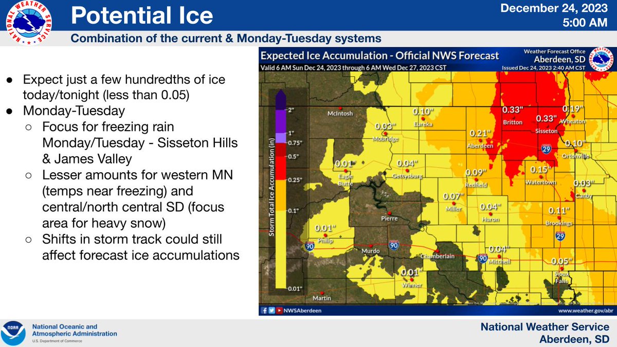
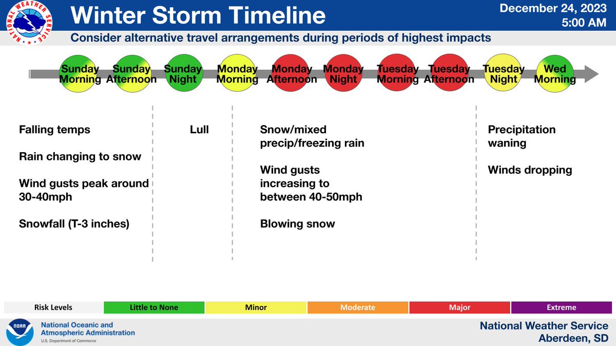
(1 of 2) minor winter weather related travel impacts today, with generally light snow totaling 1-3 inches in central South Dakota, less than an inch elsewhere. Winds will be on the increase to around 30-40mph. Cant rule out some light icing as well #SDWX
Hey everyone! We are gauging how many calendars we need to order for the 2024 Weather Club Calendar fundraiser. Please like this post if you are planning on buying one from the @sdsmt rocker shop.
@Vikings Whenever you decide to get back into science/engineering (no rush though, you are doing awesome!), feel free to reach out to @sdsmt. We'd love to have you in our grad school!
🚨COOL POSITION ALERT🚨 Manage the Presidential Weather Support Unit (which provides weather support to Air Force One and other Presidential aircraft) as a Lead Meteorological Technician in Washington, DC. Apply by 11/7: https://t.co/JhyMsL8IsS