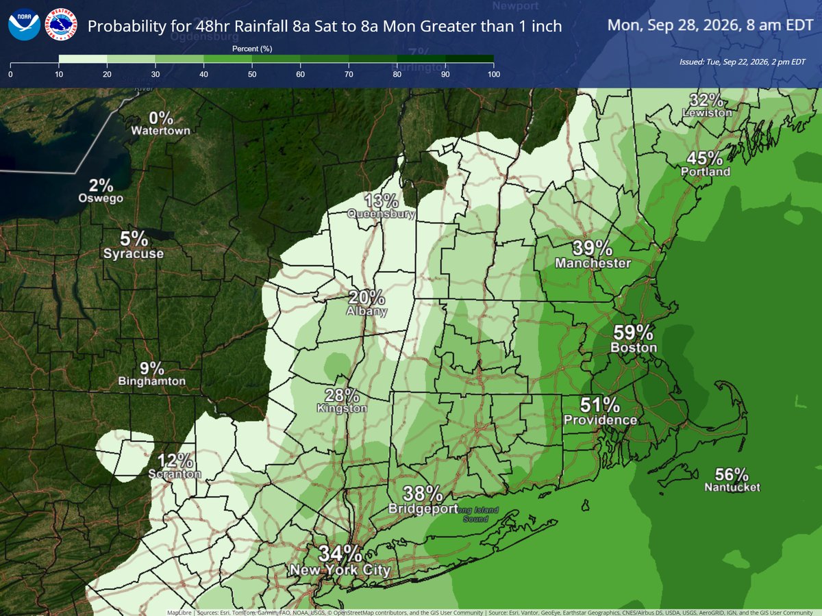
Monitoring a weekend coastal storm. Still uncertainties with storm track but confidence is increasing that the highest rainfall amounts & strongest winds remain south/east of Albany. Graphics show chance for 48hr rainfall exceeding 1" & gusts over 25mph. #nywx#mawx#ctwx#vtwx
Our damage survey team confirmed two tornadoes yesterday: an EF-1 in Wilton, NY & an EF-0 in Gansevoort, NY in Saratoga County. Thanks to the Saratoga Dept. of Emergency Management and to NYS DHSES for survey support and to all who sent in reports! #NYwx
15yrs ago today Tropical Storm Irene produced significant impacts across eastern NY & western New England with record setting rainfall & flooding. What do you remember from Irene? Visit https://t.co/NYYvwa9UdD for flood safety.
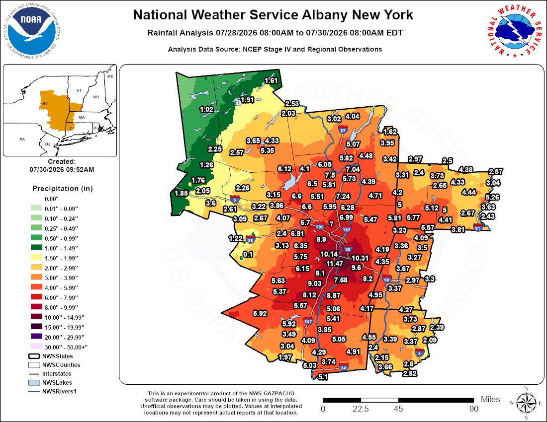
Storm total rainfall for eastern NY & western New England July 28-30. Note values at interpolated locations may not represent actual reports at that location. This was an extreme event with max amounts of 6-12" across the Capital District & northern parts of the mid Hudson Valley
Dangerous heat will build across the region this week with the hottest conditions on Wednesday and Thursday and possibly extending into Friday. The combination of hot temperatures and high humidity will lead to an increased risk for heat-related illnesses.
You may think relative humidity is the best gauge for outdoor comfort, but you should actually check the dew point! Temps are climbing over the next few days, but with dew points staying in the 40s & 50s, it shouldn't feel sticky at all. Check out these graphics to see why!
Enjoy a sunny and dry start to your week☀️! Rain arrives mid-week as a frontal system approaches with some possible t-storms ⛈️ to wrap up the work week. The best news? The mild and warming temps continue! #NYwx#CTwx#MAwx#VTwx
☀️Sunshine is here to chase away the Monday gloomies! A mild and dry start with highs in the 60s-70s before a breezy cold front arrives mid week cooling things off for the start of May. You might might want to trade those gardening gloves for warmer ones by Friday night! #518wx
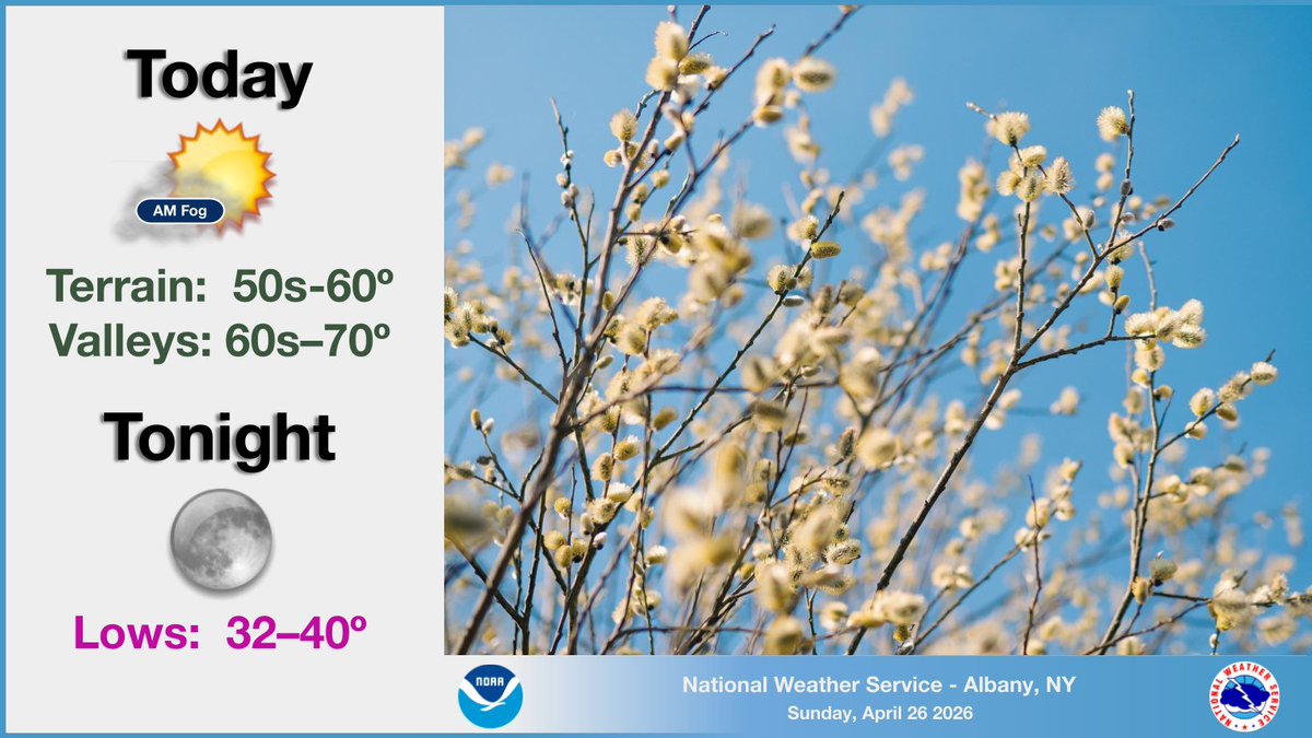
Morning clouds are moving out and the sunshine is moving in!☀️ Fog may linger early near the Capital Region and Berkshires but high pressure building in will bring a dry day. Light winds and mild temps in the 60s make for great outdoor plans before it cools off this evening!
It’s a chilly start with temps in the 20s-30s this AM! Clouds increase today and those in the mid Hudson Valley and SE of Albany should keep an umbrella☔️ handy as rain arrives by afternoon and tapers off overnight. Don't despair though, the sun returns Sunday! Enjoy the weekend!
Happy Friday!☀️Expect dry and mild weather to continue today, with just below seasonable temperatures holding through the weekend. A chance of showers arrives Saturday PM for areas S/W of Albany with an approaching low pressure system. #NYwx#MAwx#CTwx#VTwx
☀️Expect plenty of sunshine today but watch your hats! Today will be mild with highs in the 50s-60s with gusts up to 25 mph before becoming calmer and cool overnight. #NYwx#CTwx#MAwx#VTwx
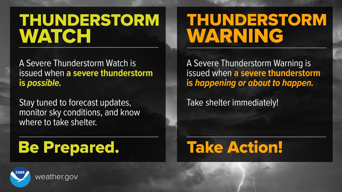
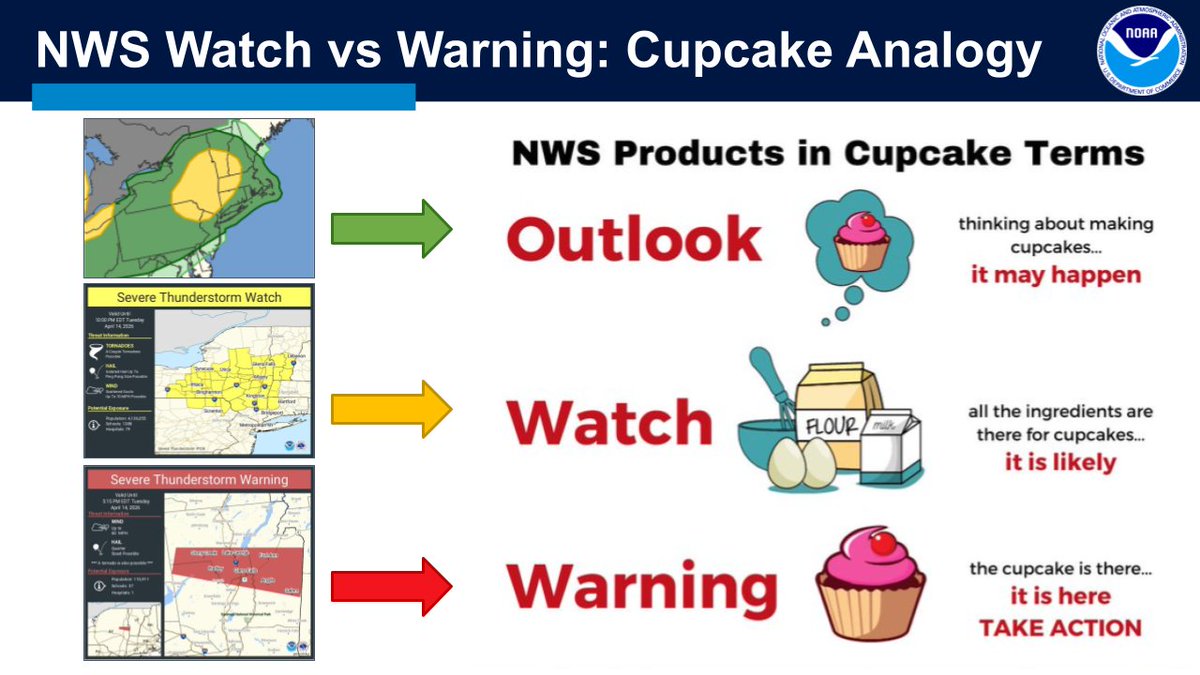
Severe weather season is here! Here's the difference between a watch & a warning. ⛈️
Think of the cupcake analogy: A Watch means we have the ingredients, so be prepared to act! A Warning means the cupcake is baked, or the storm is happening now, so take action now!
Stay safe!
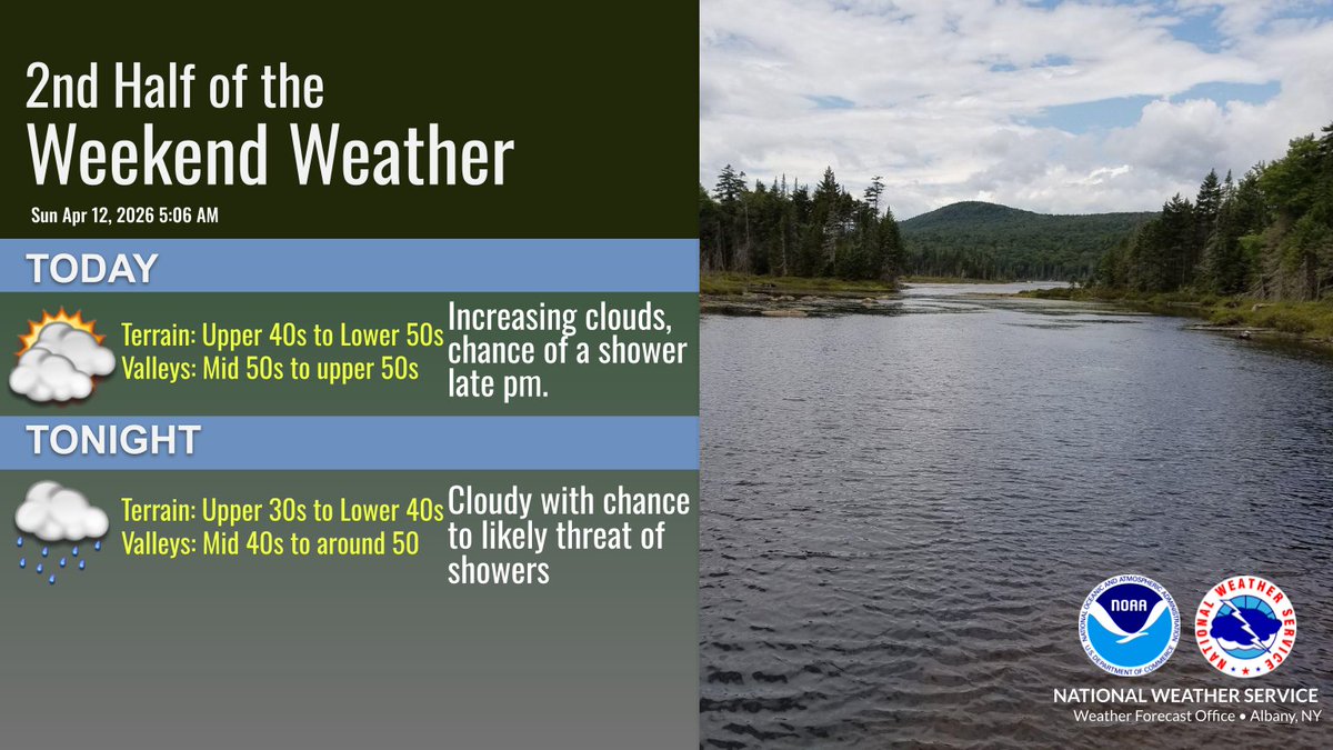
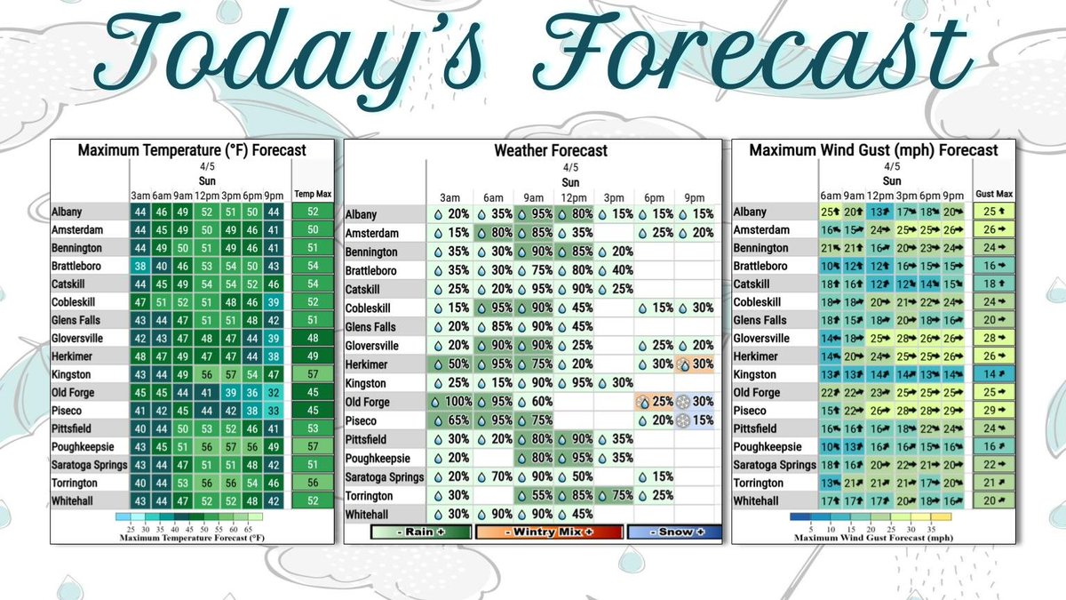
There's still plenty of sunshine to start your Sunday! Morning sun gives way to increasing clouds this afternoon. A few showers will reach north and west of the Capital Region later today, becoming more widespread tonight ahead of a breezy warm front. Highs in the upper 40s-50s.
Brighter skies are on the way🌤️! The sun will be out by afternoon and stick around through Sunday AM! Highs will be in the 50s-60s for most of the region with gusty winds tapering off tonight. Rain showers are possible Sunday PM. Wishing everyone a happy weekend! #518wx
Don’t let the nice weather blow you away! Highs today will be in the 50s-60s with gusty winds 25-35 mph expected in the afternoon and evening. Dry weather continues for most of Friday until showers move in Friday night. #NYwx#CTwx#MAwx#VTwx
Don’t put those snow brushes away just yet! Light snow accumulation is expected tonight into tomorrow AM with most of the region seeing measurable snow and a coating up to 2" in the SW ADK and S Greens. Snow will mainly stick to grass but slippery travel is still possible! #518wx
These Spring showers will certainly do their part to keep our gardens growing in May! A cold front brings a period of rain across the region this morning through this afternoon with winds becoming breezy. Recommended footwear for anyone doing an egg hunt today is rainboots!