Morning sunshine gives way to increasing clouds during the afternoon, along with scattered showers and perhaps an isolated rumble of thunder. Not everyone sees rain, but keep an eye to the sky if you have outdoor plans #MAwx#RIwx#CTwx
A strong dome of heat is expected to develop for the second half of our work week, possibly lingering into next weekend. Highs near 90 degrees will be possible for several days. #wcvb
The Massachusetts Department Of Environmental Protection has issued an Air Quality Alert. The concentration of ground level ozone could be unhealthy for those with asthma, lung or heart disease, & older adults. #wcvb
⛈️ Strong to severe T-storms possible Sat evening (5 PM–11 PM) into early Sun across SNE.
🗺️ Greatest risk: W/NW of I95 (Interior SNE).
⚠️ Hazards: Damaging winds, lightning, heavy rain.
📱 Stay weather aware. #MAwx#RIwx#CTwx
Dewpoints have been very low all week...you've probably been watering potted plants a lot as the dry air and sun whisks away moisture
A brief push toward muggy air this weekend, but then right back to the real dry stuff early next week
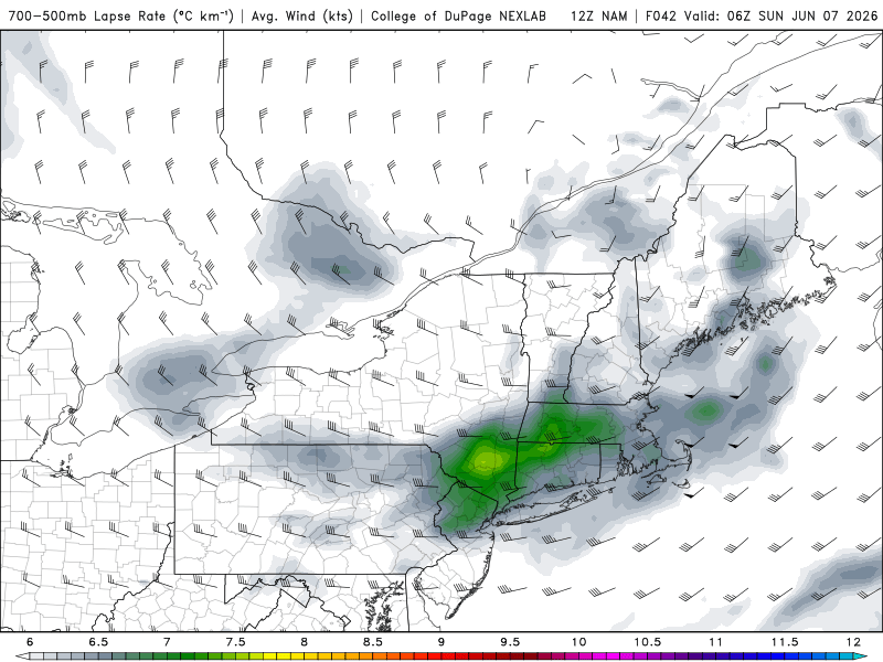
IMO best chance of some storms for us tomorrow will actually be after sunset/overnight
Mid-level lapse rates are best then and we'll still be hot/muggy in the overnight. Could definitely use the rain...and much more enjoyable at night! Fingers crossed
Very warm to hot today and Saturday, Strong to severe t-storms possible Saturday evening, cooler Sunday with a few instability showers, nice Monday, then we heat back up Tues.-Thurs., Full Friday Report Here: https://t.co/FHfbwKxBTZ
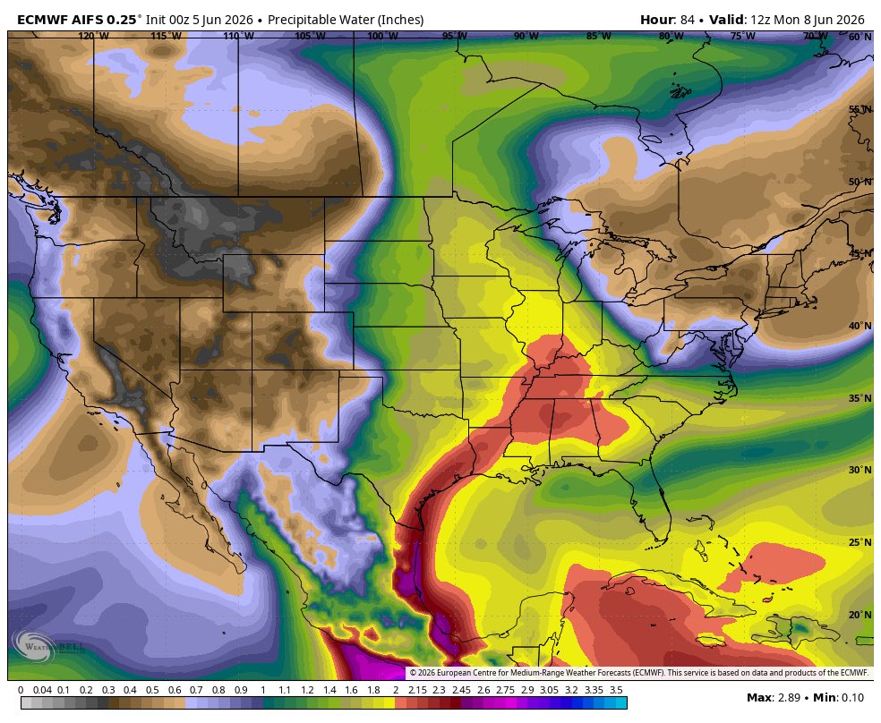
Severe weather likely going to get active again next week as significant western troughing returns with a deep moisture pull potentially from active tropical activity in the East Pacific and active tropical thunderstorm activity in the gulf.
Central(higher ceiling) and Eastern U.S. look to be in play for notable severe weather though atm.
Will have to follow Amanda in the east Pacific as it will play a factor.
Active western troughing, large open moist warm sectors, and pacific and gulf moisture tap are all important factors.
Late next week/ next weekend looks quite warm/hot. Normal long range caveats apply, especially in Eastern areas with a trough hanging out to the NE, but certainly a hot look here
Have to watch Saturday for a chance of Severe Weather in SNE as energy from the west combines with increasing DP’s to help develop isolated pre frontal thunderstorms some which may contain large hail and damaging winds. Machine Learning guidance shows the threat along with SPC.
Saturday looks quite warm, but watching the potential for a BDCF to move through eastern SNE and bring down temperatures at the immediate shoreline.
Also, humidity climbs throughout the day with dew points rising into the 60s
Some absolutely insane low temperatures this morning for June 2...36 in Hyannis? 30 on the Vineyard!!! That should be the last of the 30s for quite some time