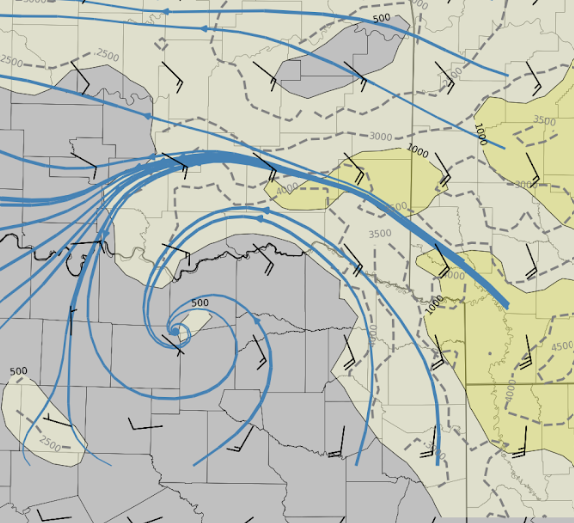
impressive swirl lifting north into SE OK (playing around with ECAPE and related cell diameter calculations ... forecast mean cell motions shown as black wind barbs) ...
🌪️05/17: The LIFT project used LiDAR & mobile mesonets to sample ground-level wind flow on a strong tornado in Nebraska.
This type of data of both the tornado itself AND its formation at such close range and proximity to ground is rare and valuable.
🔗: https://t.co/14LLWKo93r
Peak outages are overrated. The real killer is outage duration. Our new Outage Severity Index shows how ice storms are more severe than thunderstorm-forced outages. Read the full paper here: https://t.co/KAW6Gn3e91
For the first time, data from the Black Swift Technologies’ S0 drone will be integrated into NOAA’s hurricane forecast model (HAFS) during the 2026 hurricane season.
Recent tests have shown this can improve #hurricane forecast accuracy by 10% :
https://t.co/pDwzrpzyQX
I'm going to be releasing an app/website for satellite data (weather) fairly soon. If I know you and you want to help test it let me know via DM. Thanks!