Heat Advisory today for southeast MS, extreme southwestern AL, and portion of western FL panhandle. For Friday, Excessive Heat Watch issued for southeast MS, extreme southwestern AL, and portion of western FL panhandle, and Heat Advisory in effect for much of remainder of area.
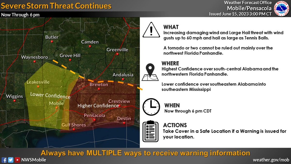
We are monitoring the area between US Highway 84 to I-10 for the potential of strong/severe storms through 4 PM. A line of intense storms will continue to develop and move slowly southward across the area bringing a potential of strong to locally damaging winds and possibly hail.
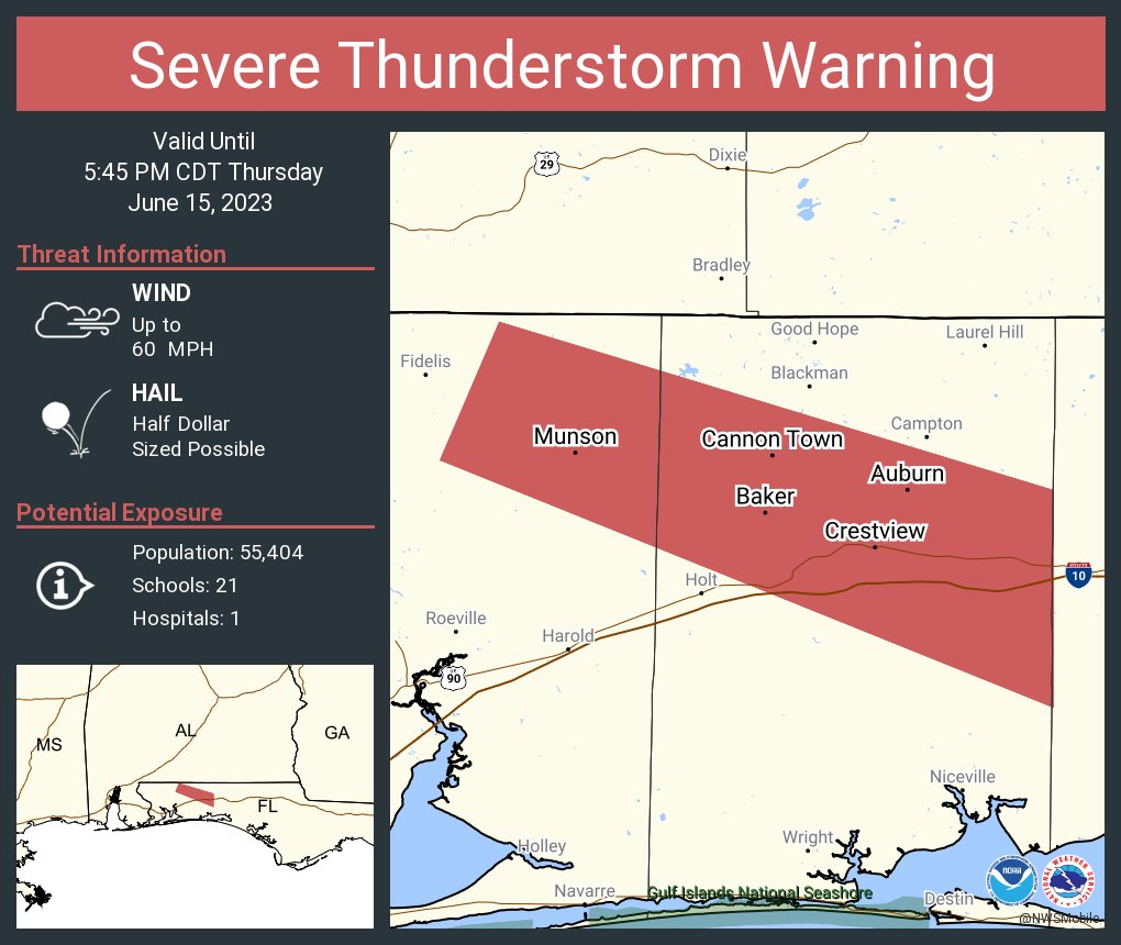
3 PM Severe Update: A line of supercells extending across Covington and Escambia Counties in Alabama continue to produce potentially damaging winds and large hail. This threat will likely continue into the Florida Panhandle this afternoon. Lower confidence in storms further west.
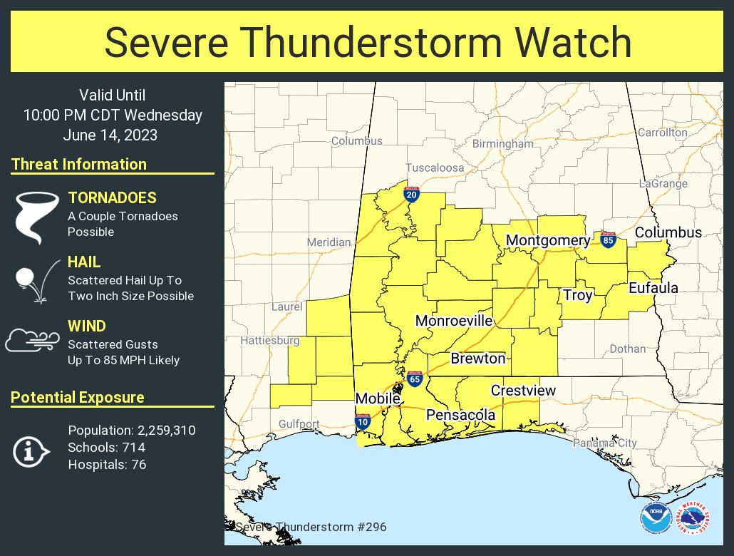
Several rounds of severe storms expected today. One round late this morning through early afternoon, then a more robust round this evening and overnight.
Damaging winds (up to 70-80 mph), very large hail (2 inches or larger), and possible tornadoes.
⛈️ 315pm MESOSCALE UPDATE- Severe storms will be possible mainly along & just north of the I-10 corridor (red outlined area) thru the afternoon & into the early evening hours. Damaging winds & hail up to quarter size will be the main threats with any strong to severe storms.