@Sensors_MDPI Author here - thanks for featuring it. The review summarizes the SfM–MVS image-based pipeline, a taxonomy of 3D scanners (incl. CT/CBCT/MRI/ultrasound/CMM), and practical steps from scans to 3D models. Hope it helps as a reference.
Working on #Photogrammetry / #ComputerVision (#SfM, #3dmodeling)?
💡Paper: a comprehensive overview of image matching — from area-based methods to feature-based pipelines (handcrafted & learning-based) + outlier rejection essentials.
Links in first reply.
@MDPIOpenAccess
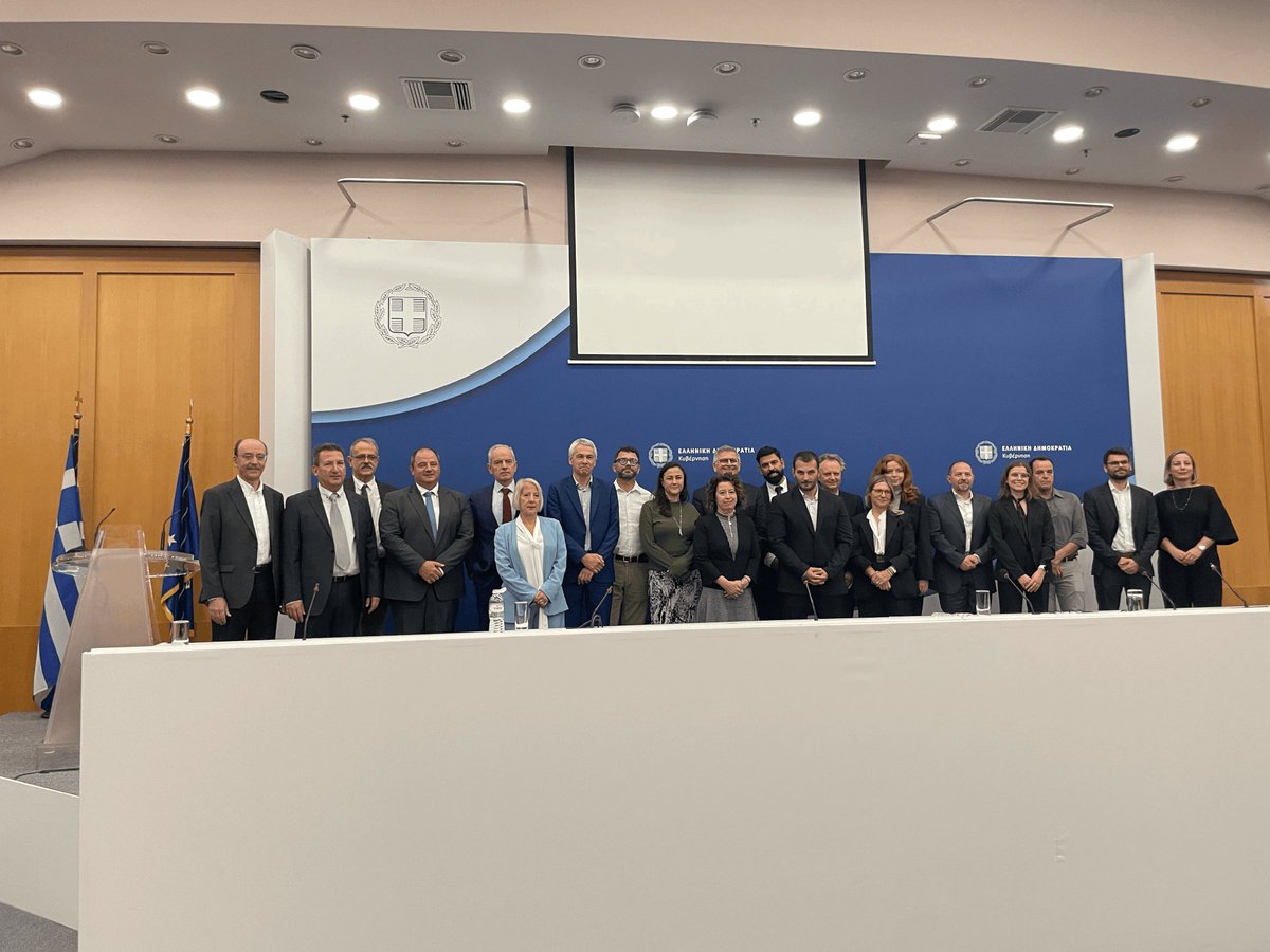
Happy to be in Paphos, last week, for the 5th @TRIQUETRA_Proj plenary! As NTUA coordinators, we are proud to see the project moving strongly into its final phase. Big thanks to all partners & hosts - and for the inspiring visit to Choirokoitia! #HorizonEurope#CulturalHeritage
The #TRIQUETRA_Project proposes a technological toolbox and a methodological framework for tackling #climate_change risks and #natural_hazards threatening CH in the most efficient way possible. Find out more about the project here:
👉📖 https://t.co/9RyDoRcsFa
Today, I had the pleasure of making a presentation at the TRIQUETRA Workshop hosted by AUTH, on #3D geometric documentation of #CulturalHeritage sites for monitoring the impacts of #ClimateChange.
It was a great day filled with insightful discussions with TRIQUETRA colleagues.
✨ Just published! ✨
Excited to share our entry paper, “Image Matching: A Comprehensive Overview of Conventional and Learning-Based Methods,” in MDPI's Encyclopedia!
📖 https://t.co/57ahDrZ1Ir
#ComputerVision#DeepLearning#Photogrammetry @EncyclopediaMD1 @MDPIOpenAccess
🌍 Excited to be part of Sat4GAIA 🌍
🛰️ We participate in the LAND program, part of Greece's National Satellite Space Project under the auspices of ESA. 📊We develop AI algorithms for land cover mapping using Greek 🇬🇷 and international 🌍 satellite data.
#EarthObservation#AI
📷 @NTUAPhotolab proudly participates in the LAND program, by developing AI algorithms for land use classification.
🇬🇷 Contracts for Axis 3 were signed, boosting Greece’s satellite data capabilities.
📷 Learn more: https://t.co/KENzmXF3fk
#NTUA#LAND#ESA#EarthObservation
✨Editor's Choice Article✨
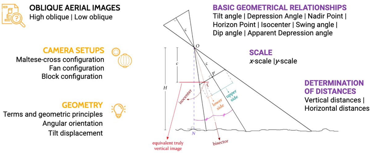
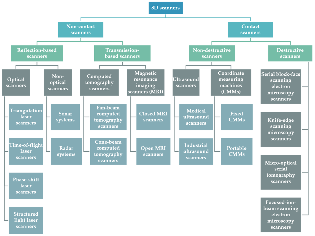
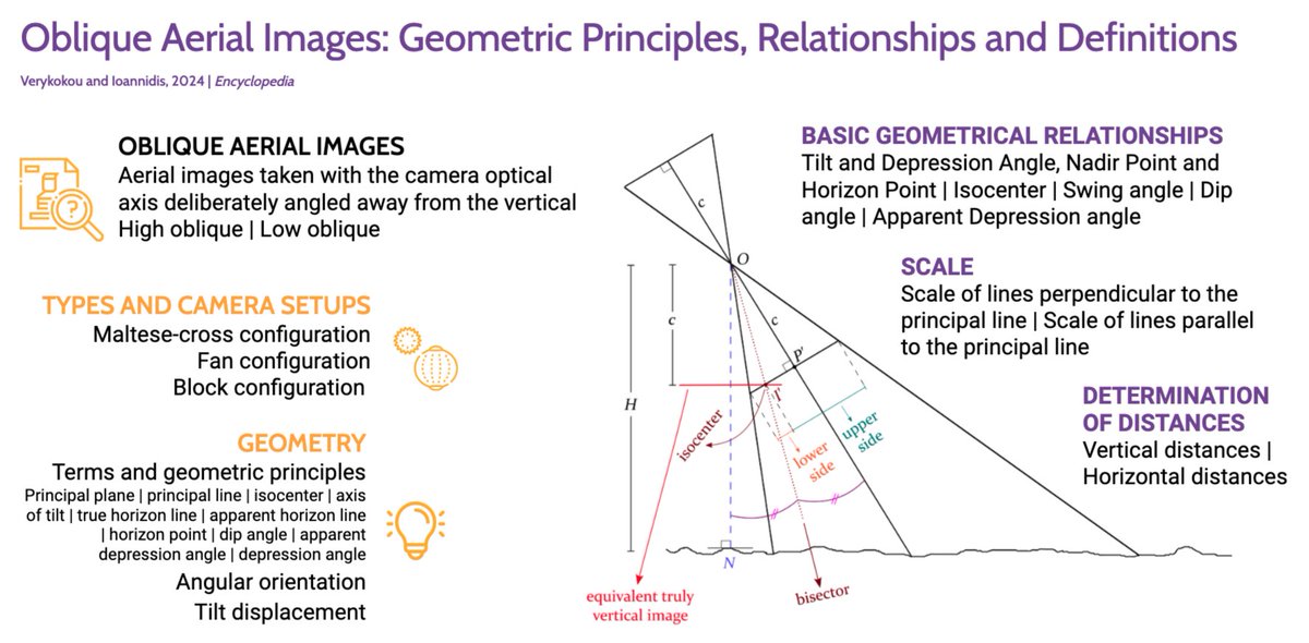
Verykokou, S.; Ioannidis, C. An Overview on Image-Based and Scanner-Based 3D Modeling Technologies
🏫 @ntua
https://t.co/dRHwBIhUWP
📣 News from the Laboratory of Photogrammetry SRSGE NTUA and TRIQUETRA Project!
📆On June 25th, 2024, we conducted a comprehensive photogrammetric campaign at the archaeological site of Aegina Kolonna as part of the TRIQUETRA Project
#Photogrammetry#3DModel#AerialImages
💝#HotPaper#mdpijpm📷 ✔️
"Evaluation of 3D Modeling Workflows Using Dental CBCT Data for Periodontal Regenerative Treatment"
👨💻Styliani Verykokou et al.
🧐https://t.co/XthfpZhlGM