2:32pm CDT #SPC Day3 Outlook Slight Risk: Friday afternoon and evening from the Allegheny Mountains vicinity through much of the northern Mid Atlantic and adjacent portions of western New England https://t.co/K89lXjsmlK
12:51pm CDT #SPC Day2 Outlook Enhanced Risk: Thursday into Thursday night across parts of southern amd eastern Iowas .northeastern Missouri .northern and central Illinois southern Wisconsin northern Indiana and central and souther... https://t.co/Y1WiOd8m1i
12:33pm CDT #SPC Day2 Outlook Enhanced Risk: Thursday into Thursday night across parts of southern amd eastern Iowas .northeastern Missouri .northern and central Illinois southern Wisconsin northern Indiana and central and souther... https://t.co/Y1WiOd8m1i
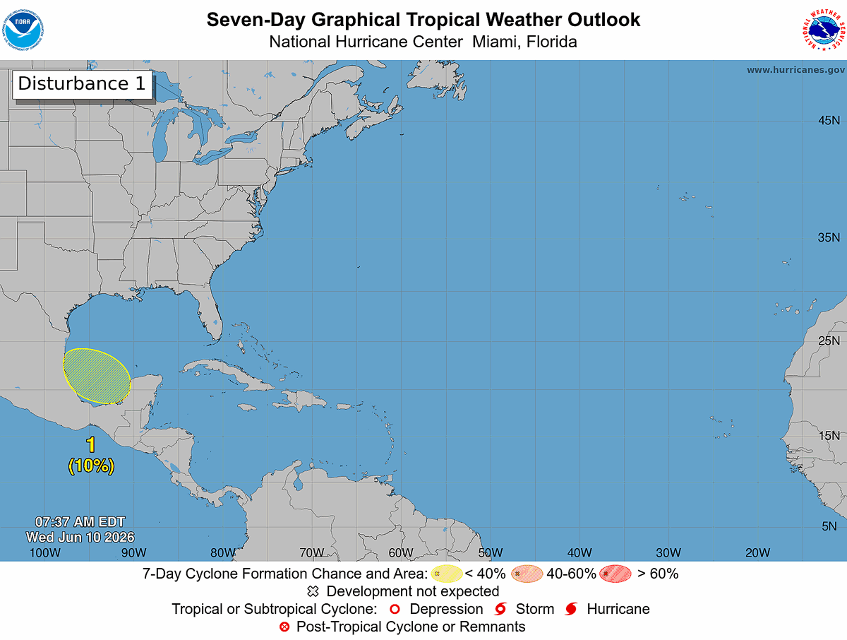
8 AM EDT Wednesday, June 10: A broad area of low pressure could form over the Bay of Campeche later this week. The system has a low chance (10%) of formation before it moves inland over eastern Mexico over the weekend. Follow the latest at https://t.co/tW4KeGdBFb
Forecasted evolution of storms from 2 pm today through 11 pm tomorrow. Damaging wind gusts 60+ mph the main risk with storms. Friday also features severe storms with damaging wind gust the main risk
1:01am CDT #SPC Day2 Outlook Enhanced Risk: across northeast Missouri, parts of southern and eastern Iowa, southern Wisconsin, northern and central Illinois, northern Indiana, parts of central and southern lower Michigan, and far... https://t.co/Y1WiOd8m1i
Seventy-three years ago today, debris from the Worcester tornado fell at Blue Hill Observatory including household items carried more than 25 miles by the storm.
Pictured: Sally Wollaston holding a dresser scarf recovered following one of New England's deadliest tornadoes.