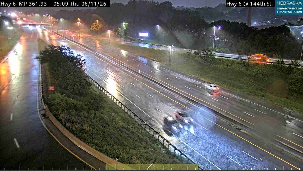
With storms and heavy rainfall, stay aware on the roads for potential flooding.
-Don't drive into flooded roads or around a barricade. Turn around, don't drown!
-Water may be deeper than it appears and can hide hazards.
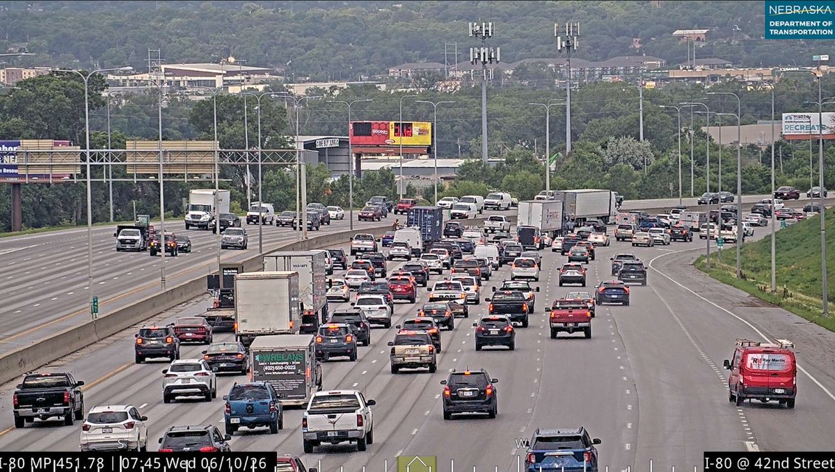
There have been multiple crash reports on I-80 in both directions from I-L-Q all the way to 42nd
With heavy rain and strong wind, the roads are very hazardous right now
There’s a severe thunderstorm watch in the metro this morning!
KETV is live right now with updates as Meteorologist @SeanEversonKETV follows this severe weather
Severe T-Storm Watch is in effect for most of the KETV viewing area, including the Omaha metro, until 10 a.m. Any stronger storms could produce very large hail, damaging wind gusts, and heavy rain. Best chances for severe activity will be before 8 a.m. in the Omaha metro.
Can't rule out a shower/t-shower early this morning, otherwise expect another hot, humid, and breezy day. Expect highs in the mid 90s with feels like temps 95°-100°. Any PM stronger storms likely stay S/E of the metro. Better chance for strong storms late tonight-Thursday AM.