What could possibly be so fascinating about this particular patch of dirt?
If you're a volcanologist, the answer is...tephra! Made up of fragments of lava, volcanic ash, and pumice, tephra deposits like this one in the Mono Craters near Long Valley record the history of eruptions. Starting with the assumption that the lowest (or deepest) layers were deposited first, it's possible to "read" how eruptions behaved and changed over time. In this case, California Volcano Observatory scientists are searching for a basalt tephra among the Mono Craters lava domes so they can map how far it traveled from the vent. Mapping the extent of a tephra tells us how much was erupted, how much energy and gas were needed to eject it, and what was happening in the atmosphere at the time of eruption. This information lets us deduce how large and severe an eruption was, and what its impacts might have been. All these factors are important information for hazard assessments of potential future activity!
📷: USGS photo by A. Hotovec-Ellis
California Volcano Observatory Weekly Update for August 17, 2026: All volcanoes in California were at normal background levels of activity for the last week. Earthquakes >M1 were observed at Mount Shasta, the Coso Volcanic Field, and Salton Buttes.
Around noon PDT on Thursday, August 13, internet communication with the majority of the Mammoth Mountain and Long Valley monitoring network was lost following heavy thunderstorms. As of this notice, communication has not been restored. Enough seismometers remain operational to monitor earthquake activity, but not to precisely locate the smallest earthquakes.
2026 @geointern graduation & paella day.
Thanks to all participants, staff and local and international experts and institutions to be able to do this XII edition.
GEOINTERN is promoted and organised by @GeoTenerife & @TenerifeNature
https://t.co/4KVXC2rGgj
Ground deformation be4 a volcanic eruption is primarily caused by processes related to the movement, accumulation, and pressurisation of magma and associated fluids (gas + water) beneath the surface, specially, H2O, CO2 and SO2
Video: @IgnacioGarciaGT@GeoTenerife
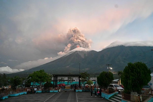
🔴 Nearly 1,700 residents near Guatemala's Fuego volcano have been moved to shelters following its eruption, prompting a red alert. Authorities warn that ash and gases could reach nearly 23,000 feet and travel up to 120 km.
📌 Source: https://t.co/3uthKoiS9F
Programme A (Plinian Deposits in Tenerife) research project led by Professor Richard Brown, Durham University
Plinian eruptions on the island of Tenerife appear to be more frequent than we thought.
2026 @GeoIntern is promoted & organised by @geotenerife
Pic: Deposits+lava flow
🚨 Teide Hit By 4,500 Earthquakes In Days 🚨
More than 4,500 small earthquakes have now been detected beneath Tenerife since July 22, with peaks of over 300 events in a single hour.
The swarm is concentrated around 10 kilometres deep and includes signals linked to rock fracturing and pressurised fluids moving through the volcanic system. It is now the longest Teide swarm recorded since this renewed activity began in 2016.
We will monitor and update if and when needed.
#Teide #Tenerife #Volcano #EarthquakeSwarm
Students from 27 seven different universities are taking place in the 13th edition of @geointern an international summer camp divided in four research programmes which is organised and promoted by @GeoTenerife
Another day with hydrogeologists + miners conducted by @genesisnbs under the supervision of mining engineer P. García to perform 2 water sampling and visit the works carried out to complete the demonstrator at a depth of 6.05 km of a #watergallery
Proj/ leader @igme1849 🇪🇸
LOOK: Time-lapse footage of minor phreatomagmatic eruption at the Main Crater of Taal Volcano that occurred at 05:30 PM, today (25 October 2025). This event generated plumes that rose 1200 meters above the crater as recorded by the Main Crater IP Camera and thermal cameras. Alert Level 1 prevails over Taal Volcano.
#TaalVolcano
🌋 Time-lapse of a minor phreatomagmatic eruption at the Main Crater of Taal Volcano, recorded at 5:30pm (Philippine time) today.
The event produced eruption plumes rising approximately 1,200 meters above the crater.
Alert Level 1 remains in effect over Taal Volcano.
Credit: PHIVOLCS
2025 Volcano camp
Por @GeoTenerife con la colaboración de
@IGNSpain
Desde Nov 1 al 8 (curso de campo)
Y del 1 al 30 (extension/investigacion)
+info https://t.co/1GdossvPdL [email protected]#cursodevulcanologia en las Islas Canarias.
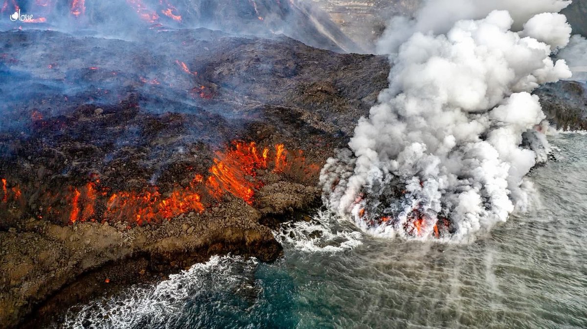
Foto: Saul Santos (Tajogaite 2021)