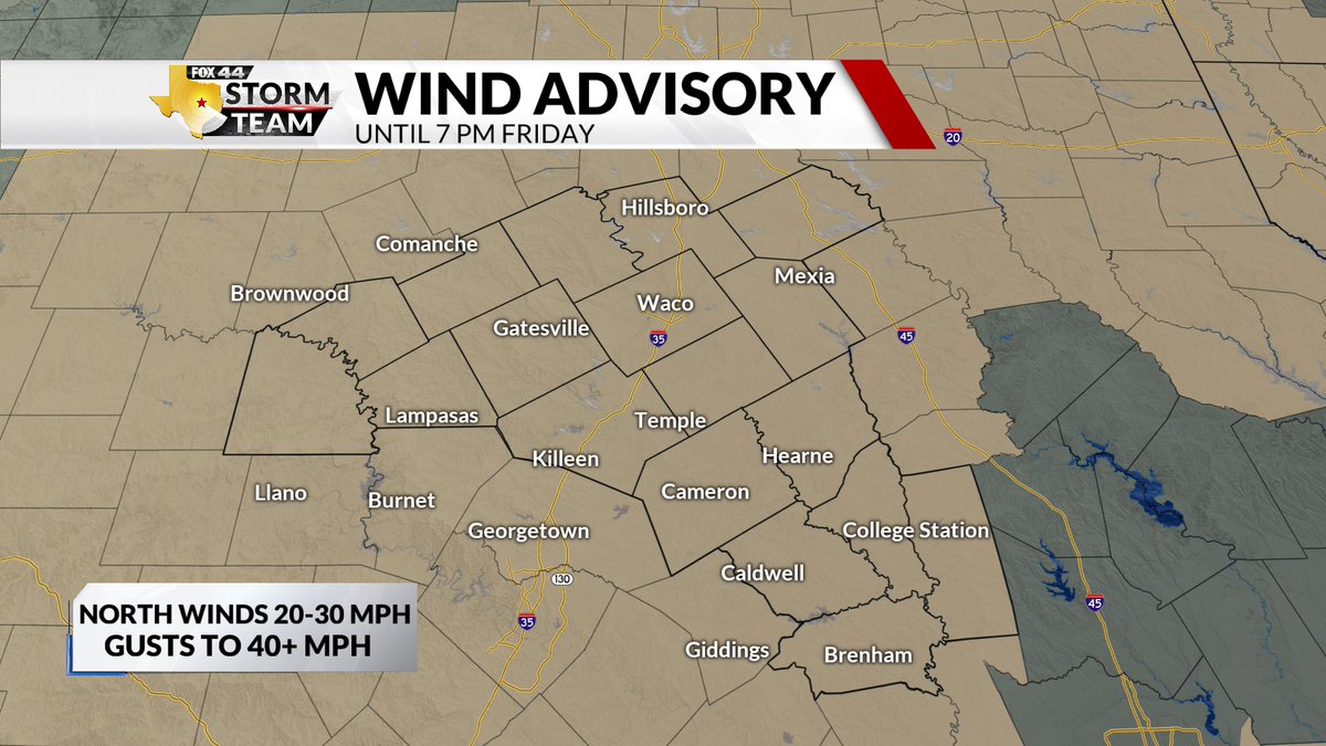
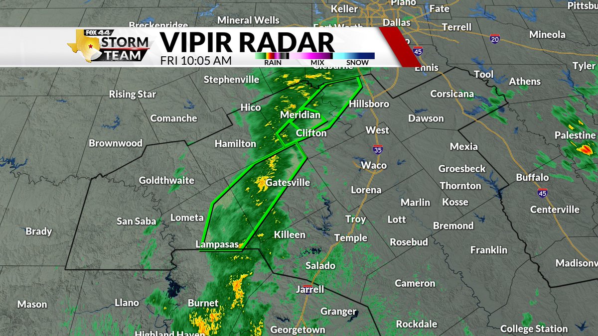
A wind advisory is currently in place for Central Texas until 7 pm Friday. This will mainly be for Friday morning and afternoon, when winds will likely reach 20-30 mph, with gusts up to 40. Stay weather alert!
#FOX44WX
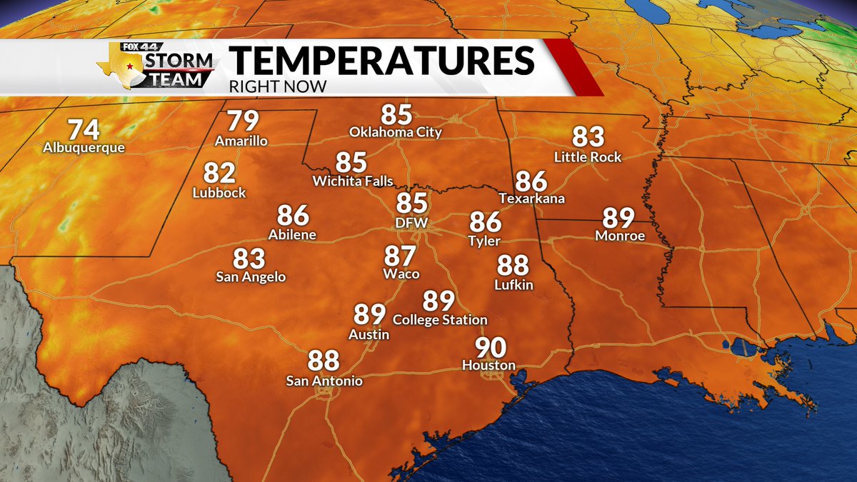
Where is fall? It's October and the temperatures we're feeling are summer-like. Lots of 90s across the state this afternoon. Big changes are on the way for the weekend, thanks to a strong cold front. I'll have details on that at 5:30PM on FOX44.
#FOX44WX
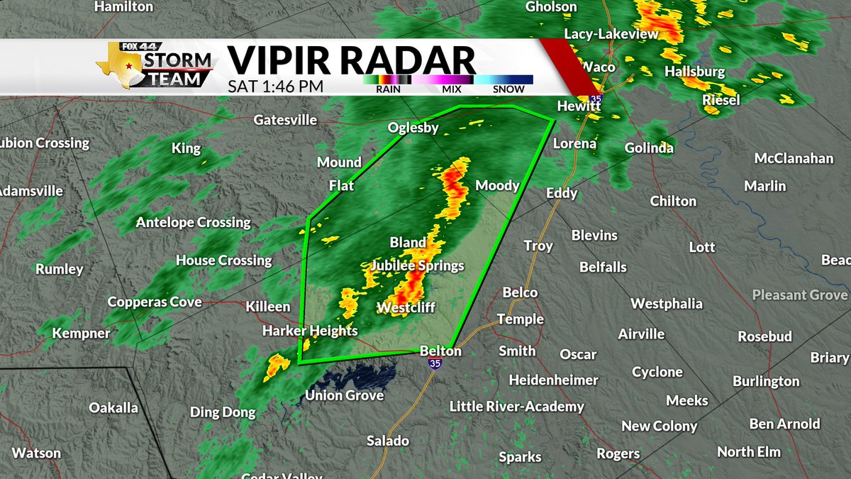
A flash flood warning is currently in place for Bell, Coryell, and McLennan counties until 4:15 pm. Between 1-4 inches of rain have already fallen, with another 2-3 inches expected. Turn around, don't drown.
#FOX44WX
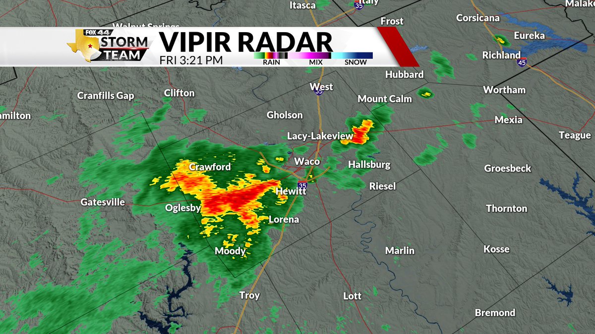
A flood advisory has been issued for McLennan County until 5:00 pm. 1-2 inches of rain have already fallen. Some locations can experience flooding. Stay weather alert!
#FOX44WX
Coryell, Lampasas, Bosque, and Hill Counties are all currently under a flash flood warning until 11:00 am . 4 inches of rain have already fallen in these areas, with another 1-2 inches expected. Turn around, don't drown.
#FOX44WX
Heavy rain continues to fall across Central Texas this afternoon. Nothing severe. But watch out for isolated flooding in the usual places. Remember: "Turn around, don't drown".
#FOX44WX
Rain continues to fall as we head into noon. If you are going out for lunch today, make sure to pack an umbrella, as the rain will continue for the next few hours, maybe even all day...
#FOX44WX
It's going to be a very rainy day, as we start with the majority of the storms being towards the east. Flooding is the main concern, with some areas expected to receive up to 6 inches of rain. Stay weather alert!
#FOX44WX
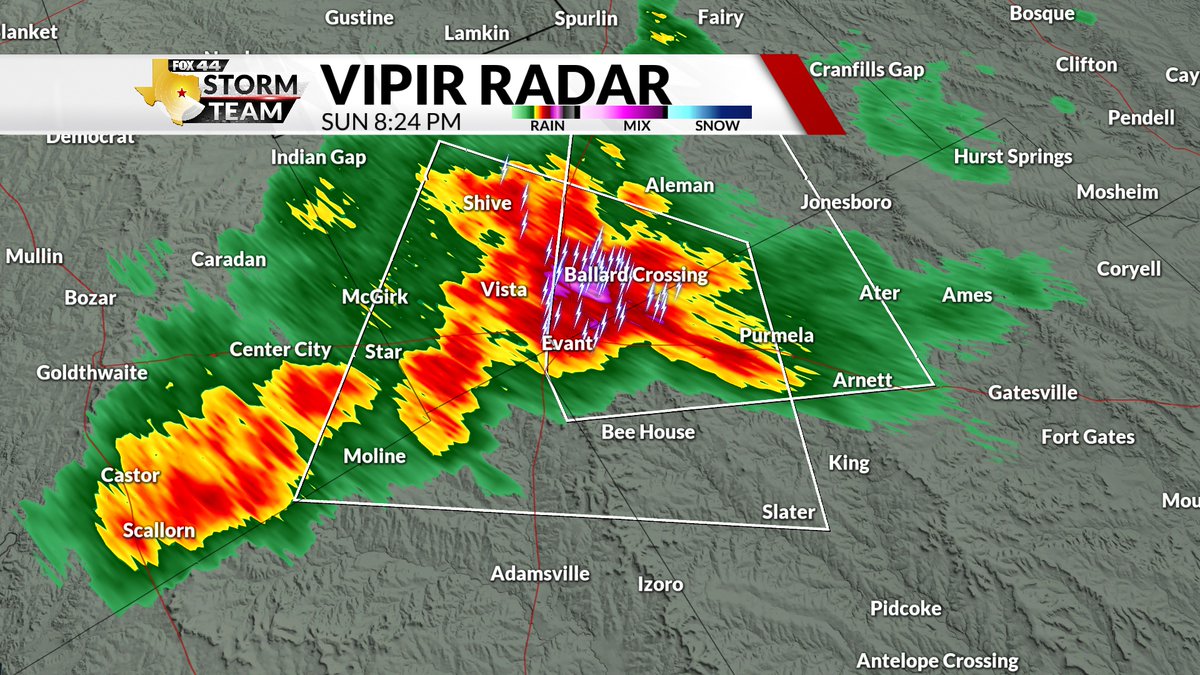
A SPECIAL WEATHER STATEMENT has been issued for Coryell, Lampasas, Mills, and Hamilton Counties until 9:15 pm. The main threats are wind gusts up to 40 mph and 1/2" hail. The storm continues to move south at 10 mph. Stay weather alert!
#FOX44WX
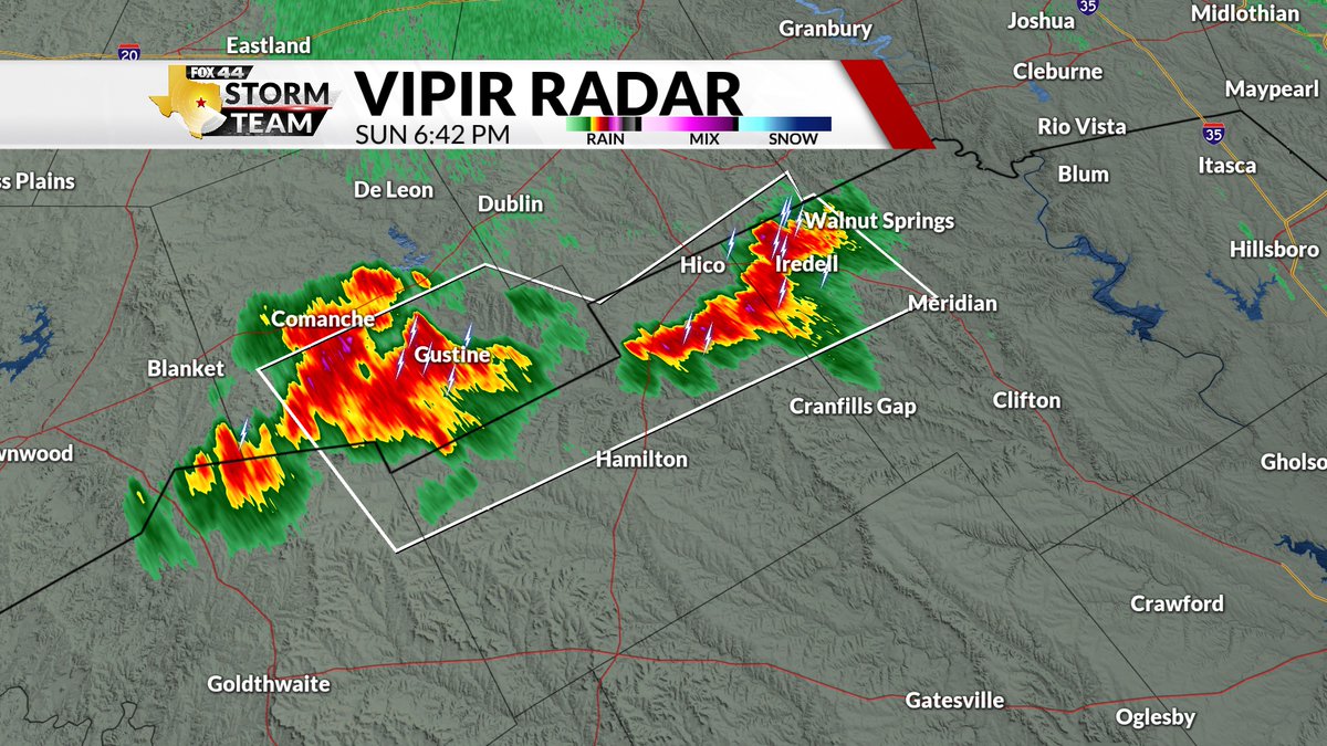
A SPECIAL WEATHER STATEMENT has been issued for Coryell and Hamilton Counties until 8:30 pm. The main threats are wind gusts up to 40 mph and 1/2" hail. The storm continues to move south at 15 mph. Stay weather alert!
#FOX44WX
A SPECIAL WEATHER STATEMENT has been issued for Hamilton and Bosque Counties. The main threats are 40 mph winds and 1/2" hail. The storm continues to move southeast at 15 mph. Stay weather alert!
#FOX44WX
SPECIAL WEATHER STATEMENT...Strong thunderstorms will impact portions of McLennan, central Robertson, northeastern Milam, western Limestone and Falls Counties through 430 PM. Movement was west at 15 mph. MAIN HAZARDS...Winds in excess of 40 mph and pea size hail.
#FOX44WX
A SEVERE THUNDERSTORM WARNING REMAINS IN EFFECT UNTIL 315 PM FOR SOUTHWESTERN FREESTONE AND SOUTHEASTERN LIMESTONE COUNTIES. At 220 PM, a severe thunderstorm was located near Farrar, moving west at 10 mph. HAZARD...60 mph wind gusts and quarter size hail.
#FOX44WX
SPECIAL WEATHER STATEMENT....A strong thunderstorm will impact portions of eastern Limestone County through 230 PM. Doppler radar was tracking a strong thunderstorm near
Groesbeck, moving southeast at 10 mph. Wind gusts up to 50 mph and penny size hail.
#FOX44WX
A SEVERE THUNDERSTORM WARNING has been issued for Bosque and Hill County until 5:30 pm. The main threats are 60 mph wind gusts and penny-sized hail. The storm continues to move east at 20 mph. Stay weather alert!
#FOX44WX
A SPECIAL WEATHER STATEMENT has been issued for Bosque County until 5:00 pm. The main threat is wind gusts up to 50 mph. The storm continues to move northeast at 10 mph. Stay weather alert!
#FOX44WX
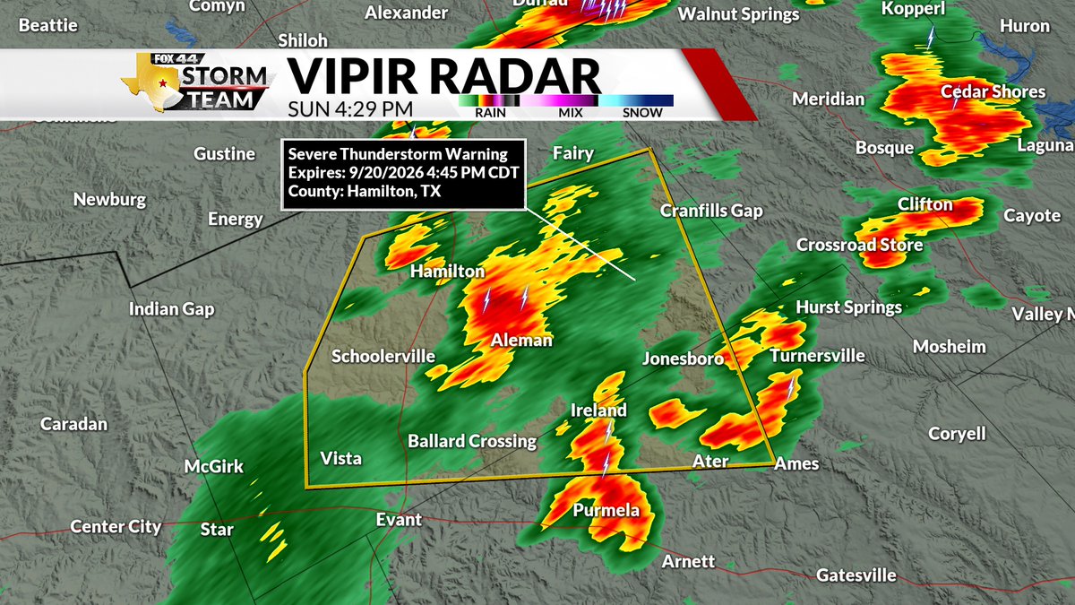
A SEVERE THUNDERSTORM WARNING has been issued for Hamilton and Coryell until 4:45 pm. The main threat is wind gusts up to 60 mph. The storm continues to move east at 10 mph. Stay weather. Stay weather alert!
#FOX44WX
A SPECIAL WEATHER STATEMENT has been issued for Bosque and Hamilton Counties until 4:15 pm. The main threat is wind gusts up to 40 mph. The storms continue to move northeast at 15 mph. Stay weather alert!
#FOX44WX
A SPECIAL WEATHER STATEMENT has been issued for Lampasas, Mills, and Hamilton counties. The main threats are wind gusts of 40-50 mph. The storms continue to move east at 15 mph. Stay weather alert!
#FOX44WX