Hurricane Isaias 3pm ET Update: Isaias is now a cat. 3 hurricane and will make landfall tonight on the Florida panhandle. This storm will not bring many direct impacts to SC, but we could still see some indirect impacts. It will be a major storm in Alabama & Florida More Below ⬇️
North Alabama: As the storm moves inland, heavy rain and gusty winds are possible late tonight and through the day tomorrow, a high wind warning is in effect until early Sunday morning, wind gusts of up to 60mph are possible, this storm will also dump a lot of rain, 3-4”+
Be weather aware and don’t let this be the last time you check the forecast, it will change over the next few days. Stay tuned to TRUSTED sources, such as the US National Weather Service Mobile Alabama and/or LOCAL News/broadcast meteorologists.
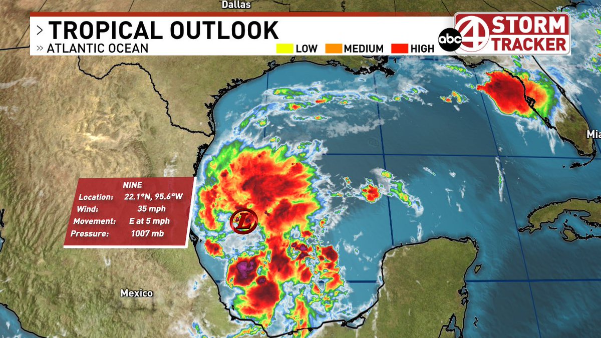
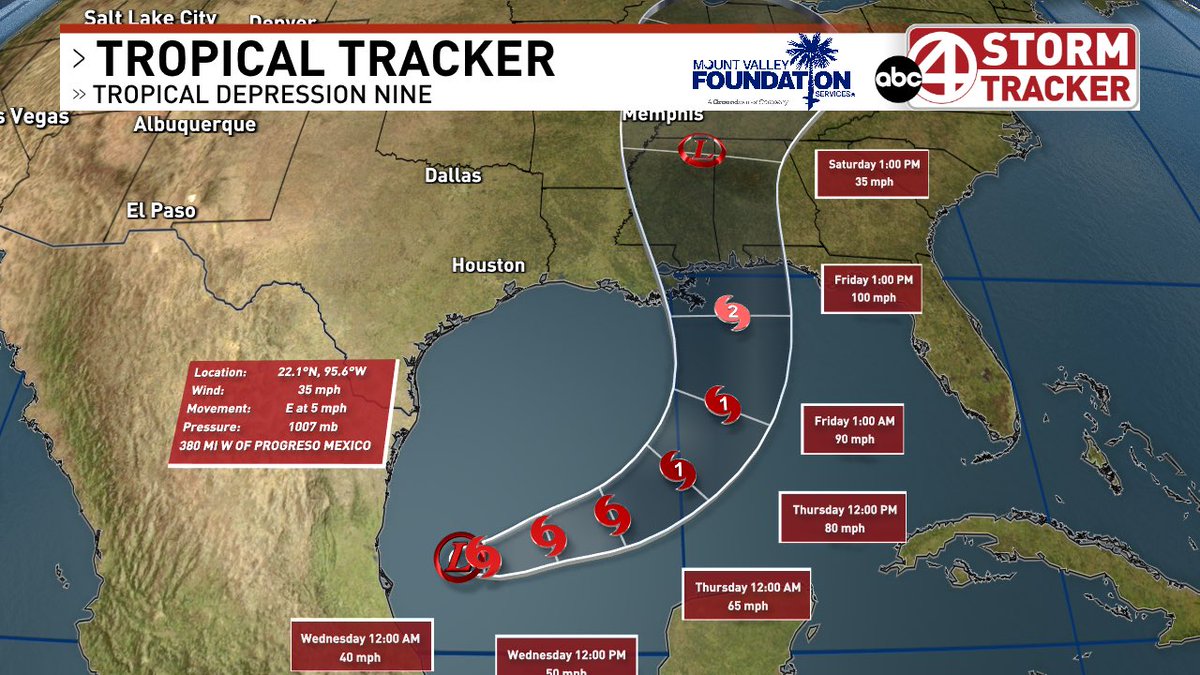
Tropical Depression 9 formed earlier today in the Gulf, this storm is forecast to be our first hurricane of the year. It will make landfall on the central Gulf Coast somewhere between New Orleans and the Florida panhandle. This forecast could change in the coming days
More Below
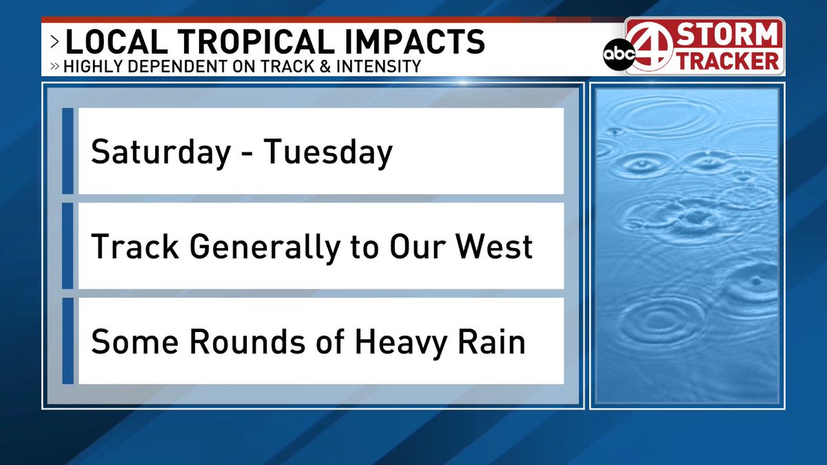
The exact impacts will change as the track shifts, but be aware regardless of any shift in the track, heavy rain and impactful weather are very likely and could begin as early as Friday Morning. (more below)
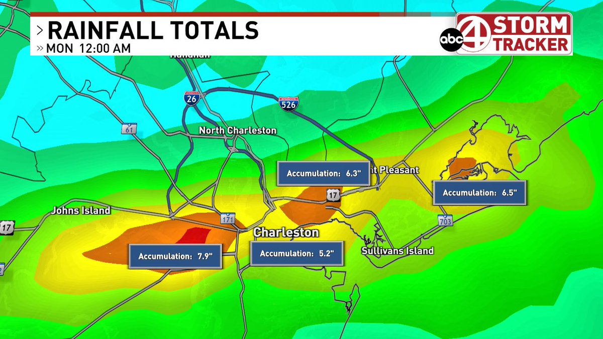
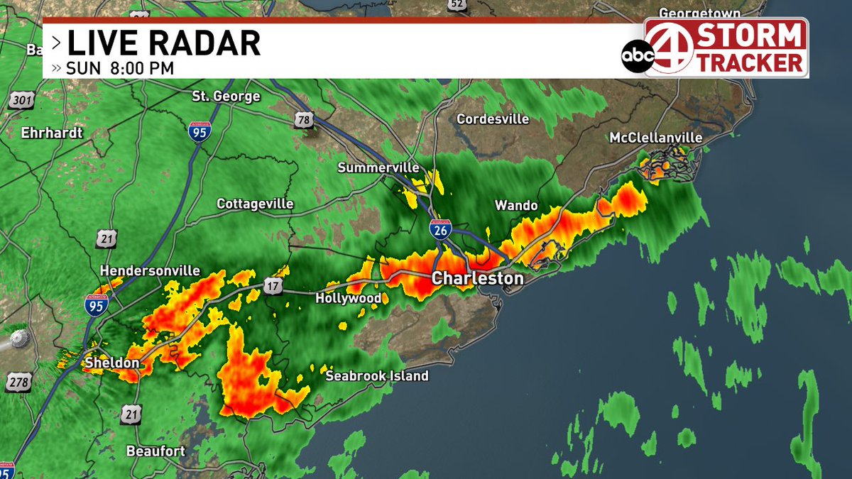
The Flash Flood Warning remains in effect until 1AM, but the heavy rain will be coming to an end across Charleston County over the next couple of hours.
We will see spotty showers overnight and through the day tomorrow, but the threat for any flooding is coming to an end.
Heads Up!
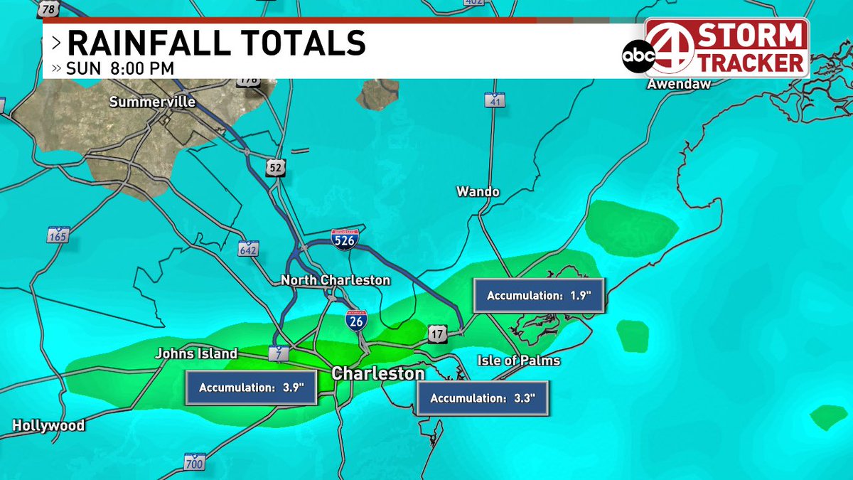
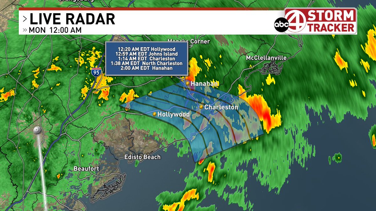
As of 10:10pm Sunday: Another burst of very heavy rain moving into West Ashley and Downtown Charleston
This could worsen ongoing flooding!
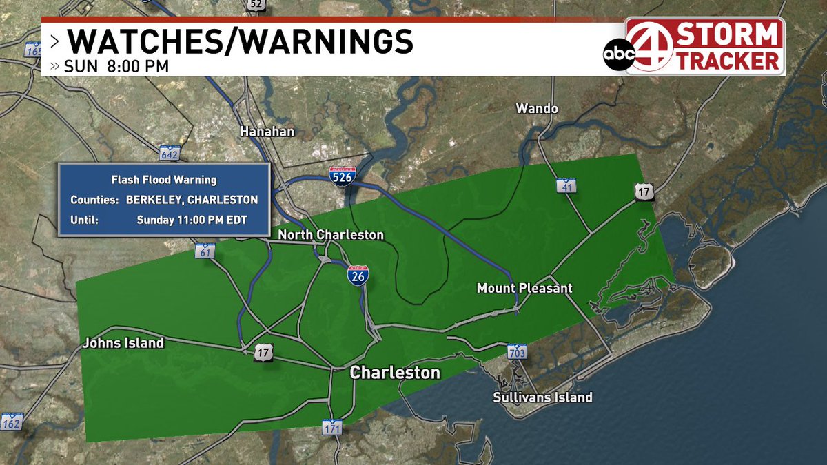
Flash Flood Warning remains in effect until 11pm.
Flash Flood Warning for Charleston and Eastern Berkeley Counties.
Heavy rain of 2-3” has fallen already with more rain on the way. Make sure to be extra careful if driving tonight and remember to never drive through a flooded road.
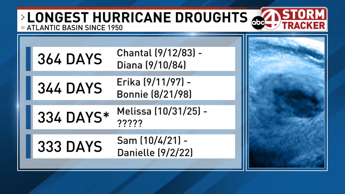
It has now been 334 days since Hurricane Melissa weakened to a tropical storm in the Atlantic. That means we’ve gone 334 days since our last hurricane, the third longest drought in history in the Atlantic.
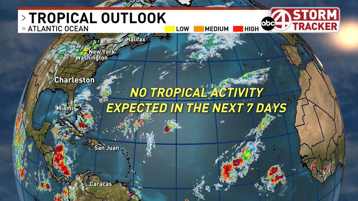
Hanna has dissipated and no activity is expected over the next 7 days.
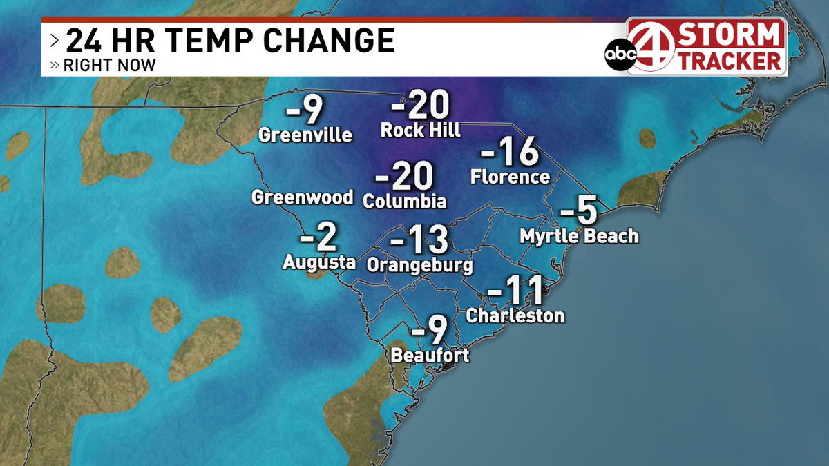
Check out these temperatures!! Significantly cooler today than at this time yesterday, feeling more like Early November than mid September! A great start to fall!
Tropical Storm Fay still chugging along in the Atlantic and is now forecast to become a short lived category 1 Hurricane. If Fay can become a hurricane it will be the first of the year, snapping the record of the longest into an Atlantic hurricane season without a hurricane.