7:00AM EST Thu Nov 14
Location: 15.9°N 82.2°W
Moving: W at 15 mph
Min pressure: 1004 mb
Max sustained: 35 mph
LIFE-THREATENING FLASH FLOODING EXPECTED IN HONDURAS THROUGH THE WEEKEND.
*The Next Update from SIWXN will be at 7 PM EST*
SIWXN TROPICAL UPDATE
NOV.10.2024
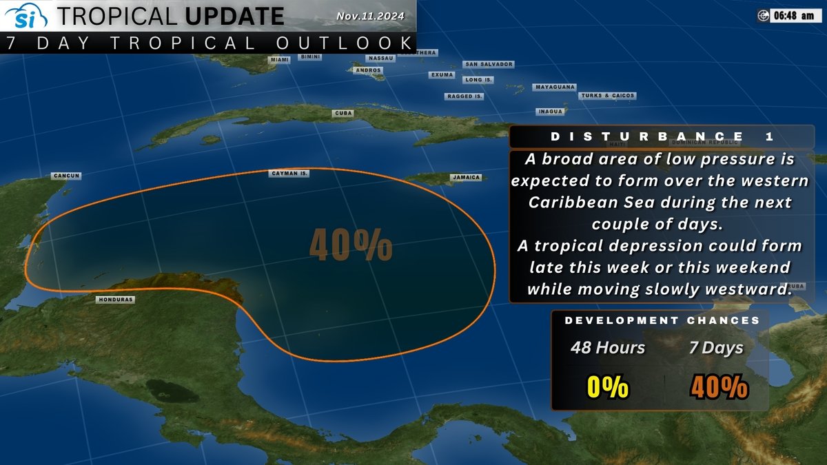
DISTURBANCE 1 NOW BEING MONITORED WITH A 20% CHANCE OF DEVELOPMENT OVER THE NEXT 7 DAYS AS IT DRIFTS WESTWARD OVER THE SOUTHWESTERN CARIBBEAN SEA.
#siwxn
#WIND#GUST expected to continue through tonight and into tomorrow associated with the leftovers of 98L and its trough of low pressure.
#stayweatheraware
SIWXN 1PM TROPICAL UPDATE
NOV.10.24
SHOWER ACTIVITY ASSOCIATED WITH INVEST 98L HAS DIMINISHED. 98L IS IN AN UNFAVORABLE ENVIRONMENT FOR DEVELOPMENT. REGARDLESS, LOCALLY GUSTY WINDS ARE STILL POSSIBLE ACROSS THE BAHAMAS THROUGH TONIGHT.
#UPDATE
CONCENTRATED SHOWERS AND THUNDERSTORMS A COUPLE HUNDRED MILES EAST OF THE CENTRAL BAHAMAS HAS SOME POTENTIAL FOR GRADUAL DEVELOPMENT INTO SUNDAY. THE SYSTEM WILL ENTER UNFAVORABLE DEVELOPMENT REGION THEREAFTER. LOCALLY HEAVY RAIN AND GUSTY WIND POSSIBLE FOR THE BAHAMAS.
#UPDATE
So, the Caribbean Sea blob has refired, keeping an eye on that and Disturbance 1 is set to be a rain threat to portions of The Bahamas.
Stay tuned, next update just after 7pm Est.
Interesting Blob around the Lesser Antilles. Keeping a close eye on this. No tags from The NHC but definitely nasty weather occurring along the belt.
#eyeonthesky
TRACKING THE TROPICS
LATEST ON DISTURBANCE 1
Development, if any, of this system should be slow to occur during the next couple of days while it moves westward to west-northwestward near the Greater Antilles, Turks and Caicos Islands, the southeastern Bahamas, and eastern Cuba.