For general updates, news, and announcements, please follow @FARO_TechInc
For architecture, construction, and engineering updates, news and announcements, please follow @HoloBuilder
Discover how #architects are overcoming common workflow pitfalls with innovative online #construction#progressmanagement tools! From inaccurate measurements to ineffective collaboration, we explore the solutions that are reshaping the industry: https://t.co/2CryzxPSLD
Our latest #UserGuide is your key to quick, scale-accurate scans! Learn essential tips for your first #3Dscan, seamlessly integrate mobile LiDAR scanning, and explore Pro features for rich point cloud data. Download the guide here: https://t.co/h1E7vGDUAw
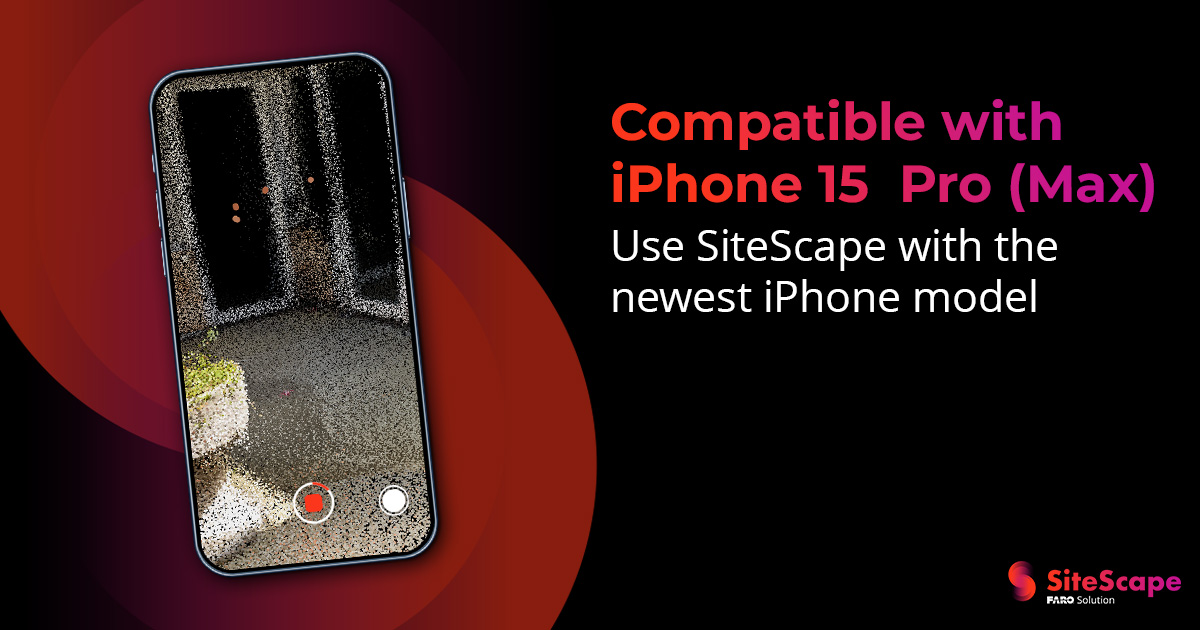
We're thrilled to announce that we are now fully compatible with the latest #iPhone15! Whether you're on a #construction site, surveying landscapes, or exploring new dimensions, #SiteScape has your back. Update your app today!
Discover how 3D #mobilescanning is revolutionizing the industry! Learn how you can leverage your iPhone or iPad to create scale-accurate #3Dscans that streamline processes and improve profitability and speed up #project completion. Learn more here: https://t.co/W59SIR6DHh
August 23rd-24th ONLY! The @FARO_TechInc#FAROSignals Conference is having a #FlashSale! Enjoy an exclusive #discount of $245 off regular ticket prices. Don't miss the opportunity to join thought leaders and industry experts! Get your tickets here: https://t.co/0SaM4mzKeF
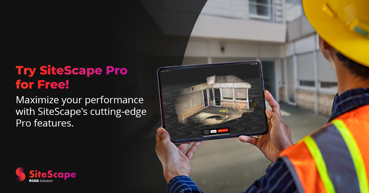
Unlock the full power of our site documenting features with a free, two-week trial of our Pro membership! SiteScape Pro includes large, high-resolution #3Dscans with Multi-Scan, unlimited storage with Pro Cloud, and more. Upgrade today in the app!
Discover how 3D mobile LiDAR scanning technology is transforming the world of architecture and design and reshaping design workflows and propelling architects into a new era of creativity and efficiency! Read more here: https://t.co/NO88JDzUPp
#architecture#mobilescanning#LiDAR
The Future of Construction #Technology is at #FAROSignals 2023!
This exclusive event is dedicated to empowering #AEC professionals with the knowledge, tools and connections needed to thrive in this era of data-driven decision-making.
Pre-register now: https://t.co/4TpUpQdqqD
We’re thrilled to announce that we have a new pro-feature, Photo Annotations! You'll be able to tap as you scan and capture even more context. Update your app today and start annotating with photos!
#sitescape#3Dscanning#lidar
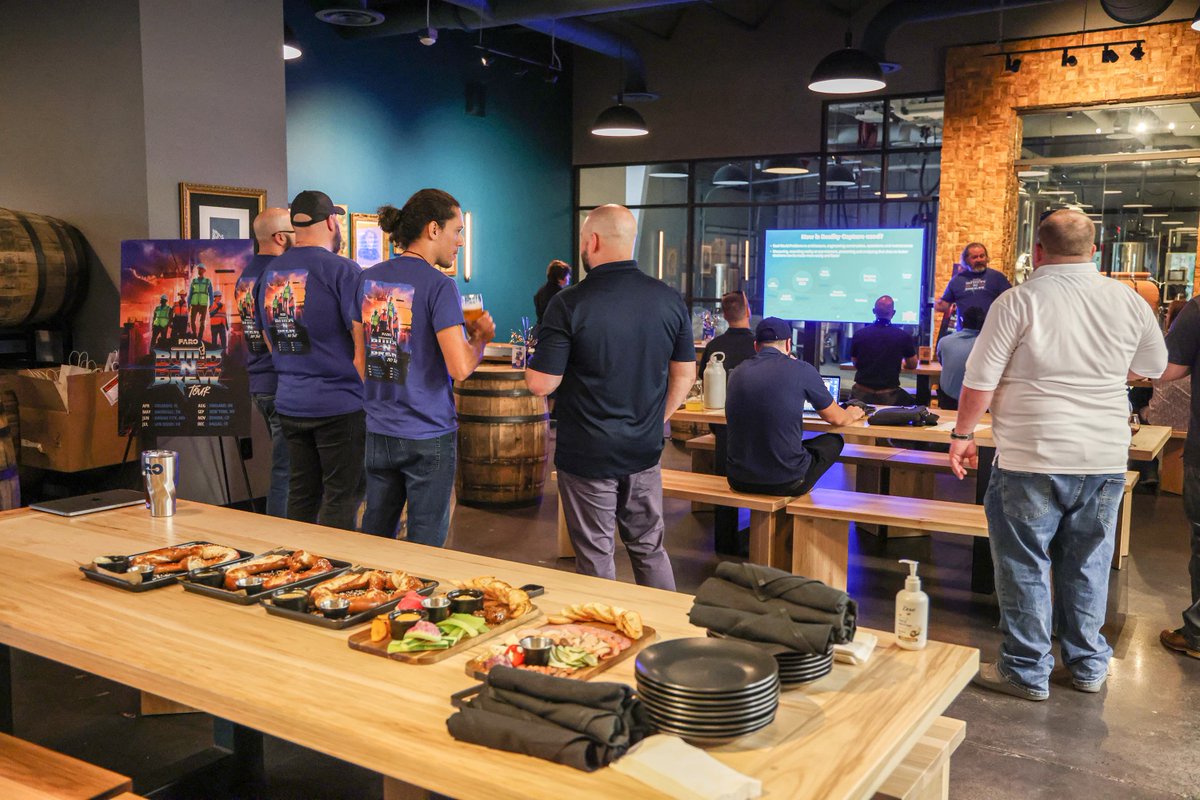
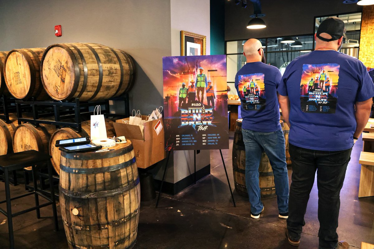
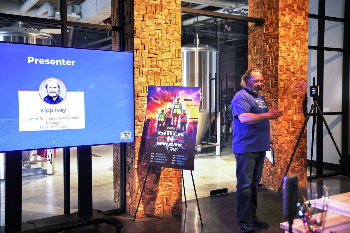
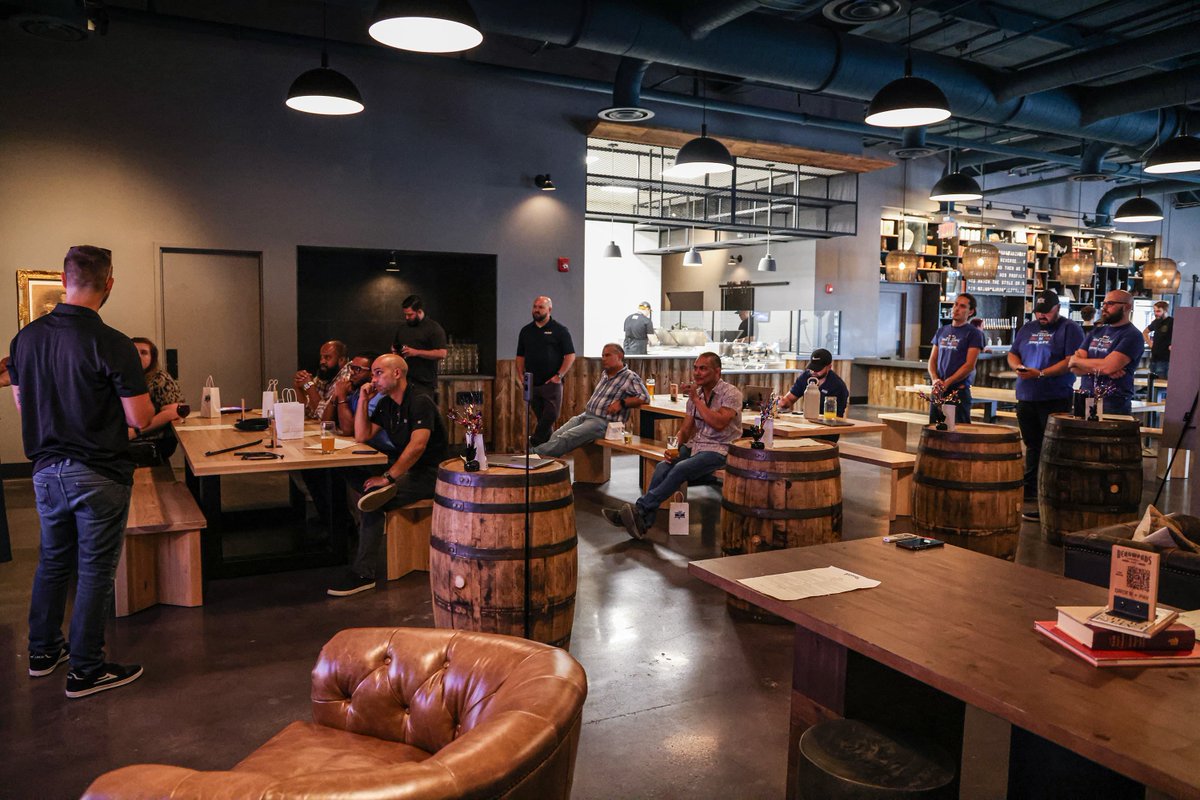
Join the @FARO_TechInc Build 'n' Brew tour! The event series kicked off in Orlando and it was great fun with good food & drinks.
The next tour date is Nashville, May 18. Register to get the latest trends about the full spectrum of #RealityCapture: https://t.co/QRb1PsyvB9
Have you seen the big news from our friends at @SiteScapeAI? Order BIM allows you to convert your SiteScape #3Dscan into an accurate #BIM & CAD Model without lifting a finger.
Learn more: https://t.co/MtBEYY0EcE
Introducing Order BIM! Convert your @SiteScapeAI scan into an accurate BIM & CAD Model without lifting a finger. Streamline your workflows, access your scanned spaces virtually anytime, anywhere, and more! Learn more here: https://t.co/JqKJpB6A6n
#pointcloud#BIM#3dmodel
We're proud to announce Order BIM! Convert your SiteScape scan into an accurate BIM & CAD Model with ease. Streamline your workflows and access your scanned spaces virtually anytime, anywhere, and from any device! Learn more here: https://t.co/XOEjCV2ZF4
#BIM#3dmodel#pointcloud
We are excited about Point Cloud Management, a brand new Add-On from our friends at @HoloBuilder, a @FARO_TechInc company, that allows you to upload and manage 3D points clouds and SiteScape scans! Learn more here: https://t.co/Ub8FGSGtTD
#pointclouds#realitycapture#AEC
@kitaedesigns That is odd! What Meshlab export setting did you use (screenshot below), and was this a ply exported from the SiteScape web app or mobile app?
@kitaedesigns We do use Draco internally to compress data and improve load times on the web application, but for exporting data, we have found very few 3D programs that support decoding/importing draco files so there's not much users can do with the files, unfortunately.
@kitaedesigns Hi Kitae, we've tried to get exporting GLTFs with points as vertices in the past, but in general, we've found that unless the file format (and the 3D framework used to open/view the file) are designed to support point primitives, forcing it rarely works :/
If you're capturing areas up to 5,000 sqft (500 sqm), check out our @SiteScapeAI Muti-Scan feature! Learn more about how to capture and align your scan segments here: https://t.co/1rI3o9ungJ
#multiscan#lidar#mobilescanning