New Sodic Soils map added to https://t.co/zQUvVIfYP9 and Soil Explorer apps for iOS and Android. Look under Conterminous US. Includes Puerto Rico & US Virgin Islands. Tech details at https://t.co/TO2dSXMAZO #NCSS1899#soil#soils#soilscience
The new Soil Explorer app for iPhone and iPad is now in the App Store! https://t.co/t30i5pgxE7 Android phone? No problem. Download the Android app from Google Play. https://t.co/Jixge95ovf
@ncss1899#soil#soilscience#geomorphology
The story of this soil landscape is out of this world! The Rock Elm impact crater. More at https://t.co/Eyy4HlgnEP and, thanks to @WGNHS, https://t.co/EZSyVsAo5f.
Explore on your own at https://t.co/p3J4M2c1lr
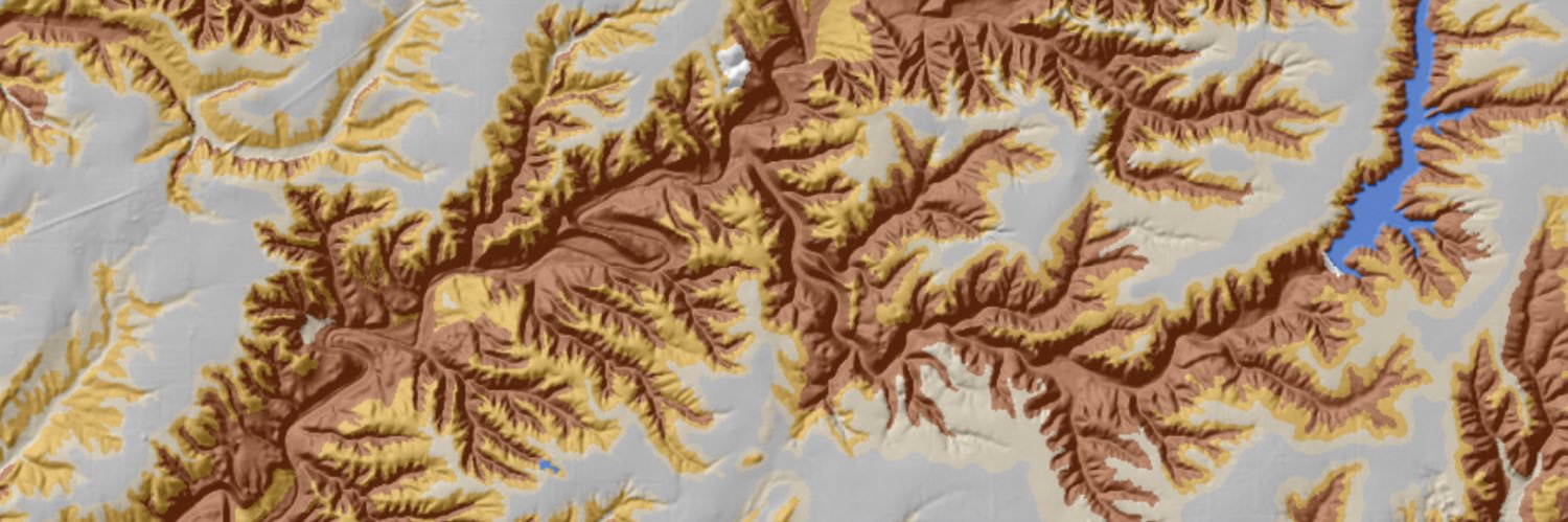
Feathery, dendritic drainage networks highlighted by well and moderately well drained soils (brown and tan) stand out against smooth, level interfluves with poorly and somewhat poorly drained soils (light gray and… https://t.co/Q416dGEsG0
Terraced loess hills at Hard Scratch, Harrison County, Iowa (1). Loess, a silty sediment deposited by wind, can be up to 100 ft (30 m) thick here where the source of the loess, the floodplain of the Missouri River,… https://t.co/iZwsk9cpcP
With day 2 of the National Cooperative Soil Survey National Conference in Narragansett, Rhode Island (1, 2) behind us, we’re looking forward to seeing subaqueous soils on the field trip tomorrow (3). #ncss2019… https://t.co/eczQkpYmtw
Organic materials (1) accumulate and become parent material for soils when organic matter additions by plant growth are greater than losses by microbial decomposition. In temperate… https://t.co/N4geUBIliO
Sinuous, entrenched meanders of Conococheague Creek just west of Hagerstown, Washington County, Maryland. The Dominant Soil Parent Material map (1) shows how the narrow floodplain (light… https://t.co/utxhazo12U
Urban areas, like this part of San Diego, California, the site of the Soil Science Society of America International Soils Meeting this week (1), present a challenge in symbolizing maps… https://t.co/OKmMWQHGCG
An outwash plain consists of stratified sandy and gravelly material deposited by meltwater from a receding glacier. Outwash usually becomes finer upwards because finer material is… https://t.co/T0oWY2Xiic
It’s World Soil Day and a great day to explore the World Soil Orders map on https://t.co/zQUvVIxzGH or the Soil Explorer iPad app! And don’t forget to check out the World maps of soil moisture… https://t.co/PztOqcI1Xl
A floodplain is the nearly level land next to a stream channel that floods when the stream overflows. Floodplains usually contain alluvium, stratified sediment deposited by running water… https://t.co/KGenXYZaTp
A sinkhole is a closed, roughly circular depression that drains into a system of caves and underground drainage formed by dissolution of limestone or other soluble rock. Sinkholes are… https://t.co/i6w9x5FmSz
A beach ridge is a low, more or less continuous mound of sandy or gravely material deposited on the backshore of a beach beyond the limit of storm waves and often associated with dunes.… https://t.co/I4uXS42ZXM
The more or less C-shaped parabolic dunes of the Fair Oaks Dune Field in NW Indiana (1) were formed by westerly winds during the Younger Dryas about 12,500 years ago. Soils on the dunes… https://t.co/QbjsdnHSWL
Mining Regolith is what remains after an area is strip mined, usually for coal. Prior to 1977, mining companies simply left the mining regolith in long ridges or windrows (1). After the… https://t.co/QIyc24NlRB
Extraterrestrial soils? Not quite, but the origin of this soil landscape is out of this world. The semicircular pattern in the Dominant Soil Parent Material (1), Soil Orders (2), and Acid… https://t.co/u2vl3Atg80
Drumlins are low, elongate, streamlined hills composed of till or outwash (1) that formed under glacial ice. This swarm of drumlins occurs between Columbus and Beaver Dam, WI. Soils on… https://t.co/7rdEKIBD0R