You wouldn’t believe the amount of claims I work where health professionals have patient records stored in their homes. Unlocked, in their basement just sitting. Recent water loss claim and there are at least 60 boxes of records in this doctor’s house. #IA 👀
Watching today's far Atlantic wave. Models have teased idea that 'if' it survives enough this week it could have a window to try and spin next week. EURO now sniffing what the EURO AI has not backed down from. CMC and ICON slowly showing. Models here from https://t.co/mSxpZtuPu3. No necessarily 'developed' just spinnage in the air. Now if we get a high build in back over the Atlantic could push 'it' west. And into Gulf even as a few teased. Or curve harmless back NE before Florida. Nothing is official with any of this. But trend is interesting enough to point out with these operational runs. EURO AI has been solid on that idea for days. Keeping one eye open. https://t.co/0EQMEw6Iu0
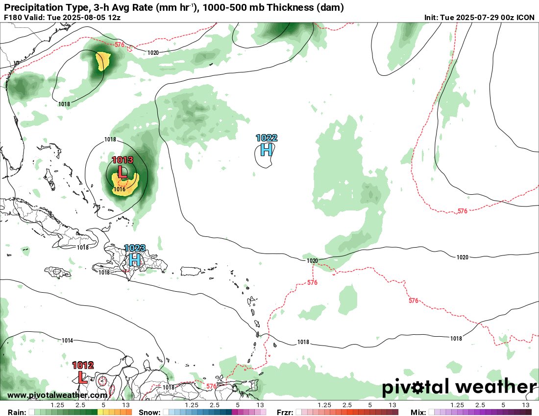
Good morning! Some really interesting model runs last night. The 0z ICON develops the tropical wave in the SW Atlantic for the first time. Below image is 7 days from now.
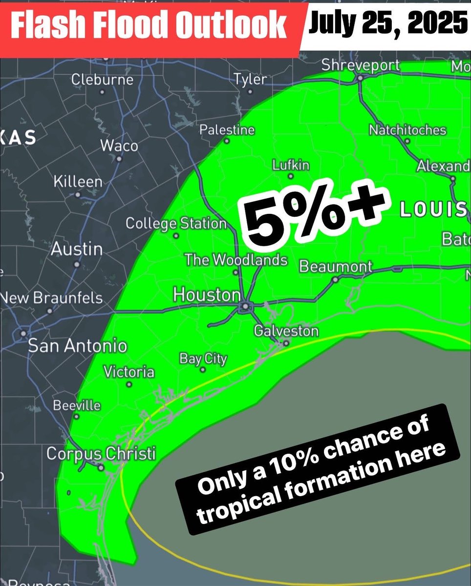
There is a marginal excessive rainfall risk today/tonight all along the Texas Gulf Coast into the Brazos Valley and East Texas. A couple localized flash floods may occur across the marginal risk region. The tropical blob responsible for this influx of moisture from the eastern Gulf is only 10% likely to become a tropical depression/storm. Keep those umbrellas and ponchos handy in Houston! #txwx #texas #flood
UPDATE: The National Weather Service in Tampa is calling this "straight-line winds of 45-50 mph" today in Desoto County. Watch the debris launch vertically at :16 in second video. Thoughts?