Special Weather Statement for Shiawassee, Genesee & Livingston until 11:00 AM 9/3/26. Strong thunderstorm near Laingsburg moving E at 35 mph. Wind gusts up to 50 mph and nickel-size hail. Seek shelter indoors.
Severe Thunderstorm Warning for Ingham, MI & Others until 10:30 AM. 60 mph wind gusts and 1.0" hail are possible. A storm near Grand Ledge is moving east. Move to an interior room on the lowest floor.
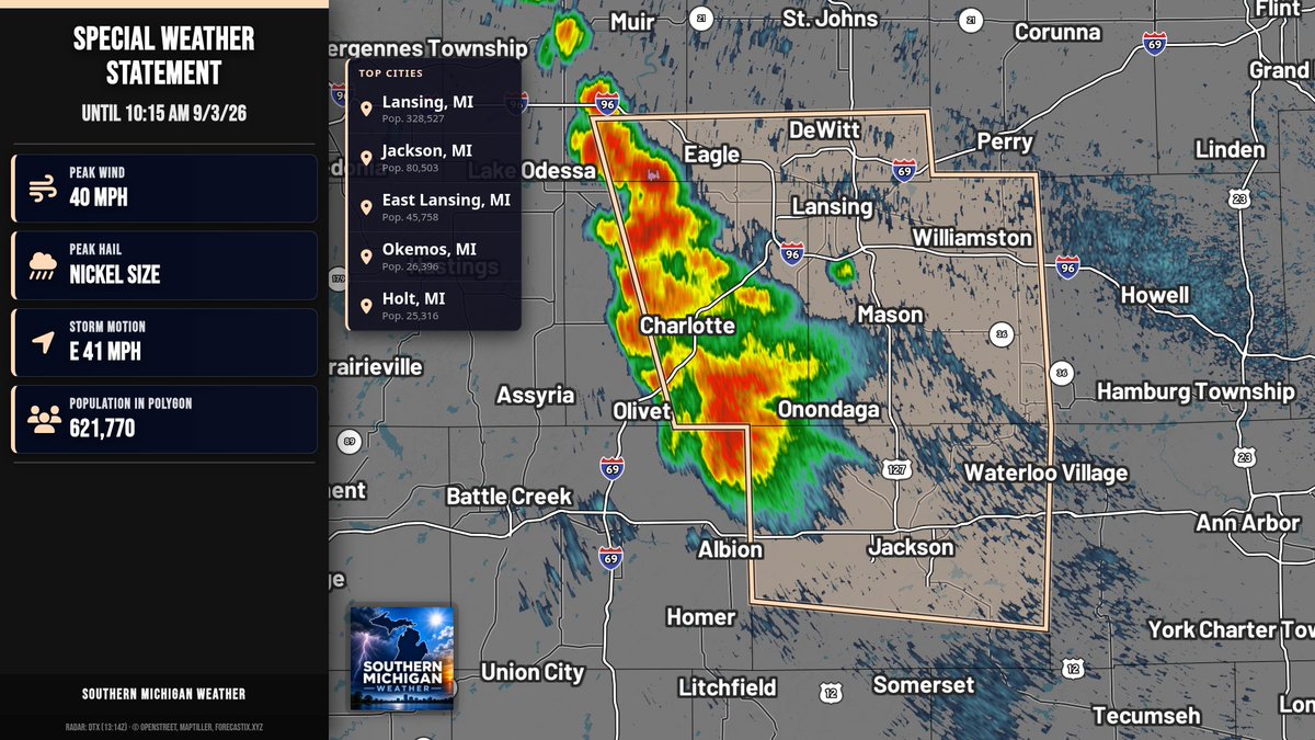
Special Weather Statement for Ionia, Clinton, and Eaton Counties until 10:15 AM 9/3/26. Strong thunderstorms with winds over 40 mph and nickel-size hail. Gusts may knock down limbs and blow unsecured objects. Seek shelter indoors.
Scattered elevated storms continue this morning from southern MN into WI and lower MI. A cell near SE of Grand Rapids may spread east. Isolated hail and damaging wind are possible. Peak wind gusts 55-70 mph and hail 1.00-1.75 in. Severe potential; watch unlikely (20%).
Severe Thunderstorm Warning for Barry and Eaton Counties until 9:30 AM EDT. Ping pong ball hail and 60 mph wind gusts are possible. A storm was near Hastings moving east at 40 mph. Move to an interior room on the lowest floor.
Special Weather Statement for Barry, Eaton, and Calhoun Counties until 9:30 AM. Strong thunderstorms with winds over 40 mph and penny-size hail are possible. If outdoors, seek shelter inside a building.
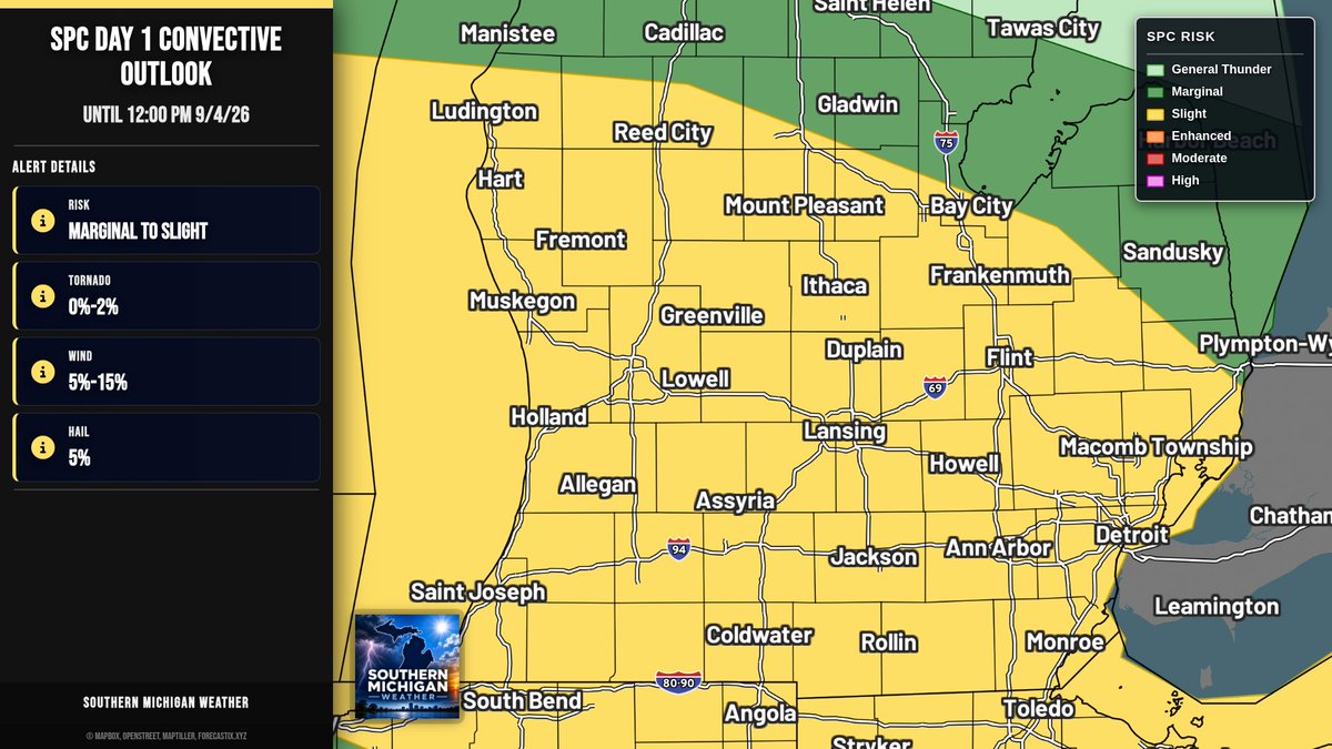
SPC Day 1: Slight Risk extends from Berrien County eastward to St. Clair County today. Scattered severe storms are possible. Slight: tornado 2%, damaging wind 15%, large hail 5%. Marginal: damaging wind 5%, large hail 5%.
Special Weather Statement for Lake, Osceola, and Newaygo Counties until 8:45 AM 9/3/26. Strong thunderstorm near Baldwin moving east at 50 mph. Winds >40 mph and pea-size hail possible. If outdoors, seek shelter inside.
Special Weather Statement for Kent, Allegan, and Barry Counties until 8:45 AM 9/3/26. Strong thunderstorm near Wayland moving SE at 35 mph. Winds over 40 mph and penny-size hail possible. If outdoors, seek shelter inside.
Special Weather Statement for Kalamazoo and Van Buren Counties until 8:30 AM 9/3/26. Strong thunderstorm may bring winds over 40 mph and penny-size hail. Gusts could knock down tree limbs. Seek shelter indoors if outdoors.
Special Weather Statement for Saginaw Valley & Thumb until morning commute ends. Patchy dense fog will reduce vis to 1 mile or less at times. Use low beams, slow down, and allow extra time. & Others
Special Marine Warning for Detroit River and Lake St. Clair Open Lake (U.S. Portion) until 4:45 AM EDT. Wind gusts to 40 kt and small hail. Strong thunderstorm near Grosse Pointe. Move to safe harbor until hazardous weather passes.
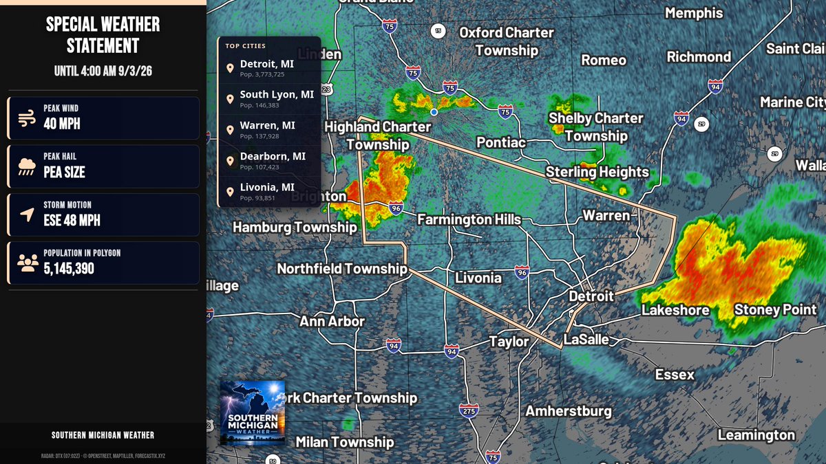
Special Weather Statement for Oakland, Macomb, and Wayne Counties until 4:00 AM 9/3/26. Strong thunderstorm near Novi moving east. Winds over 40 mph may knock down limbs and blow unsecured objects. Seek shelter indoors if outdoors.
Special Marine Warning for Detroit River and Lake St. Clair Open Lake (U.S. Portion) until 3:30 AM EDT. Wind gusts near 50 knots. Storm near St. Clair Shores and Grosse Pointe around 2:35 AM. Move to safe harbor until it passes.
Severe Thunderstorm Warning for Wayne, MI & Macomb, MI until 3:30 AM. 60 mph wind gusts and penny-size hail. Storm is moving east near Warren. Move to an interior room on the lowest floor.
Special Weather Statement for Livingston until 3:15 AM 9/3/26. A strong thunderstorm is near Fowlerville, moving SE at 45 mph. Winds gusts around 40 mph may knock down tree limbs. Seek shelter inside a building.
Special Weather Statement for St. Clair, Oakland, and Macomb until 3:15 AM 9/3/26. Strong thunderstorm near Pontiac moving SE at 45 mph. Wind gusts around 40 mph may knock down tree limbs and damage unsecured objects. Seek shelter indoors.
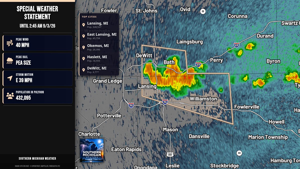
Special Weather Statement for Clinton and Ingham Counties until 2:45 AM 9/3/26. A strong thunderstorm is moving east near East Lansing. Winds over 40 mph may knock down tree limbs. If outdoors, seek shelter inside.
SPC Day 1: Slight Risk extends from Berrien County eastward to Macomb County today. Scattered severe storms are possible. Slight: tornado 2%, damaging wind 15%, large hail 5%. Marginal: damaging wind 5%, large hail 5%.
SPC Day 2: A Marginal Risk extends from Berrien County eastward to Lenawee County. Isolated severe storms are possible. Marginal: damaging wind up to 5%; large hail up to 5%.