Springfield Township , Delaware County, PA. Office of Emergency Management (OEM). Account not monitored 24/7. If you have an emergency, please call 911.
As summer heats up in PA, there are simple steps you can take to stay safe while lowering your energy use and costs.
• Close blinds during the hottest hours
• Raise your thermostat slightly if it’s safe to do so
• Use high‑energy appliances (like dishwashers and dryers) at cooler parts of the day.
Using fans, turning off unused electronics, and staying hydrated can also make a difference. Every little bit helps to manage energy usage and bills during extreme heat.
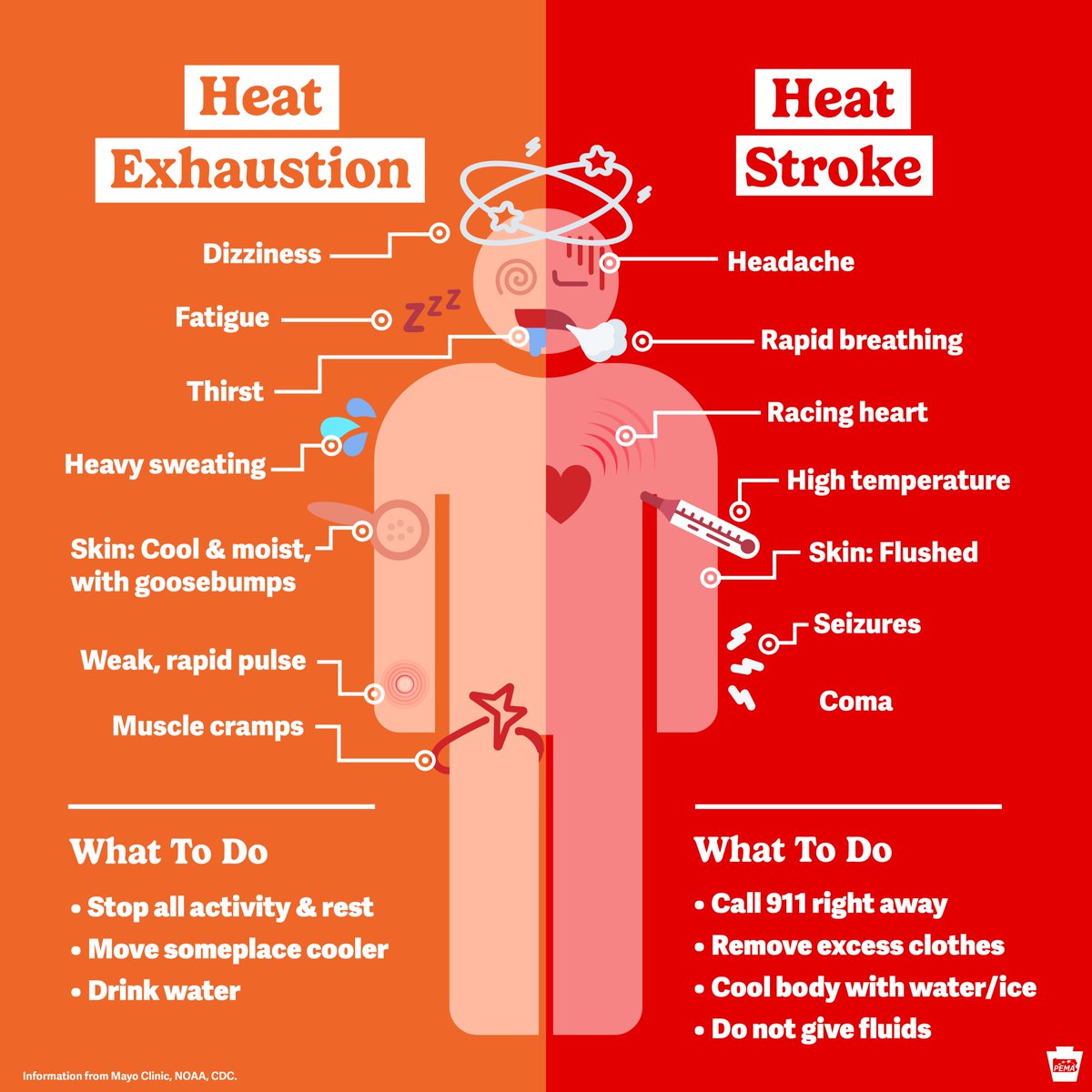
Don't get sick during this heat wave:
• Spend as much time indoors as possible 🏡
• Drink plenty of fluids 🫗
• Hang out in air conditioning ❄️
• Take a cool shower or bath 🚿
• Avoid high-energy activities during midday heat 🏃
• Dress in loose-fitting, lightweight clothing 👕
#PAwx
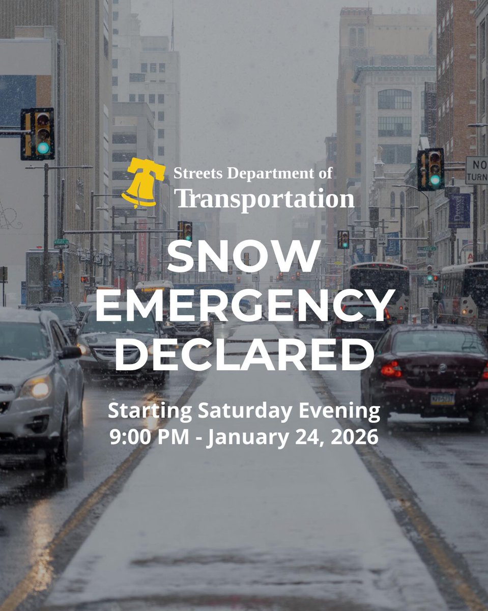
Governor Matthew Meyer has signed a State of Emergency at 5:00 p.m. today in anticipation of Winter Storm Fern. The State of Emergency will take effect at 12:01 a.m. on Sunday, January 25, 2026.
Read more at: https://t.co/1VizbTeW5O
Please adhere to this emergency. We will start to clear these streets at 11.
Thank you for your cooperation. We certainly dont want to have to move vehicles by tow truck. This will a storm that causes enough inconvenience.
Pennsylvania is currently experiencing a statewide intermittent 911 outage. You may reach the Delaware county 911 center via their non emergency number 610-565-6575
Due to a power outtage the temporary township office located at 1001 Baltimore Pike will be closed. Trash and recycling will be collected as scheduled. Thank you for your understanding.
IMPORTANT INFO!!
For those Springfield Township residents without power from the most recent storms, the Springfield Township Fire House will be open as BOTH a cooling and charging station. You may visit this location at 217 Saxer Avenue Springfield PA 19064.
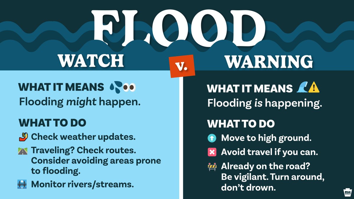
There's at least a slight risk of flash flooding in most of Pennsylvania Tuesday afternoon into the evening.
➡️ Our western and central mountain regions are under a flash flood watch.
➡️ Risk is elevated in the southwest, stretching northeastward into Clearfield County.
Prepare ASAP:
🤳 Make sure you have 2+ reliable ways to get alerts.
🌊 Watch for standing water; NEVER drive through it.
🌙 If you MUST drive at night, be extra cautious. Water on roads can be nearly impossible to see at night.
#pawx
Our weather pattern will be undergoing significant changes this week. The cloudy, cool & damp conditions will give way to hotter & more humid conditions (potentially dangerous heat). There is also some severe thunderstorm risk both Wednesday and Thursday. #pawx#mdwx#dewx#njwx
We have multiple hazards to be aware of today -- strong winds will develop across DelMarVa and coastal NJ. Then a squall line will track through the area late this afternoon.
Prepare for the potential for downed trees and power lines as the storms produce strong winds.
🚨 Due to high winds that caused tree limbs and power lines to fall, Beatty Rd is closed between Minshall Rd and Barry Dr.
There are also power outages throughout town. Please be cautious and stop 🛑 at any intersections where the traffic signal may not be functioning.