@GovTalk931 They missed multiple PI calls and holding calls yet Tarleton thinks it was a well called game, obviously, them Refs were getting some of that Texas money, would’ve been a different game had it been called right
@tarletonlover@Carmen_Cook@uacfootball Missing two PIs and multiple holding calls is not just football, that’s pretty bad officiating, plus that bogus touchback that should’ve been a safety
@ben_williams_wx I mean they even said in their updated outlook later in the day that supercells hadn’t been developing like they expected. They should’ve just issued a standard watch and if the Cap broke, and they started to see development, then upgrade to the PDS Watch
@MontCoSevereWX I feel the SPC was too quick to issue the PDS Watch, there hasn’t been any storm development all day within the watch, they even said in the updated Day 1 outlook that the storms and supercells haven’t developed like they expected
@MontCoSevereWX Question, why hasn’t there been many cells firing within the PDS Watch, Ryan hall just mentioned that it’s been pretty quiet in within the watch area and it a couple cells are just now popping up, is there a Cap that has yet to break?
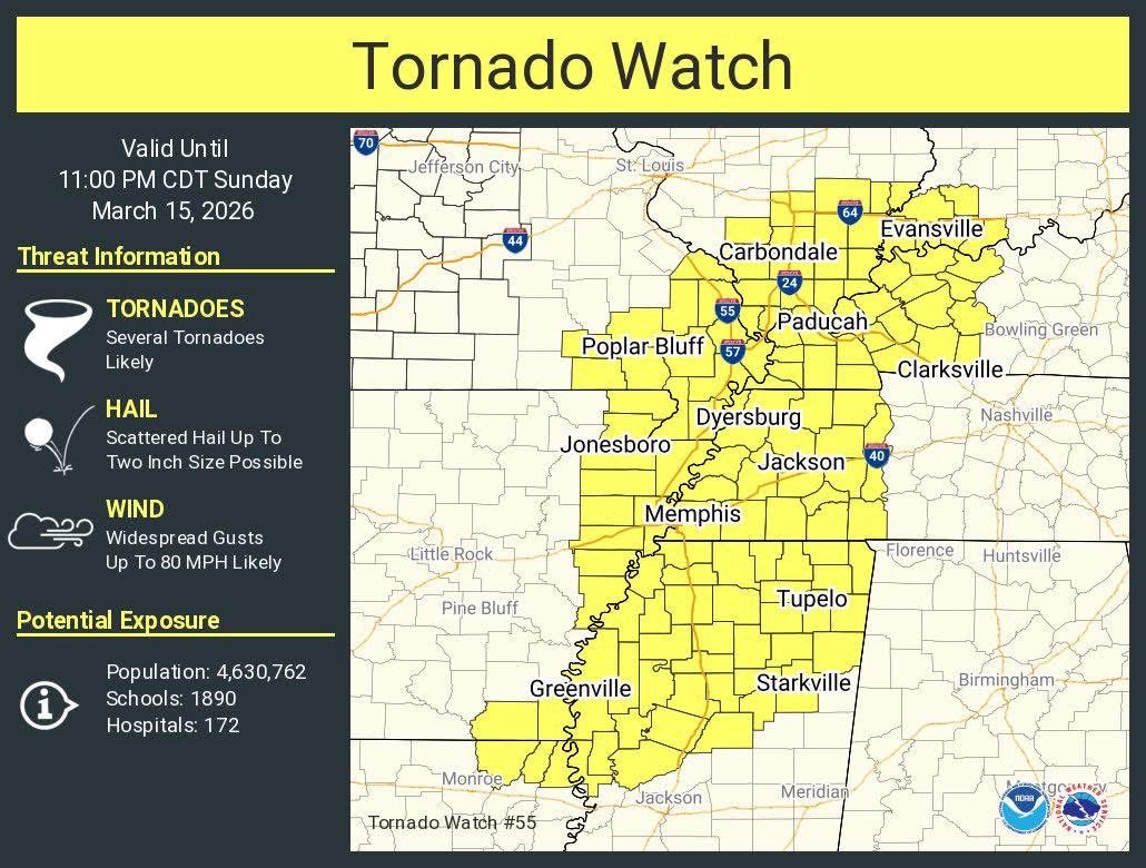
The NWS has issued a Tornado Watch for our Kentucky counties and North Ft. Campbell. Tornadoes are likely, wind gusts of up to 80 mph likely and possible hail up to 2 in.
The SPC has updated our area to a Enhanced Risk of Severe Weather for Sunday Night into Monday Morning. Our primary concern is up to 80 mph wind gusts, the Tornado risk is low but not zero
All of our area is in a Slight Risk for Sunday evening while portions of Stewart, all of Trigg and portions of Christian Counties are under an enhanced risk. Damaging winds will be the primary threat, but there is a low tornado threat as well.
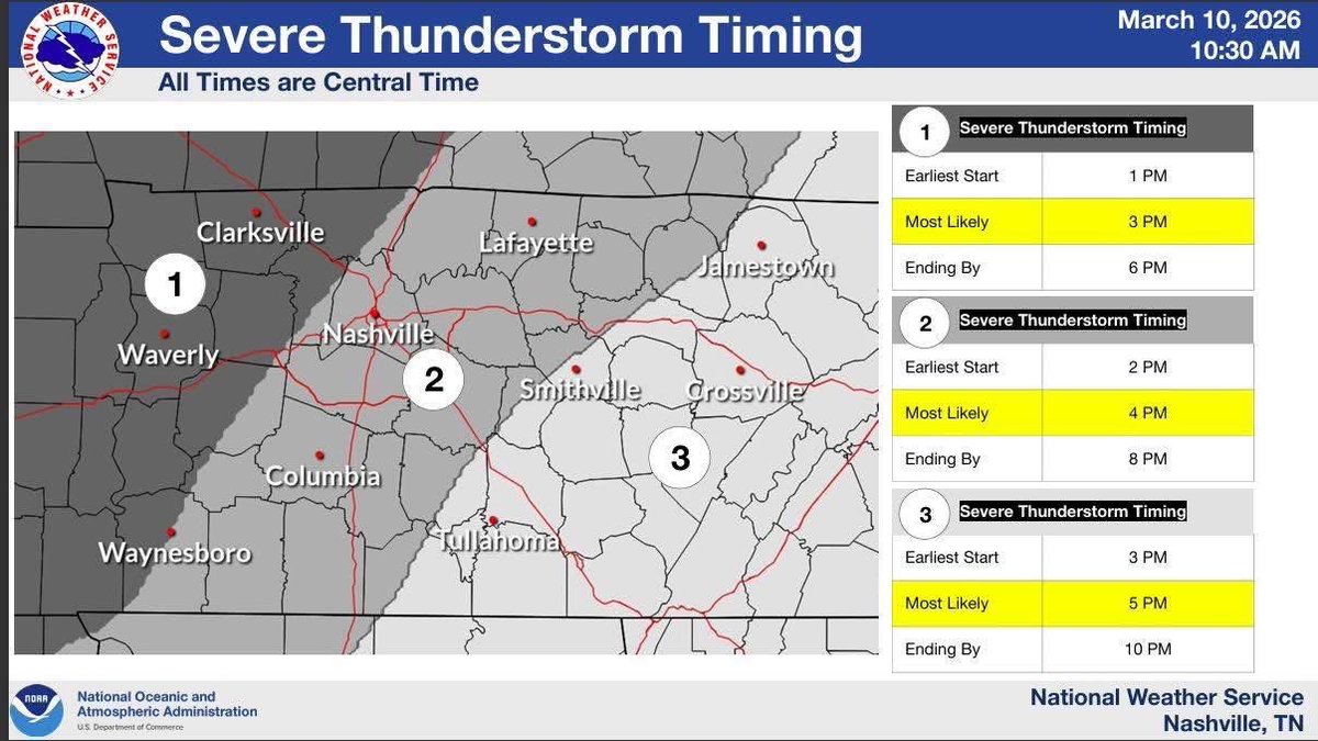
Severe Timing for our area is between 1pm-6pm, we are expecting the main line before the cold front however there could be a few discrete supercells ahead of the line, that could present the possibility for tornadoes
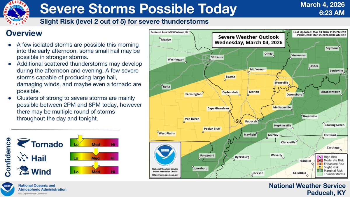
Wednesday afternoon and evening, a cold front will bring a slight risk for severe weather for all of our counties with the main hazards being damaging winds, tornadoes and small hail.
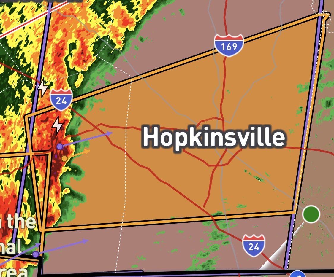
Severe Thunderstorm Warning with Tornado Possible Tag issued for Central Christian, Eastern Trigg and Northwestern Todd Counties until 11:45am. 60 mph wind gusts and nickel sized hail is possible.
The NWS has issued a Severe Thunderstorm Watch for all of our coverage area until 5pm. Primary threats include Scattered damaging wind gusts to 70 mph possible and a possible brief tornado spin up. A Severe Thunderstorm Watch means conditions are favorable for severe storms
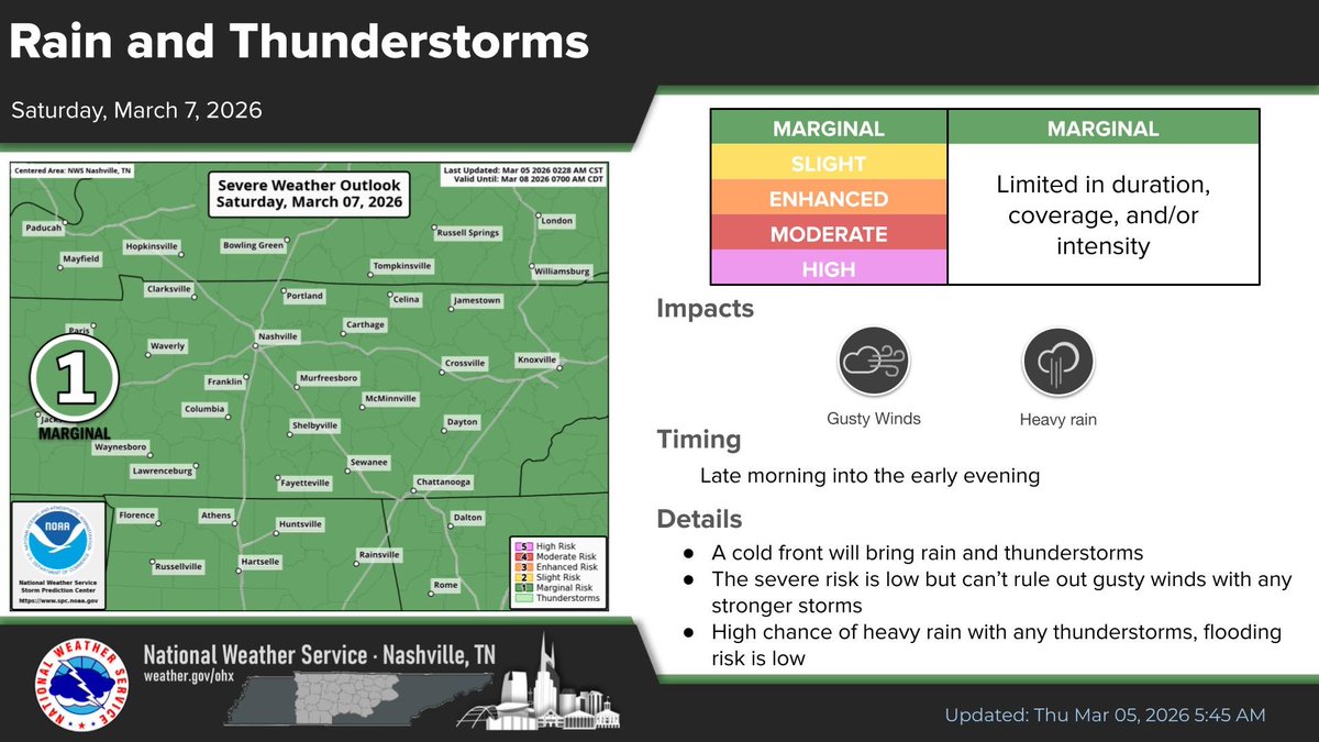
The NWS has placed all of Montgomery and Stewart Counties as well as portions of Trigg, Christian, and Todd Counties under a Slight Risk of Severe Weather for today, primary impacts will be heavy rain and gusty winds, a brief spin up tornado is possible.
The NWS in Louisville has issued a Special Weather Statement for Strong Wind Gusts Expected Tonight and Friday ahead of the cold front, especially in any rain showers. Brief wind gusts over 35+ mph are possible. Sustained winds will increase throughout the day. #southernkywx
Rain showers are moving out of Robertson County bringing an end to the rain for our area, the next forecasted potential for rain for our area will be Wednesday into Thursday of next week #middletnwx#southernkywx